Scotland’s Oldest Bridges.
A map-based catalogue of the oldest masonry bridges in Scotland.
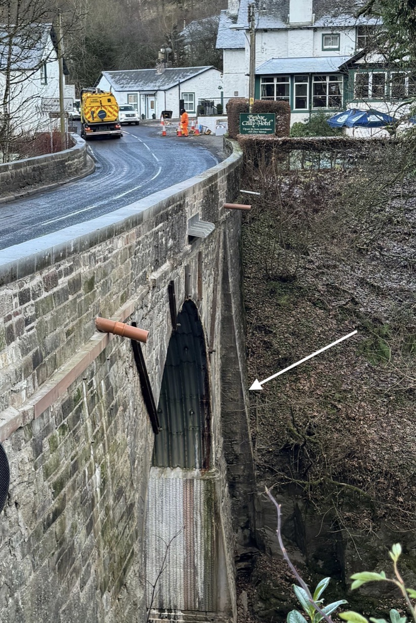
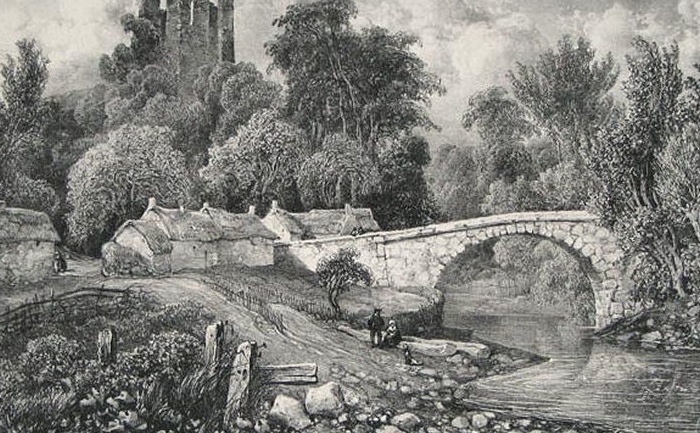
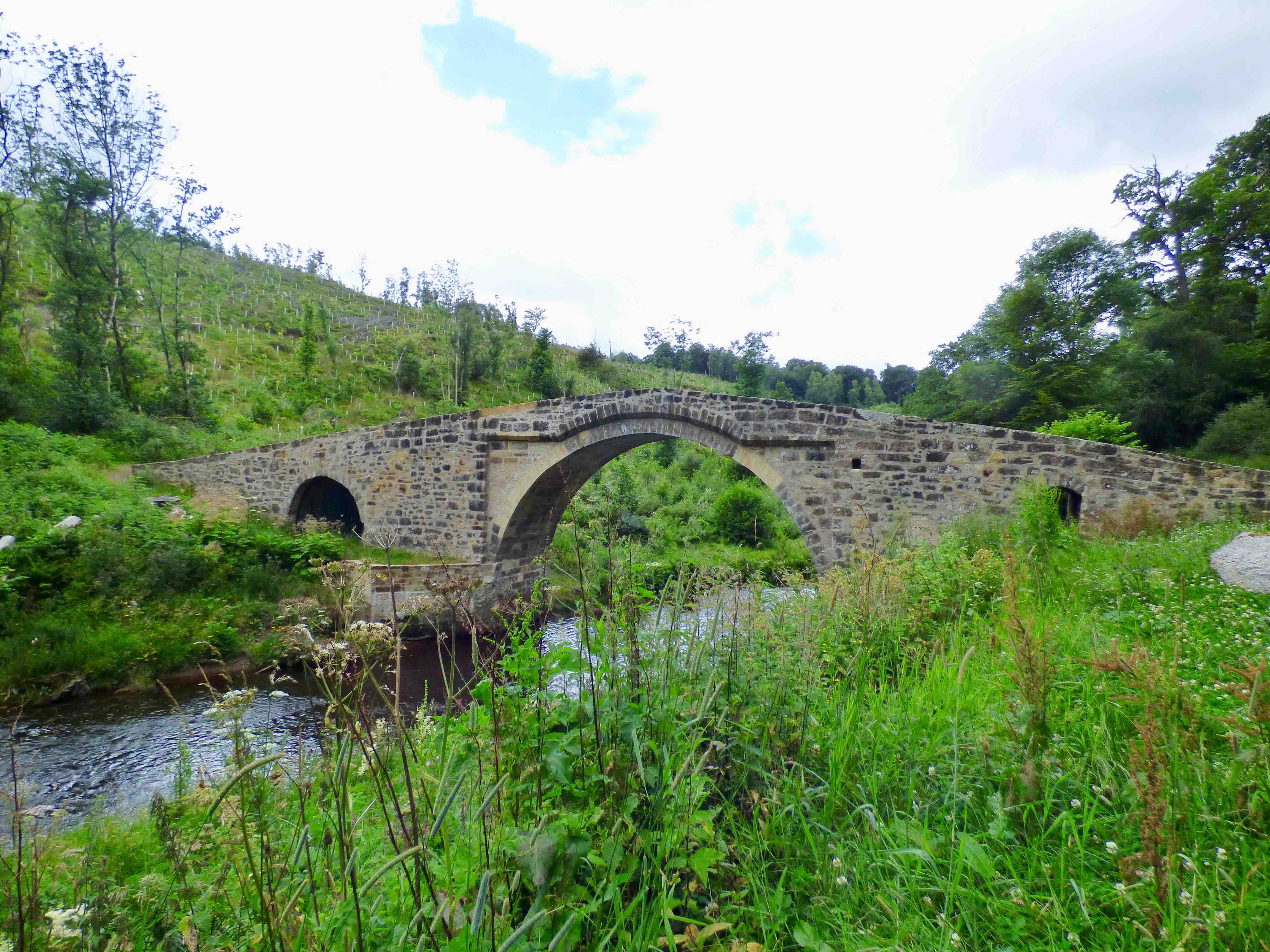
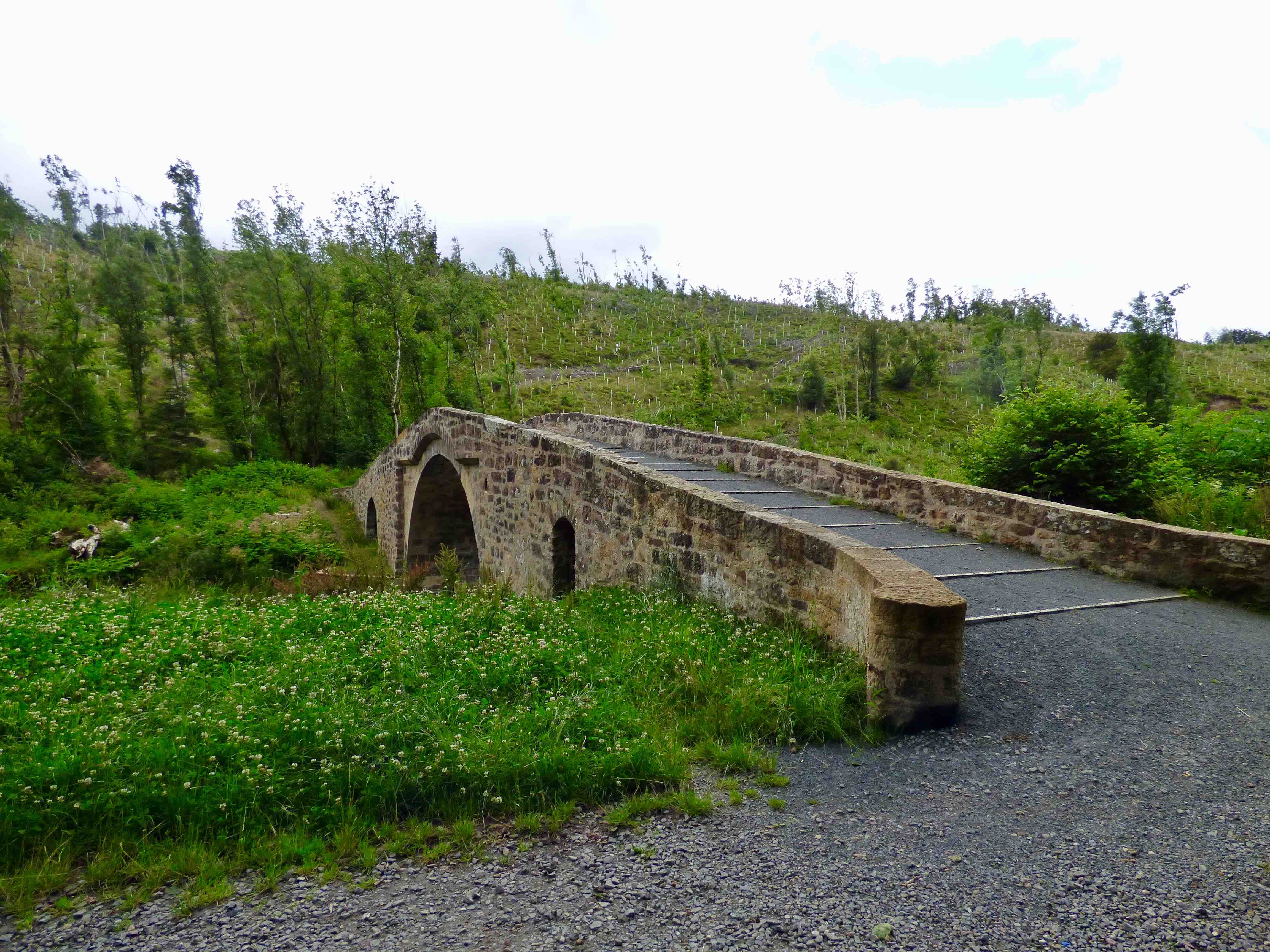
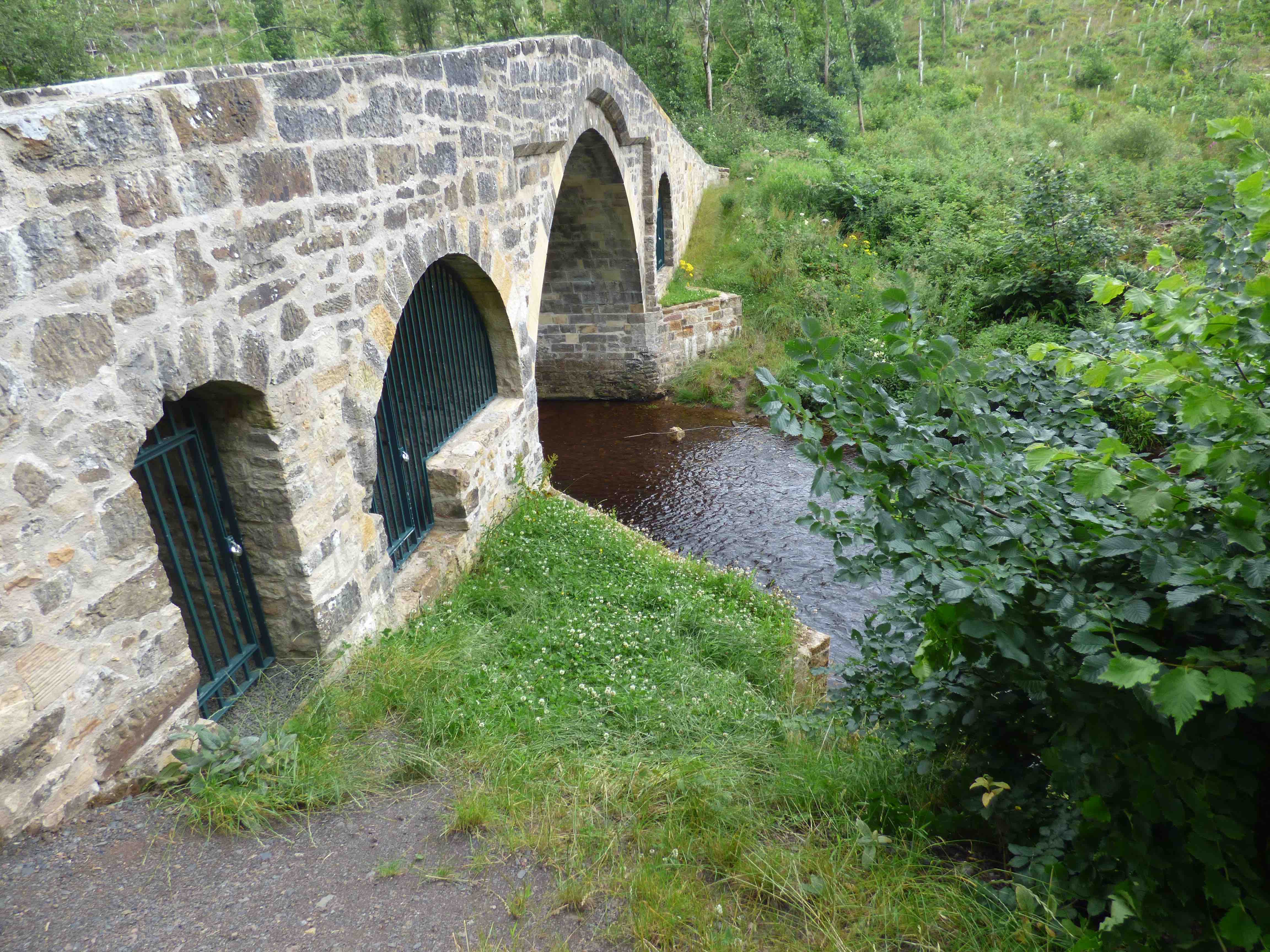
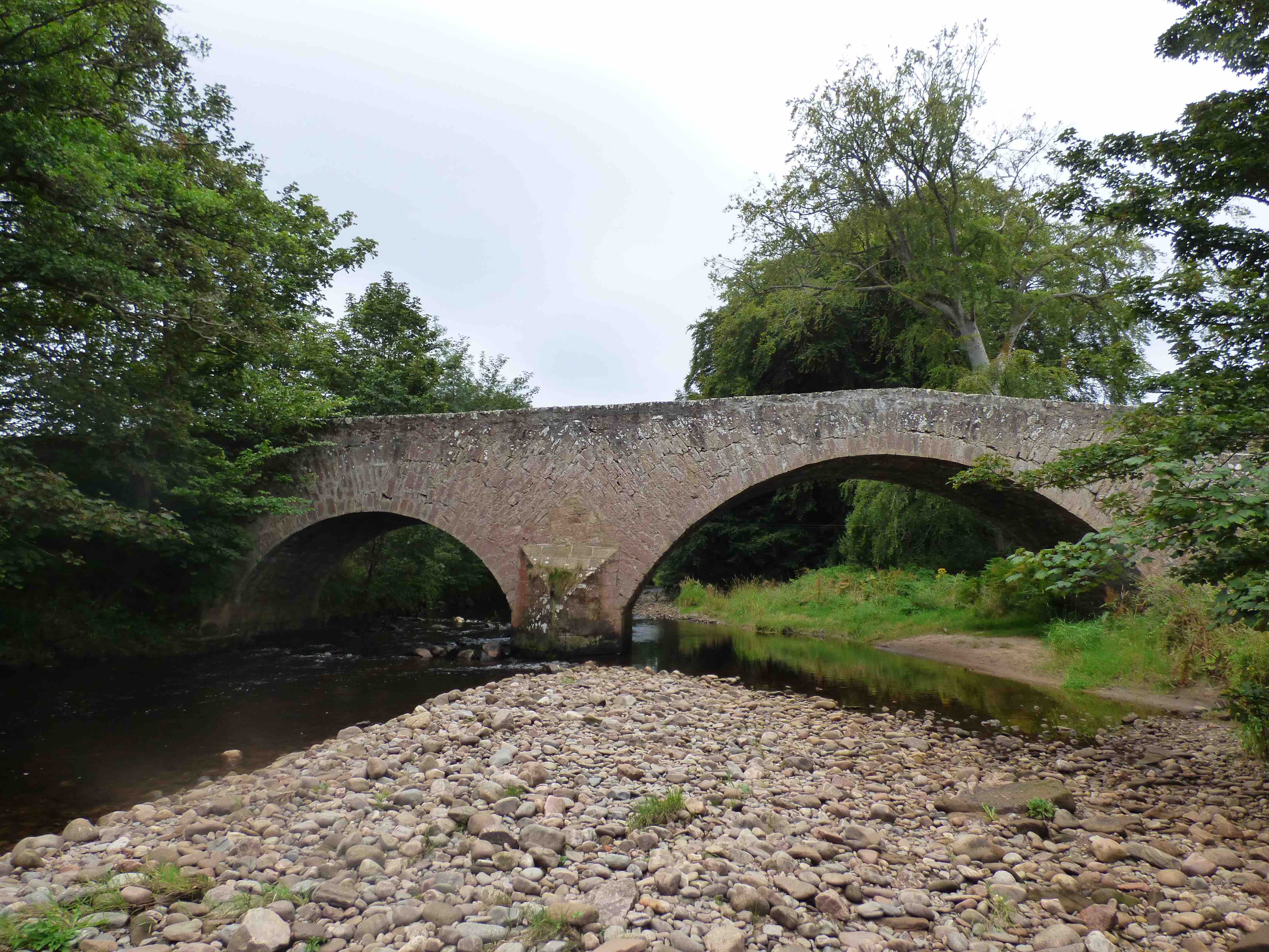
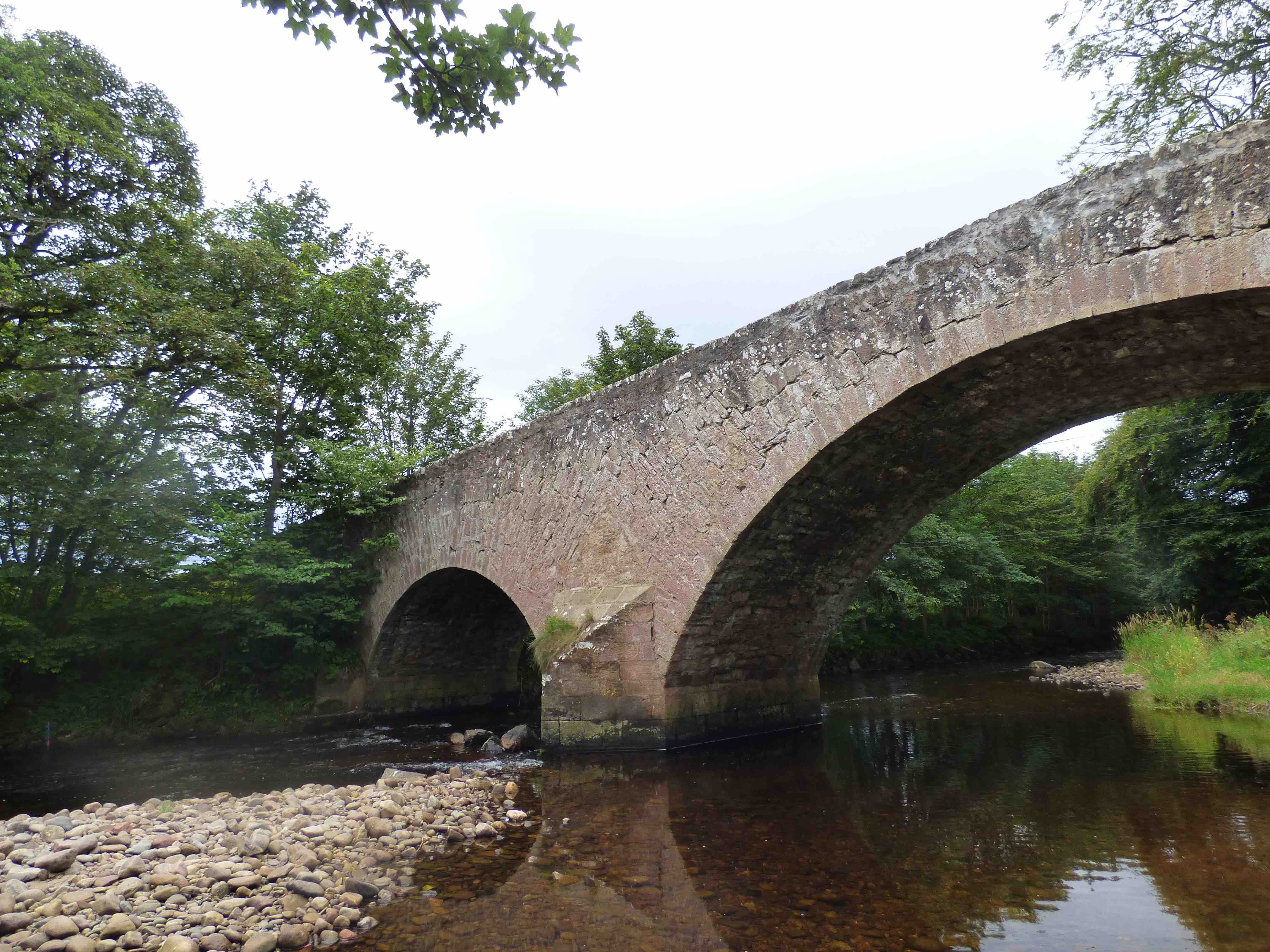
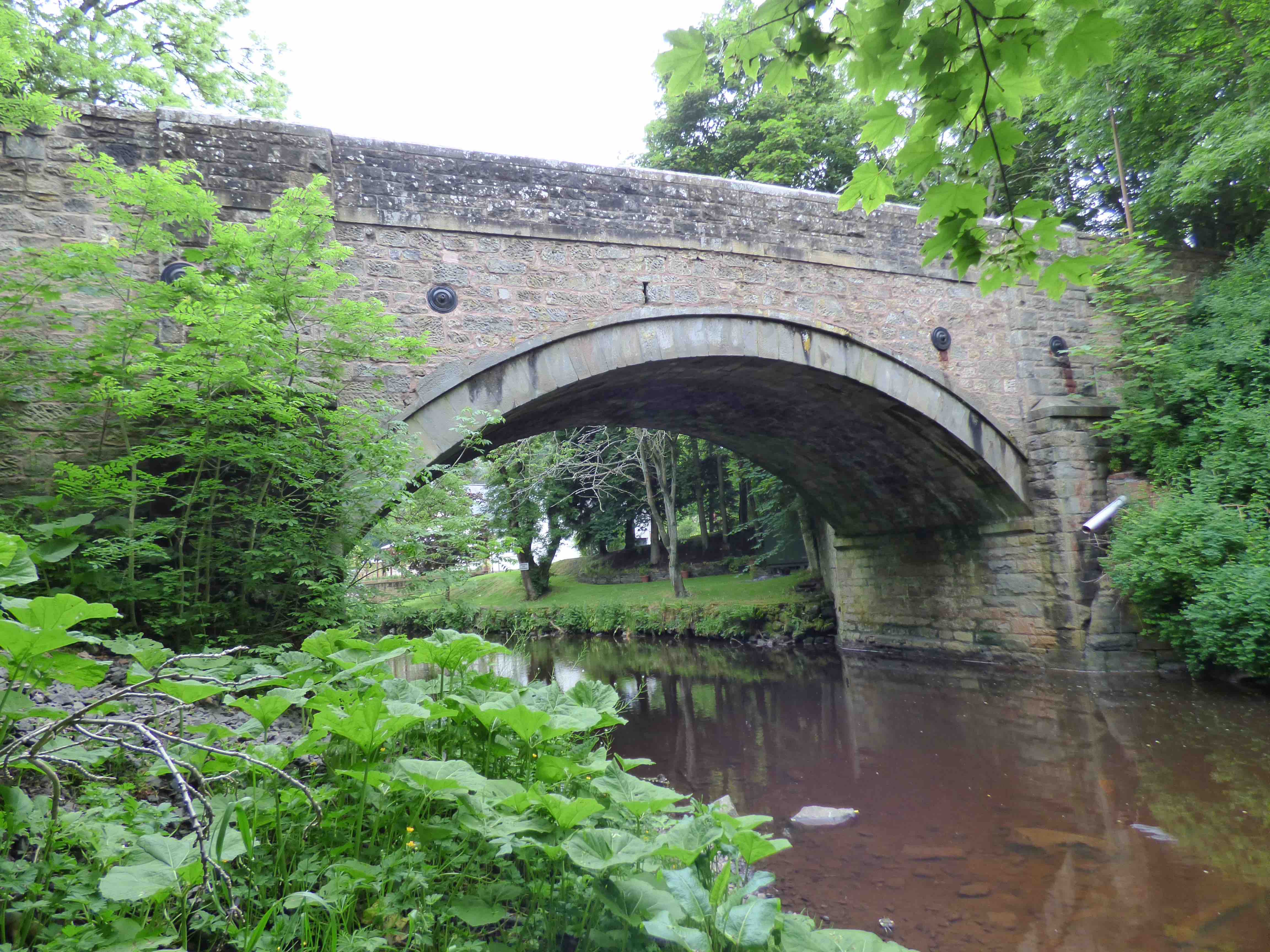
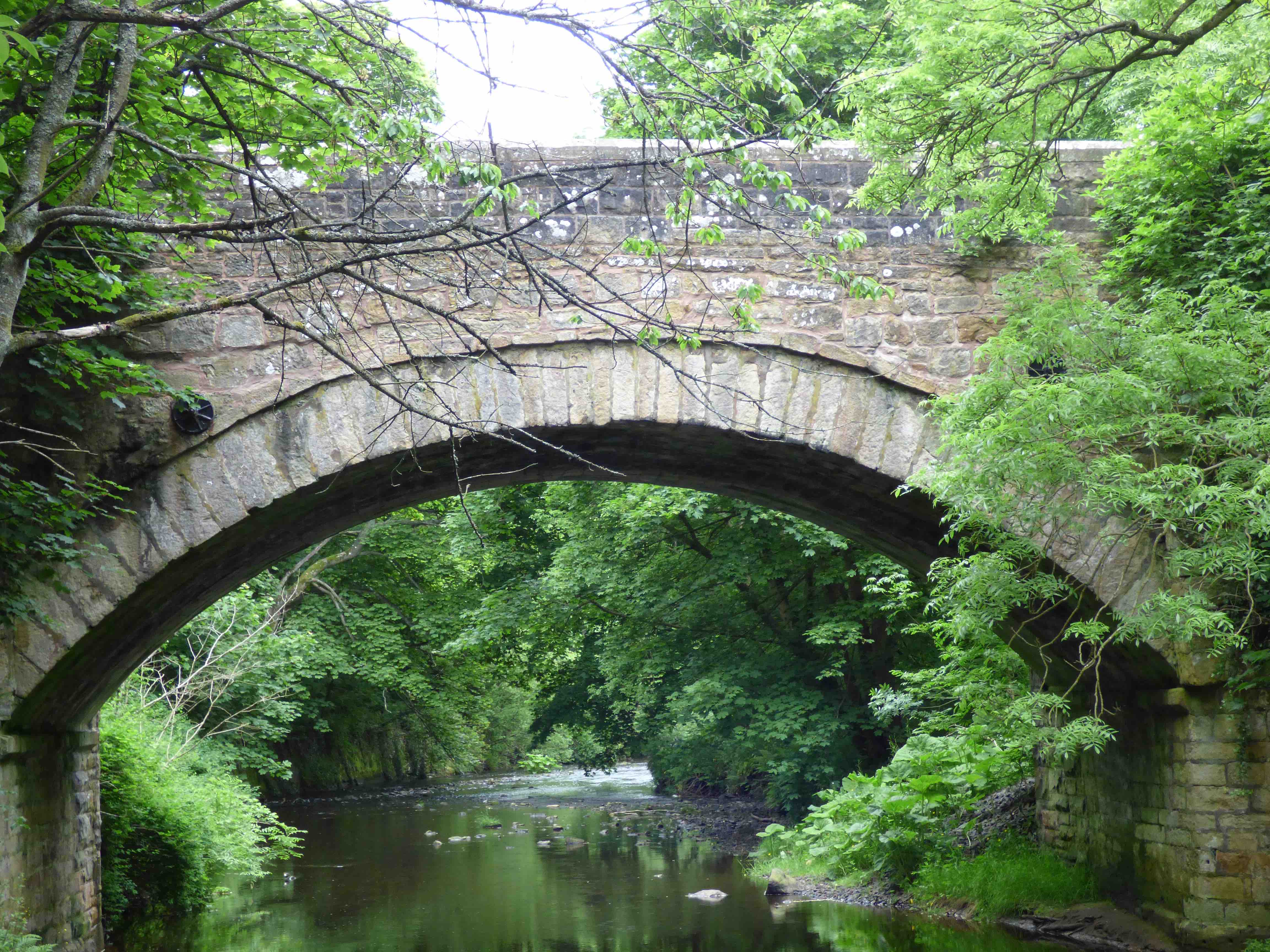
BRIDGE OF CALLY Blairgowrie
C.Perth R.Ardle 313985,751404
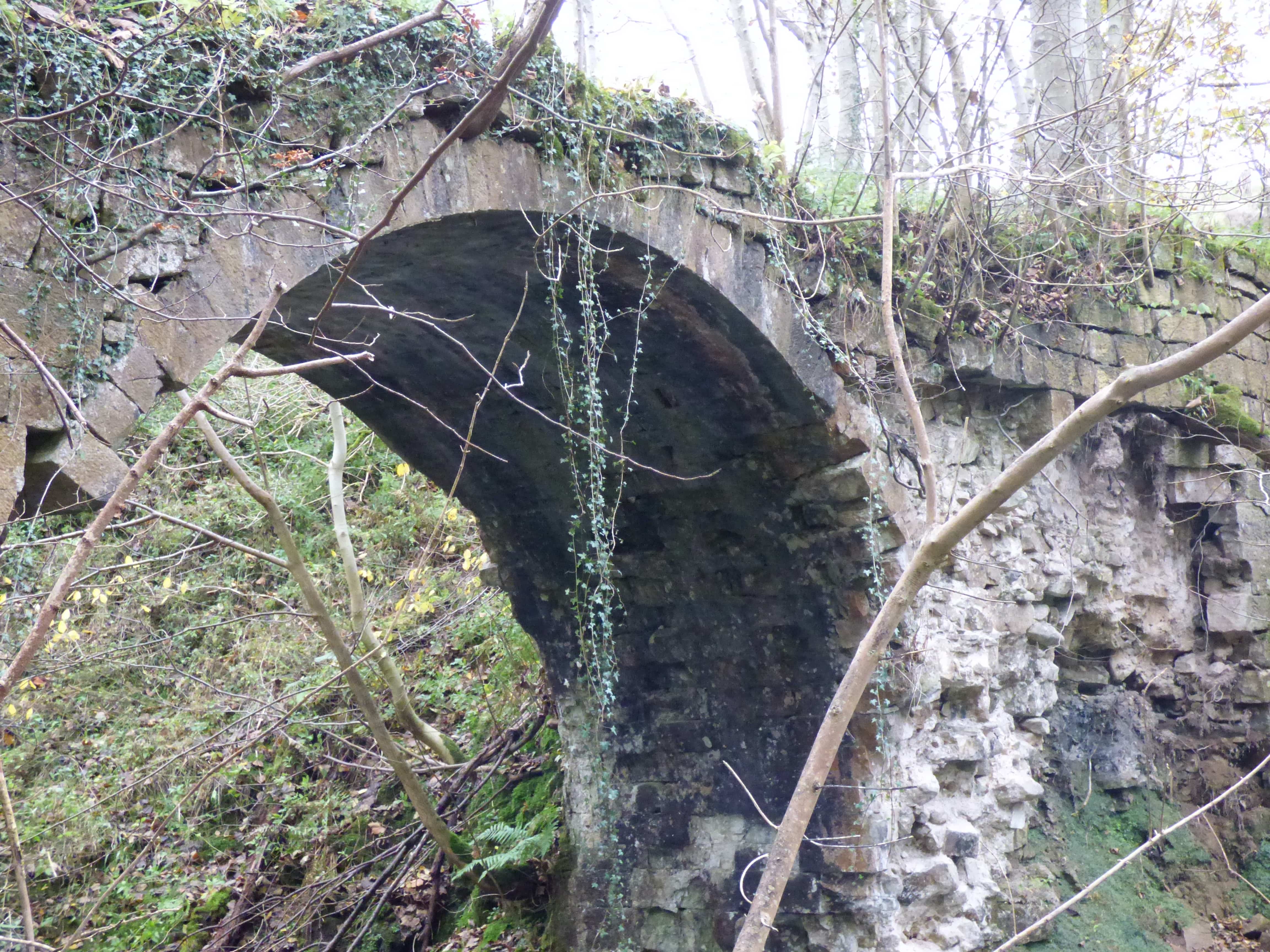
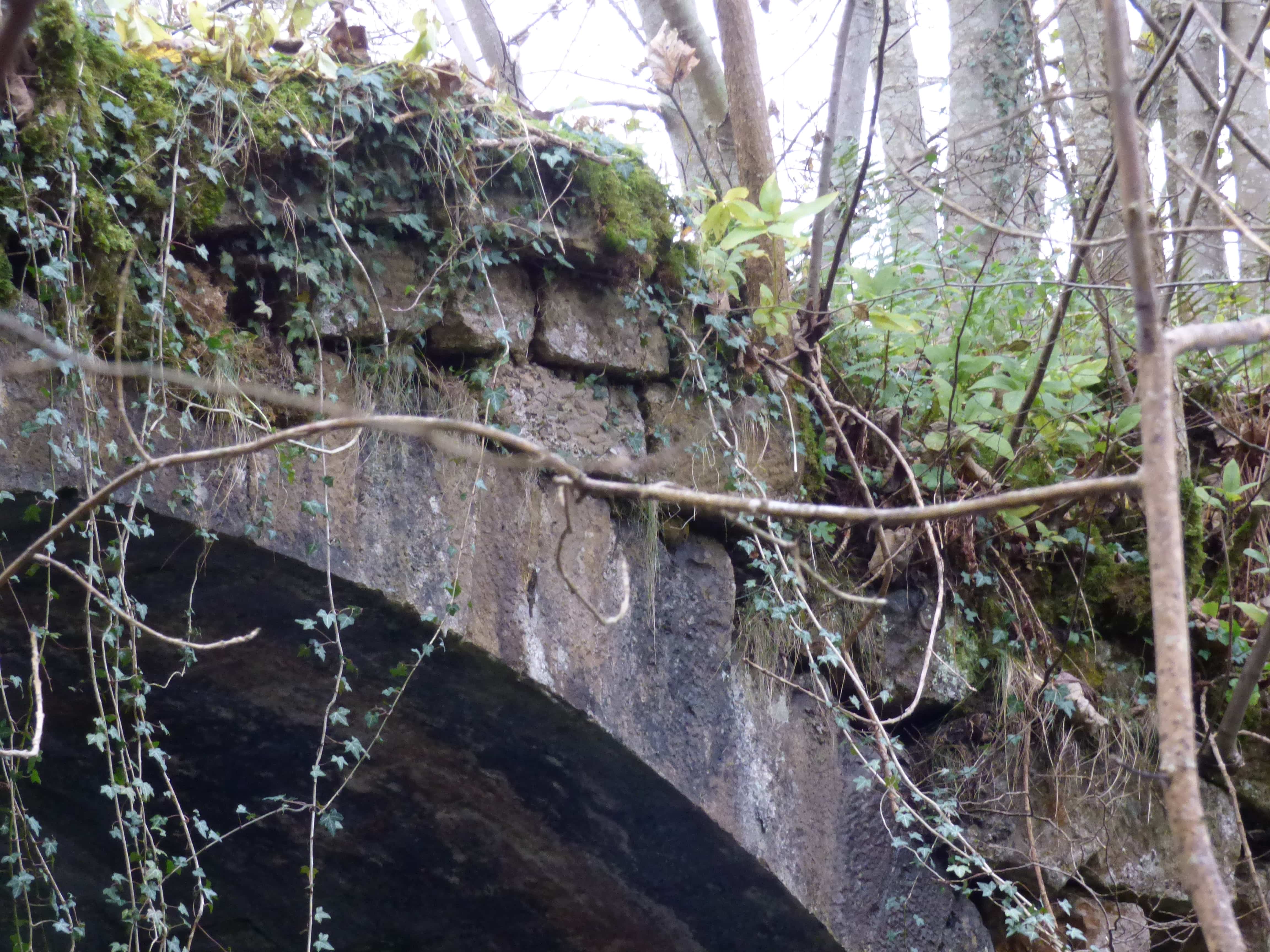
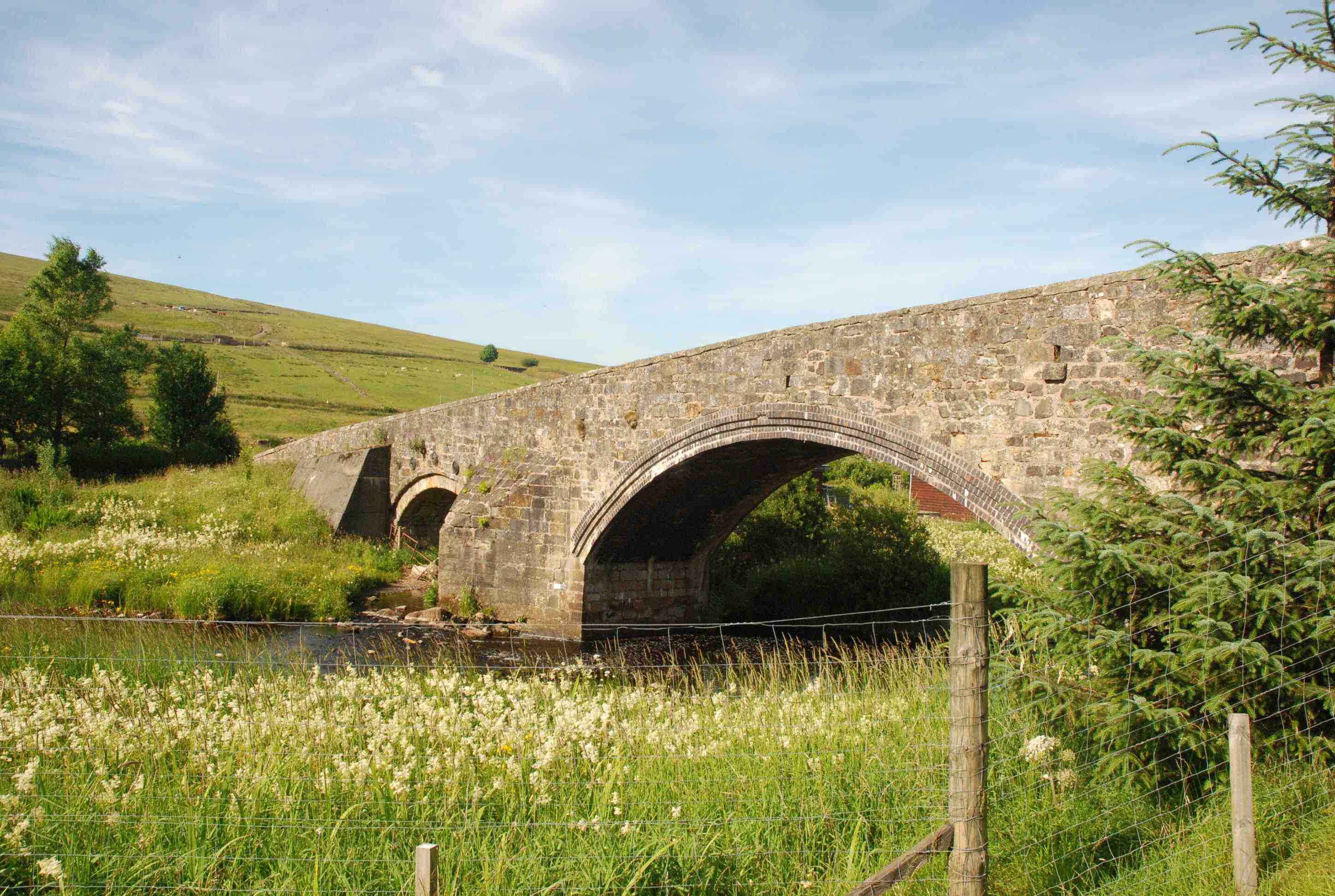
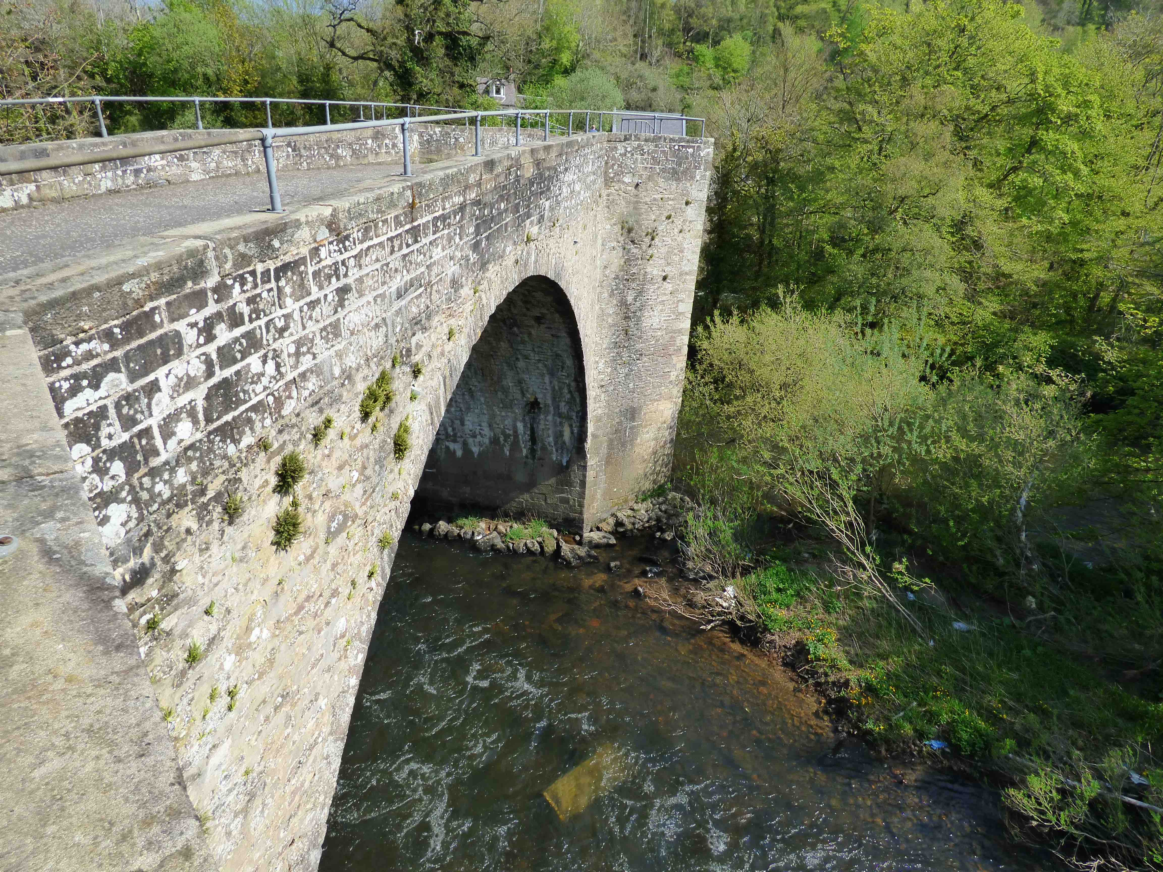
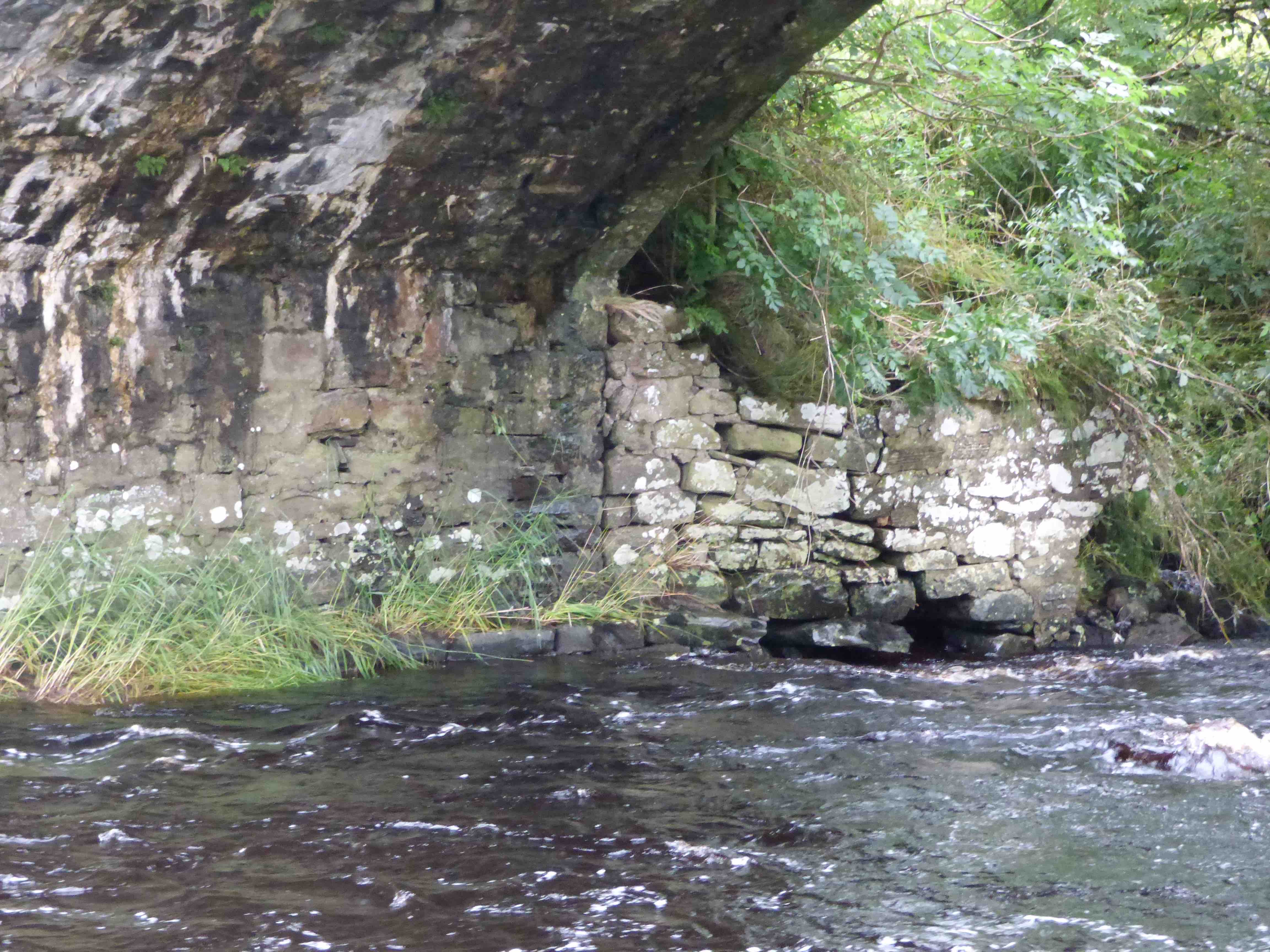
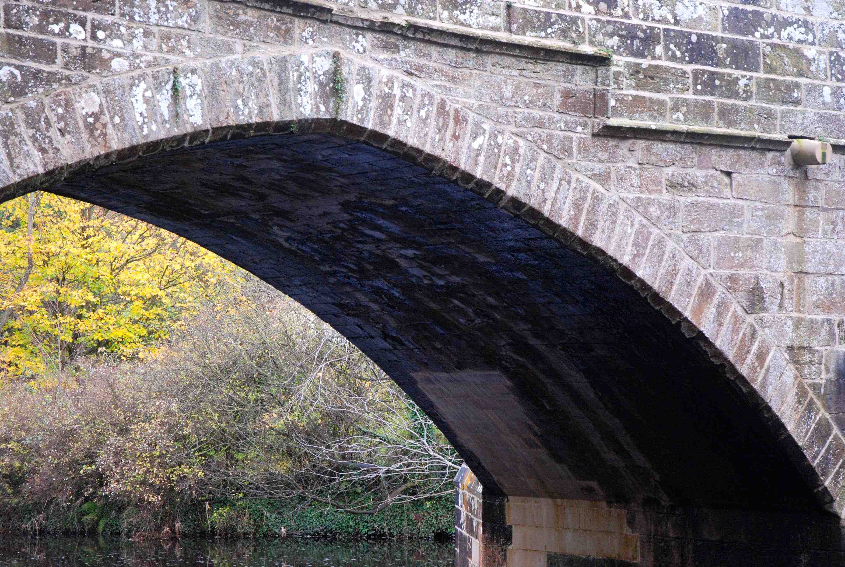
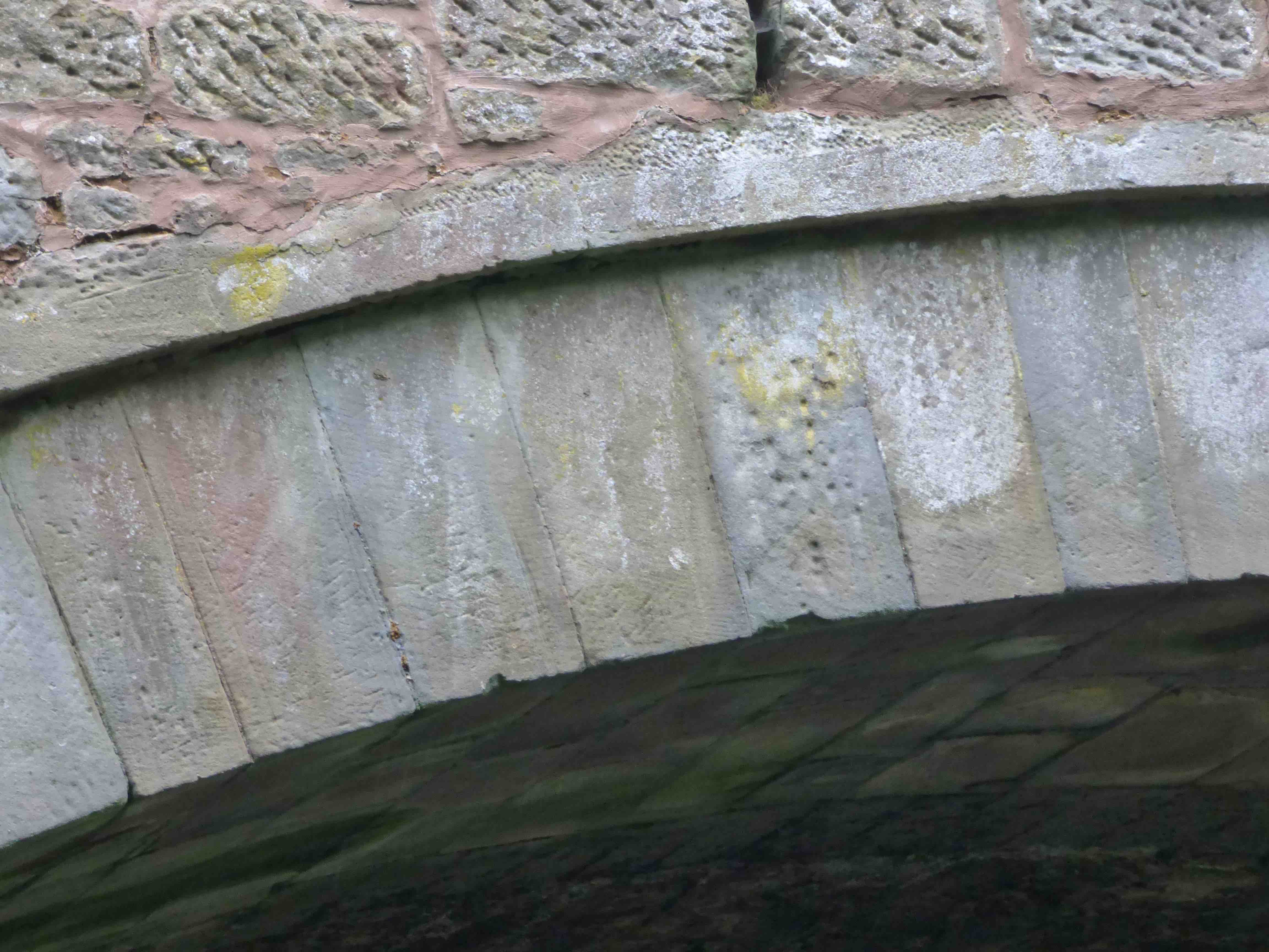
History: In 1743, an Alexander Robertson was paid £72 to repair the Bridge of Cally. This bridge is present on Roy's map but we know nothing of when it was built. Caulfield's military road, between Coupar and Fort George, came through in 1749., and the old bridge was declared unsafe. There are overgrown ruined abutments 30m upstream on both banks, next to the hotel and in the garden of the post office, respectively. Taylor had noted these (Military Roads of Scotland) and considered them to be remnants of this military road bridge. On the same road, the bridges weren't finished until 1766 (Bridge of Couttie) and more major military work was done in 1813 on the Bridge of Cally section. OSAs identify both Couttie and Cally. The present bridge probably dates from the early 19th century. The 'plumb and batter style' confirms this.( 3rd photo)
Maps:1750
Currently: Large semicircular single arch on stilts. Cramping. Fully flat-decked. Largely coursed squared rubble spandrels and surface. Plumb and batter walls. The abutments of the previous bridge are completely overgrown and do not photograph well.
Photo Photo Photo
_______________________________________________
CANTRAY BRIDGE
C.Inverness R.Nairn 280016,848056
History: Existed in 1641 (Date-stone.) Mentioned in Mcfarlane in 1726. Rebuilt in 1764 by a local landowner. Major repairs in 1850. Closed to traffic in 2011 because of major deformation and outward leaning despite metal cramping in 1958 and 1989.
Maps:1750
Currently: 18th century. One segmental and one semicircular arch. Slightly humped. Cutwaters. Date-stone retained. Armorial panel. Voussoirs in well dressed rubble. Spandrels in random roughly dressed rubble. Facing voussoirs more recent than soffits. Steel tie bars and bracing.
photo photo photo.
_______________________________________________
CARDEAN BRIDGE see DEAN BRIDGE
_______________________________________________
CARR BRIDGE Carrbridge
C.Inverness R. Dalnain 290636,822927
History: ‘Funeral bridge’ or ‘coffin bridge’ built in 1717 ’ to allow funeral-trains to get to the church. It was known as Dalrachny Bridge when built. In 1829 it was described as having wing walls and a "plump and well conditioned body" It is often described as the oldest bridge in the Highlands. This may be the case but only by a short interval. It is a very picturesque and iconic tourist attraction.
Maps:1750
Currently:1717. Only the single naked semicircular rubble arch remained after the 1829 floods and has stood ever since. Voussoirs are non-aligned to arch focus as is typical for early 18th century. 7ft wide. Remnants of abutments are in undressed random rubble. Often described as a packhorse bridge but is not strictly so.
_______________________________________________
CARRINGTON MILL BRIDGE nr. Gorebridge
Midlothian Redside Burn. 331785,659511
History: This bridge seems to on a former road going north from Temple towards Edinburgh. It was on John Adair's map of 1690. It appears that it was by-passed in 1811, no doubt because it was too narrow. The bypass bridge is 400m downstream at Carrington Bridge. Confusion arises because stonework and a plaque were taken from one of the Carrington bridges, to be embedded in Braidwood Bridge nearby. It seems pretty certain that it was the 1811 bridge that was involved, probably at the time the latter was widened in the later 19th century.
Maps: Adair 1690. Unclear on Roy, but Roy shows the old road alignment. Not on Pont or Blaeu.
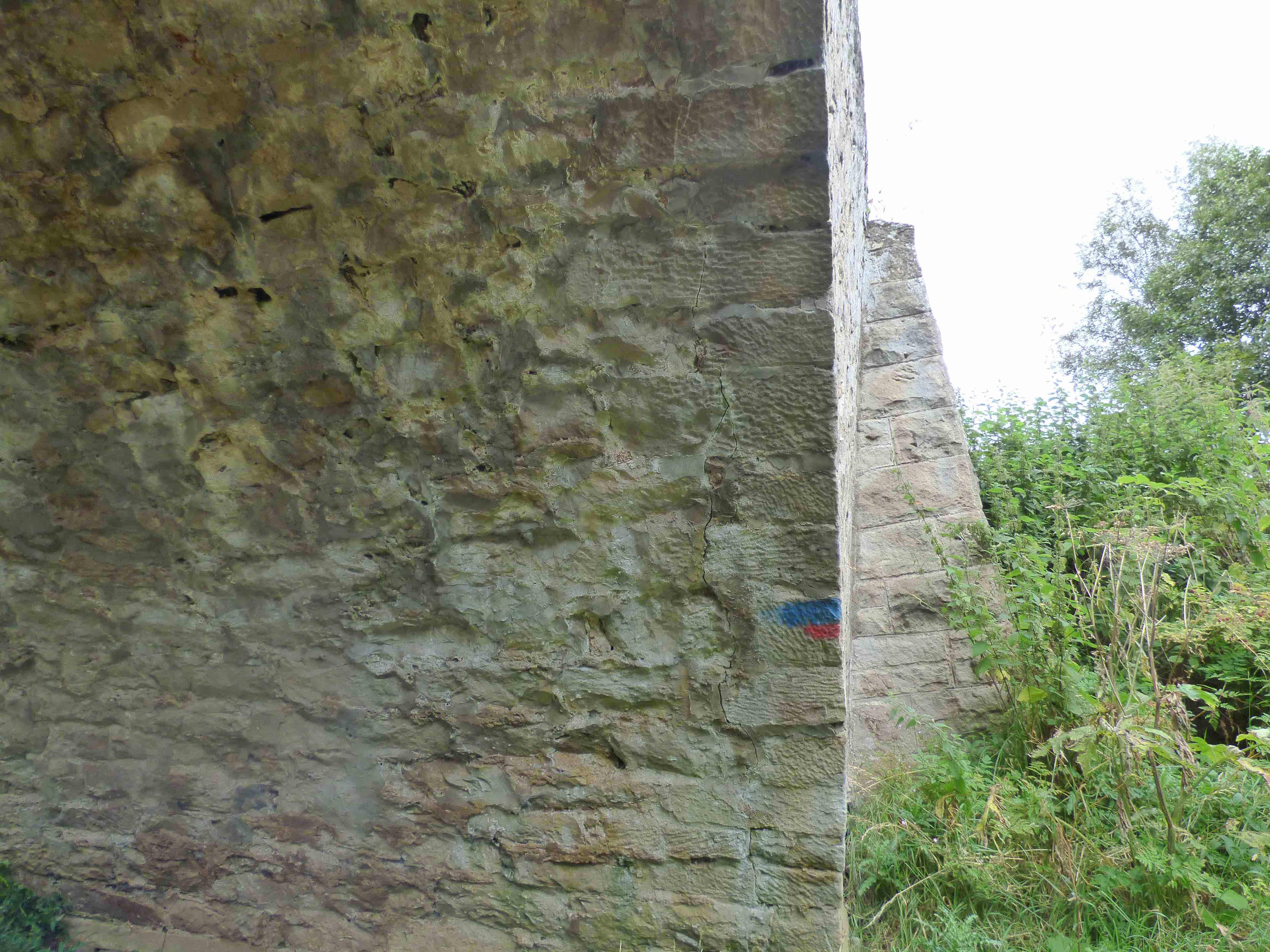
Currently. This looks like a 17th century bridge, in particular because it is 11 ft. wide without parapets; probably 8 ft wide , p to p. This width is simply not found in early 19th century new-builds. The stonework is of well dressed, squared,coursed sandstone rubble, and so excludes most of the 18th century. A date compatible with Adair's map is appropriate. The arch is in ashlar. Parapets are absent. It has a span of about 6m and slightly splayed approaches. Very overgrown. The bridge is about to collapse. (Nov. 2020).
_____________________________________________
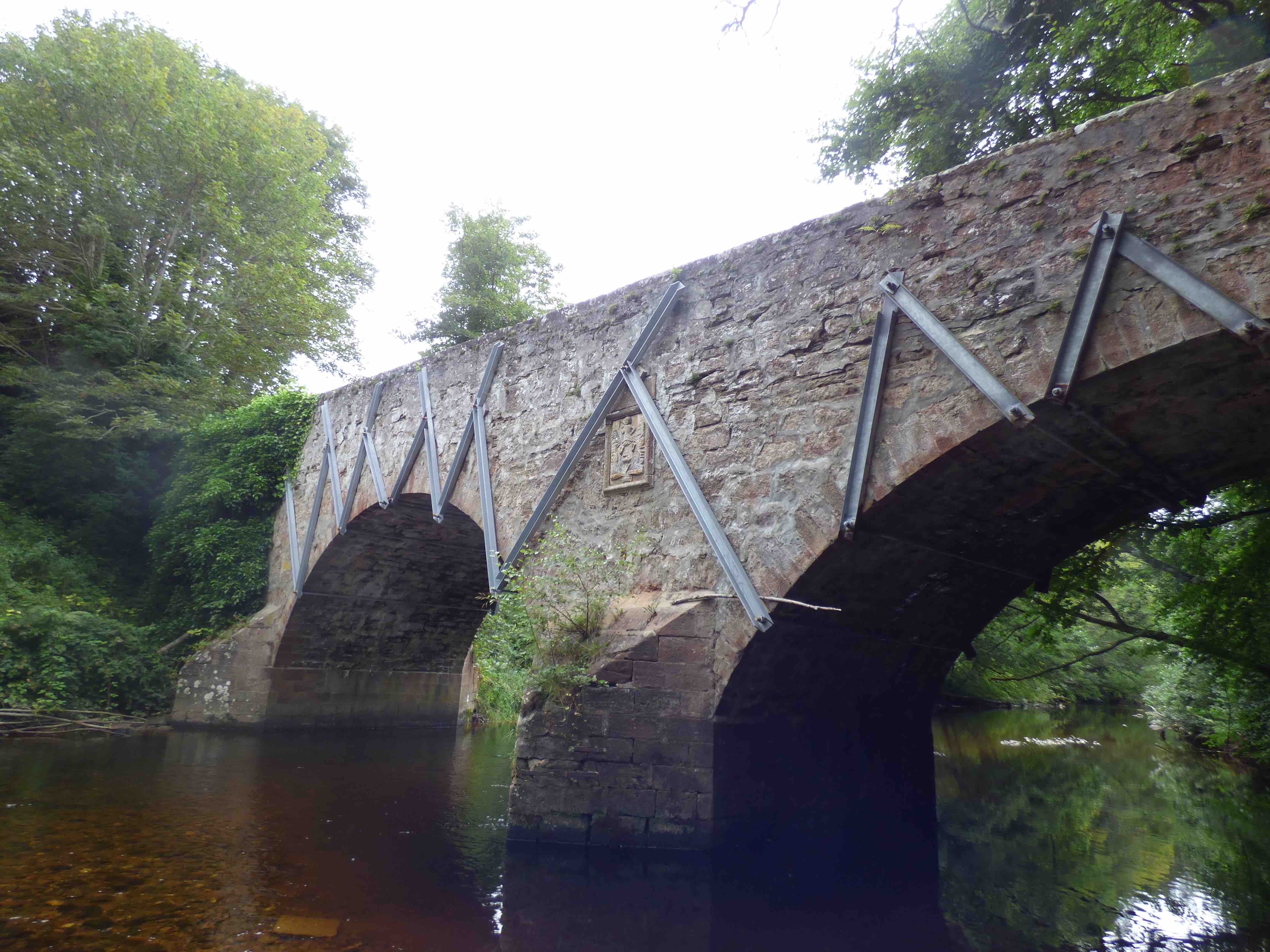
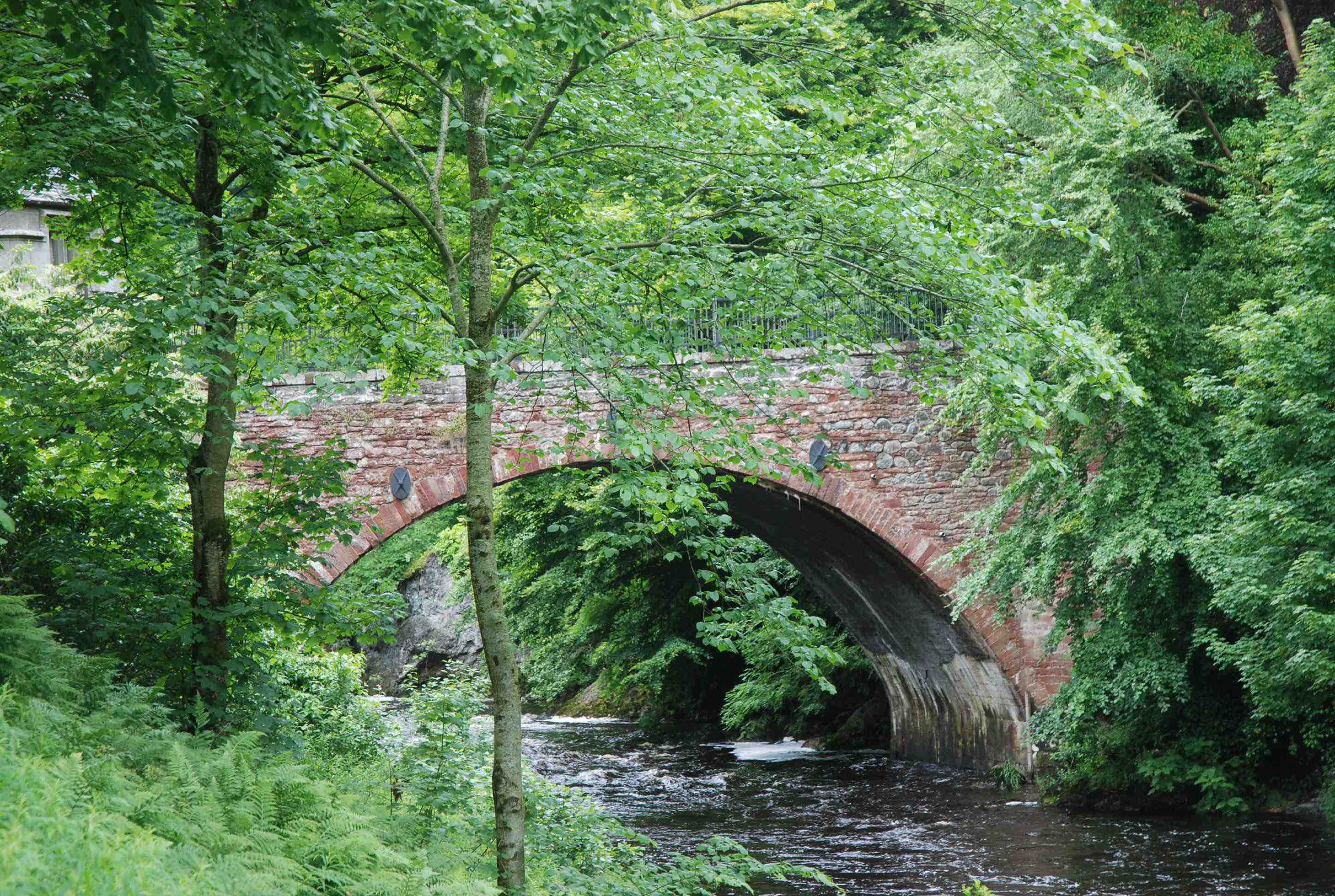
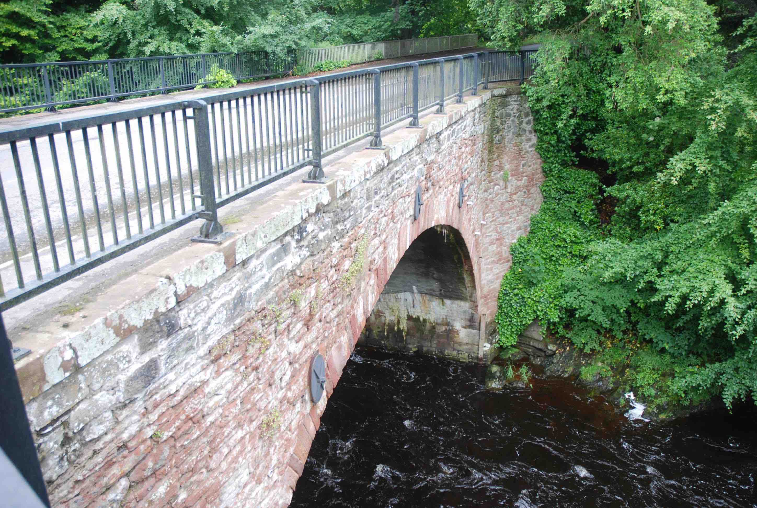
CARRON BRIDGE nr. Denny
C.Stirling R.Carron 274116,683501
History:1695 date-stone (see photo) but is older than that. There was at least one bridge over the Carron in the 15th century (Bailey) and both Denny and Carron bridges are on Pont's map. Substantial rebuild in 1690 estimated which cost 1000 merks. Monies raised by legacies and donations (Harrison). In Roy's time, the road from the valley crossed at the bridge before descending into Denny on the south bank of the river. This road is now no more than a track. It was a bigger river without the dam hence the redundant flood arch. Repairs in the 1720s by Comm. of Supply.
Maps:1750(Roy) 1600(Pont) 1640 (Blaeu)
Currently: a very old bridge with different stages of repair. Partly late 17th century.
Two stilted segmental arches of different size. Arch barrel seems more recent with five orders of tiny dressed voussoirs in brick, not stone. Spandrels and coping in rough but sometimes squared un-coursed rubble. Two orders of voussoir on the small flood arch. The lower one might be a more recent support structure. Modern buttresses on each side, perhaps of the same vintage as the arch repairs. Unusually, the bridge deck is steeply inclined. It is about 11 ft. wide. There are huge triangular cutwaters.
photo photo.
_______________________________________________
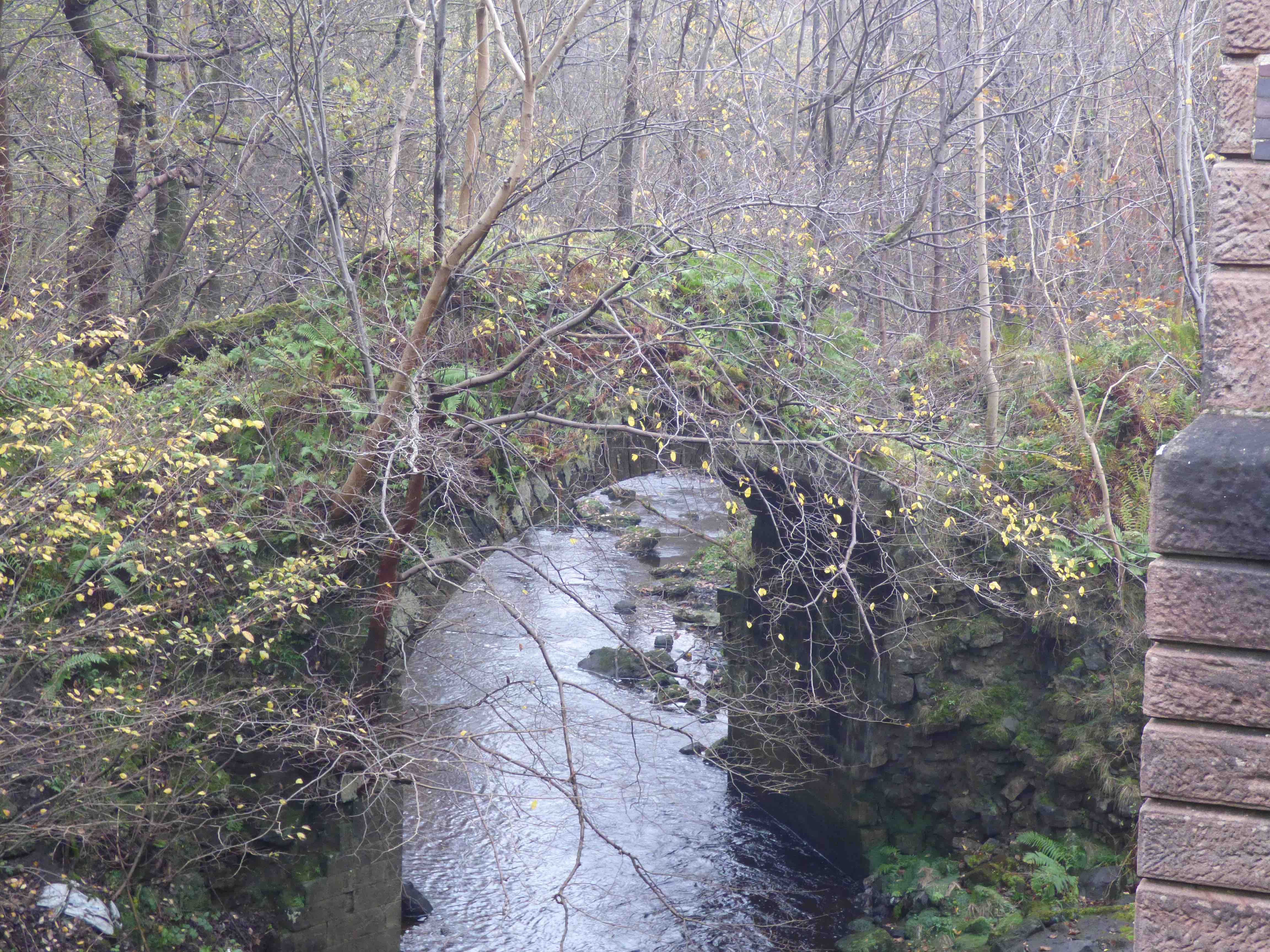
CASTLECARY BRIDGE Bancknock
C.Falkirk Red Burn 278763 678206
History: The Antonine Wall , the 19th century railway viaduct and the old Glasgow Road to Falkirk all cross the Red Burn at the same spot, on the old maps. Today the M80 also crosses here, just to the north of the motorway and below the viaduct. This little bridge has been spared despite the enormous civil engineering projects that have taken place around it. It is thought to be part of the Glasgow to Bo'ness turnpike (around 1760), but its presence on Roy (1750) might suggest an earlier date. It was also mentioned in Macfarlane (1723).
Maps:1750(Roy)
Currently: It looks like later 18th century. So overgrown it it difficult to assess. The abutment stonework appears to be ashlar which would lean towards a later date. Against this, it is rather narrow which would suggest an earlier date. The bridge is completely inaccessible in summer and only viewable from a distance in winter.
_____________________________________________
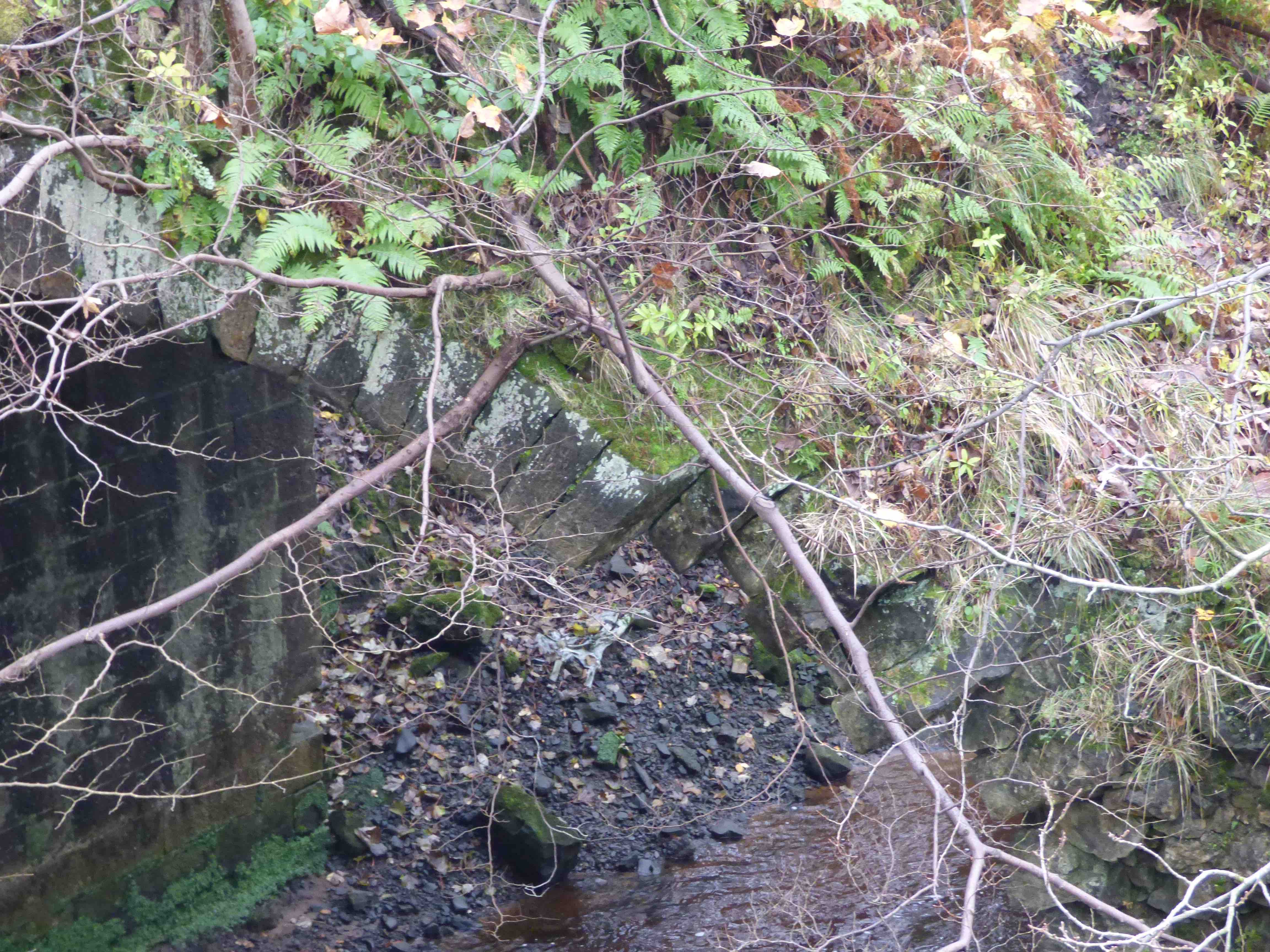
CASTLECARY MILLBRIDGE Banknock
Stirlingshire . Bonny water 279060,678916
History: MacFarlane (1720s) describes "a bridge at Castlecary Mill: One arch." It was bypassed 50 yards upstream in the 19th century. The old Glasgow/Falkirk road used to go through the Mill-farm on Roy's map. The current farmer of Castlecary Mill Farm claims this and it seems to be confirmed by the detail of the old map. The little bridge spans a very fast flowing burn, prone to flooding.
Maps:1750(Roy). Not on Adair, Blaeu or Pont.
Currently: Small single segmental arch in well dressed rubble. Span about 15 ft. Width 8ft. Cobbling visible on the flattish decking. Spandrels in well-dressed squared coursed stonework. Slight squinches to permit splayed widening. An 18th century bridge would have been built in random rubble. This bridge appears to be the original: probably 17th century; it is certainly absent from the very oldest maps.
_______________________________________________
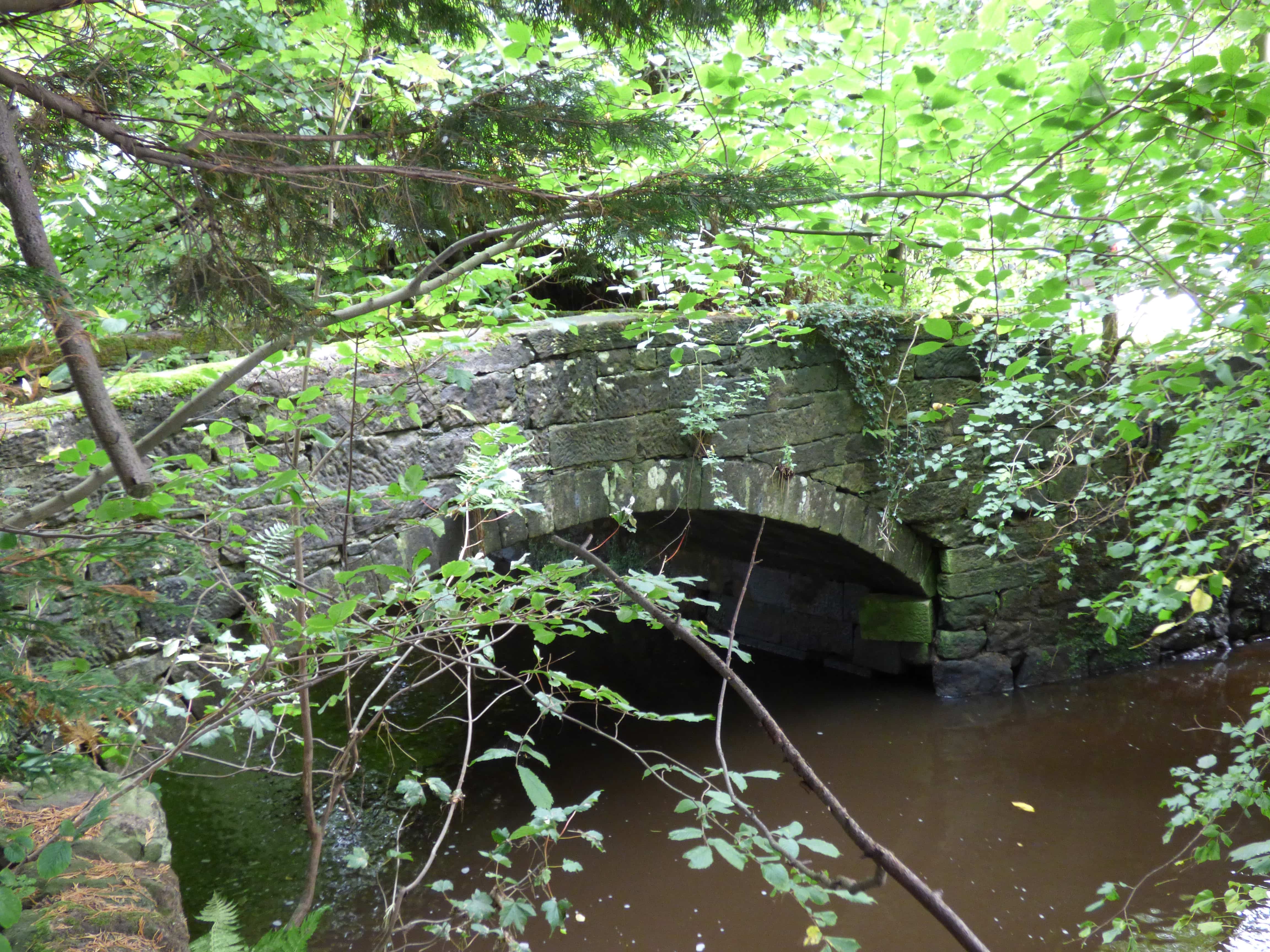
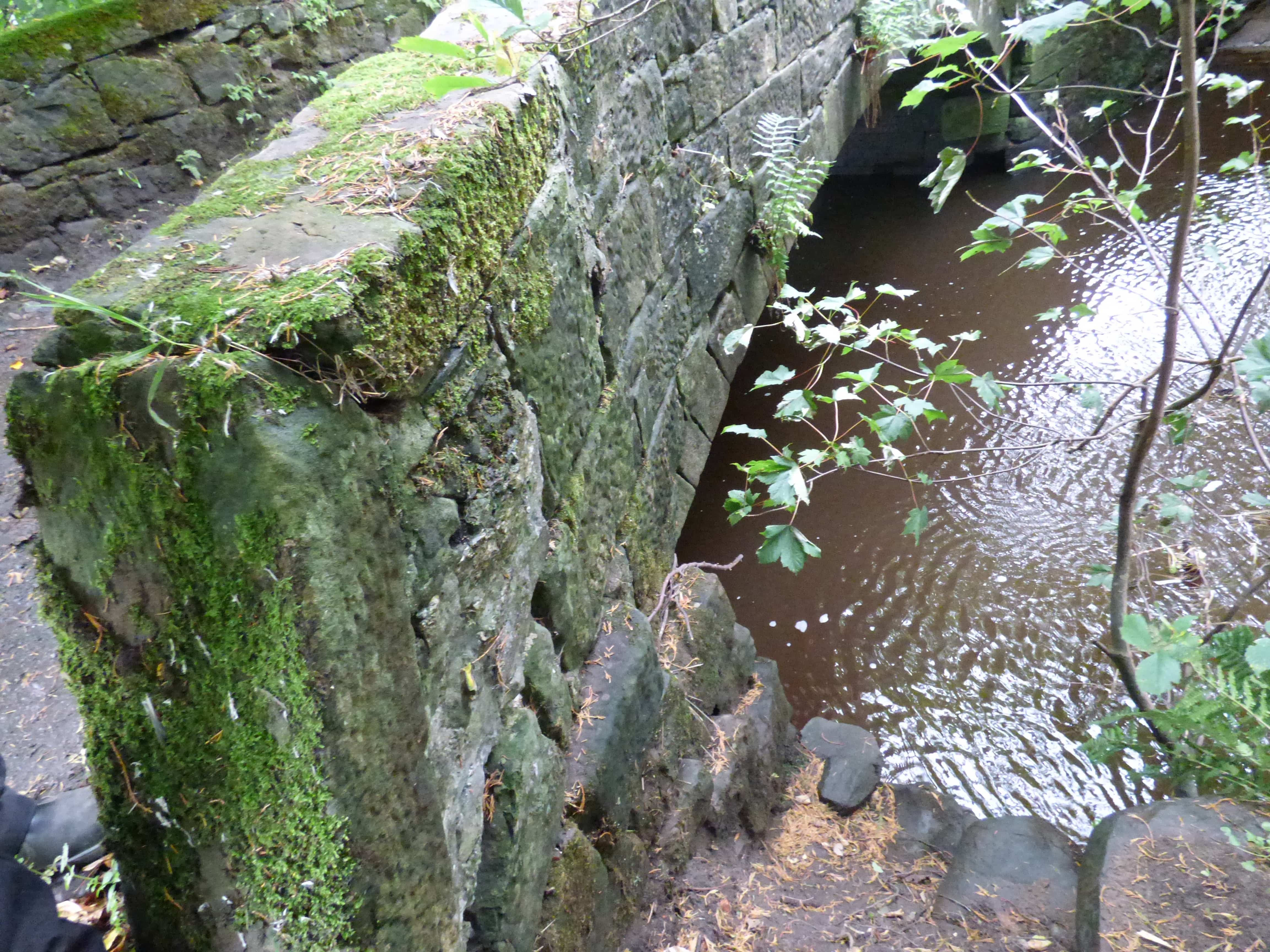
CATHCART OLD BRIDGE Glasgow
C.Renfrewshire Whitecart Water 258532,660136
History: 'Snuff Mill Bridge’. Snuff mills harnessed the flow of water to grind tobacco into snuff. There were more than twenty in Scotland, mainly from 1710 onwards, as the tobacco trade boomed. This was originally a meal bridge in the 17th and 18th centuries. It was also on the main route between Glasgow and Ayrchire. A datestone of 1624 is preserved. It became a snuff mill in 1814. Originally a semicircular arch (see photo- sketch). Rebuilt in the 18th century using the original stone. Closed to traffic in 1924.
Maps: Roy(1750) Pont 33(1600)
Currently: Coursed squared rubble, possibly ashlar: certainly very well dressed. Segmental arch. Dressed voussoirs. Additional flood arch.
Link photo photo photo.
_______________________________________________
CENTURIAN'S BRIDGE Penicuik House
C.Midlothian R.North Esk 321963,658975
History: Also known as Roman bridge. Built 1738 by 2nd Baronet Clerk at Newbiggin House, an early 17th century mansion which he had owned since 1654. John Baxter was the estate mason bridge builder. A new 'Penicuik House' was built on the Newbbiggin footprint in 1761.
Maps:1750(Roy).
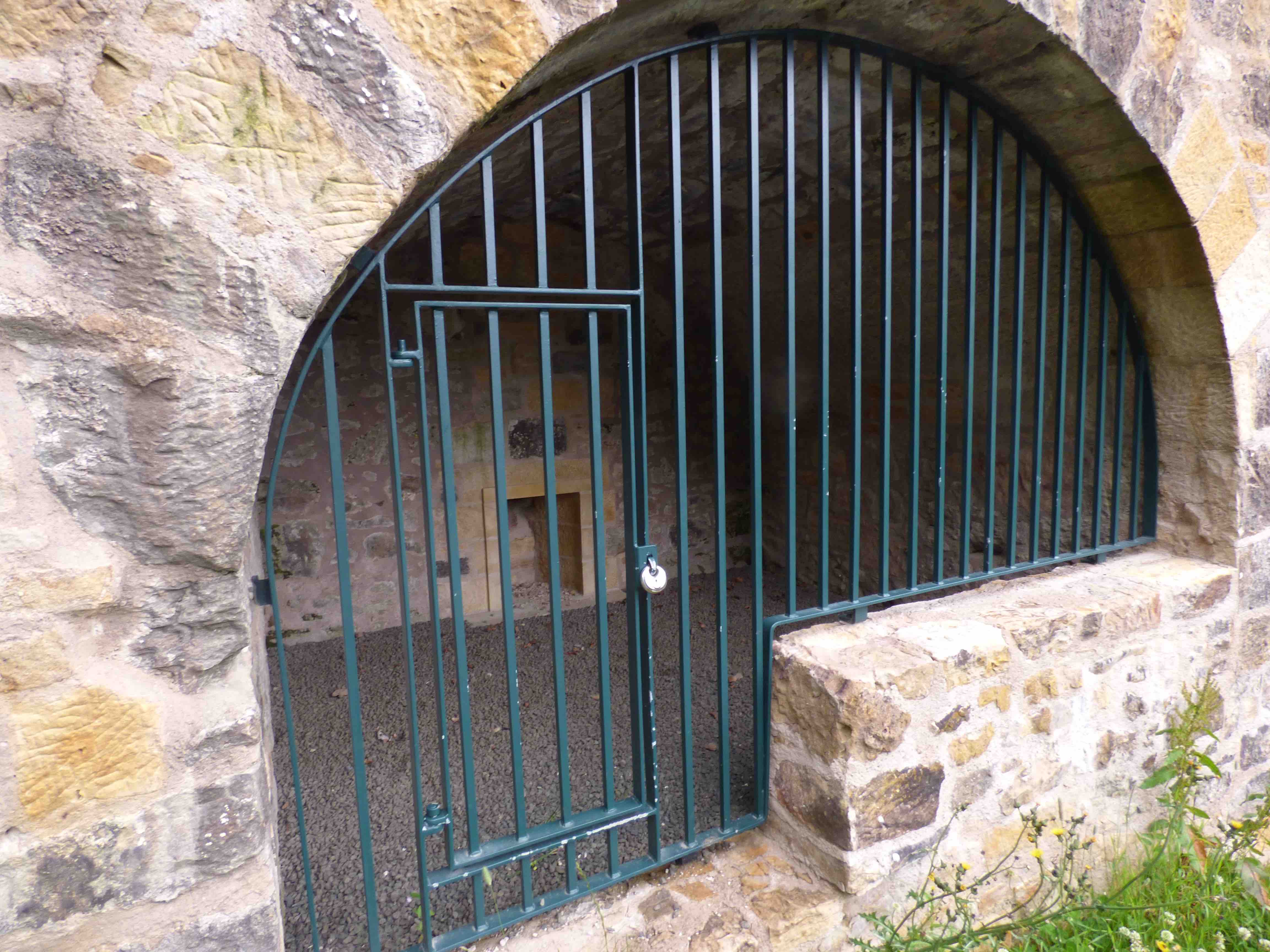
Currently: The majestic avenue leading from the house to the bridge continues beyond it, on the other bank and then appears to peter out, going nowhere. On the near bank the road is implausibly steep. On Roy, the main approach to Newbiggin was from the Northeast, not from the bridge. This is a very beautiful early 18th century estate bridge, impressively restored in 2014. Unusually decorative in style , for its time. Almost semicircular humped arched with 4 additional pseudo flood arches in the nature of Georgian follies: too high to be useful as flood arches. Two of these semicircular oculae are fashioned into small chambers. Very well dressed voussoirs, possibly ashlar. Uncoursed squared and dressed rubble spandrels and approaches. Unusual ornamental resetting of the arch within the spandrels. 9-10 ft wide between parapets.
photo photo photo photo photo.
_______________________________________________
CERES BISHOP’S BRIDGE
C.Fife. Ceres Burn. 340015,711429
History: This little 17th century bridge is on the south-west side of the town. Roy's map shows the Bishop's road approaching Ceres from the south-west, via Kennoway on the today's Fife Pilgrim Way. The bridge was so called because, in 1689, Bishop James Sharp of St.Andrews was murdered by Covenanters at some location nearby as a reprisal for his severe treatment of Presbyterians. However, the Blaeu map (1600) appears only to show a bridge on the north side of the town kirk, and structurally, this latter is almost certainly the older. Adair's map shows both bridges, one north of the town and one in the south-west, so both bridges are pre-1680. Tom Robertson (historicbridgesofbritain.com) has revealed, from his research, that Bishop Sharp spent the night prior to the attack at Kennoway, and that he was on his way to St.Andrews. So, it seems that although this is the younger of the two bridges, it is certainly the one linked to the bishop. The old bridge north of the town was not on his route.
Maps: Roy(1750) Adair (1680s) . Not on Blaeu.
Currently: A small very beautiful, humped, random rubble bridge. The recessed ashlar arches are in such good condition that one might conclude there had been a very substantial restructuring at some stage. Yet the voussoirs are slightly chamfered suggesting antiquity. Only 6 ft wide. 27 ft span. Hood mould. Cobbled decking. Splayed approaches. This could be called a category 1 Hinchcliffe packhorse bridge although its location in a 13th century village suggests it was simply the town bridge. It is so narrow and humped that one has to wonder how the bishop's carriage got over!
_______________________________________________
CERES NORTH BRIDGE
C.Fife. Ceres Burn. 339662,711788
History: This bridge was on the north side of the town on the very old maps as well as on Roy. It is just wide enough to take two lanes of modern traffic. On Roy's map it is on the route to Coupar. It is the older of the Ceres Burn crossings and the only one on the 1600 map.
Maps:Blaeu(1640) Adair(1680) Roy(1750)
Currently: The arch is in dentilated ashlar suggesting a restructuring in the early nineteenth century but the same decoration is on both faces. The substance of the stonework, however, is random rubble on the western face, suggesting an eighteenth-century or earlier rebuild and there is also a very old looking hood-mould. There is no hood mould on the eastern face. The real discovery, however, is on the soffit, where there are two additional widenings clearly showing three parallel arches. (photo 3). As the bridge is on Blaeu's map we can reasonable presume that the middle one is from the 16th century. This section is a little over 3m wide. There have been two much later expansions at different periods. In a 19th century expansion, it appears that the facing voussoirs have been remodelled to match each other.
_______________________________________________
CHARLIE’S BRIDGE Keith
C.Moray Haughs Burn. 341515,850953
History: This little bridge seems to be unknown. Certainly unrecorded. No available information. Yet it is firmly on Gordon's 1636 map and known by locals as "Charlies Bridge". It seems that in the 1746 skirmish in the run-up to the battle of Culloden, the bridge was crossed by Prince Charlie. This is not the case, although the skirmish certainly took place in Keith and 90 prisoners were taken by the Highlanders.
Maps: The bridge is absent from Roy and from Blaeu- but is exactly in the correct spot for Gordon's map. Today, it is labelled "Bridgend" on the OS.
Currently: Appears to be the original. A small packhorse bridge, over a very small burn, completely overgrown with ivy. About 6ft wide and 18ft long. Semicircular arch in rubble and un-coursed random rubble spandrels and abutments.
_______________________________________________
CHARTERSHALL BRIDGE Stirling
C.Stirling Bannock Burn 279232,690233
History: This bridge was reputedly first built in 1696: probably a mill bridge and may have been over the mill lade which is adjacent. The present bridge has a plaque which states "This bridge was rebuilt by the justice of the peace 1747" So clearlly statute labour, around the time of Roy's survey. The bridge was bypassed in the 1960’s, immediately upstream.
Maps:1750(Roy)
Currently: 18th century single segmental arch with well faced random rubble spandrels and rubble voussoirs. Solid coping to parapets. No string. The abutment revetments are interesting.They appear to be in weathered ashlar and possibly a remnant from an earlier 17th century structure(photo). A few yards to the north is a culvert over the mill lade which still exists.
photo photo photo.
_______________________________________________
CLACHAN BRIDGE see ABERFOYLE
_______________________________________________
CLARKS BRIDGE Beith
C. Renfrewshire Roebank Burn 235741,655457
History: According to Crawford and Semple, this bridge was built about 1715. Firmly on Roy, on the original abandoned road out of Beith going north towards Paisley, approximately 50 yards west of the present crossing. Remnants of the original road can be seen in the undergrowth. Late 19th century OS shows the old road was still in use.
Maps:Roy(1750)
Currently: Extremely overgrown and dangerous high bridge over a deep chasm. Access at water level almost impossible. Single semicircular arch with dressed rubble voussoirs. Spandrels in coursed squared well dressed and squared rubble on the western facing. This looks like a 19th century widening. Rough undressed random rubble on much of the the east side which may be original. Access to the soffit was not possible, so the widening could not be confirmed. Unusual flood arch arrangement which also appears more 19th century. The bridge is now completely lost and overgrown, yet intact. It is surprisingly wide even for a 19th century reconstruction. There are masonry road blocks across the access which date from WWII.
photo.
_______________________________________________
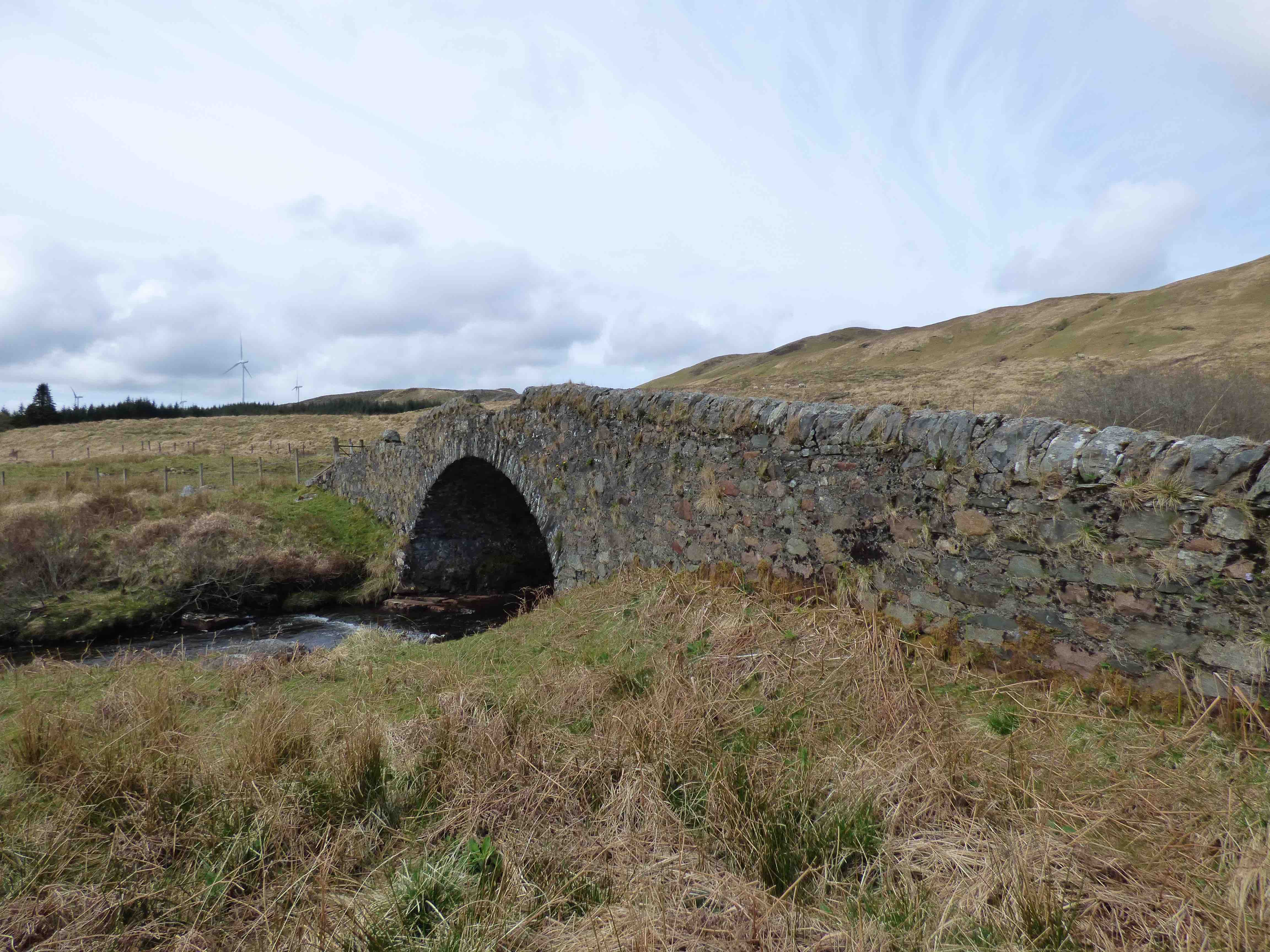
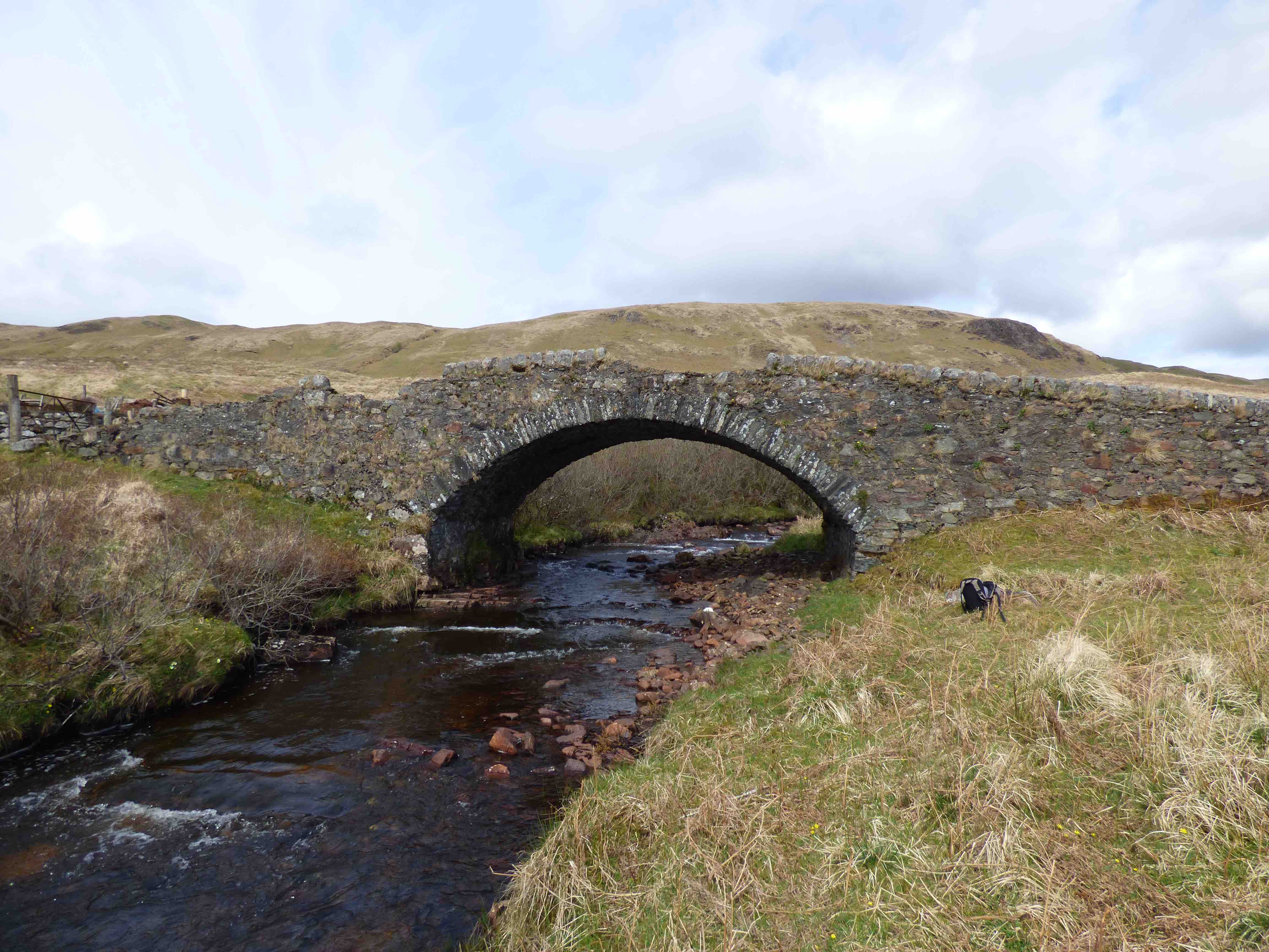
CLEPHANTON BRIDGE Cawdor
C.Nairn R.Nairn 282426,850216
History:1755 military bridge. Major Caulfeild. Coupar to Fort George. This road was built while Roy's survey was being conducted but it does appear on the map so this bridge had a predecessor. Roy describes it as 'Nairn Bridge’. The bridge has the shape and style of a Caulfield military bridge but may have been substantially rebuilt in the 19th century.
Maps: 1750(Roy).
Currently: An 18th century bridge with 19th century improvements. One segmental arch plus one smaller flood arch. Spandrels in squared coursed rubble but radiating out from the voussoirs giving a beautiful pattern. This is most unusual and almost certainly not an original feature. The voussoirs are of different lengths; as such, the arch itself is integral to the spandrels, though the the voussoirs are of better dressed stone at the arris. This may be part of an extensive repair on both faces which does not match the soffits. No string course. Buttressing and cutwaters.
photo photo photo photo.
_______________________________________________
CLYDE'S BRIDGE Abington
S.Lanarkshire R.Clyde 294128,626697
History: This bridge lies close to the old Roman road coming down from the Edinburgh region, through Biggar, towards Carlisle. It replaced an ancient ford known as Ramwellcraigs, and was part of a packhorse route carrying lead from Leadhills towards Edinburgh. A successful petition to Parliament in 1661 described "lamentable loses and dangers at the ford" (Acts of the Parliament of Scotland 1661/1/103). The plans for a bridge came to fruition in 1683 in a single arch bridge built by a William Baillie, with a range of toll charges to reimburse him. The proximity of Cold Chapel confirms the location in the Parliamentary papers. This is the bridge on Roy's map. In 1768, a 'new' bridge was built 360 yards downstream of this early structure. It was built by Russell and Telford (Transactions of Glasgow Archaeology.20 p323). This is too early to have been Thomas Telford. No trace remains of the earliest bridge. The present old bridge was bypassed in the 1960s in an upgrading of the A74 and A702 junction. [Note: It seems there was another bridge of very similar structure and style built at Elvanfoot, Newton, about 10 miles south, around the same time period. There are few available details to confirm this, but a 19th century sketch certainly exists. It was replaced/bypassed by a Thomas Telford bridge, a little downstream, in the early 18th century]
Maps:1750(Roy)
Currently: Rather a puzzle. Three flat recessed segmental arches of varying size. Iron ties. Hood mould. Huge cutwaters. There is an inscribed date of 1768. The bridge has been built with a range of relative 'retro' styles, much as we are certain of the date of build. The large cutwaters and hood mould are of 16th/17th century style, and the width is a mere 11 ft. The stonework on walls and spandrels is of rather crude rubble, scarcely coursed and poorly dressed; oddly, this is more redolent of early 18th century. However, the solid arches and voussoirs do match a late 18th century date. Here, at Clyde's Bridge, the modern A702 now bypasses the bridge, adjacent on the north side.
__________________________________________________
CLYDESHOLM BRIDGE Lanark
C. Lanark R.Clyde 286871,643911
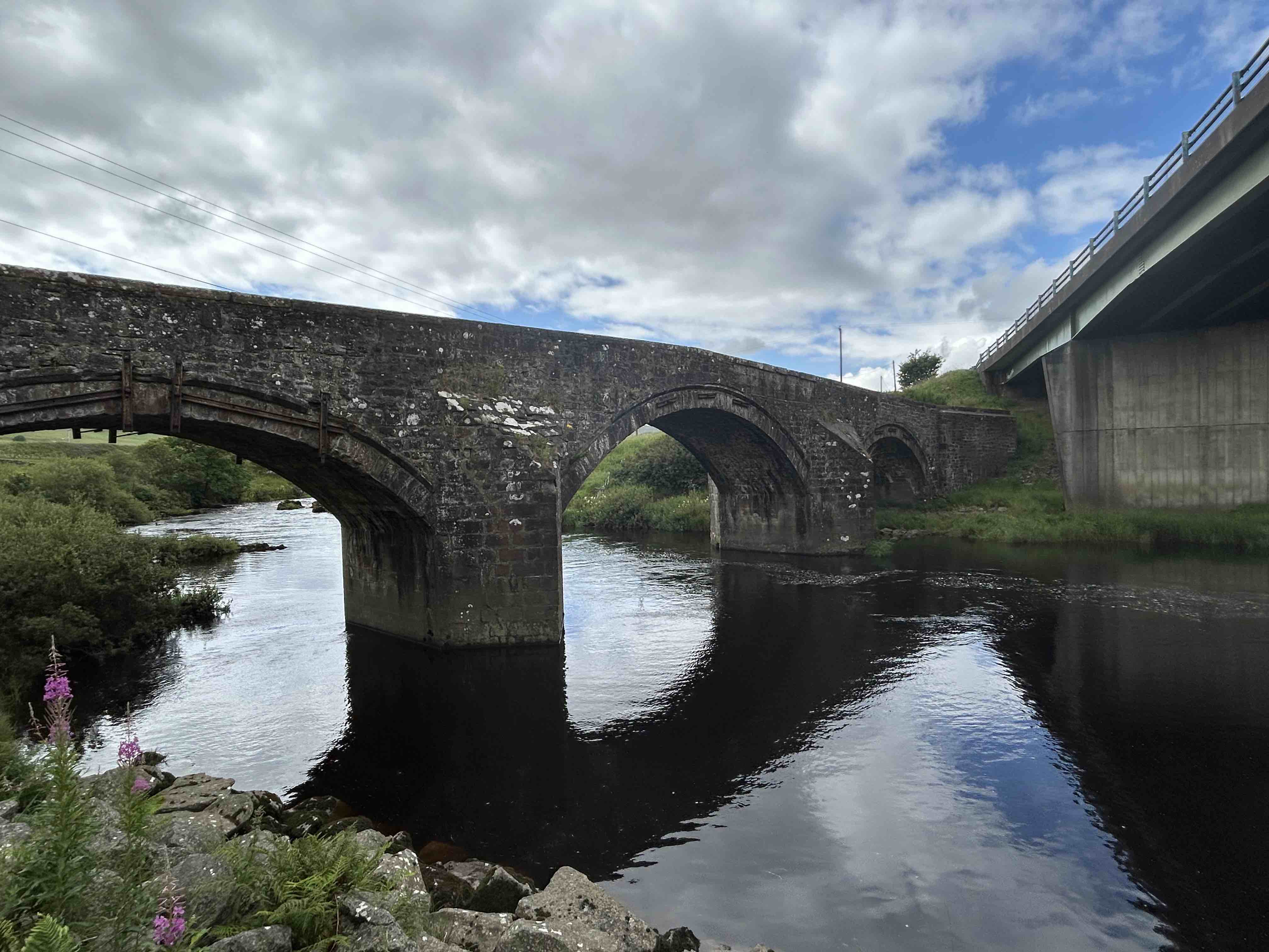
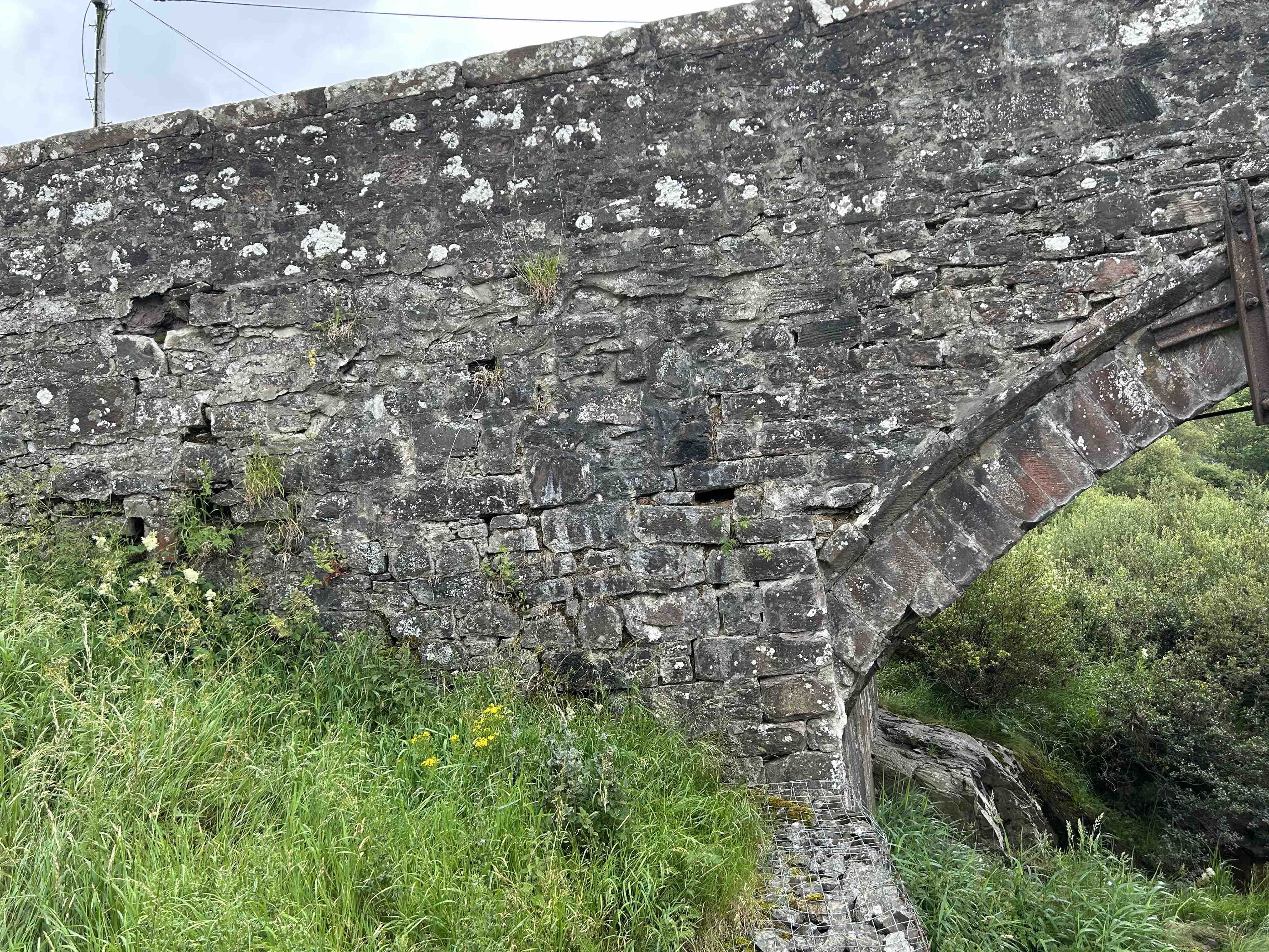
History: This is the oldest surviving bridge over the River Clyde on the ancient Glasgow to Carlisle road. A ford was mentioned 1461. HenryVI crossed it, fleeing north. Ferry boat established in 1491 by Royal Charter with a well paid ferryman with hereditary rights. The present structure was the first bridge. Planned from 1649 because of heavy loss of life through spates in the river (Parliamentary records). The bridge was not completed until 1699. Master of works was John Lockart. It cost 16000 Merks (1375 pounds English). Tolls were imposed: two pence per pedestrian. The accounts still exist. The river is fast flowing here and floodwaters have occasionally been close to the crown of the bridge. It is extremely well built.
Maps:1750(Roy)
Currently:1699. Three large semicircular arches without ribs. Three islands, immediately upstream, channel the water by a stream to each arch. Four m. wide. Random un-coursed rubble spandrels. Slim ashlar voussoirs. Triangular refuges at each pier. More recent parapets in squared coursed rubble.
Link photo photo.
_______________________________________________
CORTACHY BRIDGE Kirriemuir
C.Forfar R.South Esk 339557,759775
History: This may be the home bridge of the adjacent 14th century Cortachy Castle which belonged to the Ogilvie Airlie family. Mentioned by MacFarlane in 1744.
Maps:1750
Currently: Dated 1759; this was probably a restructuring.
Single arch. Almost semicircular. Wide red sandstone voussoirs. Squared coursed rubble spandrels and abutments. 13 ft wide. Iron tie-rods and mattress plates. Plain without a string course but spandrels from different build. Difficult to see any widening but this would be probable. Fully flat-decked. Almost certainly restructured in the 19th century.
photo photo.
_______________________________________________
OLD CRAIGBRIDGE Strathavon
C. Lanarkshire R. Avon 271209,643212
History: Very little history available for this 18th century bridge. It was certainly on Roy's map and then on the old turnpike from Strathavon to Muirkirk ( OSA). Massive floods on the Avon in 1771 may have led to a rebuild but there is no confirmation of this, although two more upstream bridges were wiped out at the time. It was bypassed 100m upstream in 1938. The bridge is now at risk of collapse and in the absence of any support from historical authorities, the longtime resident of the adjacent cottage, William Brown, has been valiantly attempting to stem the tide by attending to essential maintenance. He admits, himself, that is a losing battle. This is a fast flowing river with serious flooding issues at this spot.
Maps:Roy(1750)
Currently: Although the crude undressed random rubble masonry of the walls and spandrels might suggest this was the bridge on Roy's map (1750), the very well dressed voussoirs suggest a later date, albeit that the arch is not not recessed. The width of 16 ft, parapet to parapet, almost certainly suggests a later date. Possibly 1770s. There is certainly no evidence of parallel widening. No string course. Simple cutwaters, both upstream and downstream. Two slightly raised wide segmental arches of about 35 ft. Pier looks robust which may help with durability. Slightly humped. Parapets in serious decay. There is an interesting revetment (photo 4) on the northern downstream bank which may be a remnant of a previous structure.
_______________________________________________
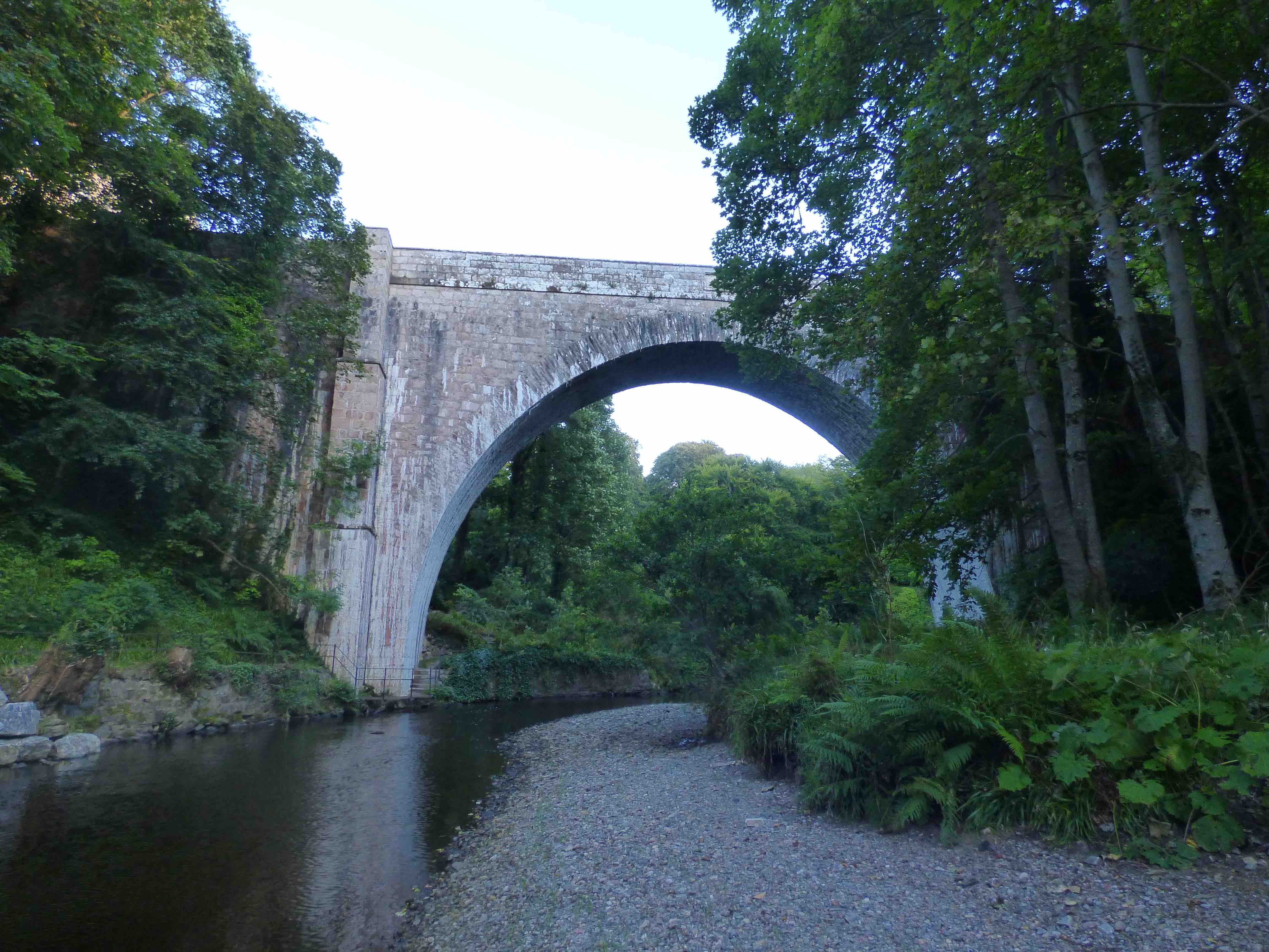
CRAMOND BRIDGE Edinburgh
C. Lothian R. Almond 317951,675463
History: Built in1488. Two arches collapsed in 1587. Parliament reported ‘..the brig of Crawmond quill now and hes bene this lang time failing downing na passage hed or may be he’d thairby’. It possibly remained 'down' until 1617 when there was a complete rebuild except for the remaining western arch of original design. Even the piers and cutwaters were refashioned. Further repairs in 1687 by Robert Mylne master mason to the Crown. Also repaired in 1761 1775 and 1854. Walter Scott recounts a story that James V was attacked by brigands while crossing the bridge, incognito and without entourage. A local man intervened and saw off the robbers. Unaware it was the King he then welcomed him into his home, for a while, to clean up and recover. He was suitably rewarded in due course. There followed a tradition of Royal hand washing, on the bridge, attributed to James V but subsequently honoured by George IV.
Maps:1750(Roy) 1680s(Adair) Oddly not on Blaeu.
Currently: A 15th century old yellow sandstone ashlar and squared coursed rubble bridge with un-coursed random rubble approaches. Flat decking. Three stilted pointed arches of around 35 foot span. The eastern one appears almost segmental. The western arch is the oldest and has four huge ribs and a counter-course ring of chamfered voussoirs added to by the first chamfered rib. The two eastern 17th century arches have larger un-chamfered voussoirs in a single course. The central arch has the smallest span which is odd. Cutwaters are of varying shape which is also strange. The bridge is 13 ft wide from parapet to parapet. Strong string course rises up at crown of the arches. Very well maintained with recent pointing.
Link photo photo photo photo photo.
_______________________________________________
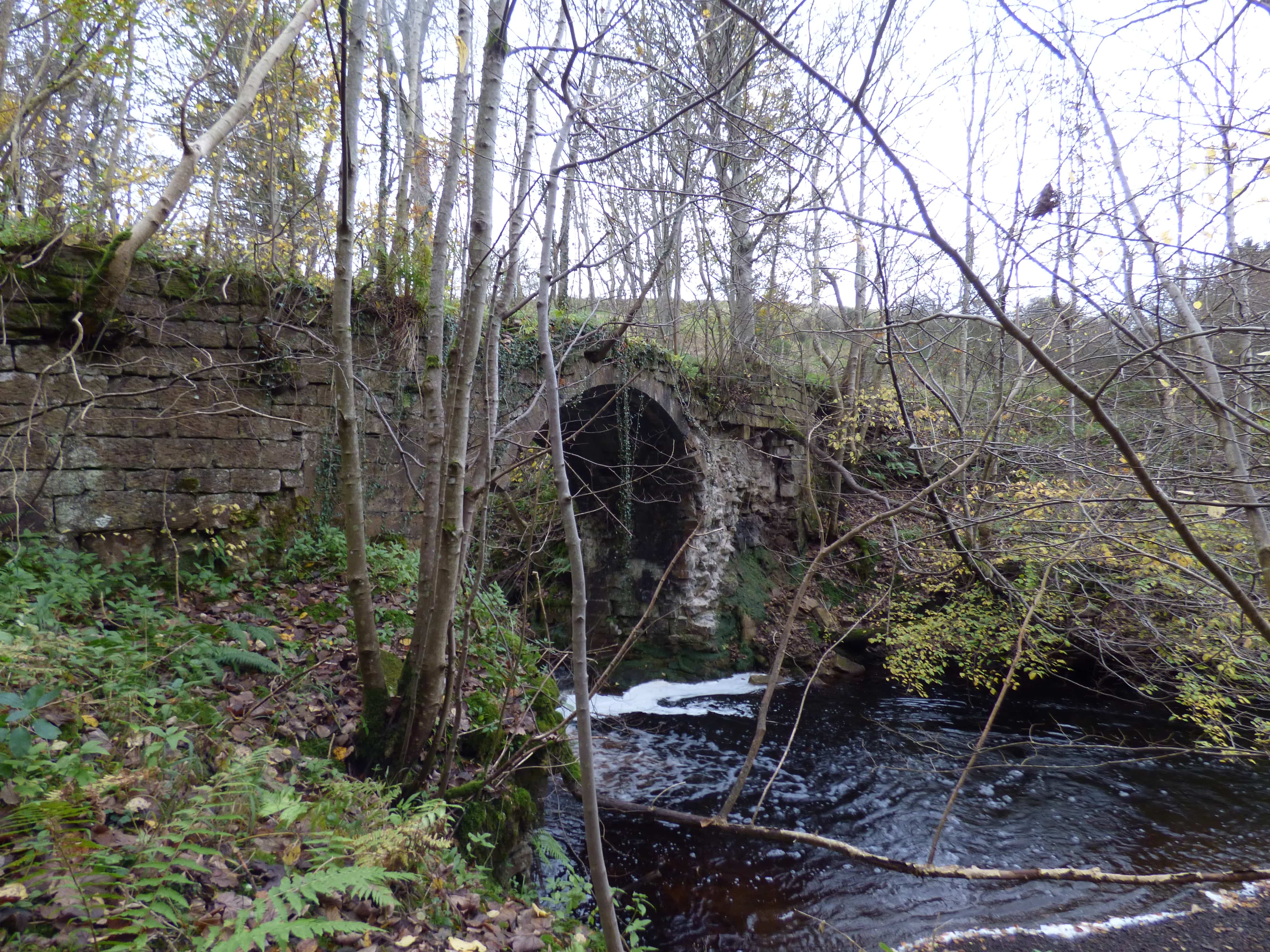
CRATHIE BURN BRIDGE
C.Aberdeen R.Crathie Burn 326024,795276
Maps:1750
Very clearly on Roy but certainly not linked to the later military road. Probably a remnant of the Old Deeside Road. Currently: Tiny isolated segmental arch which is the central remains of a wider structure. Most of the rest of the bridge has disappeared. The abutment revetment (photo) defines its previous dimensions. Voussoirs only with a turf deck.
photo photo photo.
_______________________________________________
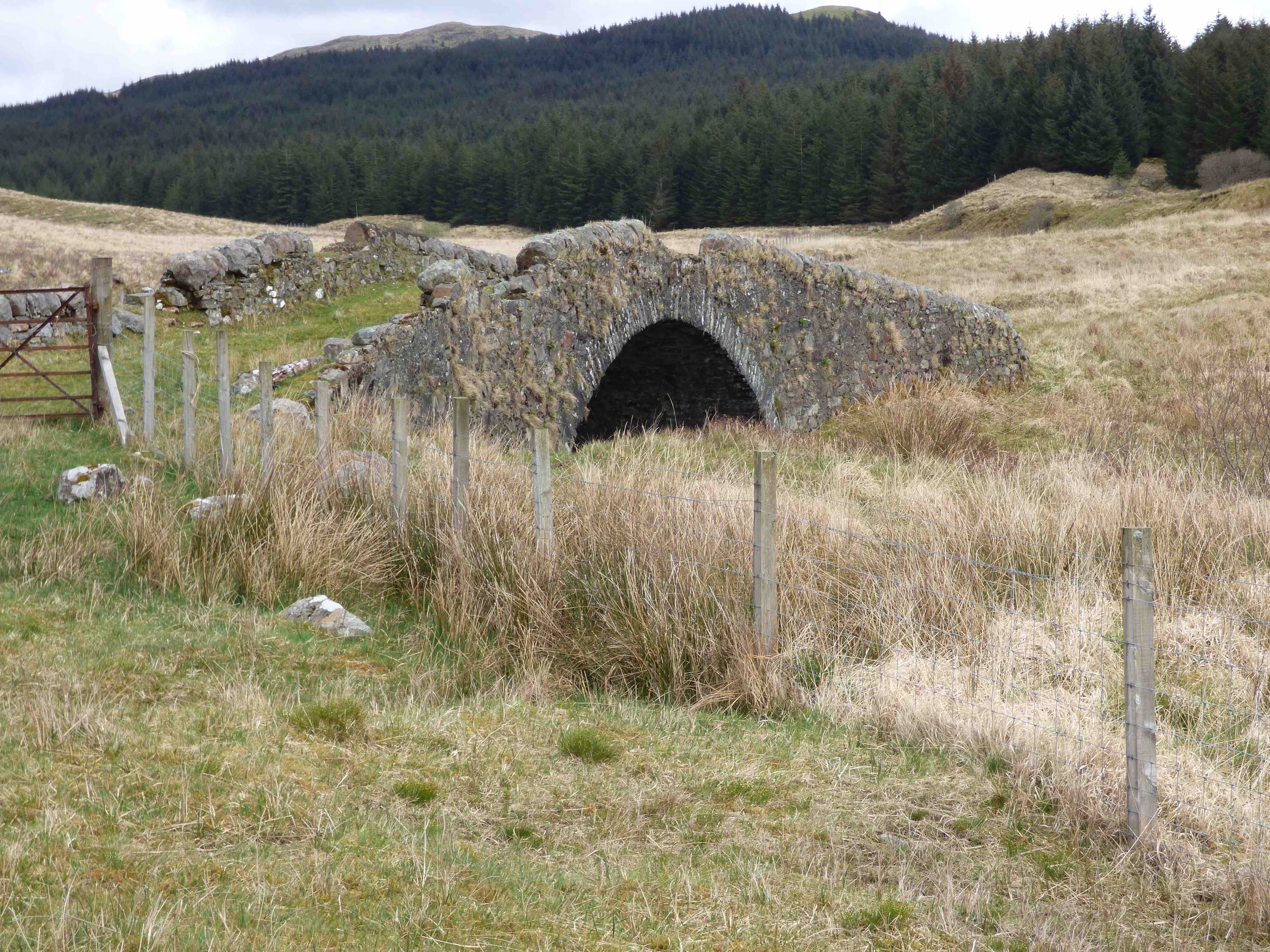
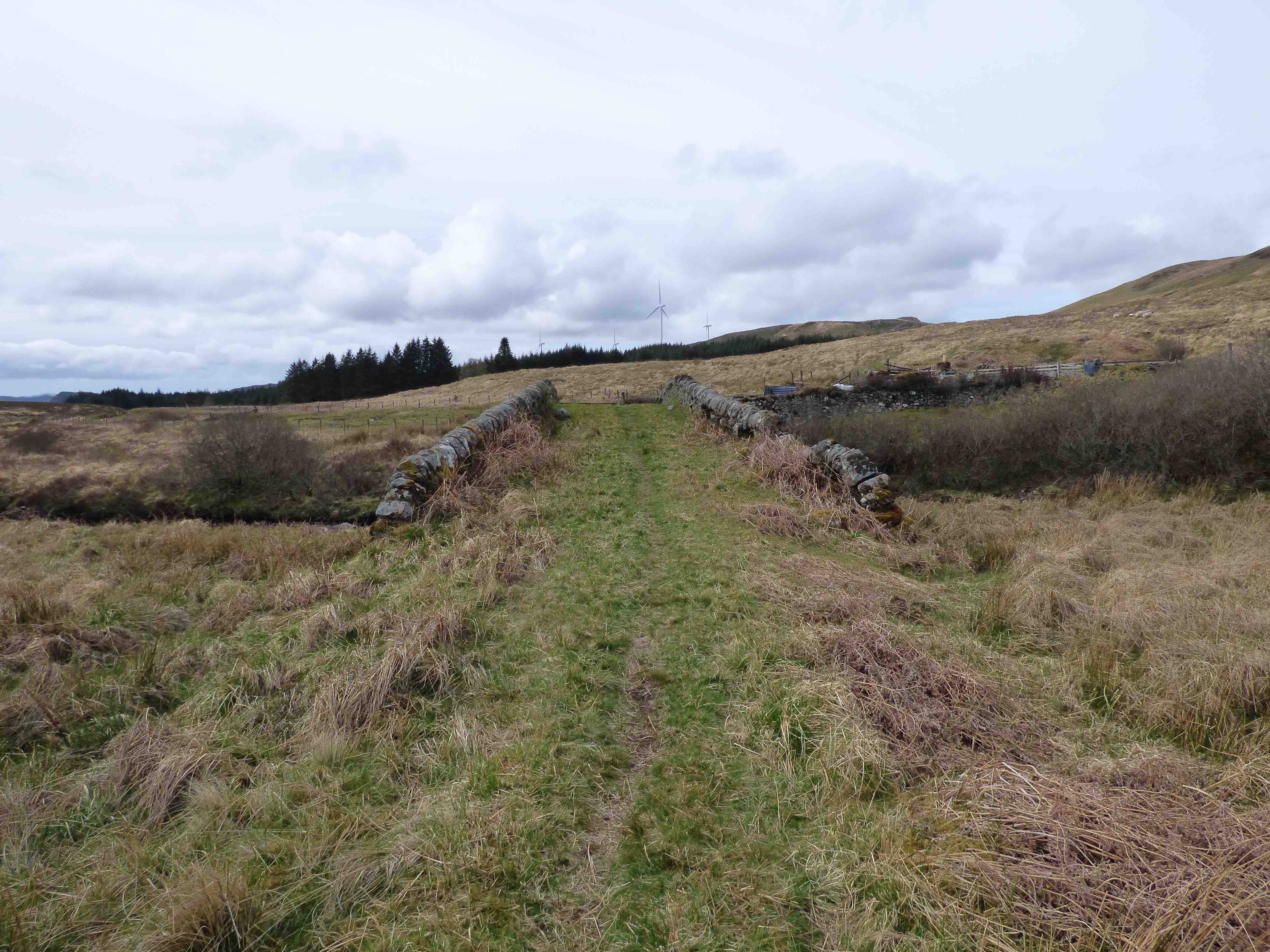
CREAG AN LUBHAIR BRIDGE
C.Argyll R.Add 194721,699731
The most remote of Roy's bridges, today. An ancient long distance drove road ran from Kilmartin, through the hills between Aweside and Loch Fyne, aiming for Inverary. Well mapped on the OS. Well documented by Haldane. Cattle were herded from Kintyre as well as from Islay and Jura. Some came from Mull. They were on their way to markets in Crieff and Falkirk. The road is well outlined on Roy's road network from 1750. This bridge has recently become less remote because of the new Forestry Road to Loch Awe.
Maps: 1750(Roy)
Currently: 18th century. A very substantial rubble bridge with a single stilted segmental arch. Humped. Random un-coursed rubble. Hardly dressed. Long whinstone voussoirs of irregular length. Pitch dressed rounded coping stones. Slight squinch on the upstream side. Splayed. 12 ft between parapets. 25 foot span. Remarkably like a Major Caulfield Bridge though this seems improbable. No military provenance. The drove road itself is very clear on the landscape, both inside and outside the forest.
_______________________________________________
CROSS WATER BRIDGE New Luce see NEW LUCE
_______________________________________________
CRUBENBEG BRIDGE see ETTERIDGE
_______________________________________________
CRUDEN BAY BRIDGEND BRIDGE see BISHOPS BRIDGE
_______________________________________________
CULLEN HOUSE BRIDGE Cullen
C.Aberdeen R.Cullen Burn 350601,866233
History: Cullen House dates from 1602. The main estate bridge leading as a viaduct into the main drive was built to a design by William Adam in 1744.
Maps: Features prominently on Roy (1750)
Currently: 18th century. Enormous granite single span bridge in squared very well dressed blocked in rubble spandrels and abutments. Marked well dressed string course in ashlar. Remarkably wide voussoirs, also in rubble: about 3 ft wide. Huge semicircular arch. Parapets are a little more recent. Interlocking coping stones. Elaborate design to buttresses which are more like pilasters. This bridge, like the Adam creation at Aberfeldy, is completely atypical for the period.
_______________________________________________
CUDDY BRIDGE Innerleithan. see INNERLEITHEN
_______________________________________________
CURRIE BRIDGE
C. Midlothian Leith Water 318275,667743
History: New Stat. Accts., .1845 ' Bridge said to be 500 years old ‘ but this has not been substantiated. "As deep as Currie Brig" is a proverb suggesting cunning and shrewdness. It was on the main road to Lanark from Glasgow. First recorded in 1666: the Covenanter Battle of Rullion Green. Rebuilt in 1896 and widened on the downstream side.
Maps:1750(Roy) 1680s(Adair) 1640(Blaeu)Pont(1600)
Currently: The eastern downstream side is 19th century with a stilted segmental recessed arch in ashlar and a solid hood-mould. Squared rubble spandrels now brought to course. More recent parapets with coursing and string course. Iron ties (photos 1 and 2). The western upstream side appears original (probably 17th century) but in such good condition that the dressed rubble arch may have been taken down and then restored. Rubble voussoirs and no hood-mould. No chamfering which is significant for dating. Random rubble spandrels are pitch-faced but not squared and only partially coursed with some residual sagging which has now been strengthened. There is no string course on the upstream side (photos 3 and 4)
photo photo photo photo.