Scotland’s Oldest Bridges.
A map-based catalogue of the oldest masonry bridges in Scotland.
EFG - Alphabetical List
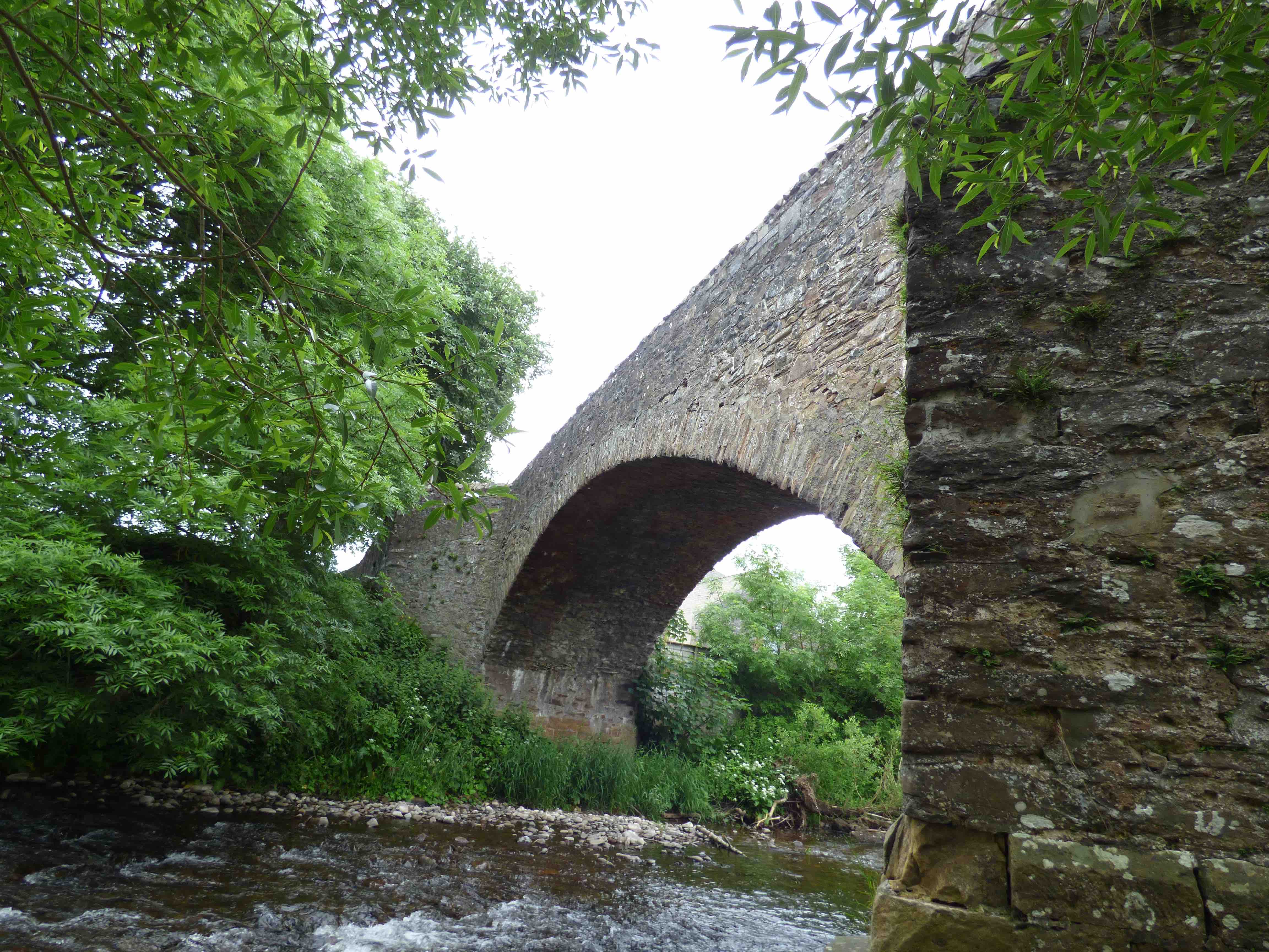
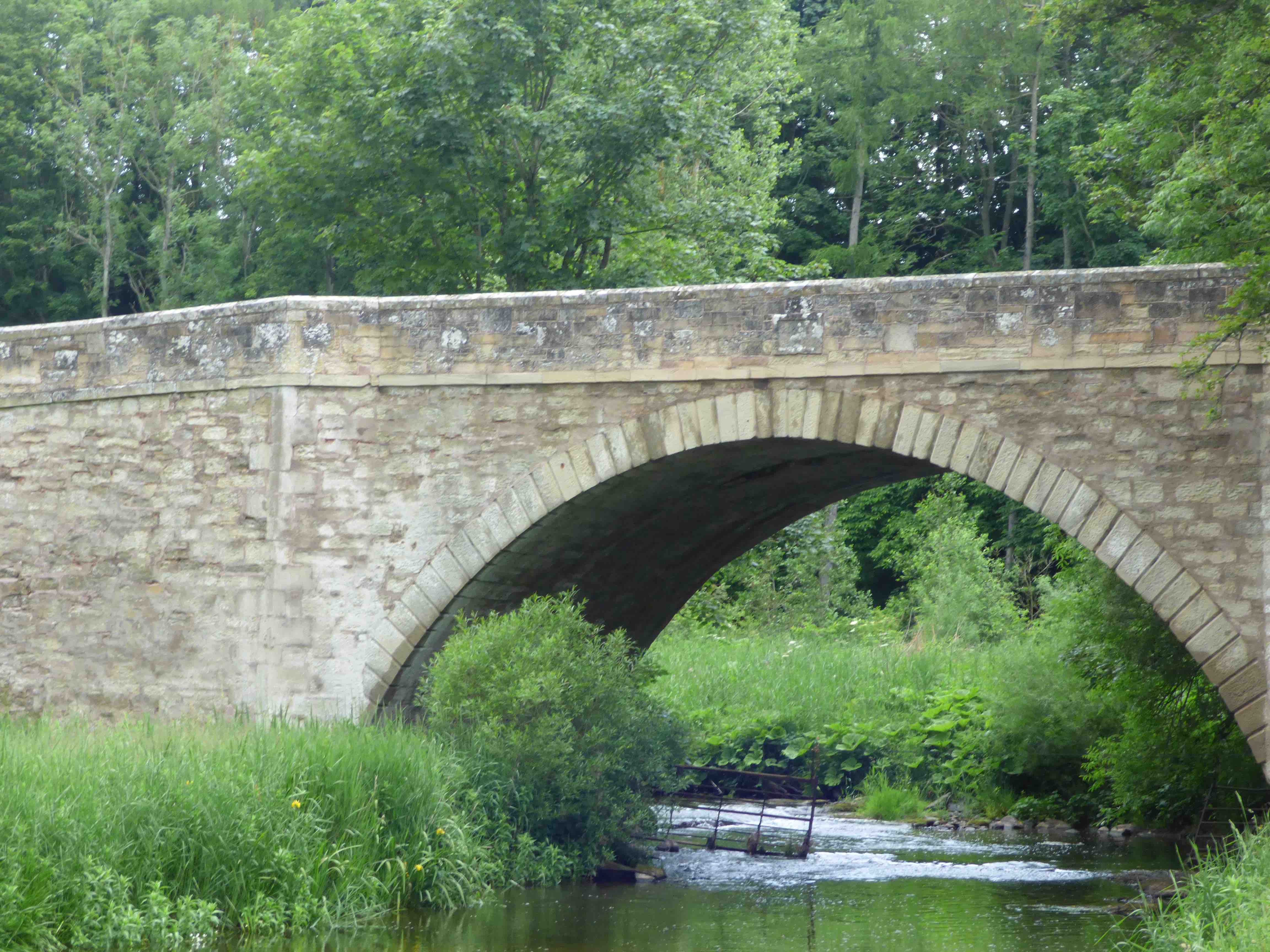
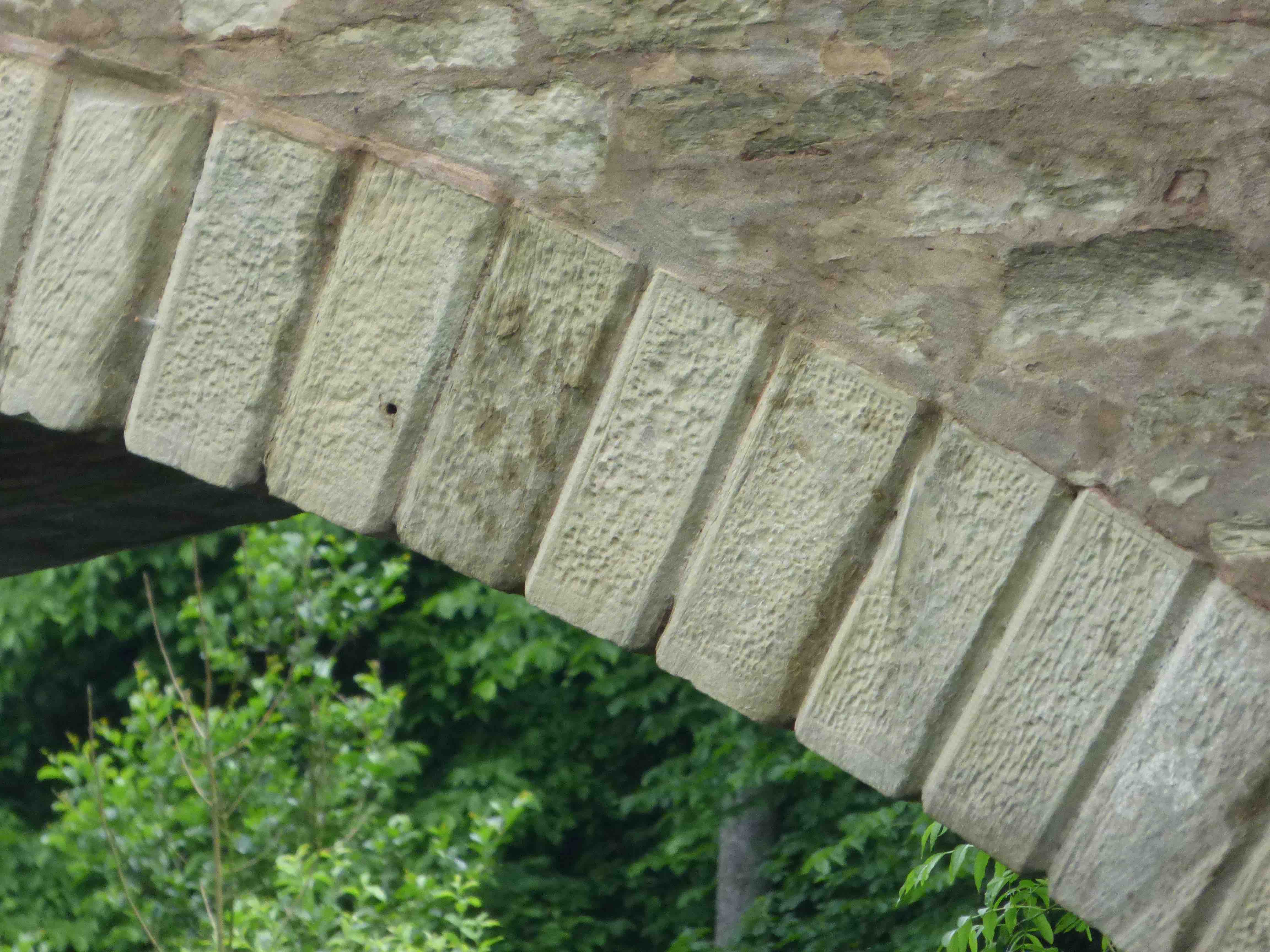
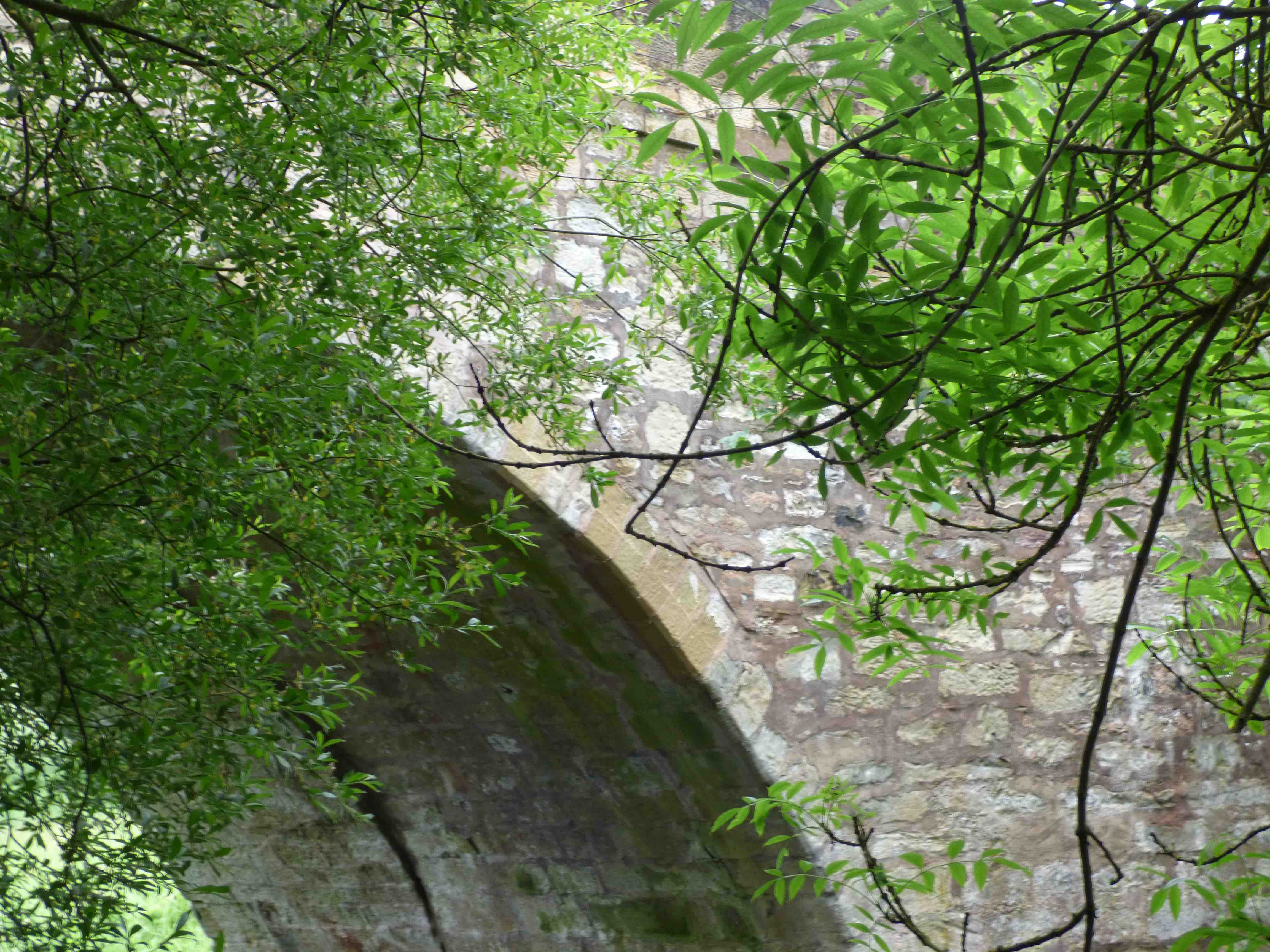
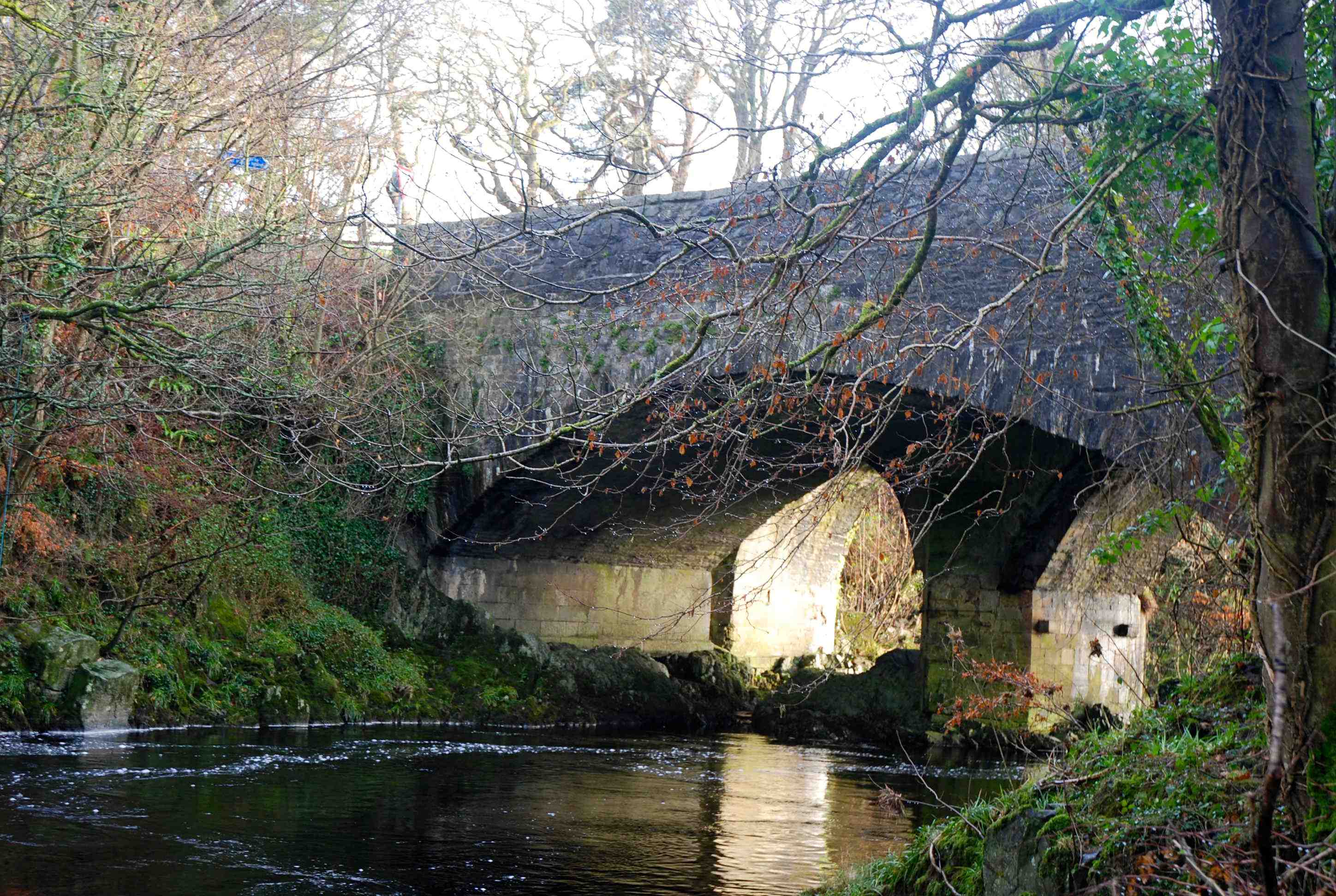
EARLSTON BRIDGE
C. Berwick Leader Water 357061,638230
History: Close to Dere St. going north. There may have been a Roman crossing around this spot. The town was expanded in 1736 with the new church. This probably dates the bridge. It appears there was a ford (Craig's Ford) before that.
Maps:Roy(1750)
Currently: beautiful 18th century structure with two wide flat flush segmental arches and heavy cutwaters. Dressed random rubble spandrels and slim rubble and whinstone voussoirs, non-recessed. No string course. Parapets in later material. Coarse triangular coping. Splayed approaches. Nine ft. across p to p. Now a walkway.
photo photo photo photo.
_______________________________________________
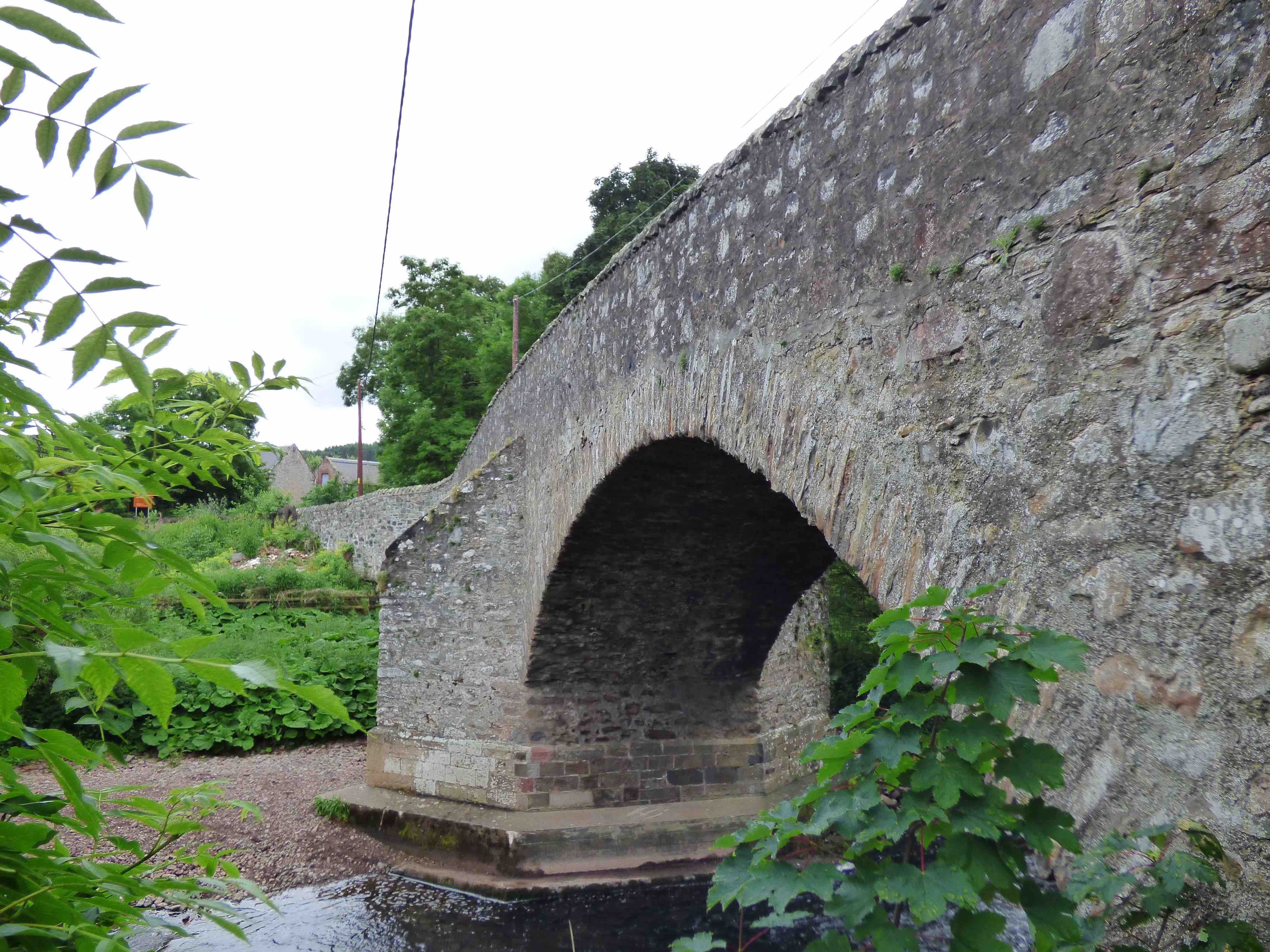
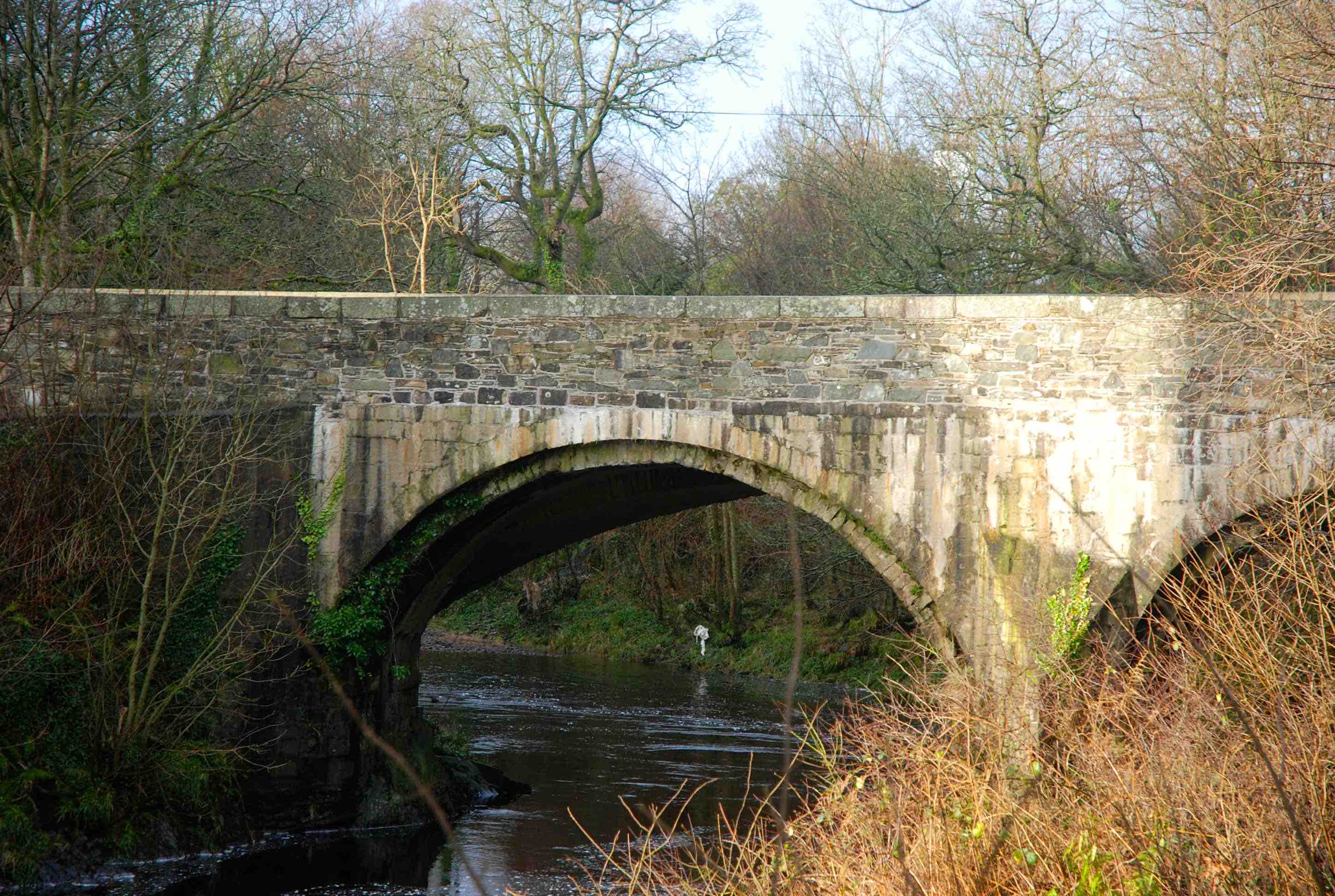
EAST LINTON BRIDGE
C.East Lothian R.Tyne 359261,677107
History: The present masonry appears to be from before the time of the 'Rough Wooing’ invasion of Southern Scotland , 1547, when the previous stone bridge was destroyed by the English army on retreat. Serial recorded repairs thereafter. In 1594, two pence per ox was charged for repairs. Further repairs in 1625 and 1639. Tolls for seven years decreed by Parliament in 1661 Widened in 1763 (from 9ft to 12 ft). The bridge was a key element of the Great Post Road North. There was an adjacent upstream ford known to have been used by the English troops. The ‘Jookstane’ was a boulder within the ford that revealed the water level.
Maps:Roy(1750) Blaeu(1640) Adair(1680s)
Currently: 16th century. 100 ft long. Two huge ribbed segmental arches. 44 ft spans. 11 ft rise. Four ribs each. Large buttresses to the abutments. Chamfered voussoirs and chamfered ribs. Many irregularities due to serial repairs. Refuges at one end only. Large yellow and red squared ashlar and coursed sandstone rubble spandrels, tied with tie rails (19th century). Marked delamination of the stonework. Splayed approaches. The keystone date is for the widening in 1763. The bridge is now 18ft wide. The original carriageway width of 9ft is narrow for a bridge on an important route. The alignment of the approaching roads matches the position of the ford not the bridge.
Link photo photo photo photo.
_______________________________________________
EASTSIDE BRIDGE Kirkintilloch see LUGGIE BRIDGE
_______________________________________________
BRIDGE OF ETTERIDGE
C.Inverness R.Truim 268031,792300
History:1730 military bridge. Wade. Bypassed by Crubenmore Bridge in 1802 and more recently both older bridges bypassed by William's 1925 bridge on the old A9. Finally, all three bypassed by the most modern A9 which runs entirely on the West Bank of the Truim River.
Maps:1750
Currently: Classic Wade 1730s military bridge in undressed random rubble with one semicircular arch which is stilted on one side, plus one flood arch. Crude rubble masonry; flat decking; poorly aligned voussoirs which appear to be whinstone. Iron cramping. 11ft parapet to parapet. A very typical Wade bridge.
Link photo photo.
_______________________________________________
EVAN BRIDGE Beattock
C.Dum & Gall Evan Water 307713 602786
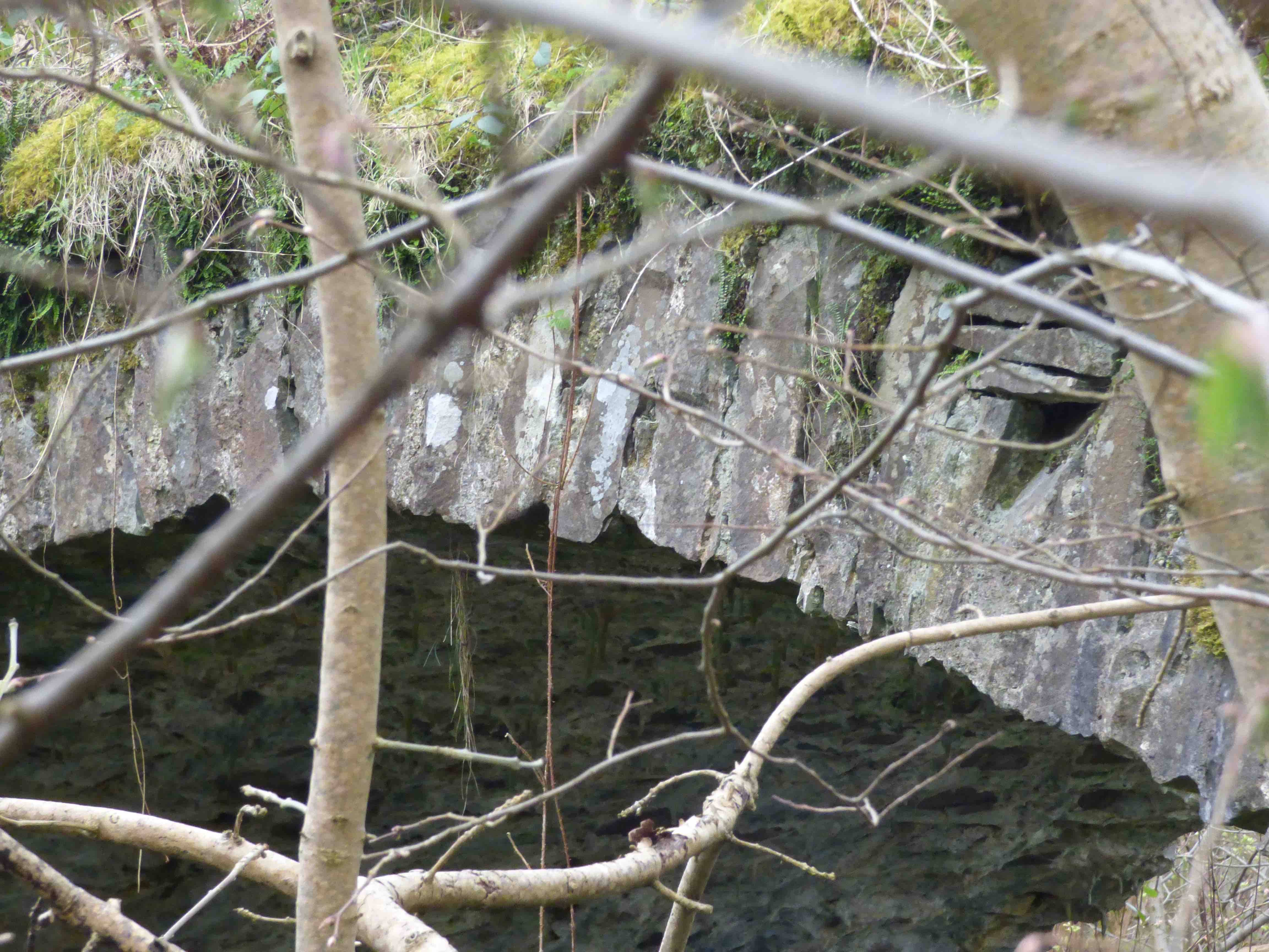
History: This is a hidden treasure which is at risk of collapse. It cannot be seen on modern maps. It was built in 1717 by the Commissioners of Supply. Roys map clearly shows that it was constructed for the Moffat Dumfries Road, not for the main road south to Lockerbie (as in RCAHMS and HES). In the early 19th century, the post carriage came off the bridge killing two horses and destroying the vehicle. This accident was an important stimulus to the building of the new Carlisle Glasgow road, built by Thomas Telford around 1820.
It was bypassed by a Telford bridge, built 80m downstream, which is still taking traffic.
Maps:Roy(1750)
Currently: partial ruin with considerable loss of parapets and upper layers of spandrels. Early 18th C single segmental arch with rubble spandrels and abutments. Voussoirs also in rubble but a little better dressed. Very overgrown and delapadated.
photo photo photo.
_______________________________________________
FIRKIN BRIDGE L.Lomond
C.Argyll. Firkin Burn 233507 701242
History: 1745 Military. Caulfeild. Dunbarton to Inverary. However, the road was restructured by Telford in the early 19th century and revised again in the 1930s before being completely bypassed in the 1980s by the modern A82.
Maps:Roy (1750)
Currently: Small random rubble segmental arch. Clearly slightly extended in the 1930s, on the downstream side, but it is 18 ft wide which suggests Telford rather than Caulfield. It is possibly original Caulfeild on the upstream side which is rougher in build. The soffit has been harled which is not helpful for dating.
_______________________________________________
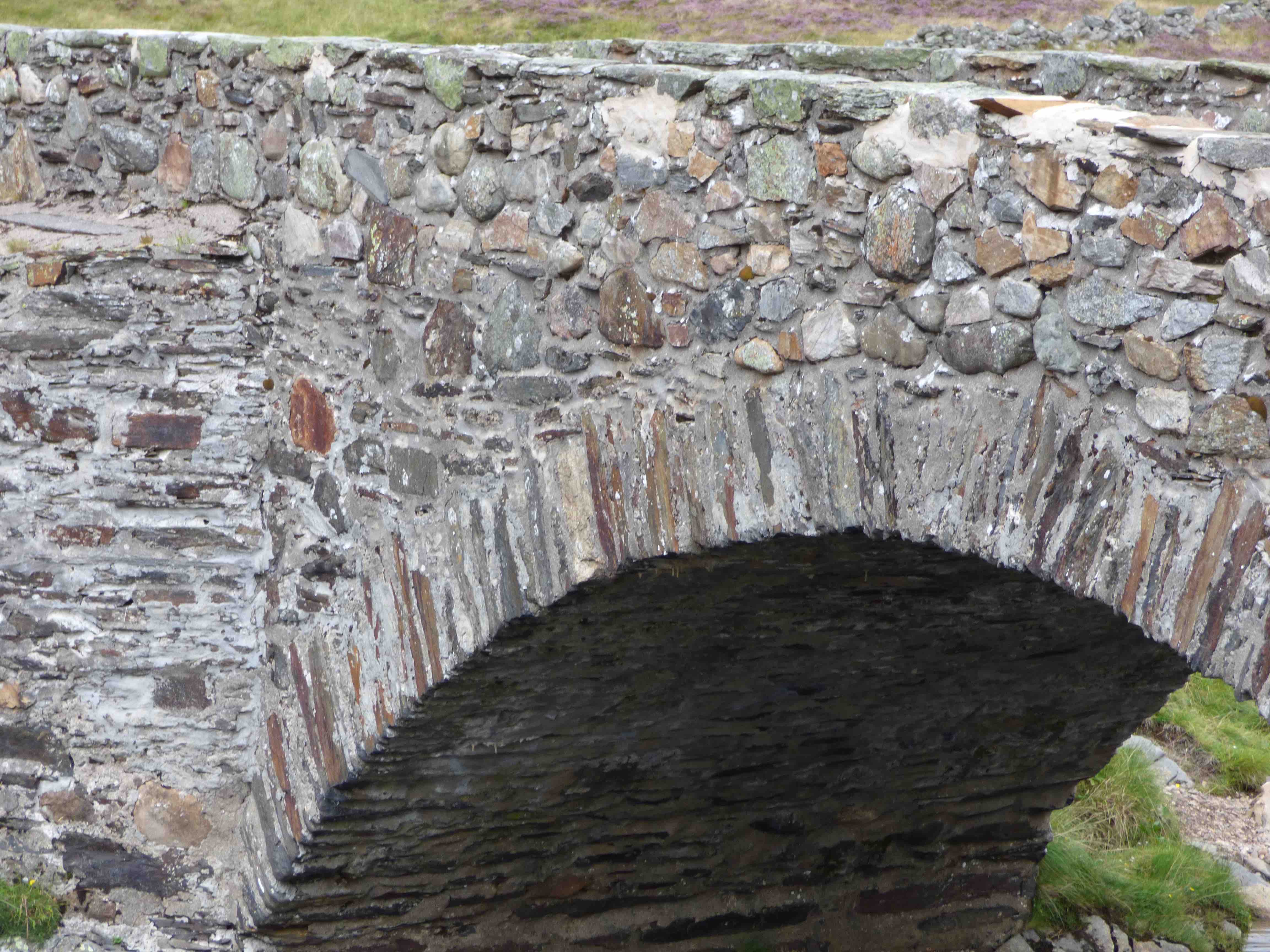
BRIDGE OF FETTERESSO Stonehaven
C.Aberdeen Carron Water 85280,785565
History: Nothing known.
Maps:Pont 11 1600 only. Not on Roy.
Currently: beautiful little two span 18th century bridge. Random rubble in parts, coursed rubble in others. Tiny semicircular flush arches of 13ft span. Clearly widened from 7ft to present 13 ft(see photo). Splayed approaches. One arch is now silted up with a raised embankment. No string course. It is odd, that this bridge is not on Roy. Adjacent ruined church and graveyard suggest it may be a 'collection' bridge repair.
photo photo photo.
_______________________________________________
FINTRAY BRIDGE see LOW BRIDGE
_______________________________________________
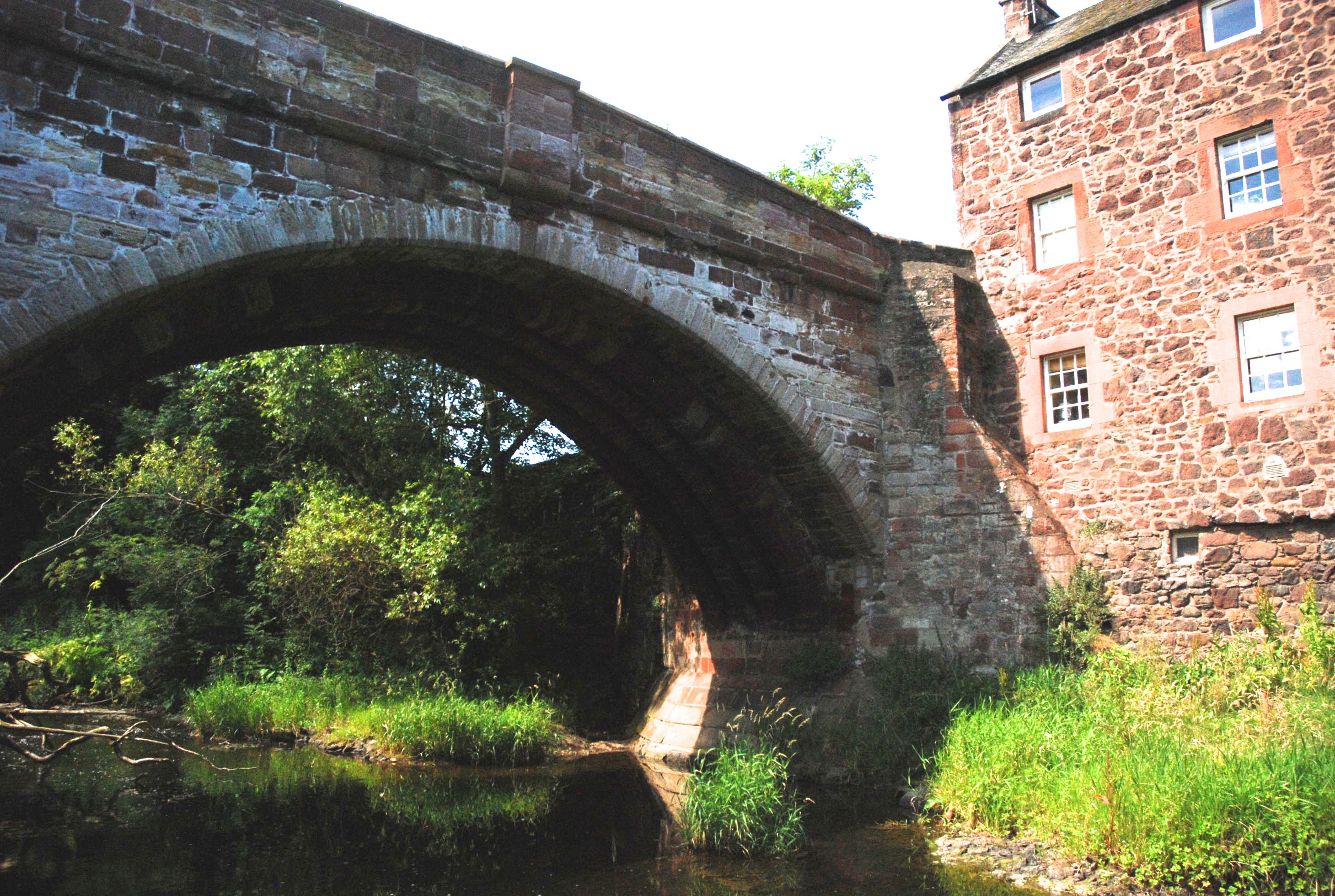
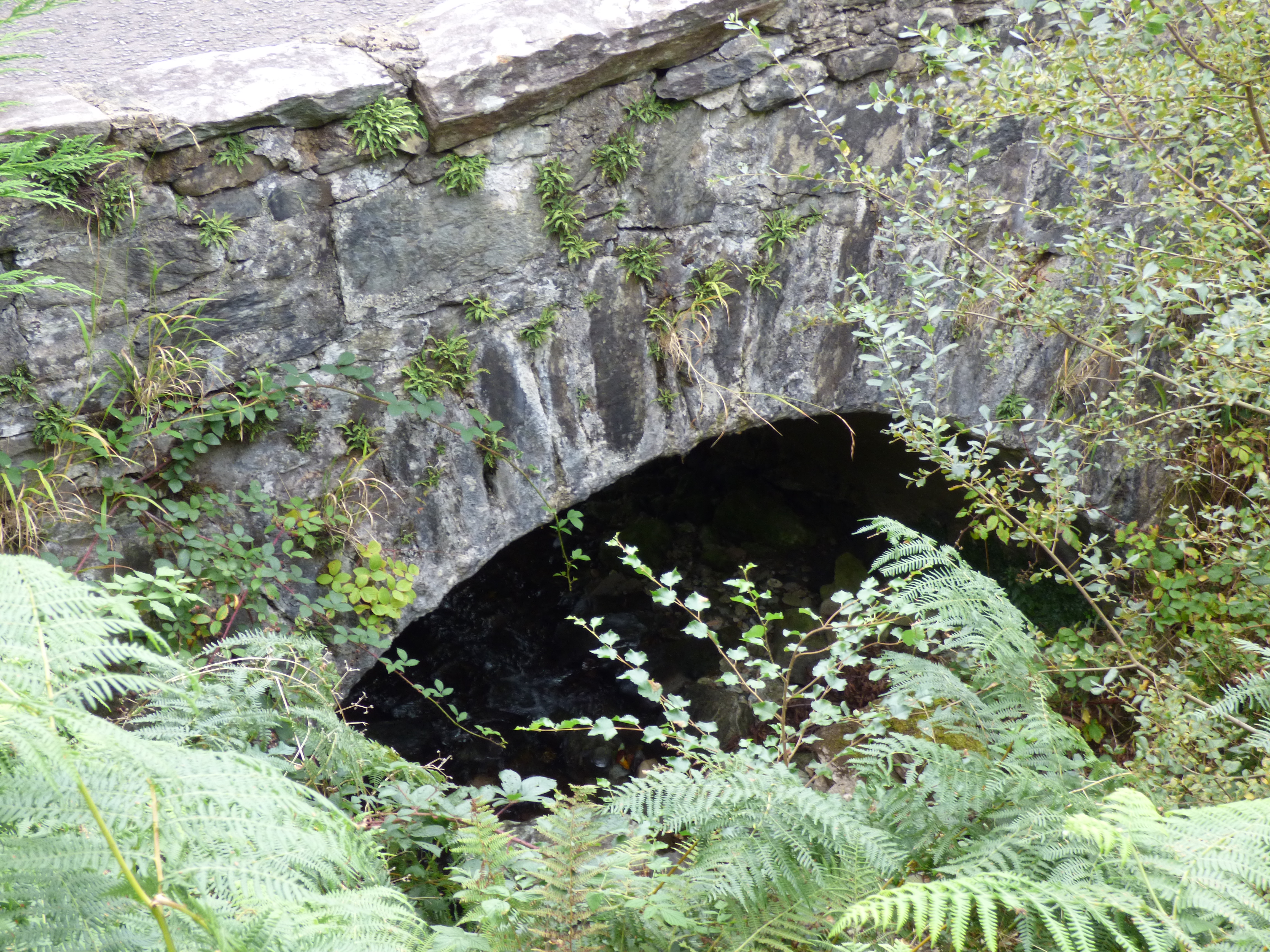
FLEET BRIDGE Gatehouse of Fleet
C. Du & Gall R. Fleet 259832,556216
History: First wooden bridge was built in 1610. This road was the 'Gate' and a Gatehouse built at the river edge. Repairs were followed by a toll in 1661 by Act of parliament. Washed away in 1721. Rebuilt in 1730 by John Frew. Part of Military road in the 1760s. Widened in 1779. Rebuilt again in 1811. Further widened with concrete walkways in 1965.
Maps:Roy(1750) Blaeu(1600)
Currently:Two almost semicircular arches with central buttress. Sandstone voussoirs. Un-coursed, pitch faced rubble spandrels. General layout is largely the 1811 rebuild with level deck but with arches probably retained from 18th century.
photo.
_______________________________________________
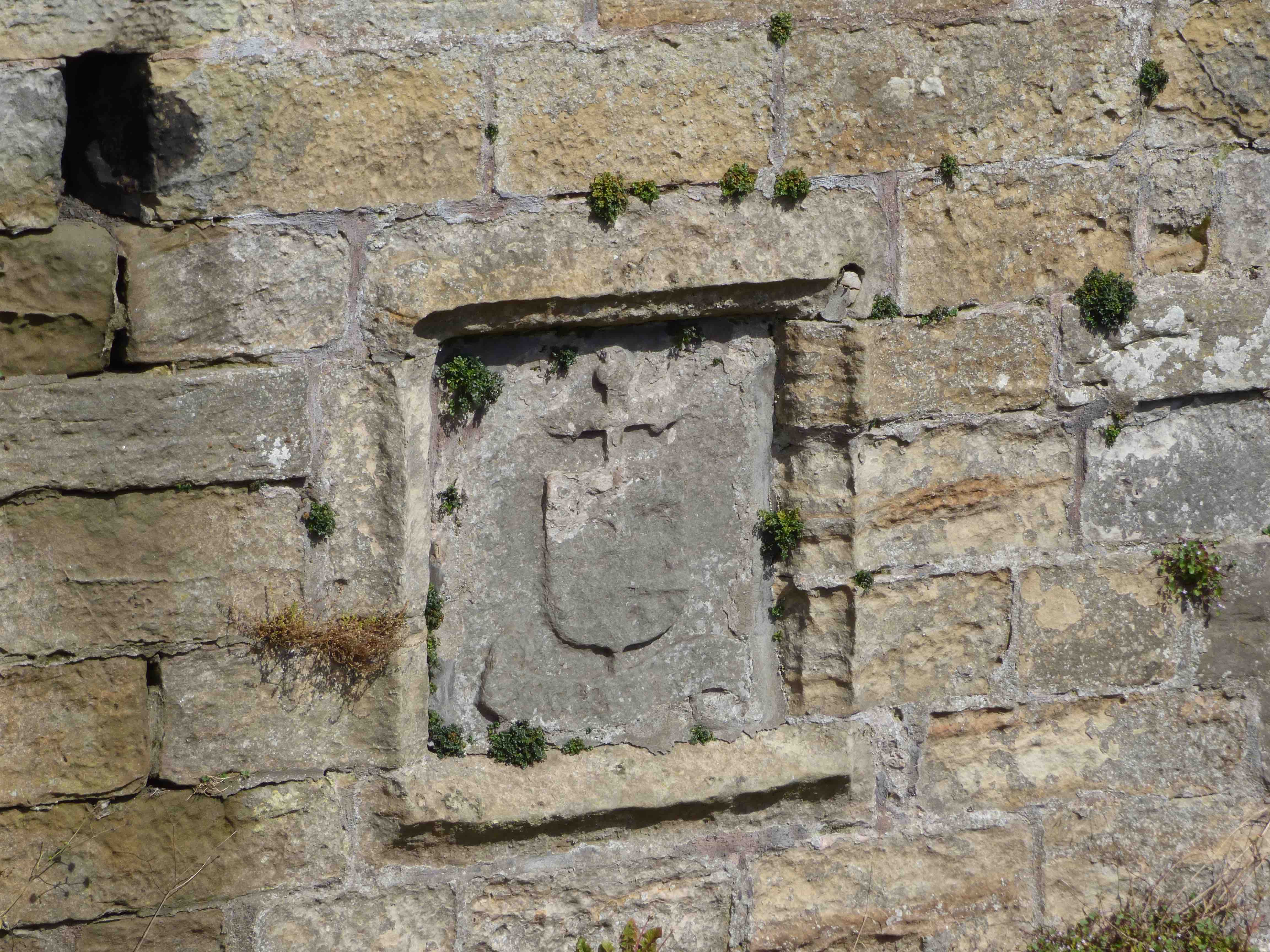
FOGO BRIDGE nr Coldstream
C.Berwick R.Blackadder 376977,649203
History:Dated 1641. Rebuilt in 1843. Panels with arms . Old Stat Accounts record this as the only bridge in the parish.
Maps: 1750(Roy)
Currently: Appears to have been rebuilt in two periods since the 17th century. Single segmental arch. Well dressed coursed and squared sandstone rubble spandrels, abutments and approaches on the later build, with rusticated sandstone ashlar voussoirs. Parapets are more recent. Strong string course. On the original build, the voussoirs are very different, in squared rubble. Very evident repairs to the arch; spandrels are faced but not squared or coursed. Two panels, one of 1641, attributing the bridge to James Cockburn and the other, of 1843, recording repairs. The repairs were very substantial; the bridge is of 19th century style, though some earlier features are evident on the downstream side. Original width is 8ft. between the parapets. Full width is 18 ft.
photo photo photo.
_______________________________________________
UPPER FOYERS BRIDGE
C.Inverness R.Foyers 249795,819957
History: Probable location of a Pont bridge. The river was the Faech/Loin on Pont's map. A very narrow high gorge over the water. Reputed to have been a single log spanning the gap.
Maps:Pont (1600). Not on Roy.
Currently: Eighteenth century single span semicircular arched rubble bridge with rubble voussoirs. Eight ft. wide parapet to parapet. This is unusually narrow and suggests structural challenges over the deep gorge. Unfortunate modern concrete coping. Not military.
Link photo photo.
_______________________________________________
FRASERS BRIDGE Datchat Mhor
C.Perth R. Clunie 314779,786467
History: 1749 military road. Caulfeild. Coupar to Fort George. Possibly the first bridge to be built on this road.
Maps:1750
Currently: Beautiful original granite undressed random un-coursed rubble spandrels with 2 span flat segmental arches and wide whinstone voussoirs. Flush arches with aligned voussoirs. Single cutwater. 12 ft p to p. Gently humped
photo photo photo.
_______________________________________________
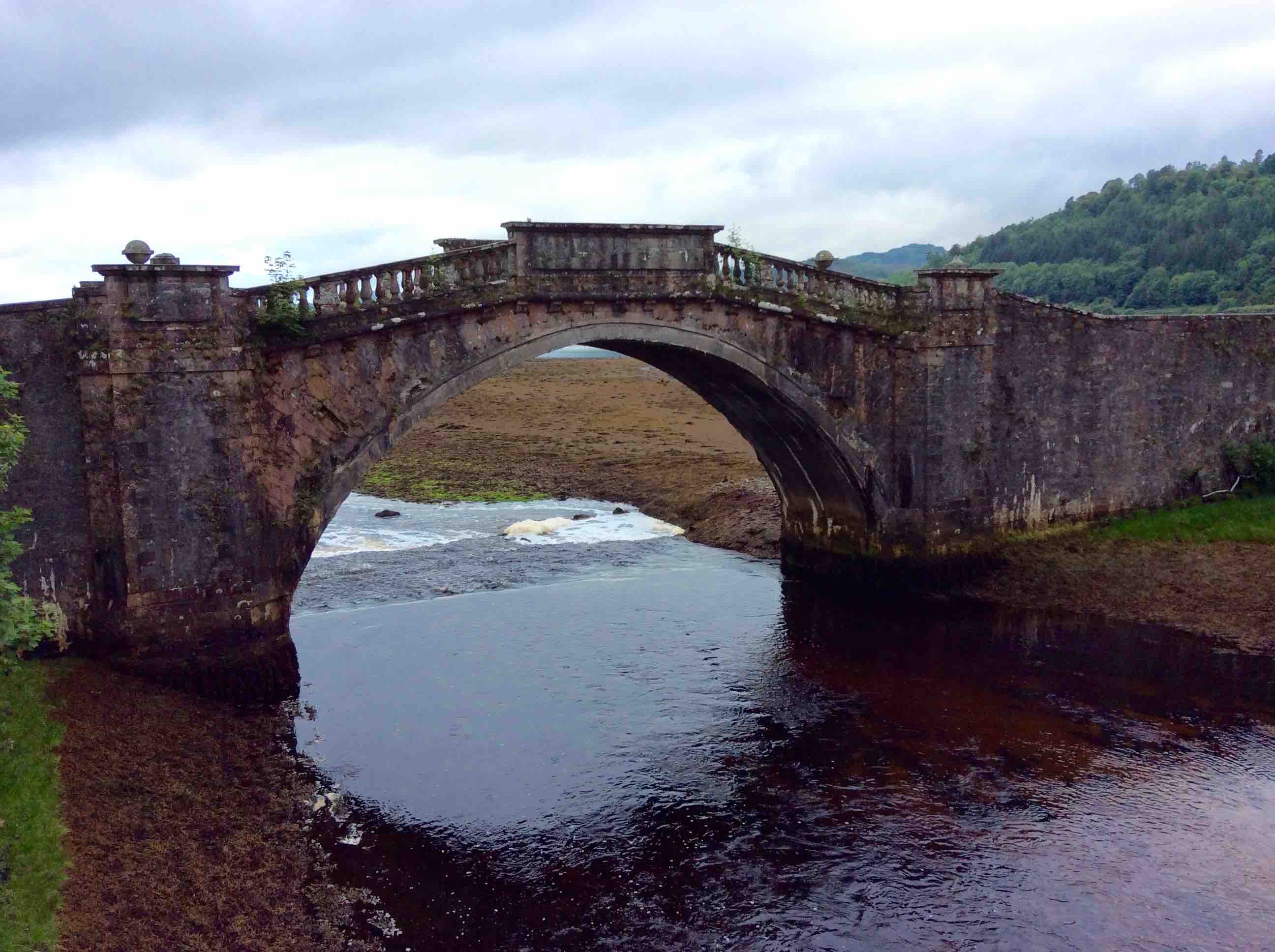
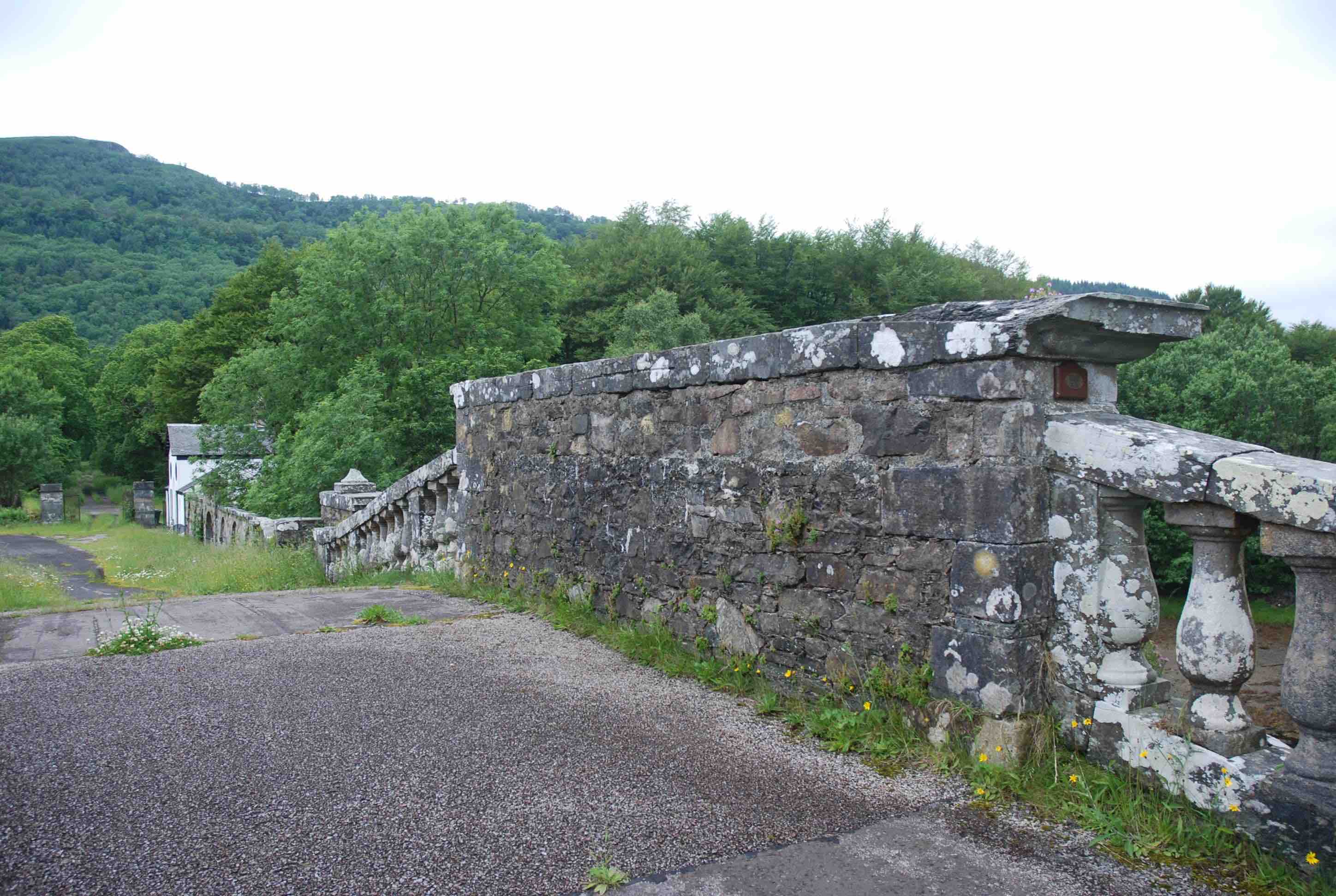
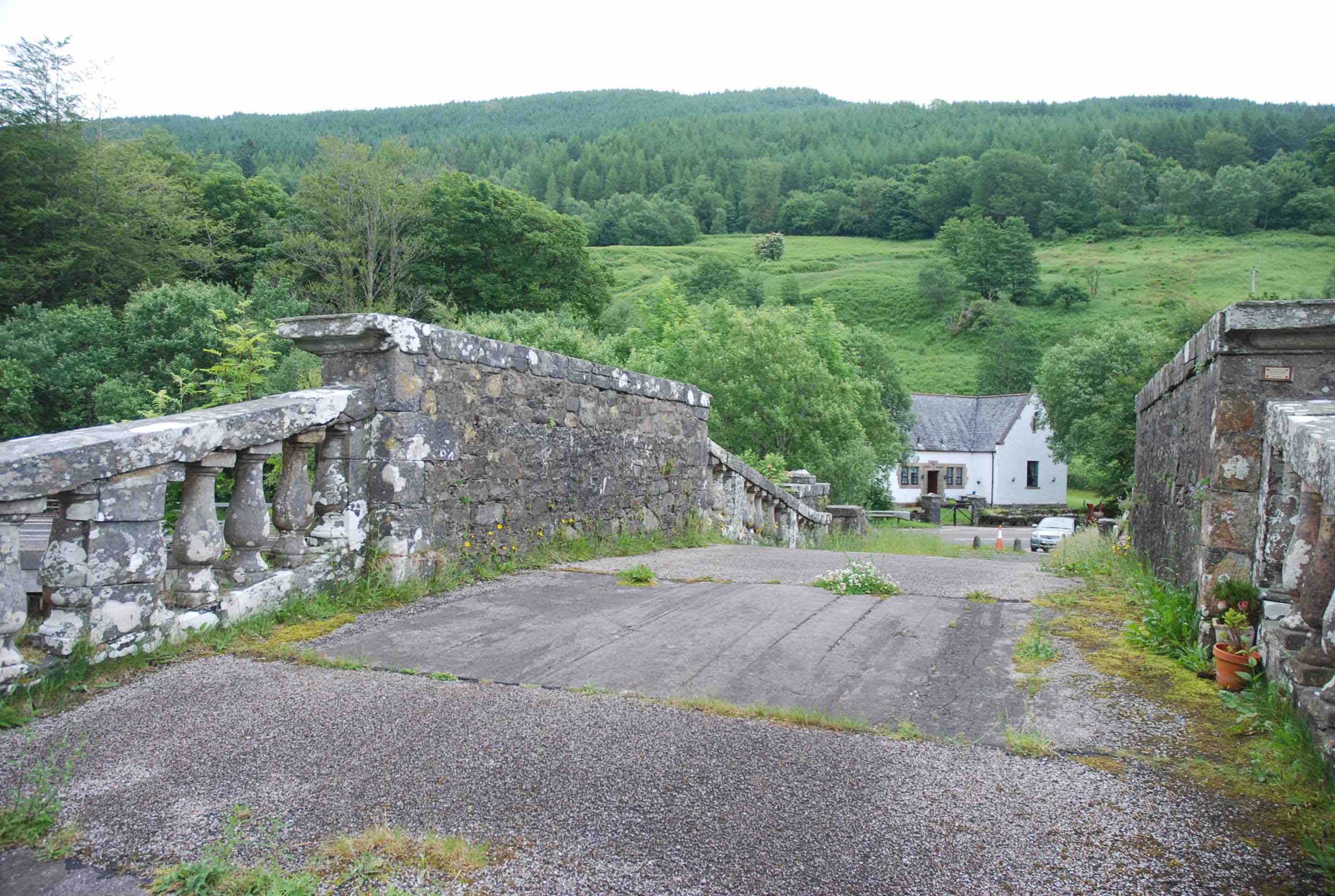
GARRON BRIDGE Inverary
C.Argyll R.GearrAbhain 211401,710086
Maps:1750
History: Built 1748 by the military under Caulfeild. Designed by Robert Morris. Taylor is unclear whether this was strictly part of the military road but it seems indisputable even though the style is anomalous. It seems that John Adam had assumed his father's role as 'master mason' to the Board of Ordnance and that he had had some say in the design, which may explain the decorative style. As the bridge lies in the Argyll estate is seems very likely that the Duke also influenced the design. So it is partly an ‘estate bridge’.
Currently:Very ornamental for the time. Almost semicircular humped bridge with a 40ft span with sloping balustrades meeting on a level ornamental parapet on the crown.Decorative pilasters on the abutments. Large stone balls on the refuge walls, only on the downstream side. Missing on the other side. Random rubble approaches with some coursing and squared coursed rubble spandrels. The bridge is now bypassed. The last photo is from the Louis Stott Collection (Ref).
photo photo photo photo photo photo photo
_______________________________________________
GARRY BRIDGE Dalnacardoch Glen Garry
C.Perth R.Garry 272649,770027
History: 1730s military road. This was Wade’s third road, running from Crieff to join the Dunkeld /Inverness road at the River Garry. The bridge was just before the roads joined. Also known as Dalnacardoch Bridge. Some sources suggest that the build date was 1690, just after the Battle of Killiecrankie, so ante-dating Wade by 30 yrs.
Maps:1750
Currently:1730s. Possibly earlier . One almost semicircular arch of 47 ft. Voussoirs in whinstone. Horizontal deck. Harling coating is falling off. Appears dilapidated. Ten ft. wide parapet to parapet. Still in use. It looks much more like a Wade bridge , so may have been restructured by the military. Taylor has no comment.
photo photo.
_______________________________________________
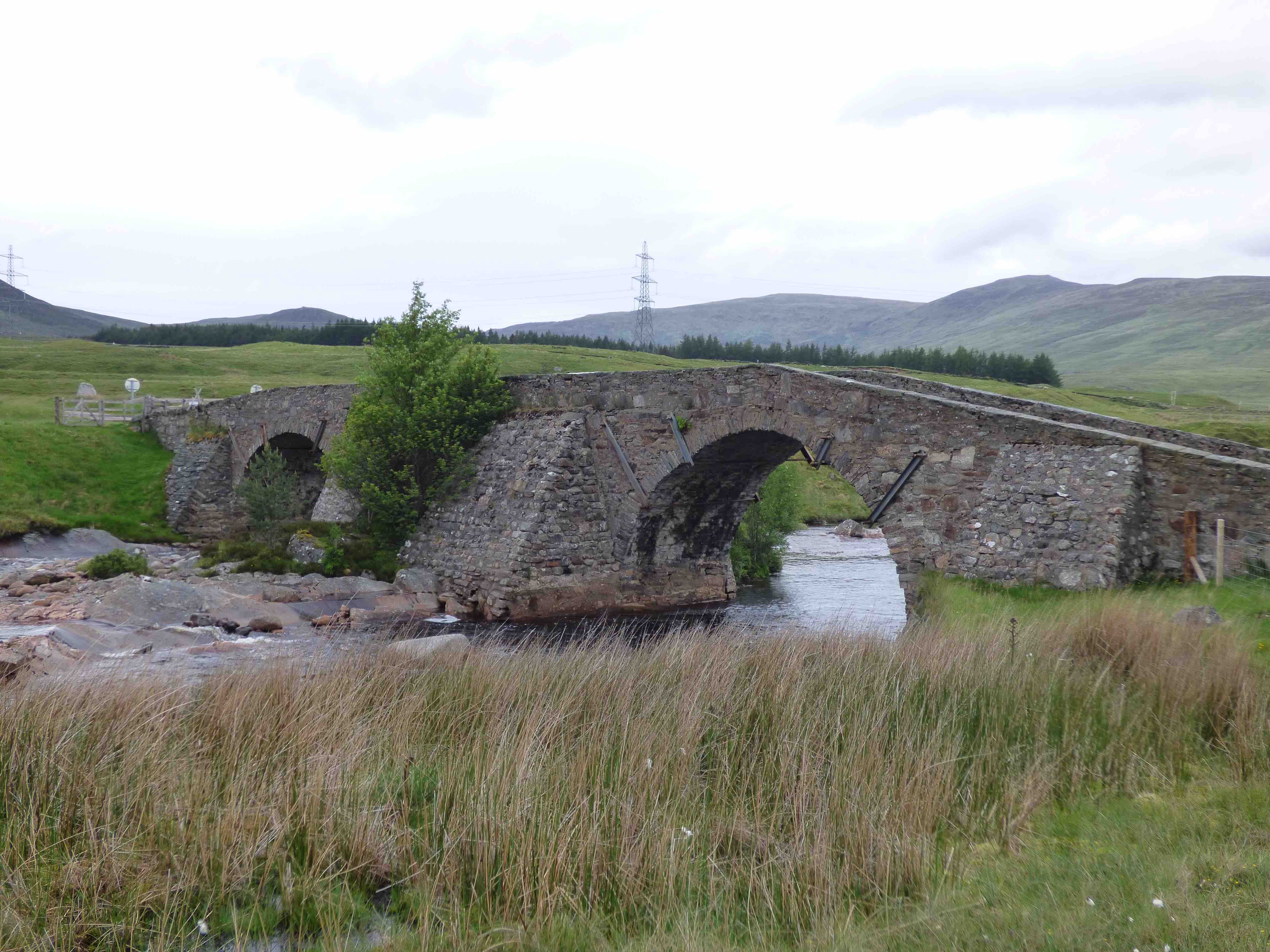
GARVAMORE BRIDGE Corrieyairack Pass
C.Inverness R.Spey 252176,794749
History: 1732 Garbhamor. Military bridge. Wade. Dalwhinnie to Fort Augustus road. This was Wade's first multi-arched bridge. The cost of all the Correyairack bridges was £466. Original Kingshouse nearby. Wade celebrated the completion with an oxen feast for 500 men, working on the road and bridges. This was the highest bridge on the Spey River. He initially called it St.George's Bridge.
Maps:1750
Currently:1732. Stunning, though strangely ugly. Two widely separated semi-circular arches of 40 ft. Separated by a pier on a rock island. A humped bridge, but horizontal between the arches. 10ft wide parapet to parapet. 180 ft long. Enormous buttresses in support of each pier and abutment. Metal tie-rods on arches. Spandrels in un-coursed, poorly dressed random rubble. Voussoirs in whinstone.
photo photo photo photo.
_______________________________________________
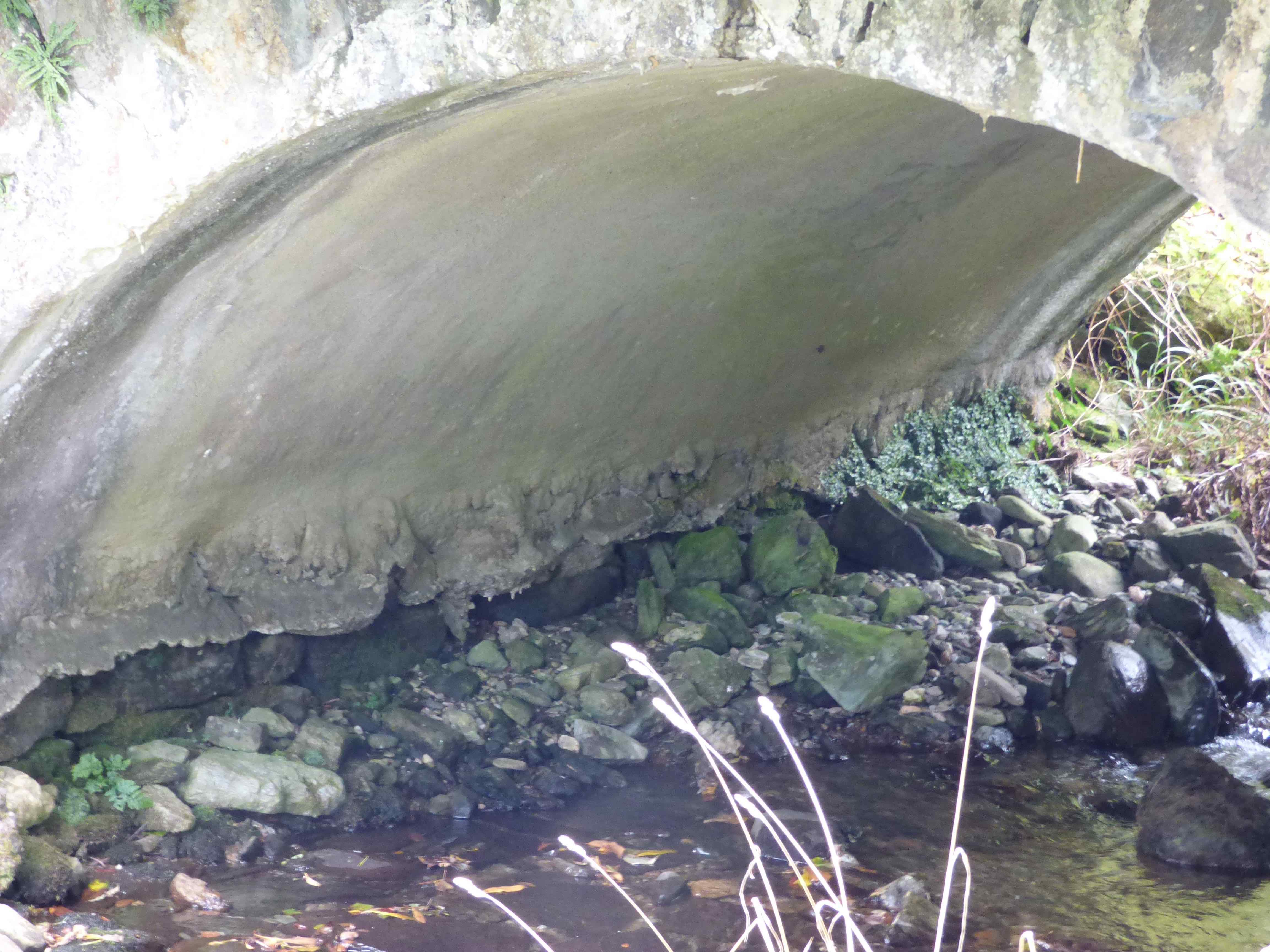
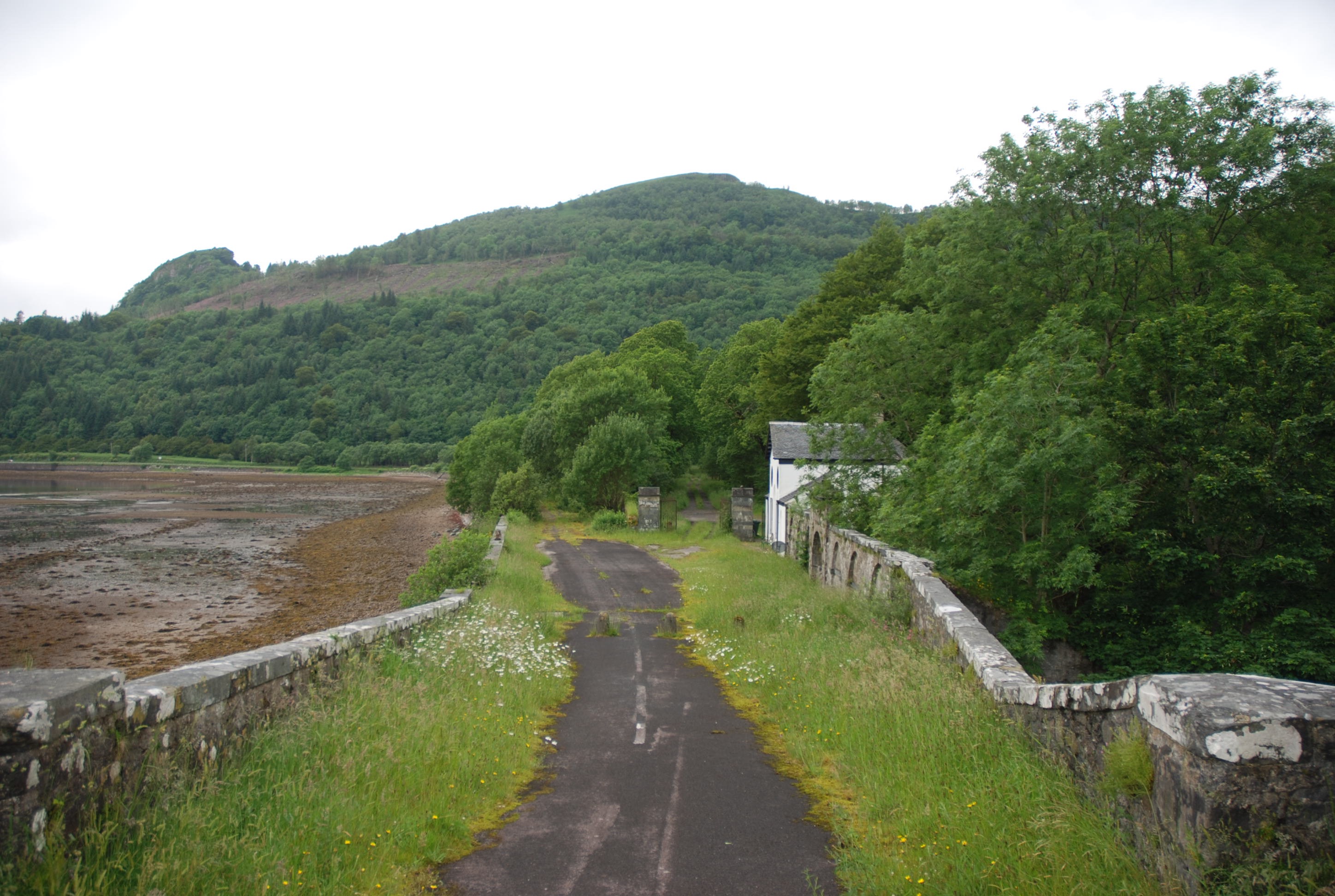
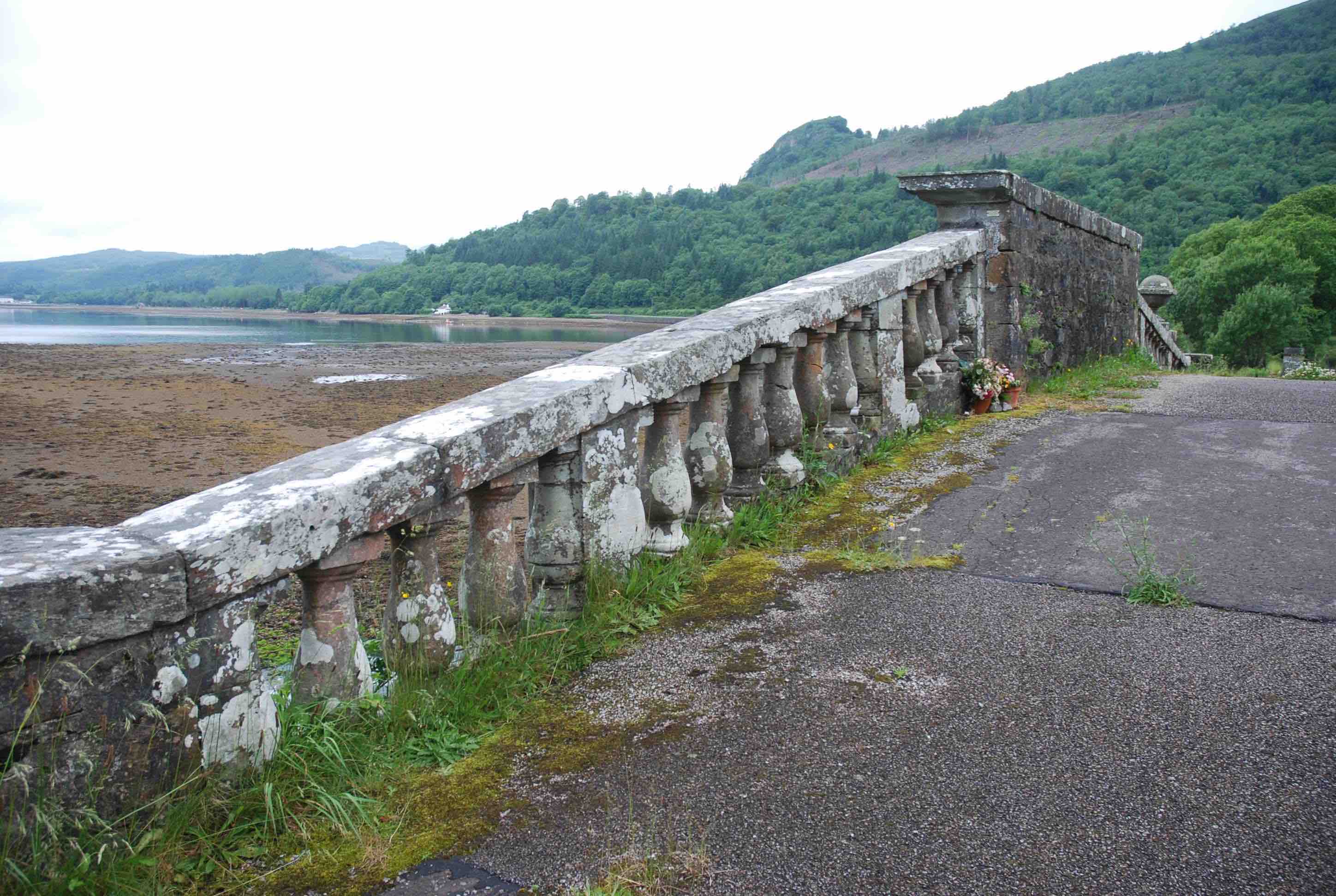
GLENDEVON HOUSE BRIDGE
C Perth River Devon
History: Roy's map (1750) describes a road going north from Dunfermline through Rumbling Bridge and up Glendevon to Gleneagles. Coal, grain and lime were transported. Also, Haldane confirms a cattle drove road from Strathearn going south, possibly resting at Pool of Muckart on the journey to Stirling.The road crossed from the west bank of the Devon at this bridge. In the early 19th century the turnpike was built with a crossing further downstream at Blacklinn(1836) and this little bridge was demoted to become the access bridge to Glendevon House(first dated 1760's). A further route to Castle Campbell would have required a crossing at this point. I could not find the HES reference to bridge repairs in 1757 Comm.of Supply minutes. However, in 1775 the bridge was certainly widened. Further repairs in 1797 and 1816.
Maps: Roy(1750). Roy's map is the earliest available for this region of Perthshire.
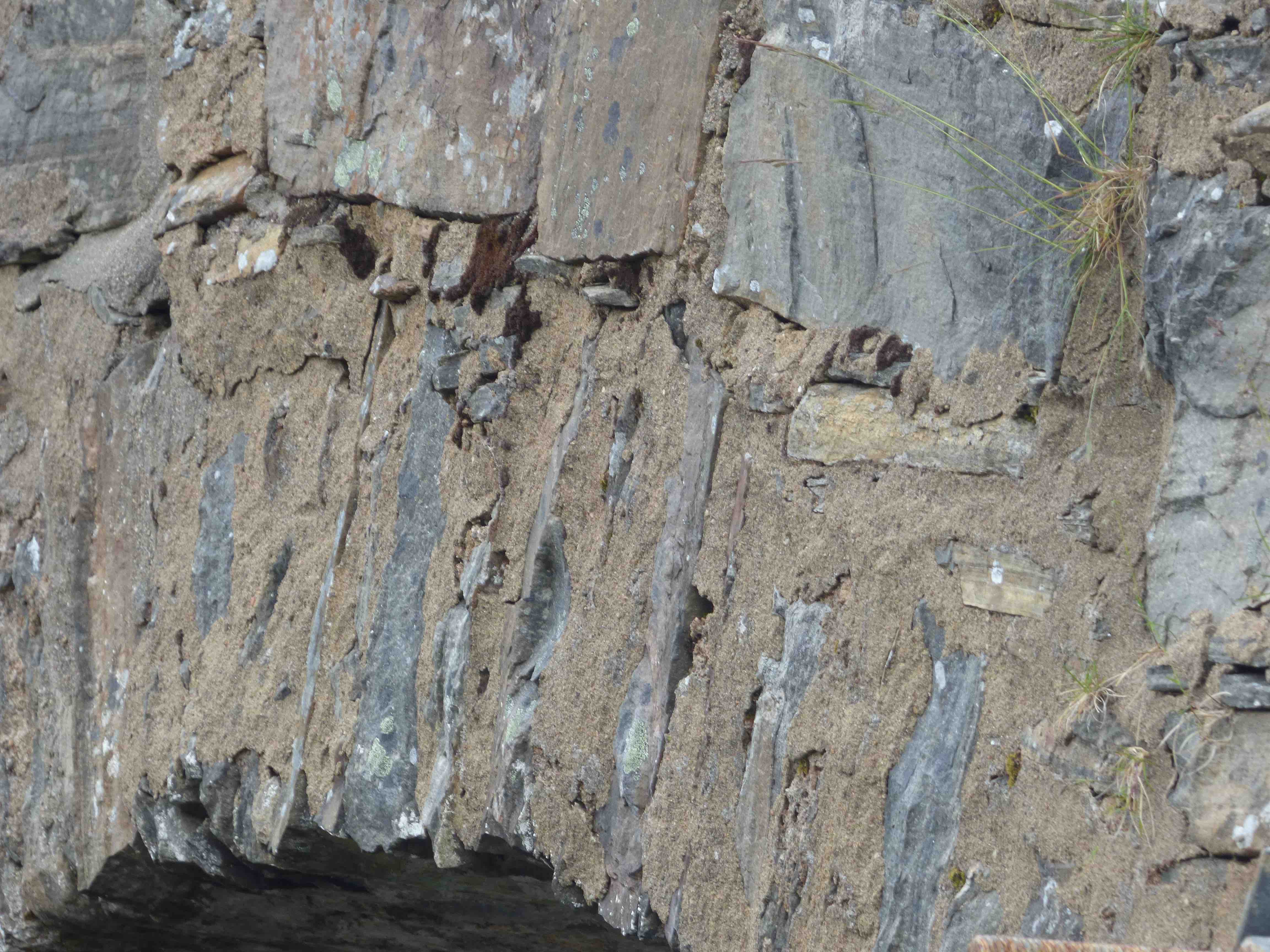
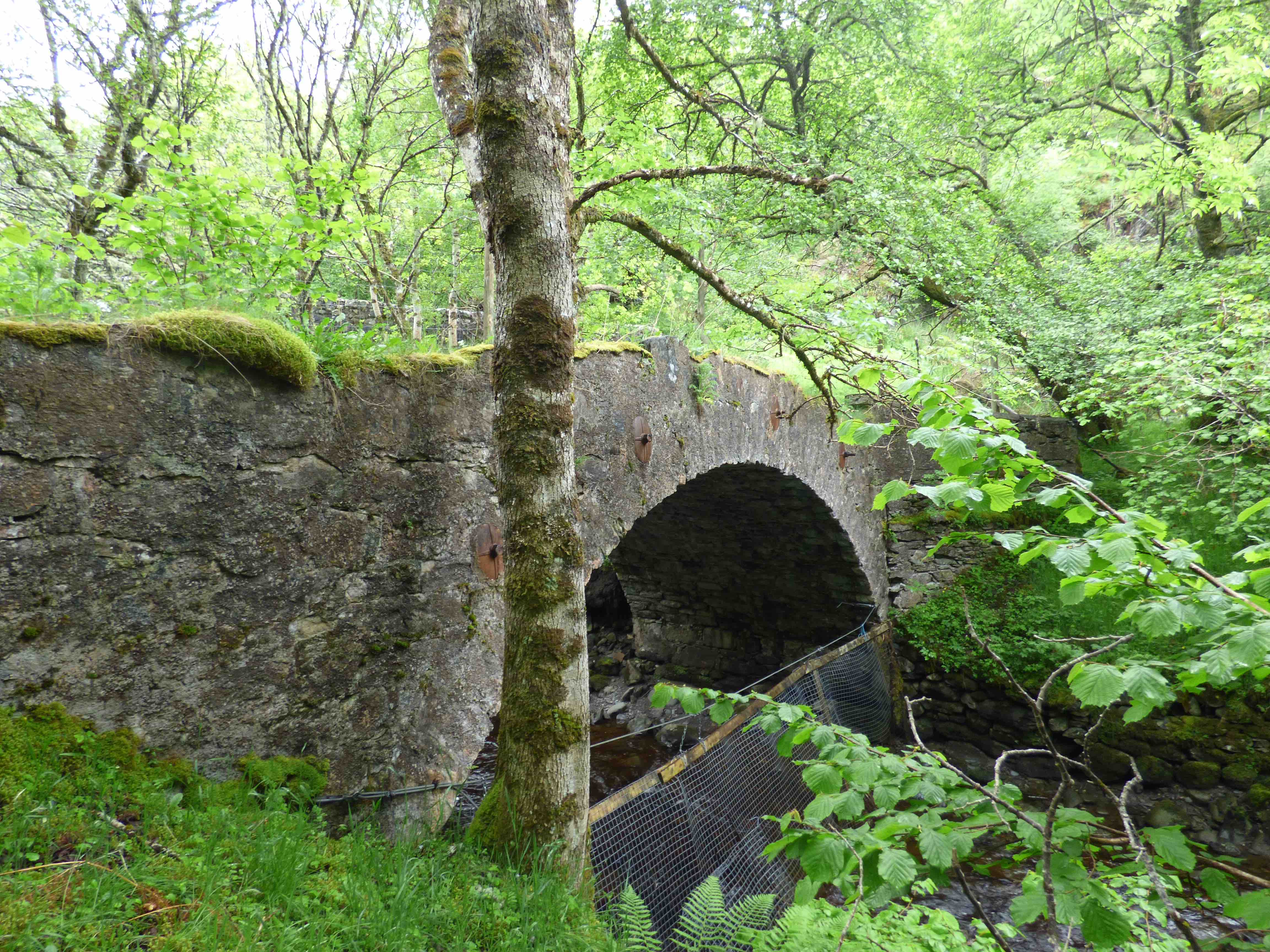
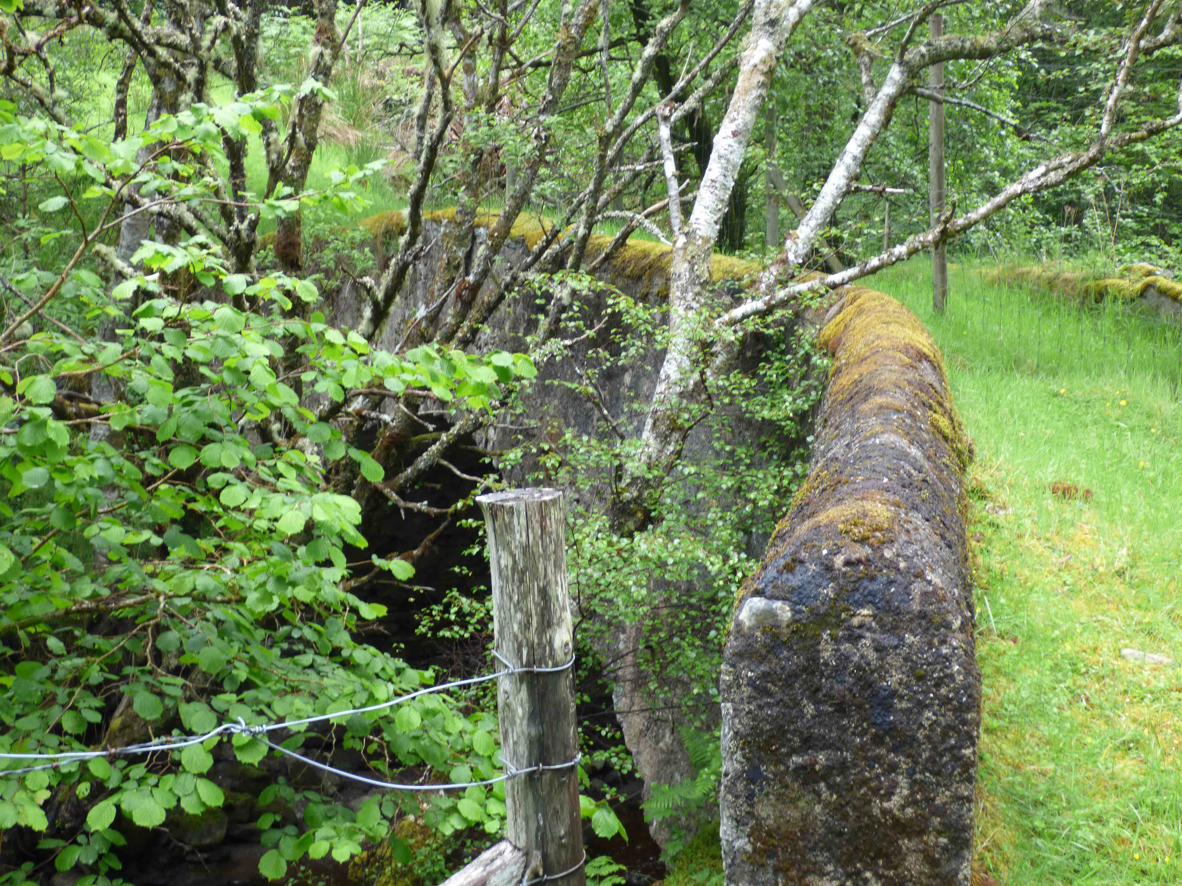
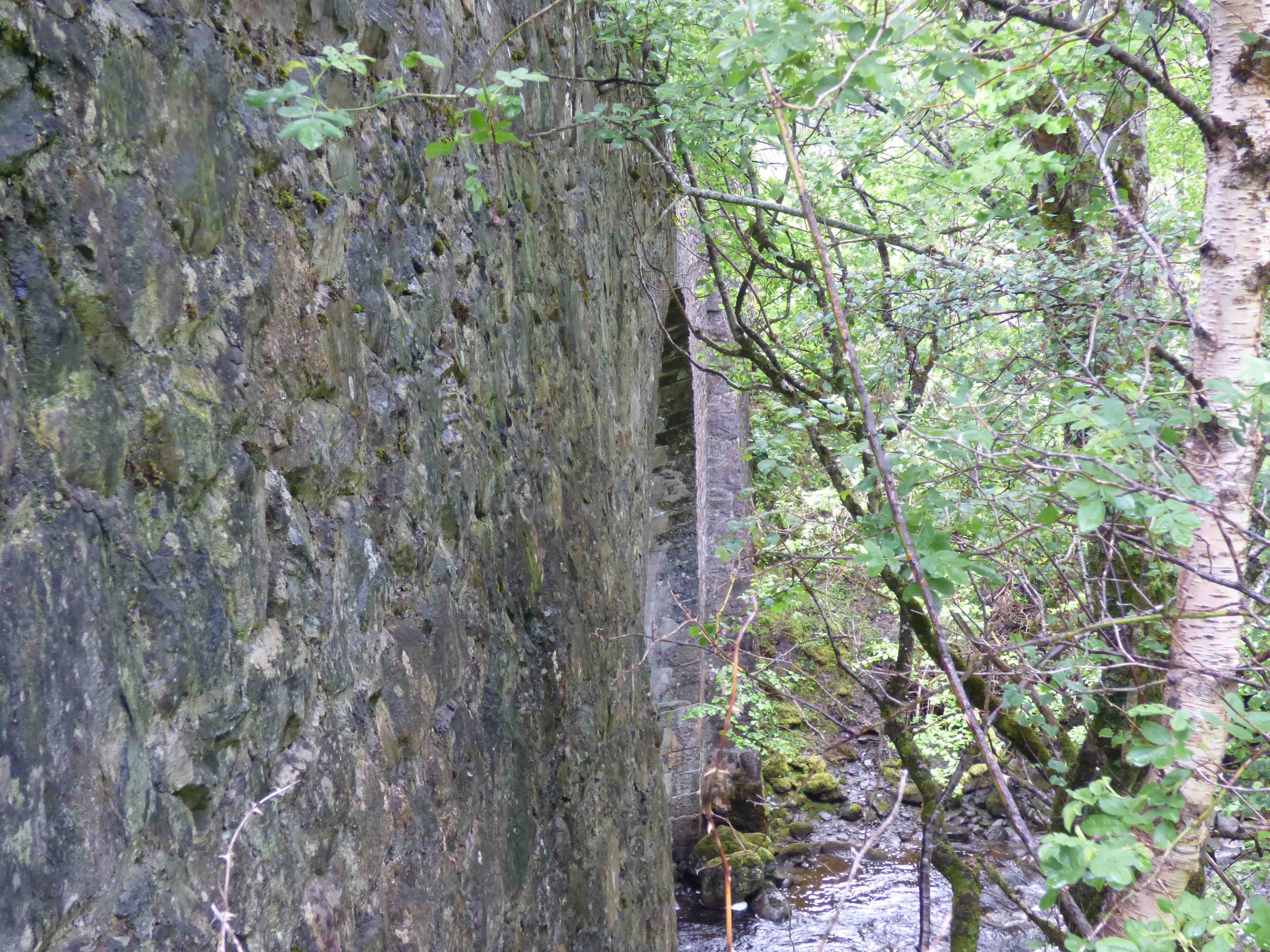
Currently: A very beautiful humped 17th/18th century bridge with two semi-circular arches. Very rough random rubble in scarcely dressed field stone. Flush crude rubble arches. Marked splaying on the SW approaches. Originally 8 feet wide(implies 6 ft. parapet to parapet) but parallel-widened by a further 8 ft in 1775 on the NW side.Now 13ft p to p, and unusually, the original parapets are intact. Also unusual is that there is almost no difference in the stonework on the widened facing.Only the small cutwater differs from its sister on the earlier downstream face. On balance the bridge appears to be a late 17th or early 18th century packhorse type structure with later 18th century upstream widening in which the new facing carefully copies the earlier style. (See 'Packhorse Bridge' section in Lists.)This little bridge is really quite a treasure. Thanks to M.Pease for detail.
_______________________________________________
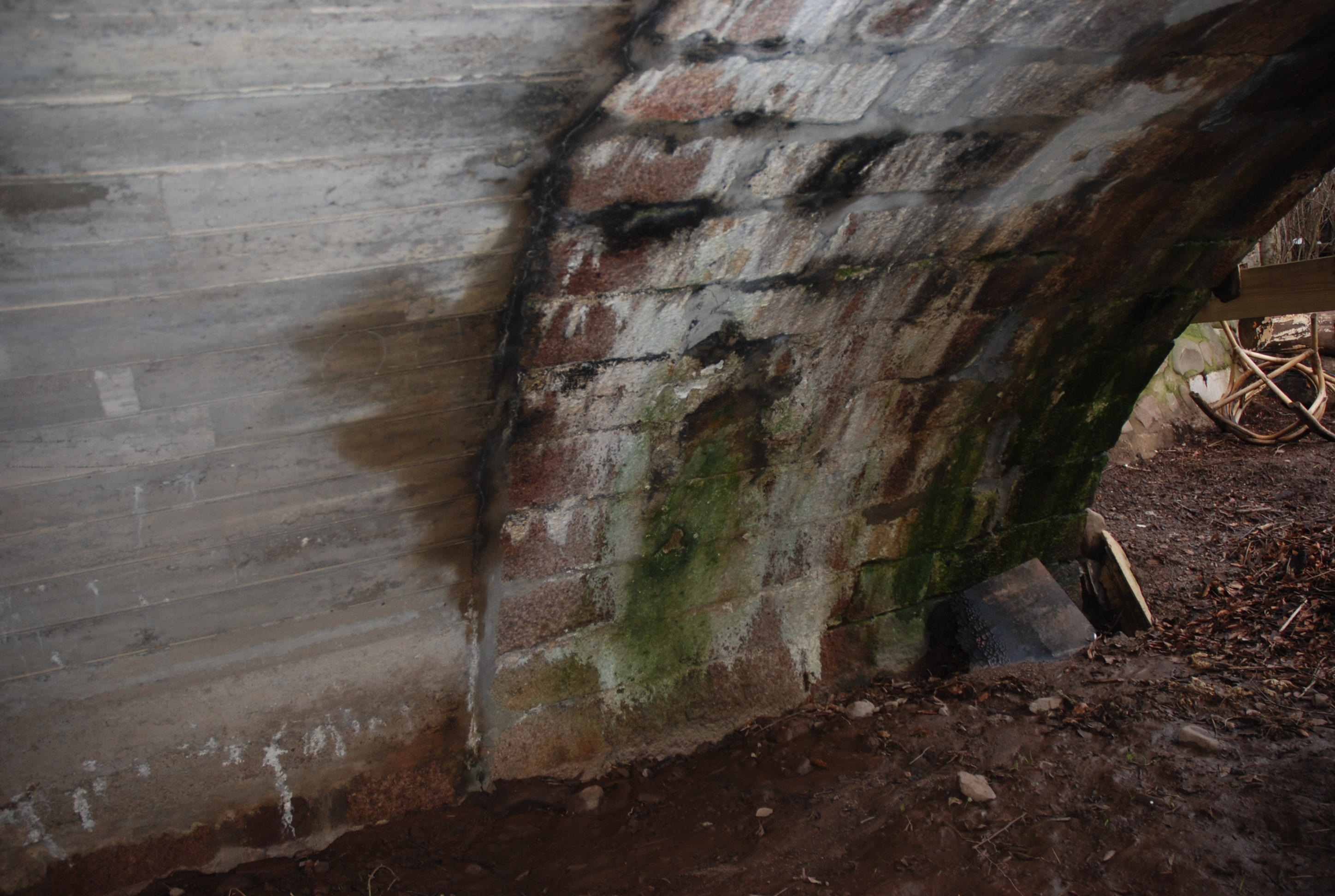
GLEN DOE BRIDGE
C.Inverness Allt Doe 240847,808775
History:1730 military. Wade. Fort Augustus to Inverness road.
Maps:1750
Currently: Five yards to the south of the current bridge and a little below it, is this small, eighteenth century , single segmental humpbacked arch in rubble, with minimal parapets and turf decking. Well dressed, sometimes squared but un-coursed, rubble spandrels. Well dressed voussoirs. The bridge is collapsing: there is a large hole in the decking, looking through to the river. Now harled, and harling has deteriorated. Very dilapidated and overgrown. The current bridge, adjacent, has the substance of a 20th century structure, which is revealed on the soffit.(photo4) However, facings are from the early 19th century Telford period with preserved plumb and batter buttresses, and it is 22 ft wide. There is a further puzzle here: the small original bridge might not be from the Wade period, but rather from the 1740's. This is suggested by the segmental arch, which is unusual and the width of exactly 12 ft which is characteristic of a Caulfeild build, rather than that of Wade. We know that in the 1760s £750 was spent in updating the wade bridges in the region.
photo photo photo photo.
_______________________________________________
GLENLUCE PARK BRIDGE Glenluce
C.Dum & Gall Luce Water 219158,557352
History:Twelfth century Cistercian Abbey nearby. After the Reformation, the (1590) Castle of Park was established. Also, probably the bridge. It is known to have collapsed in the 1660s (Harrison); several drowned; there was no bridge for some time after that. However, part of the Military Road 1760’s (firmly on Roy). Reported as 'very old' in 1838 when widened(Stat.Accts) by attaching on a new wide segmental arch on the west side.
Maps:Roy(1750)
Currently:The bridge is clearly ancient with a range of styles from different centuries. Two arches on the east, one semicircular and one segmental. On the west, one long wide segmental arch. Ashlar piers and two orders of voussoir- the first is recessed. Ashlar abutments. Parapets appear to be 18th or 19th century. RCAHMS suggest the semicircular arch may be 16th century which certainly fits with style. The bridge is 17th century perhaps with 16th century remnants.
photo photo photo.
_______________________________________________
GRANNIFORD BRIDGE see DEE BRIDGE
_______________________________________________
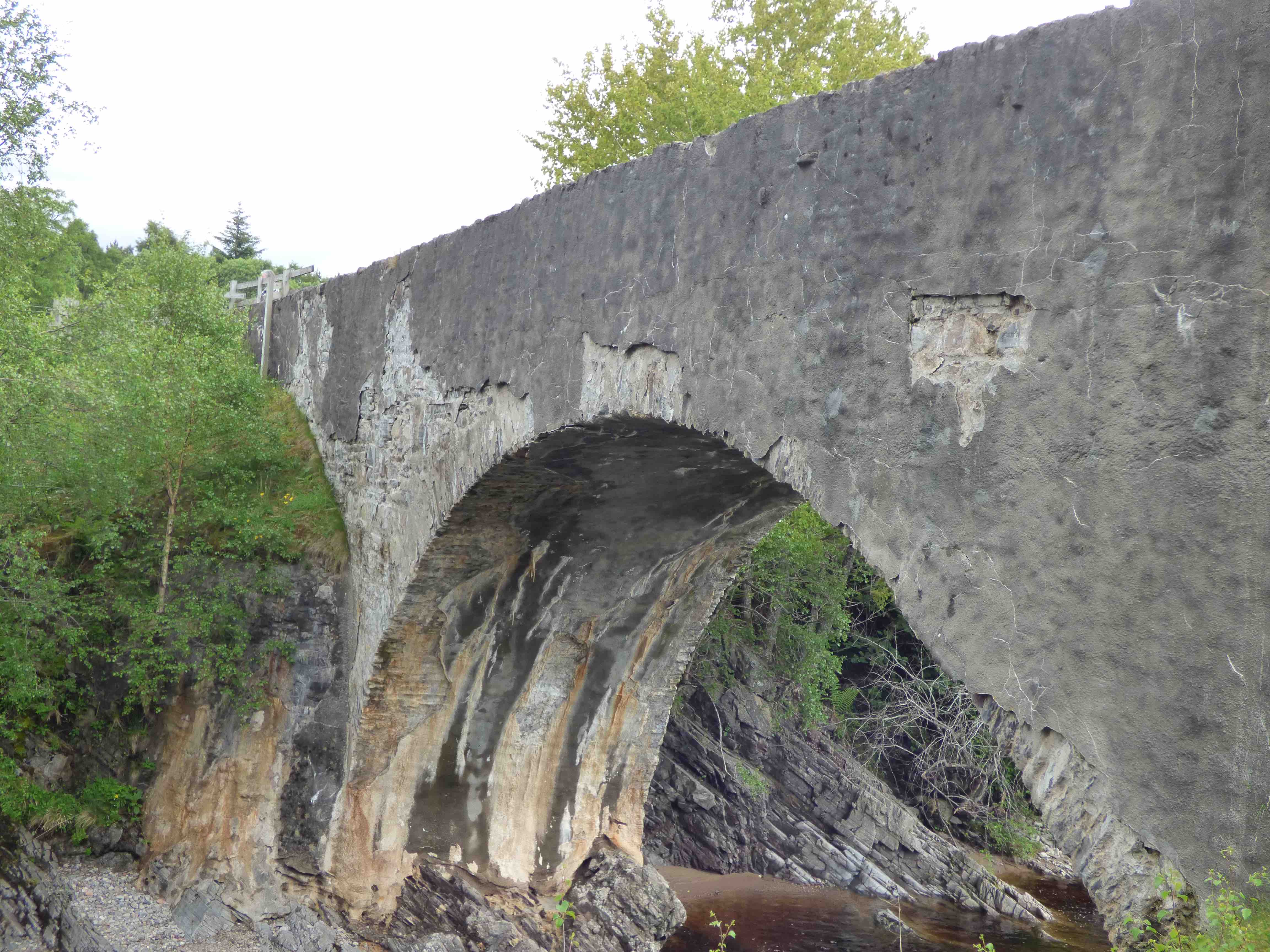
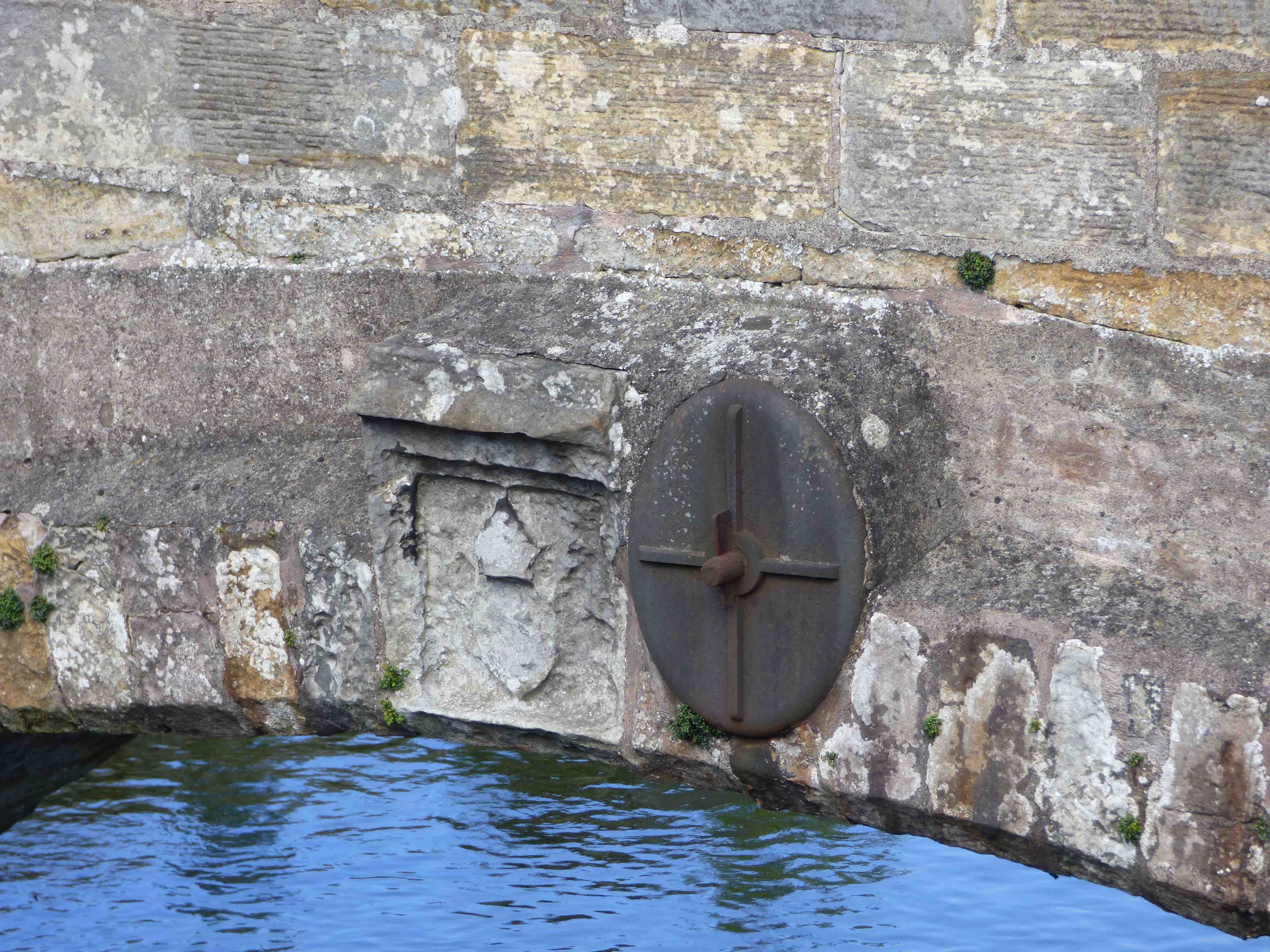
GUARD BRIDGE nr St.Andrews
C.Fife R.Eden 345196,718875
Archbishop Beaton in 1530: another plaque. It was described as "ruyneous" in 1601, initiating major repairs. There was an extensive restructuring in 1665. Wide semicircular arches without ribs suggest the present masonry is from this period. However, the very large piers may be from the earlier builds. Further repairs in 1678 and 1786. In 1796, the OSA describes six arches and room for one carriage. Part of the 'recent' turnpike to Cupar. OSA also describes a chain across it to prohibit over- heavy carts. New parapets and refuges in 1802. Bypassed by the adjacent upstream concrete bridge in 1938 after which it became a pedestrian way. Immediately downstream are the pillars of a railway bridge, built in 1852 and spectacularly collapsed in 1859.
Maps: Roy(1750) Adair(1680) Blaeu(1640) Gordon(1600)
Currently:appears mainly 16th and 17th century. Horizontal decking. Five semicircular arches without ribs plus one smaller segmental arch, of about 40 ft span. Triangular cutwaters with built-in refuges. About 12ft parapet to parapet. Structurally the most unusual feature is the remarkable ratio of very slim 15 inch chamfered voussoirs on such a large semicircular span (photo and see engineering section. Link3). The main substance of the bridge is in very weathered ashlar. Unusual absence of a string course although the newer parapets are well defined. The copestones may be original.