Scotland’s Oldest Bridges.
A map-based catalogue of the oldest masonry bridges in Scotland.
A - Alphabetical List
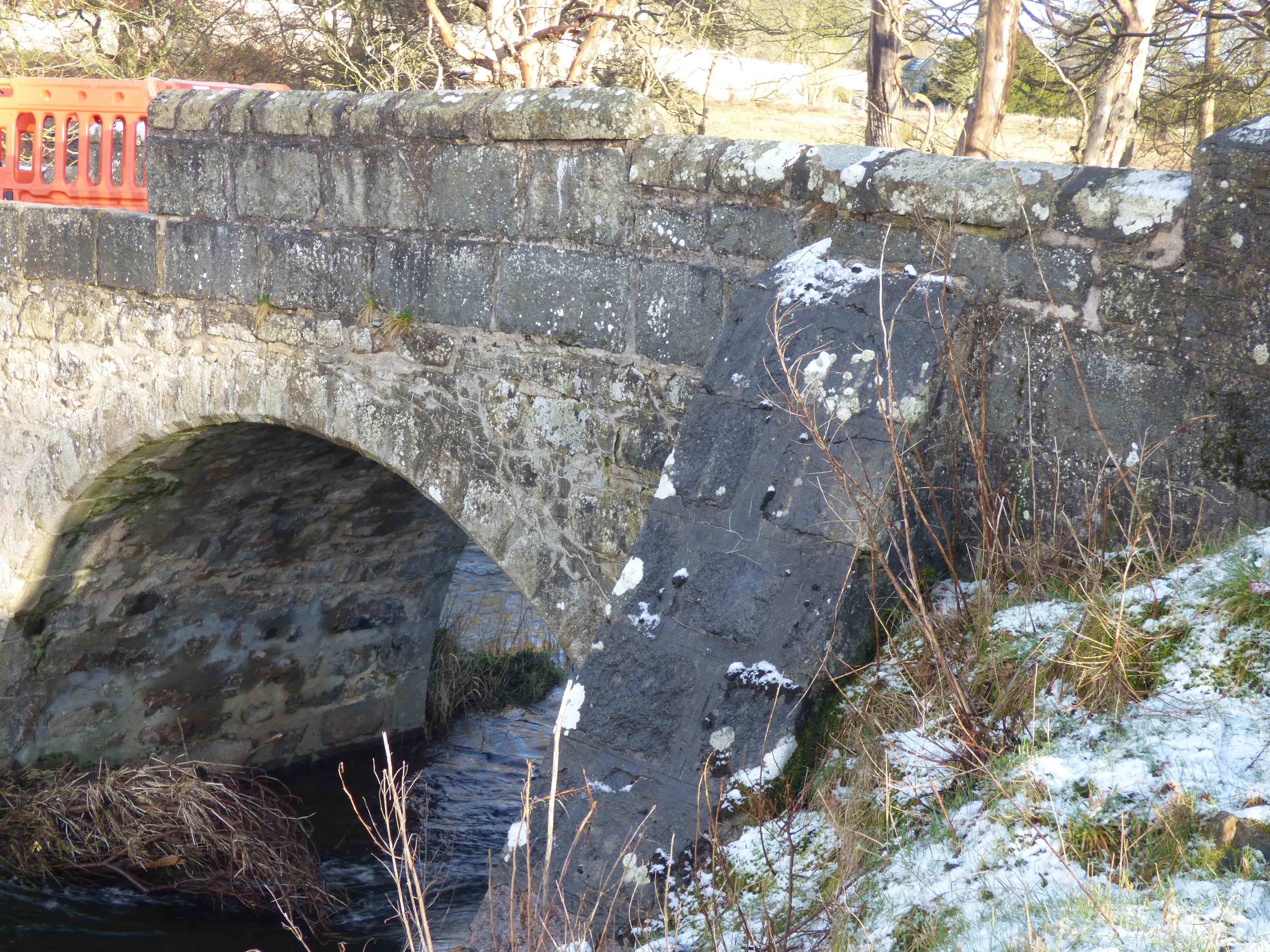
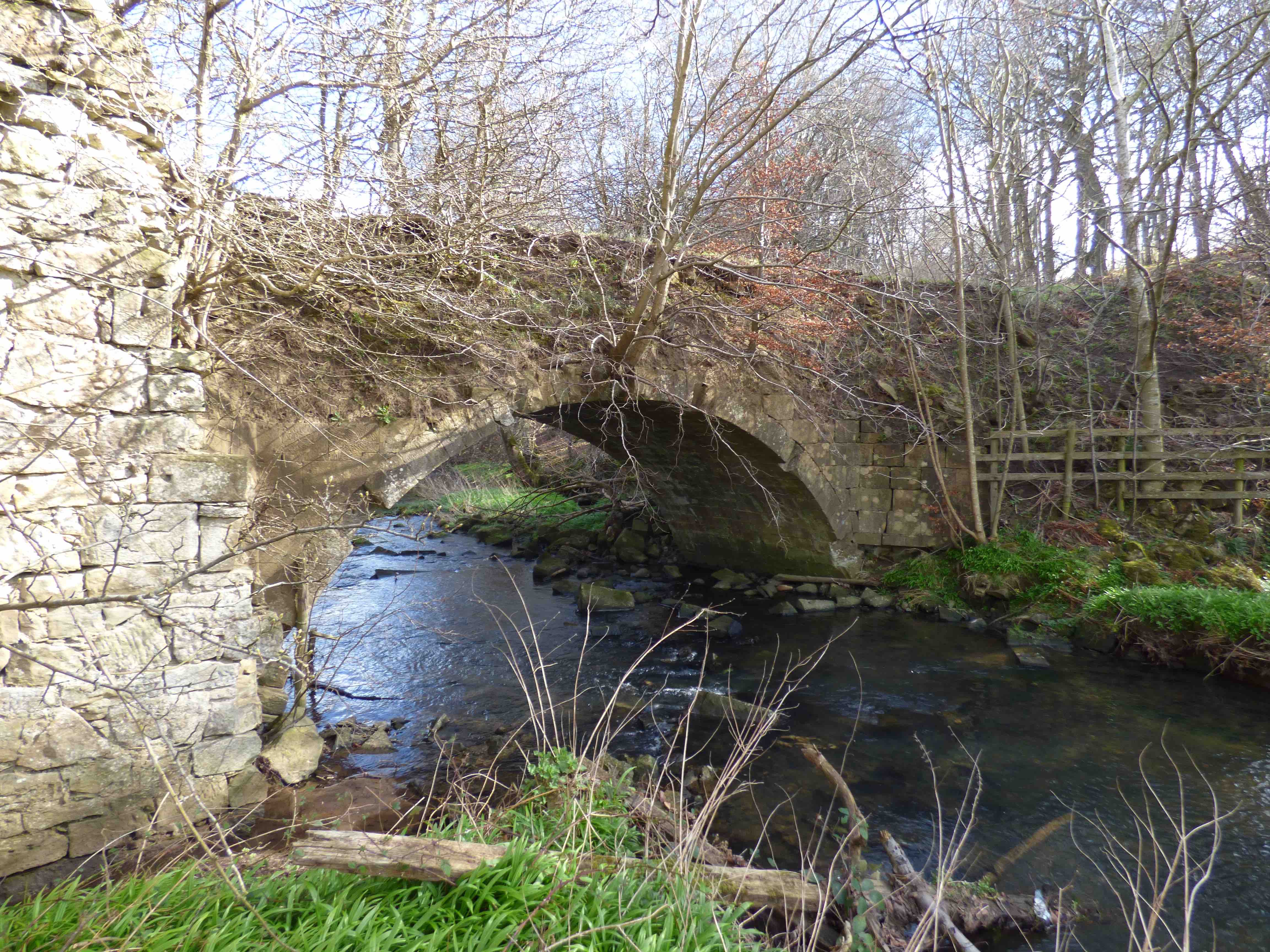
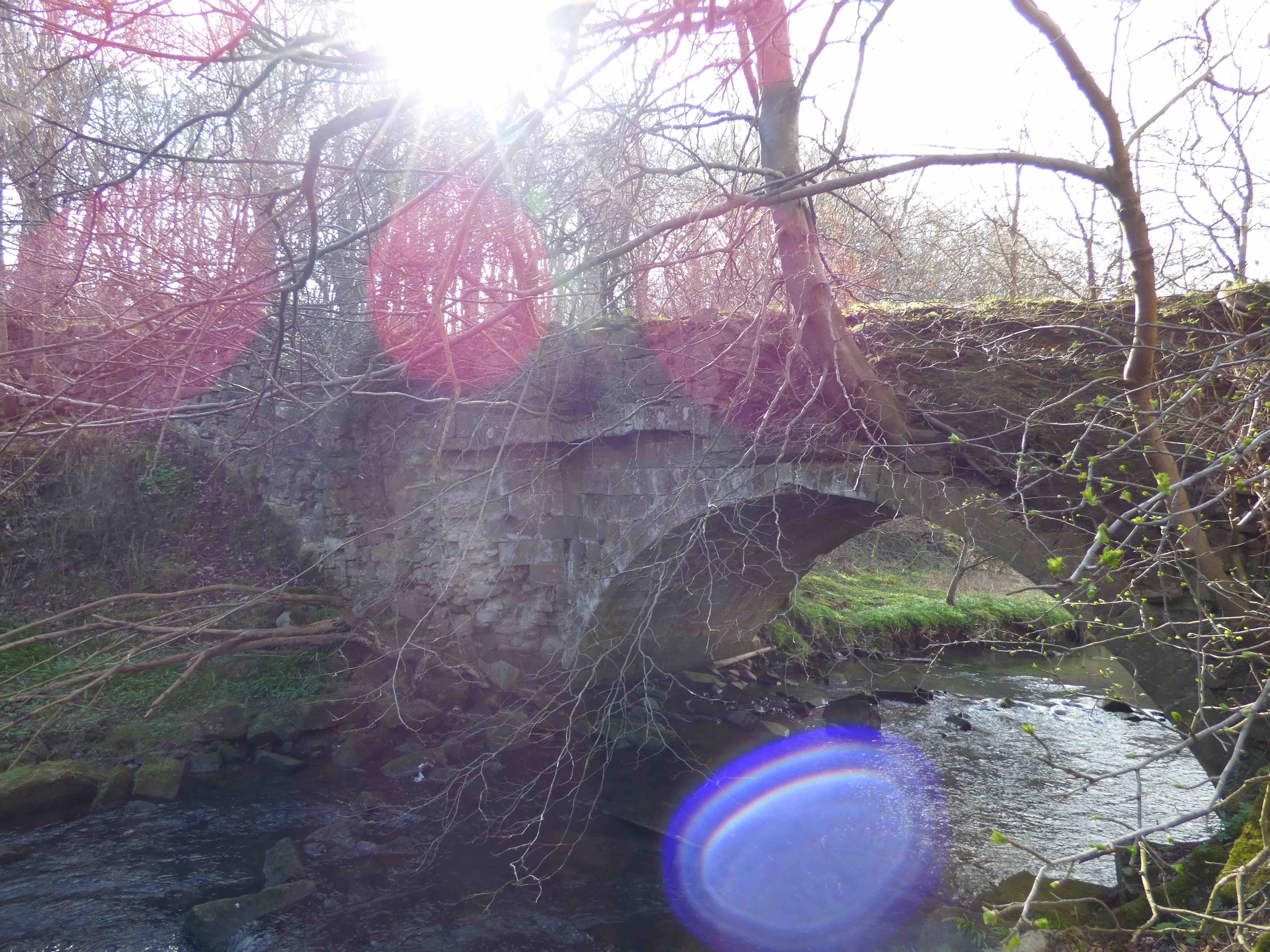
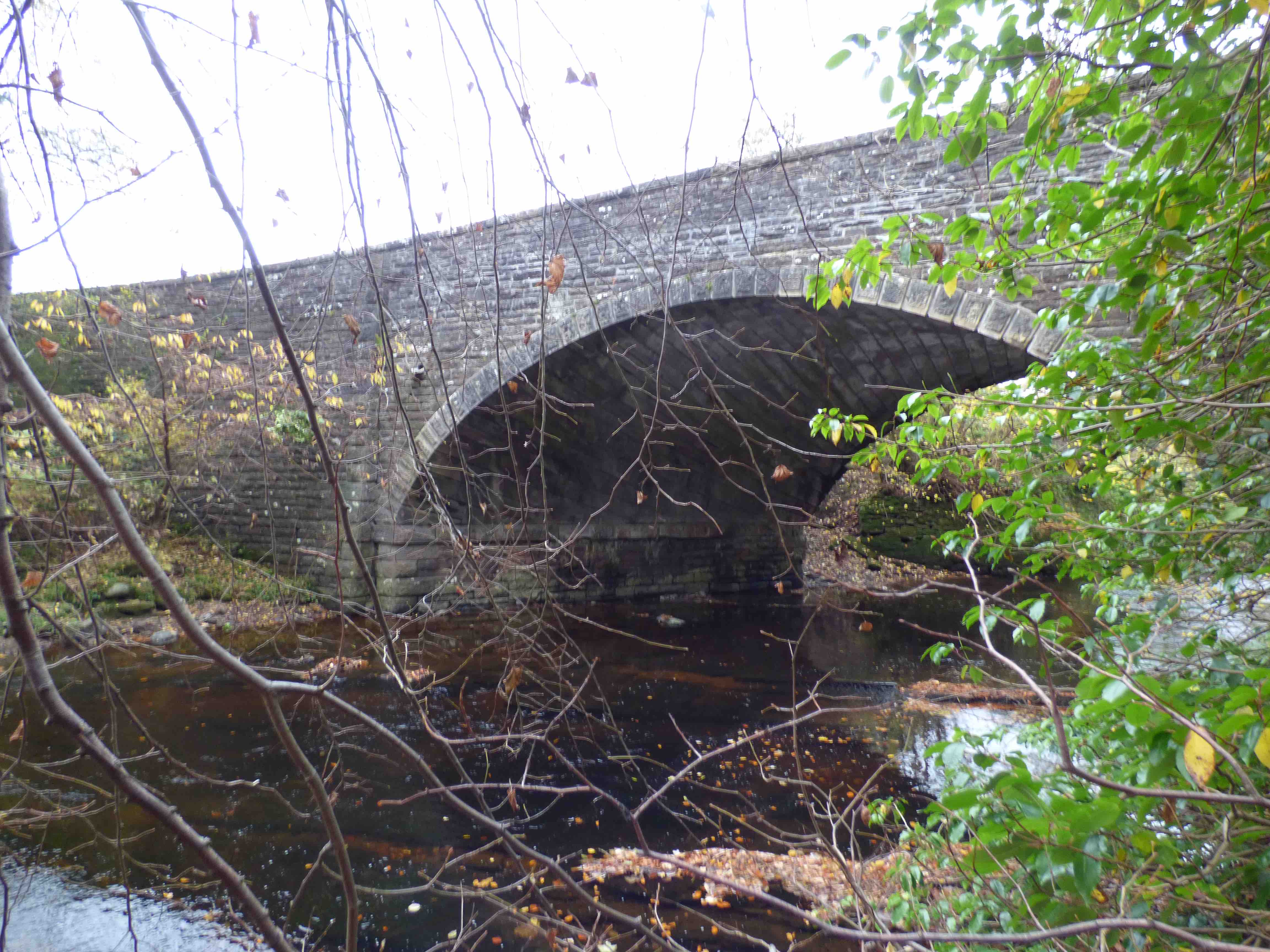
ABBEY BRIDGE Haddington
C.East Lothian R.Tyne 353294,674546
History: Inglis dates the bridge from 1440 to 1540. The gothic arches suggest 15th century. A priory was founded very nearby, in 1178, by Ada, Countess of Northumberland, mother of Malcolm IV. The priory had developed into a Cistercian nunnery with abbey. The Scots Parliament met at the abbey, in 1548, to confirm a treaty with France, whereby the young Mary, Queen of Scots would marry the Dauphin. The Siege of Haddington was taking place less than a mile away at the time and the abbey and bridge were almost on the front line. This Abbey was clearly a place of importance and very local historical prominence might explain why the bridge is very wide for the date and location (not on a main highway).
Maps:Roy(1750) Adair(1680s) Blaeu(1640) Pont(1600)
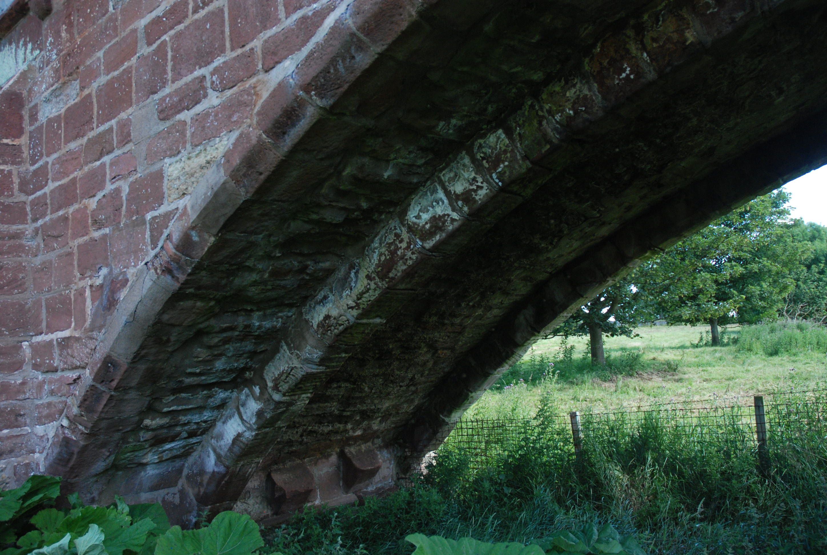
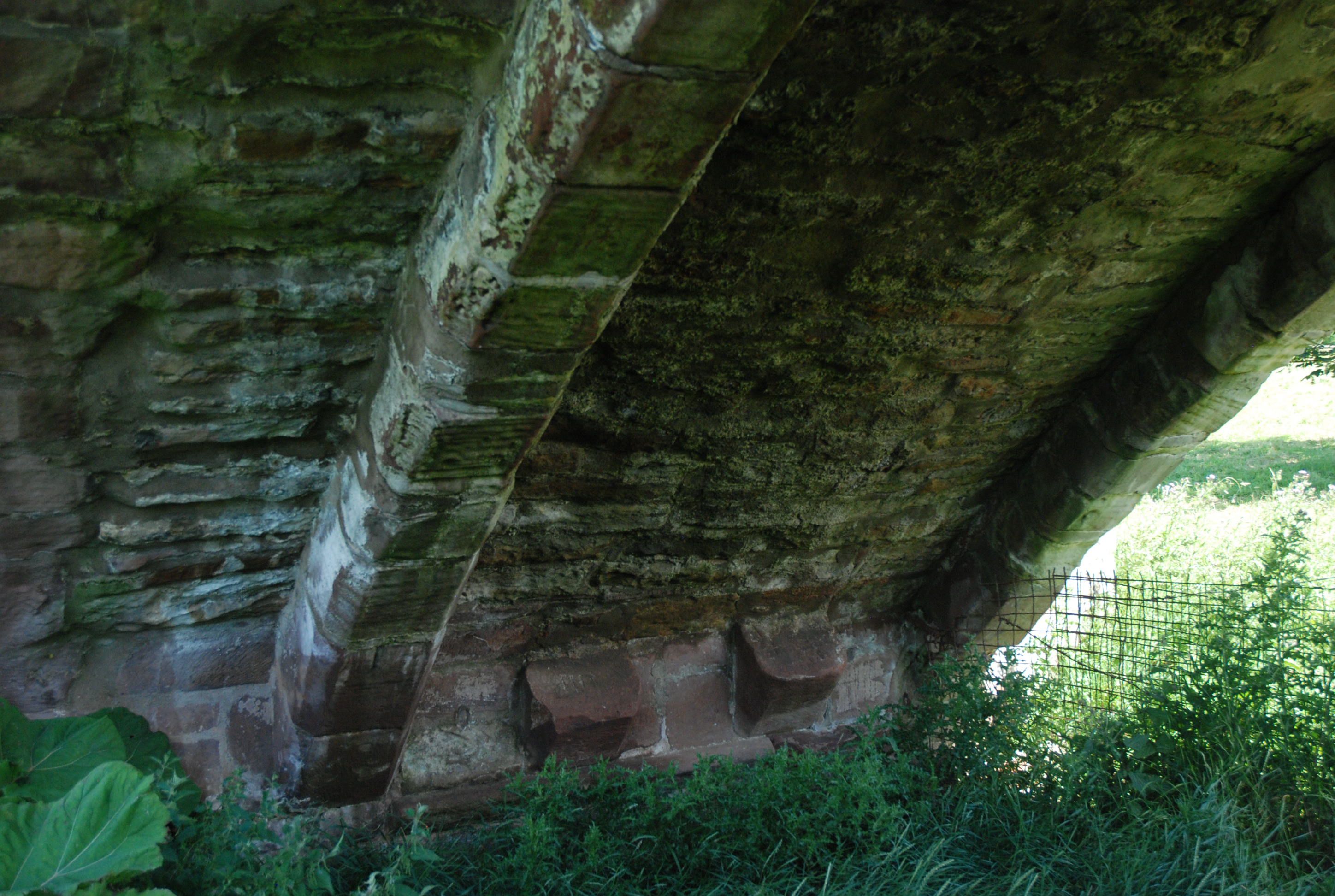
Currently: appears to be 15th century. Three complete gothic drop-centred arches. Red sandstone ashlar and partly dressed squared coursed rubble spandrels from many periods. Grey un-coursed random rubble approaches(18th century). Heavy ribbing. Two of the arches have missing ribs but the spring-stones are still there (see photos). Sixteen ft. wide but evidence of widening by about 18 inches (see photo): possibly for refacing only. Very slim voussoirs contrast with heavy ribbing.
Gothic arches suggest an earlier date. This is one of ten remaining gothic bridges in Scotland. Similar in style and substance to the Pencaitland Bridge (also drop centred arches), which is 12km away and credibly attributed to the Sinclairs of Herdmanston.
Link photo photo photo photo photo photo.
_______________________________________________
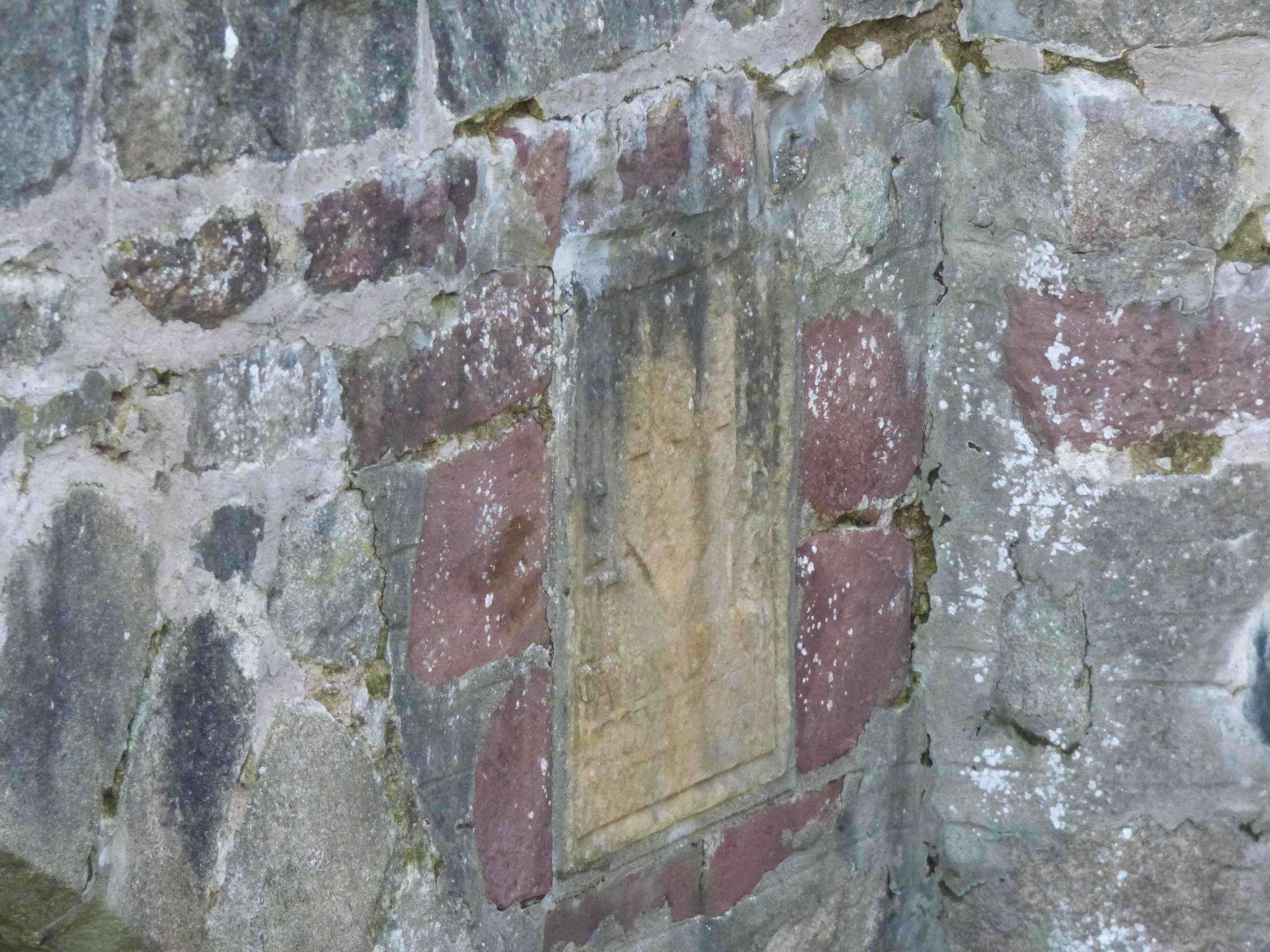
ABBEY BRIDGE Old Deer
C.Aberdeen South Ugie 396635,848139
This bridge is dated to 1717 by its masonry plaque. It lies immediately adjacent to a 13th century abbey ruin. Macfarlane (1720) describes a 'fine stone bridge' built by the owner of Broxy nearby. Very recently(2024)it was taking traffic but damage to the parapets has led to closure which, hopefully, may be permanent.
Maps:Roy(1750) Blaeu(1640) Pont 10(1600)
Currently: dated 1717. However, it has an older style with features that may be of the 17th or even 16th century. It may be compatible with the oldest maps. Three unequal semicircular flush arches. Uncoursed rubble very roughly squared. Small traingular cutwaters and one large buttress on the west facing. Parapets are stepped and more recent in in larger coursed blocks. Granite rubble voussoirs, chamfered on the largest arch, on both facings, only. Unchamfered on the small arches which are on the wider section. It is difficult to understand why the section-widening was done, most probably in the early 18th century. This is kawell built and well preserved bridge, now becoming neglected. The chamfered voussoirs hint at earlier provenance, as does the 9ft width on the earlier original section. The date panel appears to be a later insertion into the original larger arch spandrel.
_____________________________________________
ABBEYTOWN BRIDGE Airth
C.Stirlingshire Pow Burn 289649,686537
History: On the old main road to Falkirk. The ‘Abbey' was Holyrood to which the bridge and nearby pre-reformation church belonged. In 1629, 'two bridges at Airth needing repair.' Completed with a local tax (Harrison). Panel on bridge 'Founded upon wood and rebuilt by the shire 1726'. There was an important well nearby. (SA's)
Mentioned in Macfarlane (1720s)
Maps:1750(Roy) rather poorly and effaced. Firmly on 1680s(Adair) 1600(Pont) 1640(Blaeu).
Currently: Single segmental arch humped bridge in un-coursed sometimes squared rubble. Unusual large blocks on parapets and abutments. (See photo.) Eleven ft. wide. Crumbling. Two orders of voussoir arches. The lower one might have been added later as also seen in Newmills near Culross. May be saddling. Panel in the centre inside of parapet illegible. Now on a private road with limited access.
Link photo photo photo.
_______________________________________________
ABERFELDY BRIDGE see TAY BRIDGE
_______________________________________________
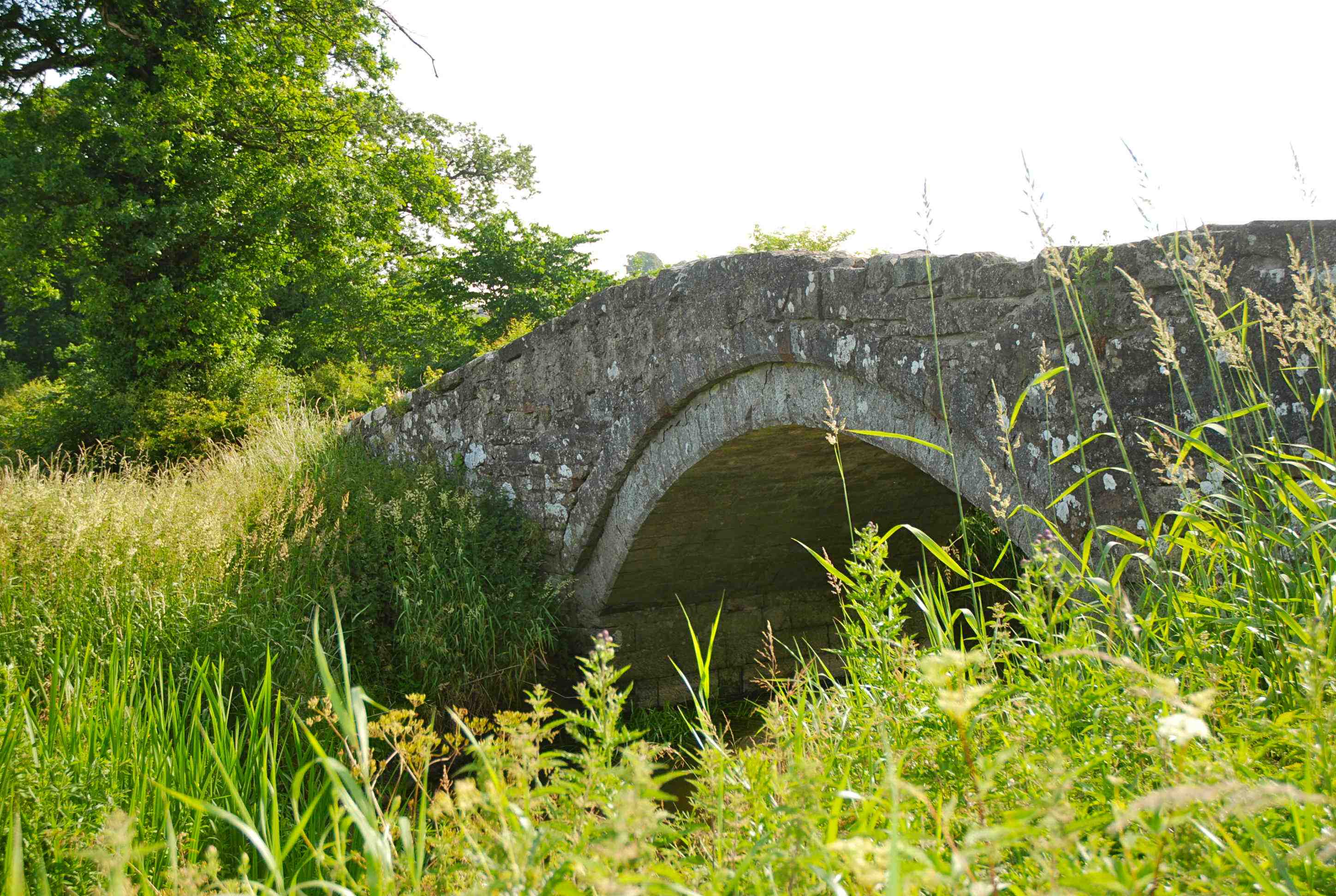
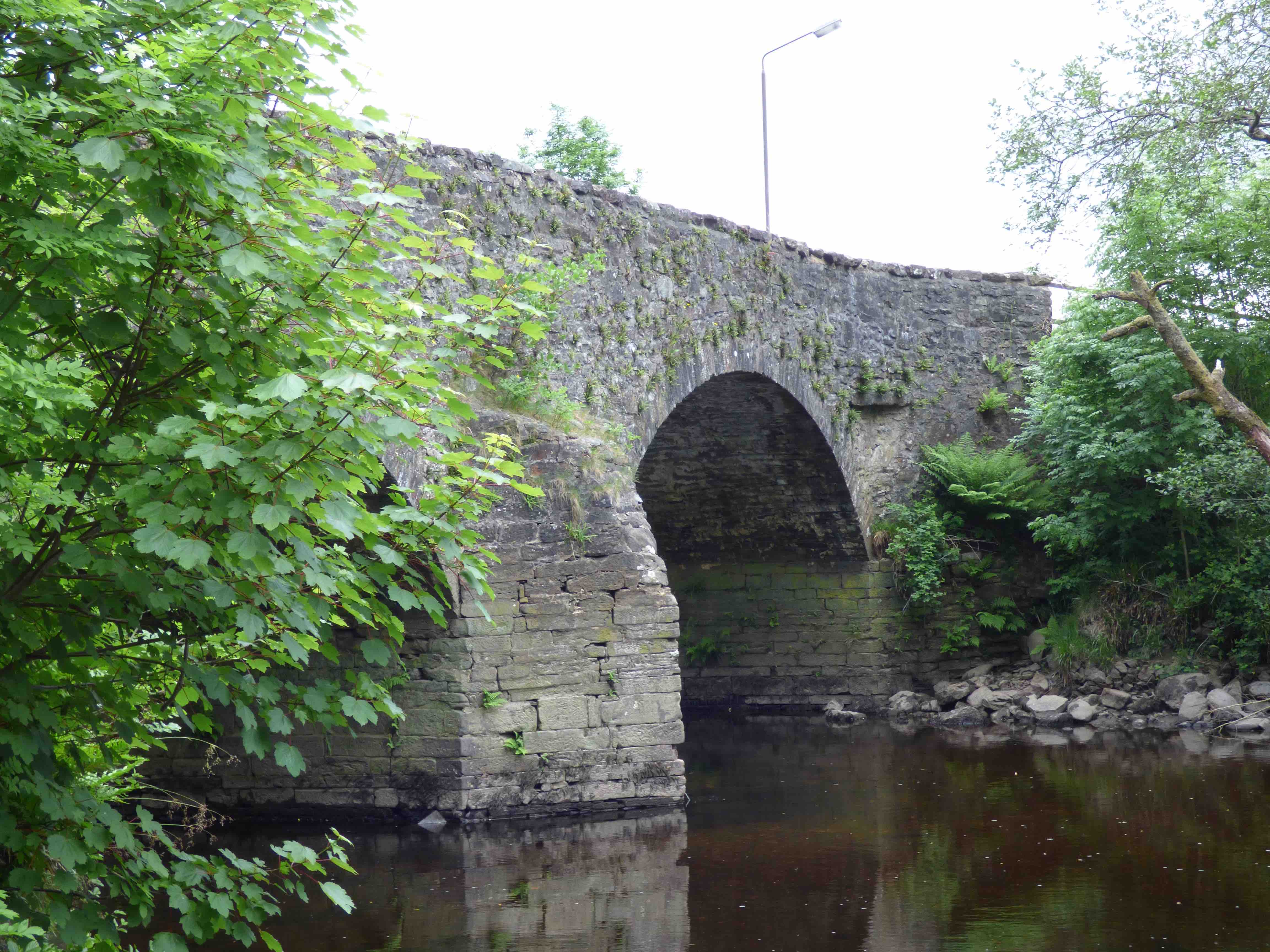
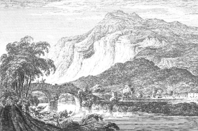
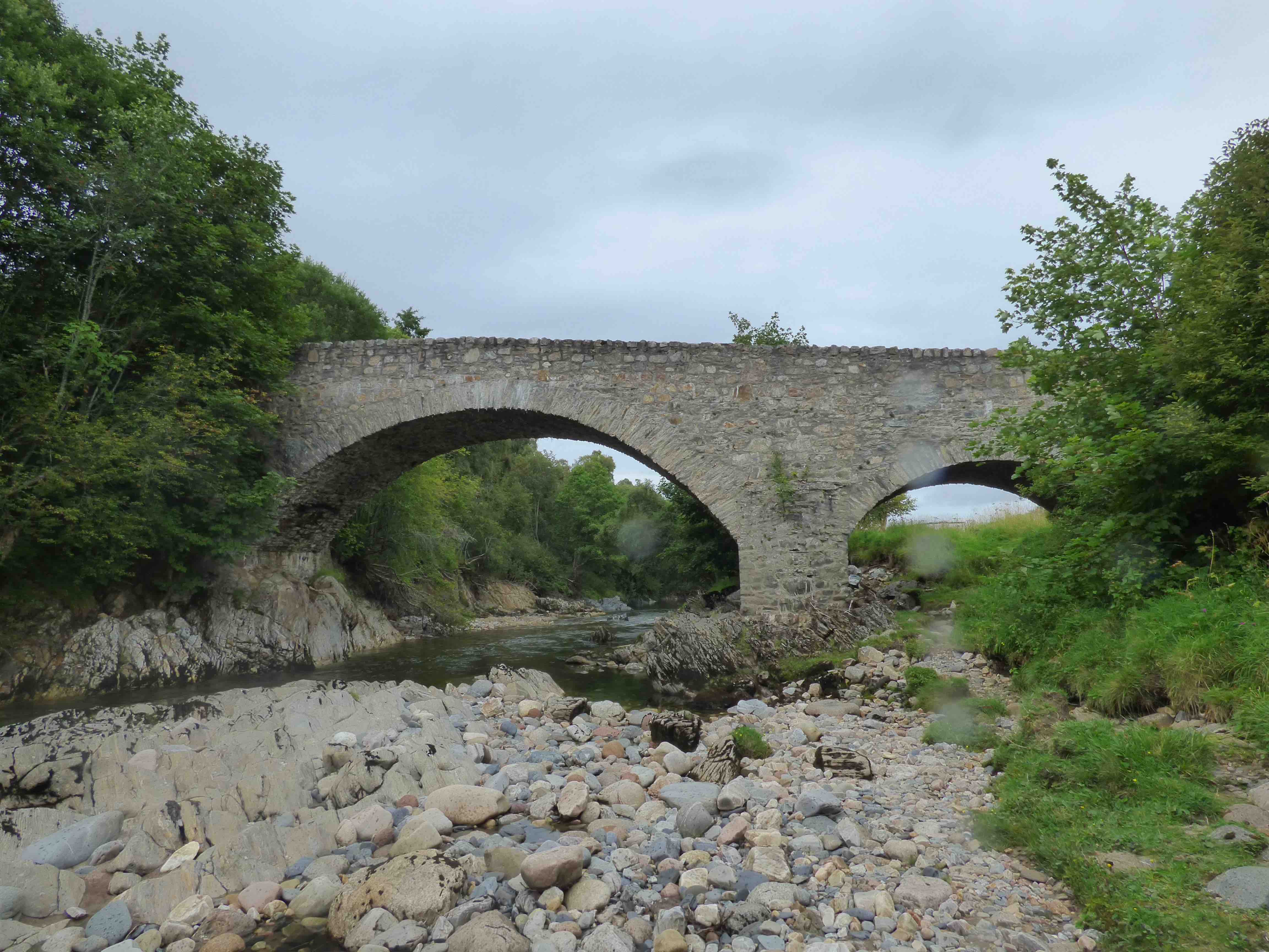
ABERFOYLE BRIDGE
C.Stirling R.Forth 252016,700924
History: The most upstream bridge on the River Forth. This bridge is an enigma. It was known as 'Clachan Bridge', and is quite a large structure for such a small rural community which did not gain any prominence until the early 19th century, thanks to Walter Scott. He refers to Rob Roy crossing 'the old fashioned bridge, very high and very narrow'. Firmly on Blaeu (circa 1640), but Blaeu's bridge is quite a distance from Aberfoyle settlement. There was a drove road, an alternative descent from Argyll, coming through Aberfoyle on its way to Balfron and then through the Carron Valley to Falkirk. Repaired in 1761. Macfarlane (1720s) records that it was destroyed by the order of the government (1715 rebellion) and had not been repaired.
Maps: Roy (1750) Blaeu(1640)
Currently: Looks mid 18th century. Overgrown but quite beautiful. Two raised segmental arches. Humped. Un-coursed squared random rubble spandrels and approaches.Quite crude. No string course. Two arches with central cutwaters which are crumbling. Long wings, partially buttressed. Original parapets, which is rather rare. Rough flat coping stones. Abutments, foundations and piers appear much older, possibly 16th century. One has to wonder if the original arches were semicircular. Skene's sketch (photo4 1829) might suggest this. There is an odd flood arch arrangement which would be more recent.
_______________________________________________
ADDISTON BRIDGE Edinburgh
C.Edinburgh. Gogar Burn
History:This remarkable little bridge is about 100m south of the A71 and upstream of the present crossing. The road was straightened in the early 19th century as seen on the Ainslie map (1821) thus bypassing the old bridge. However, the old structure is still standing although it is now semi-ruinous. It appears on the Adair map (1682) but is not on Blaeu(1640) which suggests a build date around 1650. The old road, approaching the bridge from the NW, is also still there (photo) although, as with the bridge, access is very difficult.
Maps: Roy(1750) Adair (1680s) and Ainslie(1821)
Currently: 17th century. Well dressed stone except for rather crude masonry on the abutments. Almost semicircular arch with ashlar voussoirs. However, most of the decking and facing has fallen away; much of it is in the river. Half of the arch on each side has also gone, offering a very narrow and precarious way over. Curiously, it appears that some reparative masonry work has been applied, sometime in its long history as a ruin; a squinch has been built on the NE facing to prevent further collapse. This has been a shoring up initiative rather than a restorative one. Also, the paired down facings have also been supported with some well dressed stones.
_______________________________________________
ALLT COIRE UCHDRACHAN BRIDGE Corrieyairack Pass
C.Inverness Allt Coire Uchrachan Burn 239266,800299
History: Hanoverian military. Two bridges side by side. The more modern wooden functional bridge has old random rubble abutments; it is probably original 1730s Wade. The intact segmental arched bridge with whinstone voussoirs and un-coursed random rubble spandrels is probably a younger,1760s structure. Caulfeild carried out repairs to the Corrieyairack amounting to £360, which was three quarters of the original 1730s spend on bridges.
Currently: 18th C. rubble bridges. Voussoirs appear radial. Present wooden lintel on older abutments with remains of parapet and string course. The intact stone bridge has a segmental arch with voussoirs of uneven length. Spandrels in undressed random rubble. This is a William Caulfield style bridge.
photo.
_______________________________________________
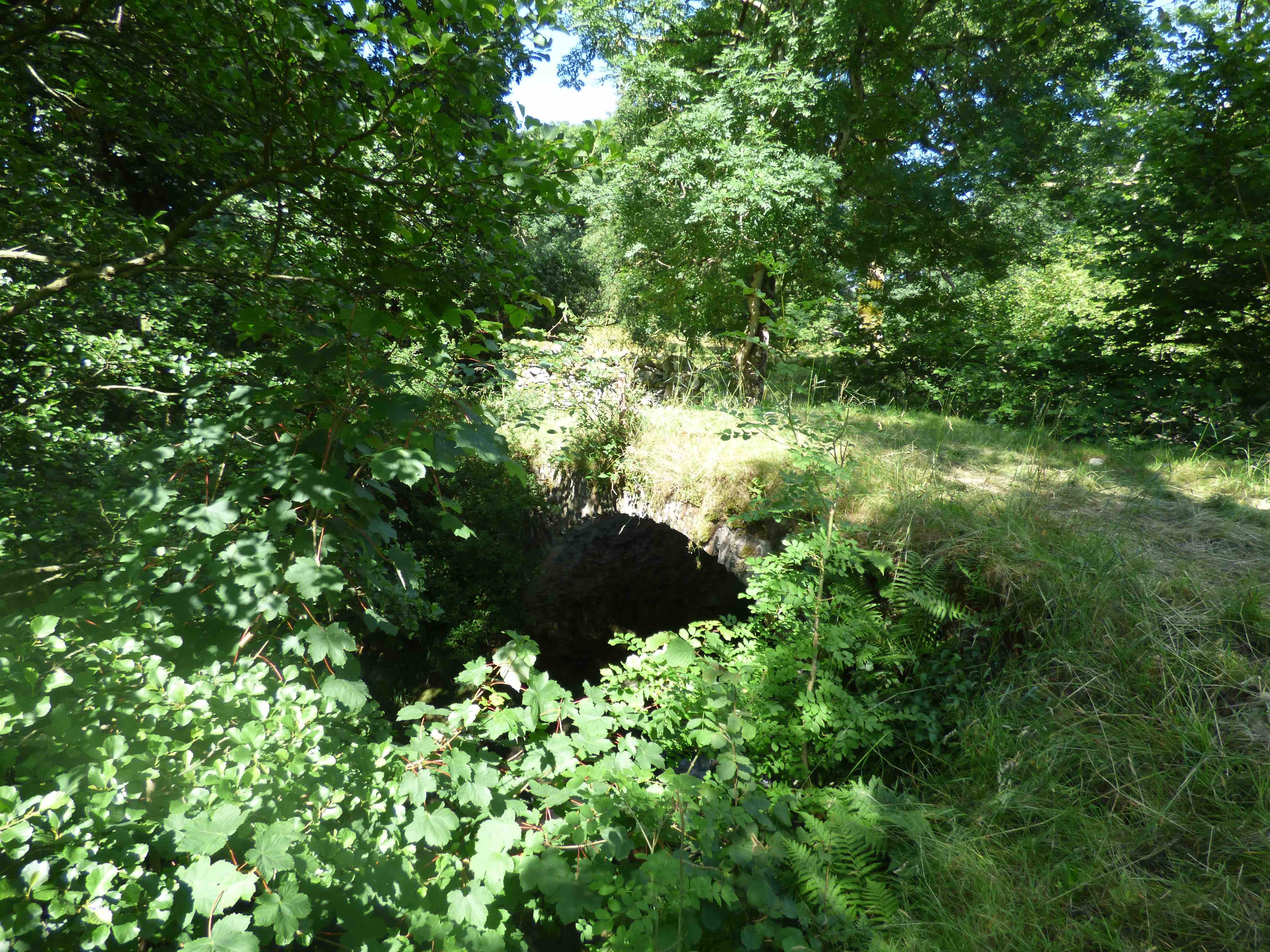
ALLT DOE BRIDGE nr. Fort Augustus. 240847,808775
C. Inverness. R.Allt Doe
History:1730 military. Wade. Fort Augustus to Inverness road.
Maps:1750
Currently: Five yards to the south of the current bridge and a little below it, is this small, eighteenth century, single segmental humpbacked arch in rubble, with minimal parapets and turf decking. Well dressed, sometimes squared but uncoursed rubble spandrels. Well dressed voussoirs. The bridge is collapsing: there is a large hole in the decking, looking through to the river. Now harled, and the harling has deteriorated. Very dilapidated and overgrown. The current bridge, adjacent, has the substance of a 20th century structure, which is revealed on the soffit (photo4). However, facings are from the early 19th century Telford period with preserved plumb and batter butresses, and it is 22 ft wide. There is a further puzzle here: the small original bridge might not be from the Wade period, but rather from the 1740's. This is suggested by the segmental arch, which is less usual and the width of exactly 12 ft which is characteristic of a Caulfeild build, rather than that of Wade.
_______________________________________________
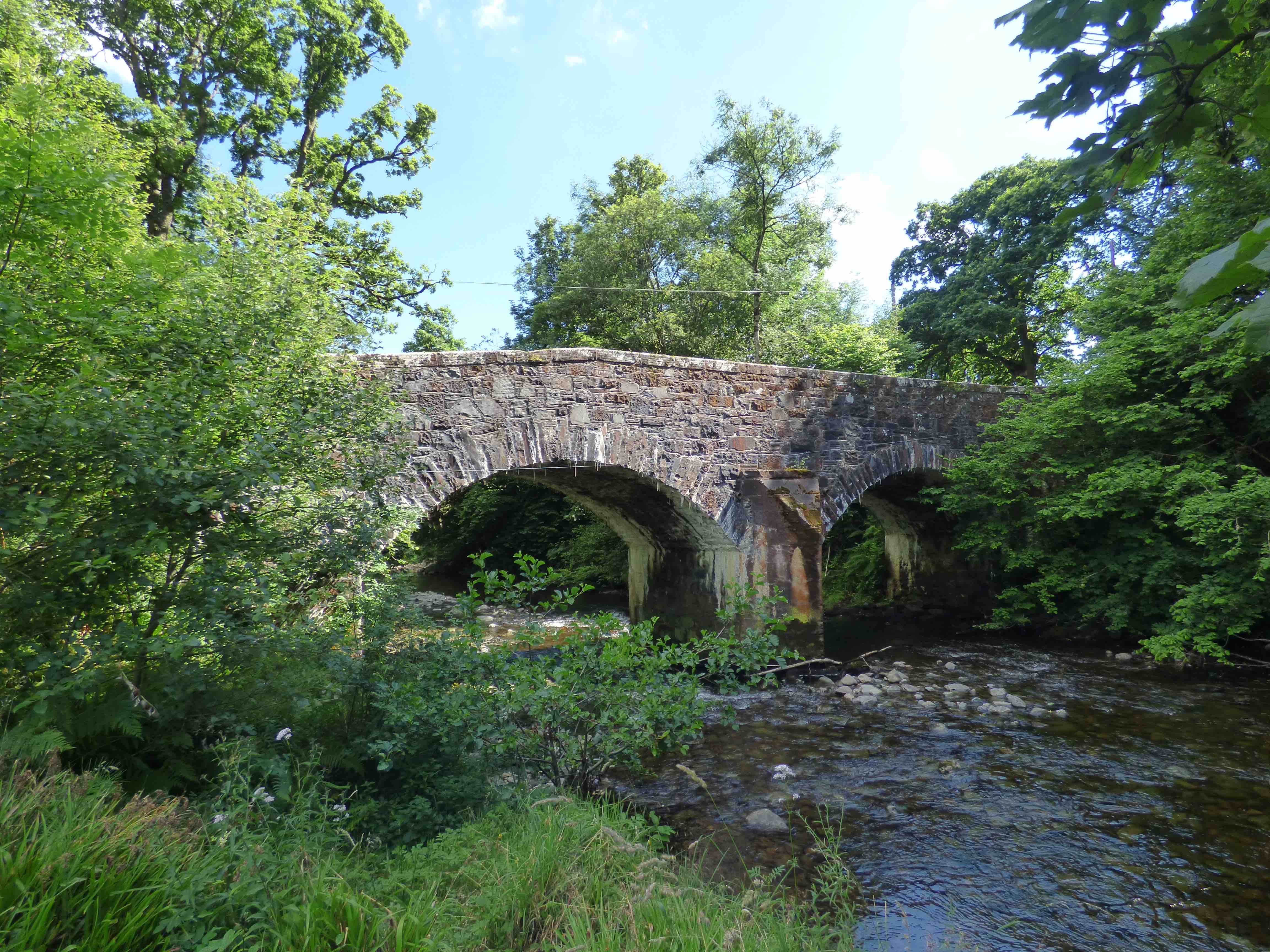
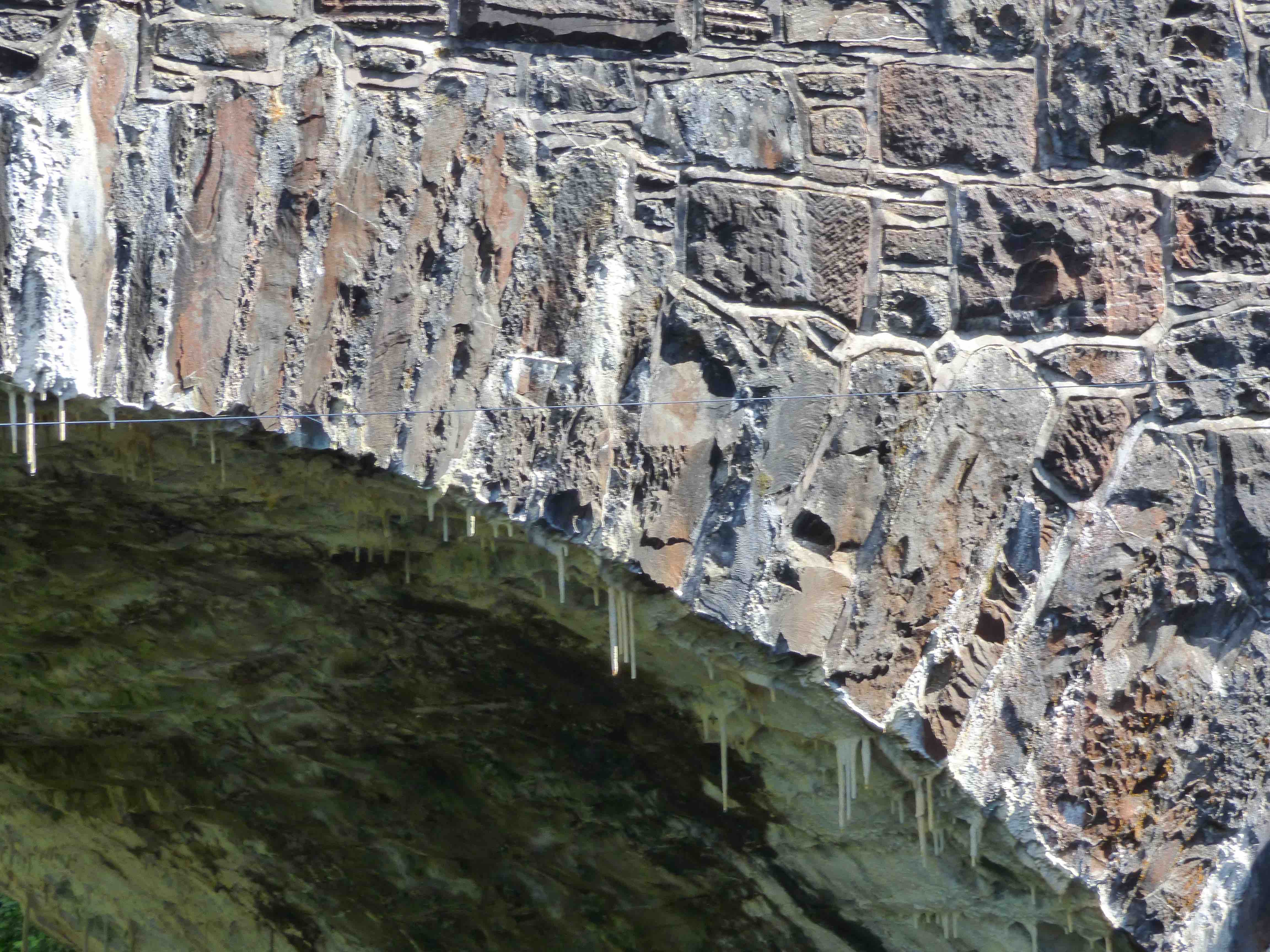
ALYTH OLD BRIDGE
C.Forfar Queich Burn 324517,748719
History: Reputedly built around 1500. Known to be rebuilt 1674. Described as originally a packhorse bridge. Five foot wide. Heightened in the 19th century and wide parapets were added. Flat-decking. In 1750 the town was entirely on the north bank of the burn and the road from Coupar finished at the bridge.
Maps: 1750 (Roy) 1600(Pont 28)
Currently 17th century; perhaps some parts are earlier. Two stilted segmental arches, one smaller. Random un-coursed red sandstone rubble with rubble voussoirs of varying lengths. Cutwater unusual and may be very ancient. Overhanging parapets are quite unusual.
photo photo photo photo.
_______________________________________________
AMULREE BRIDGE Sma Glen
C. Perth R.Braan 290050,736785
History:1730s. Wade Crieff/Dalnacardoch military road. Also, the junction of four 18th century drove roads, descending through the Sma' Glen to the Tryst at Crieff.
Maps:1750
Currently: 1730s. Two segmental arches plus one flood arch. Very damaged by age and poorly repaired and restored. Northerly arch voussoirs are in concrete and the entire upstream side is repaired in concrete. The remaining downstream southerly arch is in squared, sometimes coursed random rubble spandrels with whinstone voussoirs and coping.
photo photo.
_______________________________________________
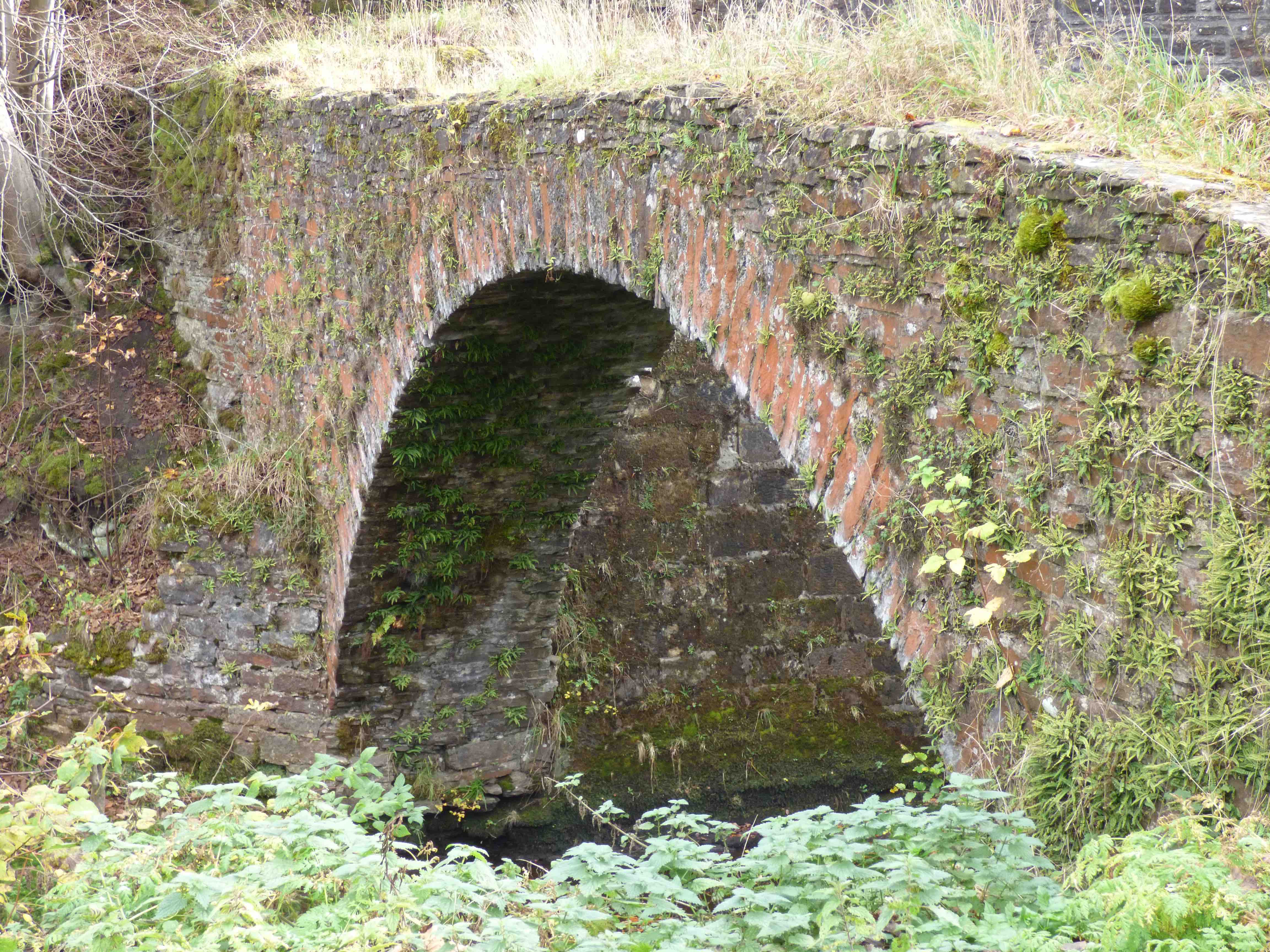
ANNACHIE BRIDGE nr.Rattray
C.Aberdeen Black Water 410488,853088
Maps:1750. Not on Blaeu. Roy's map shows the main road north (equivalent of A90 from Peterhead to Fraserburgh) very much to the east and running close to the coast. Nothing remains of this road. Macfarlane describes this bridge in 1722. Blackwater was a stately home. The burn was the 'Anchie'.
Currently: A remarkable little isolated bridge which appears to be the original 18th century. Very roughly squared and coursed rubble spandrels. Parapets gone. Single semicircular arch with dressed voussoirs. Un-coursed rubble spandrels. No evidence of the road.
Link1.
_______________________________________________
ANNET BURN BRIDGE Callander
C.Perth Annet Burn 270660,703031
History: This bridge lies on the 1749 military road built by Caulfeild (Stirling/Fort William). However, we know that there was a pre-existing 'carte road' identified in the 1720s by General Wade's surveyors, and this bridge, almost certainly, was a part of that. How old it is, is difficult to determine but the corbeling and the narrow width might suggest 17th century. It seems probable that in 1749 Caulfeild incorporated the bridge into his military road accepting that it was on the narrow side of his specifications ( 9-10ft.).
Maps:1750. Not clearly outlined.
Currently: A 24ft segmental arch span with rubble voussoirs and random rubble sidewalls and spandrels. Ten ft. wide. No string course. Splaying has been added later; it was not part of the original style. The bridge has a horizontal deck which is significant. Odd corbeling above the arch but below decking level; it appears to be non-structural and is certainly not a Caulfield feature. The horizontal deck also tends to exclude Caulfield and the narrow width certainly suggests an earlier date.
_______________________________________________
ARKLAND BRIDGE Scaur Valley nr Thornhill
C. Dum &Gall Scaur water 280500,598143
History: Noted on Roy as 'Bridge of Scaur' and well marked. Recorded as swept away in 1749, so the bridge on Roy must have been a very new replacement.
Maps: Roy(1750) Possibly on Pont but very faint. Extremely remote.
Currently: 18th century. Two segmental arches with rubble voussoirs. Spandrels in pitch-faced partially squared un-coursed rubble. Cutwater. Splayed parapets with solid squared coping stones. No string course.
A local farmer pointed out an additional strange little bridge which exists 300m upstream, which is clearly very old and now used by cattle. It is tiny, but well engineered with abutments and revetments. Interestingly, it is, in fact, at a better matched location for the bridge on Roy’s map. See photo 3.
Link photo photo photo.
_______________________________________________
ARDOCH BRIDGE Braco
C.Perth R.Knaik 283791,709911
History: This tiny bridge is hiding below the NW side of the current road bridge at Braco. Tradition is that it was built in 1420 by Michael Ochiltree, Bishop of Dunblane. However, in 1742 William Caulfeild built the Stirling to Crieff military road. This was his first project. Roy's map (1747) shows the military bridge, but there is also, on close inspection of the map, the faint outline of the older bridge, just adjacent on the NW side. So the military bridge was built alongside the old one. Other maps fail to show this feature until the OS of 1859, which shows it clearly. However, even the military bridge is not the one we see today because since that time it has been again replaced by a late 19th century skewed bridge. The very oldest bridge is still standing alongside; it was ruinous by 1989 and restored by the Society for the Preservation of Rural Scotland. Whether or not it was the bridge of 1420 is difficult to answer. The segmental shape suggests not. It has more of the characteristics of a 17th century packhorse bridge.
Maps: (Roy)1750. Adair(1680s)
Currently: an early packhorse bridge, in appearance, fully restored. Possibly 1650.
Single semicircular whinstone arch, unevenly abutted on the rocks. 5'9" wide and only 4'6" parapet to parapet. Squared un-coursed rubble spandrels. Very low parapets. No string course. Very narrow, which is the most interesting aspect; certainly not a Caulfield military bridge which would have been 12' wide.
photo photo photo.
_______________________________________________
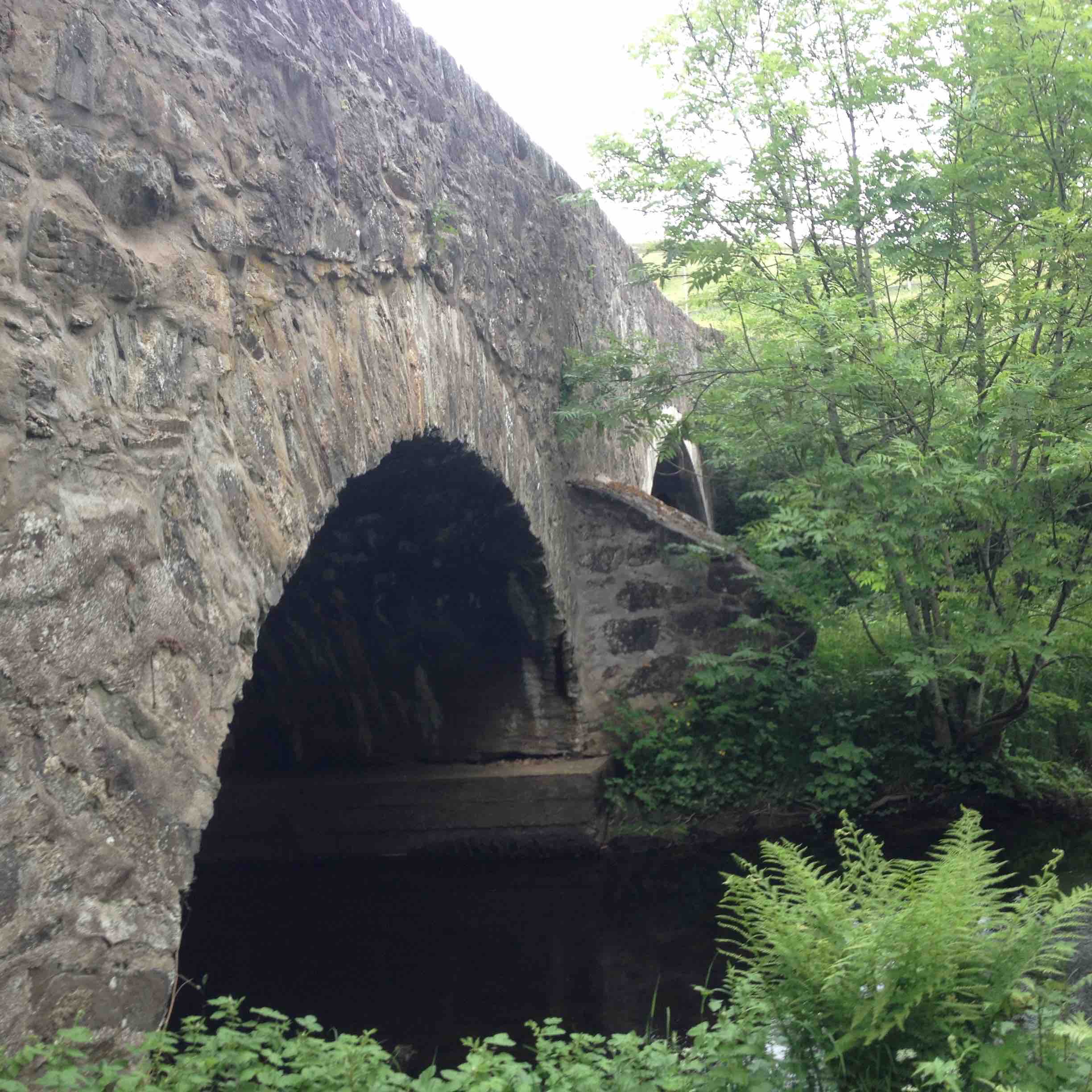
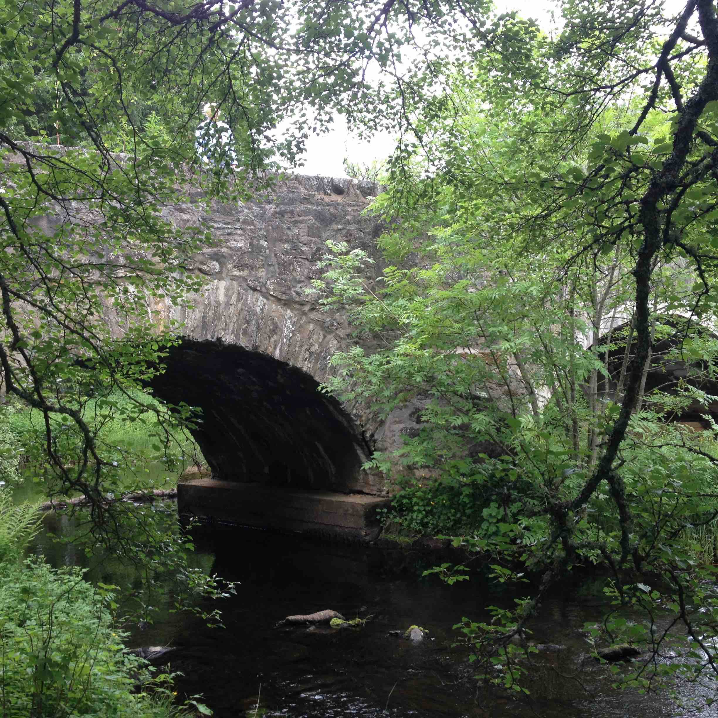
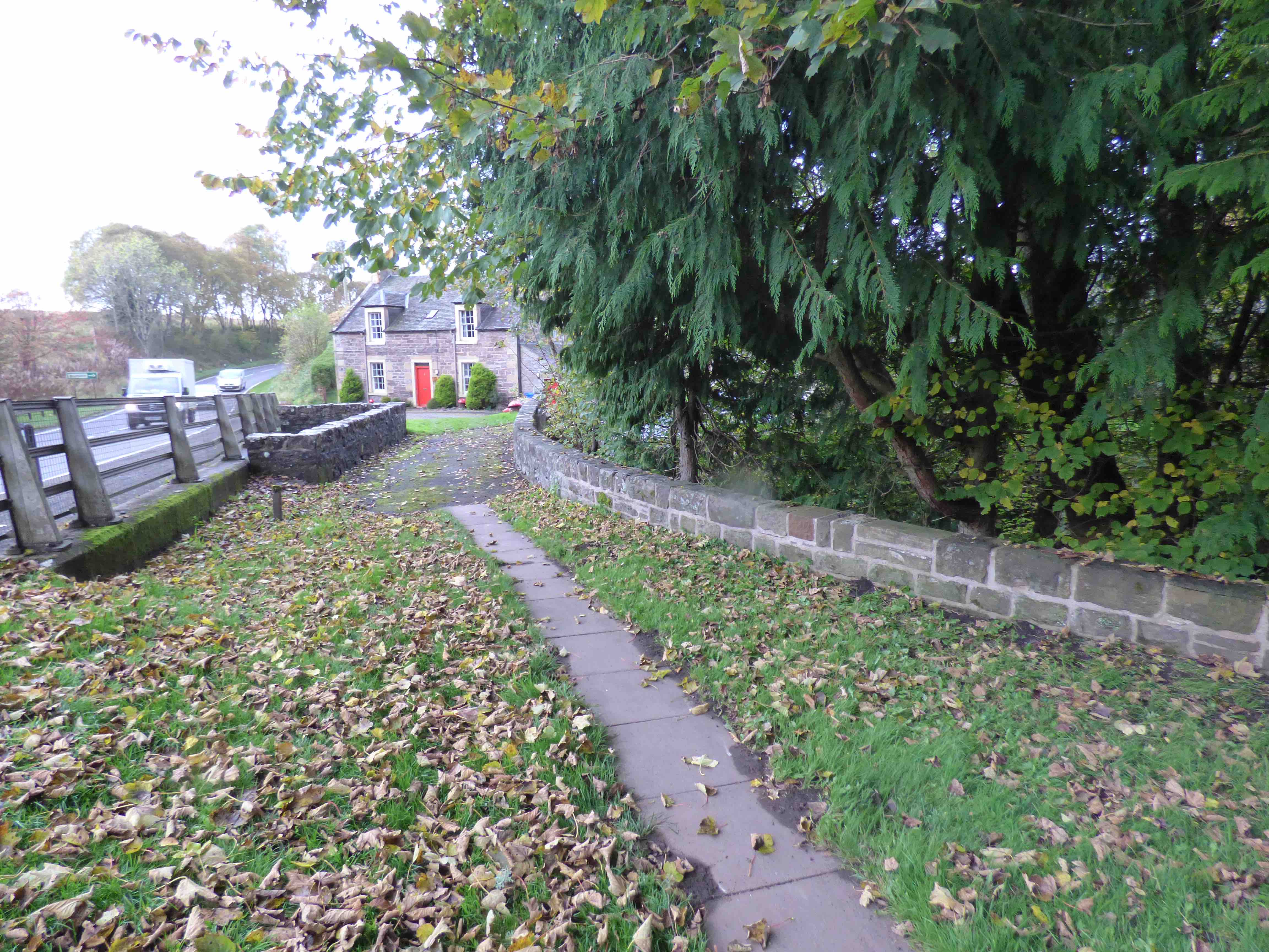
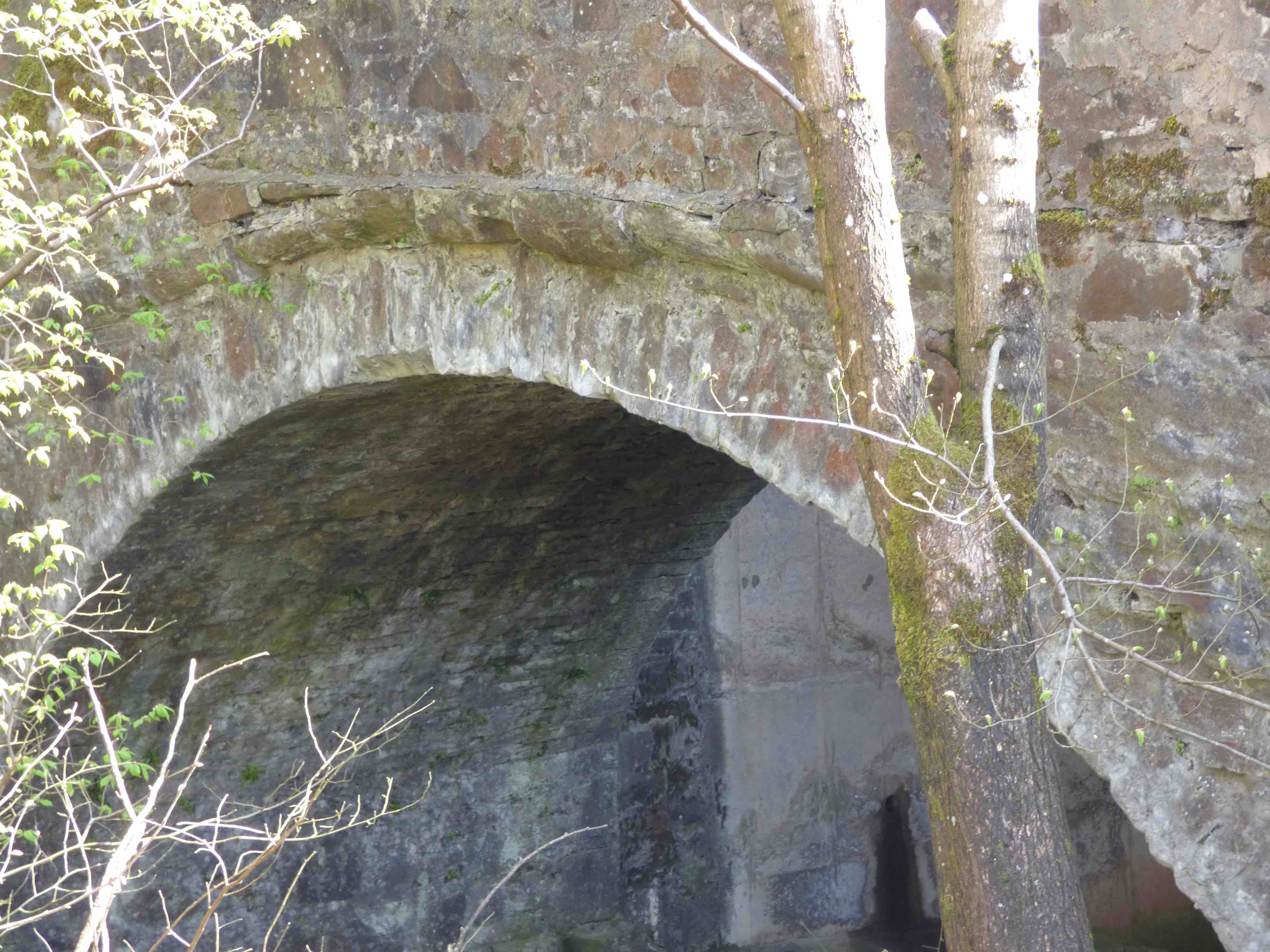
OLD AVON BRIDGE Hamilton
C. Lanarkshire R. Avon 273329,654625
History:Pre-1600. Possibly built by the monks of Lesmahagow . " Built before the 16th century" (St.Acc 1792). This was on the ancient main road south out of Glasgow towards Carlisle. Extensively rebuilt and widened in the early 18th century, because two arches were destroyed. Canmore and HS both suggest 17th century, but its 16th c. record on Blaeu and Pont is important. The bridge was bypassed upstream in 1725, by Thomas Telford as part of his celebrated Carlisle to Glasgow road. In 1974, the M74 took-over.
Maps:Roy(1750)Pont 34 (1600) Blaeu(1640)
Currently:16th century structure with 18th century work. Three large almost semicircular arches, each with 3 enormous chamfered ribs sprung higher than the piers. There are two orders of ashlar voussoir on the ribs which is unusual, and two orders on the main arch, the lower of which is decorative but hard to see (photo3). Spandrels are well coursed and squared stugged rubble. Appears to be ashlar in some older parts. Parapets are much later. 10ft wide. 30 ft. Spans. Cobbled horizontal decking may be a feature of the later rebuild. There is a small flood arch on the south abutment.
photo photo photo photo photo.
_______________________________________________
AVON BRIDGE Tomintoul
C.Aberdeen R.Avon 314963,820145
History: This Caulfield military bridge is from 1754 but Roy's map shows a predecessor because this section of the Coupar/Fort George road had not yet been built at the time of the survey. One arch of the current bridge was swept away in the 1829 floods.
Maps:1750
Currently:1754 military. One stilted segmental plus 1 flood arch. Lop sided. Mainly random rubble with wide voussoirs in whinstone. Small cutwaters and buttressing on the downstream.
Link photo photo.
_______________________________________________
OLD BRIDGE OF AYR
C.Ayr R. Ayr 233855,622110
LINK TO FULL SUMMARY.
History:Charter 1236.
Maps:Roy(1750) Blaeu(1640)
Currently: 1588