Scotland’s Oldest Bridges.
A map-based catalogue of the oldest masonry bridges in Scotland.
MN - Alphabetical List
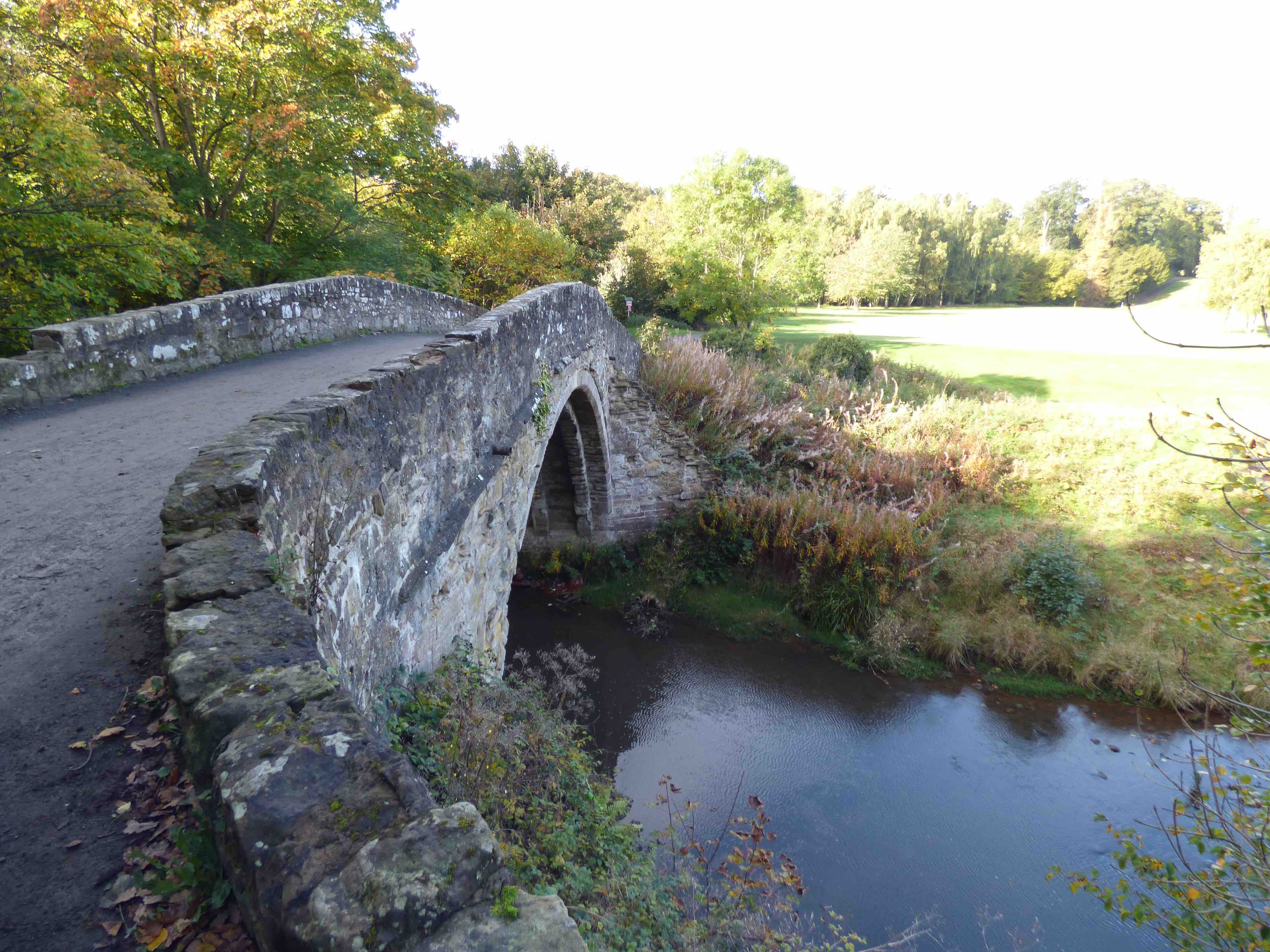
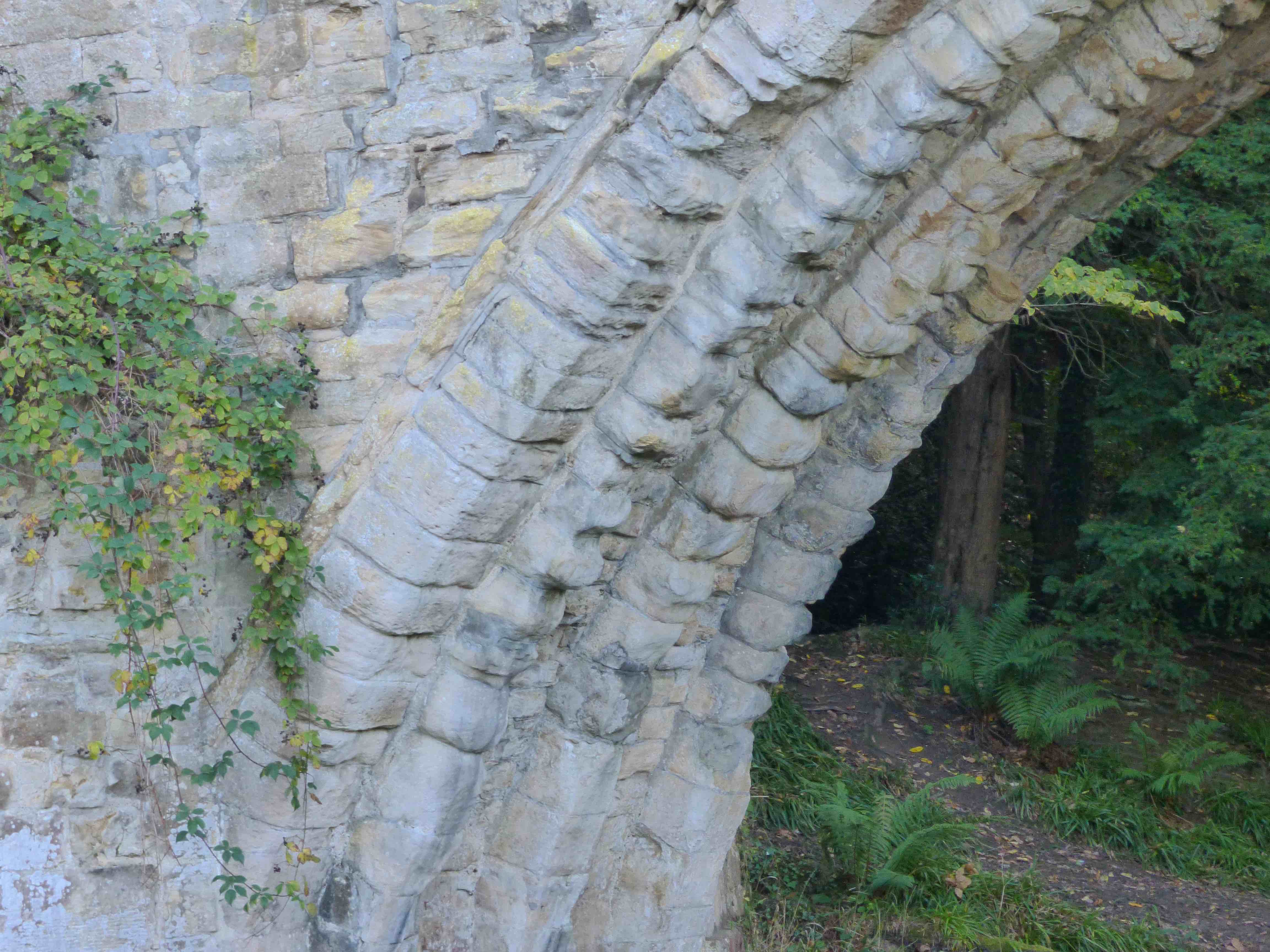
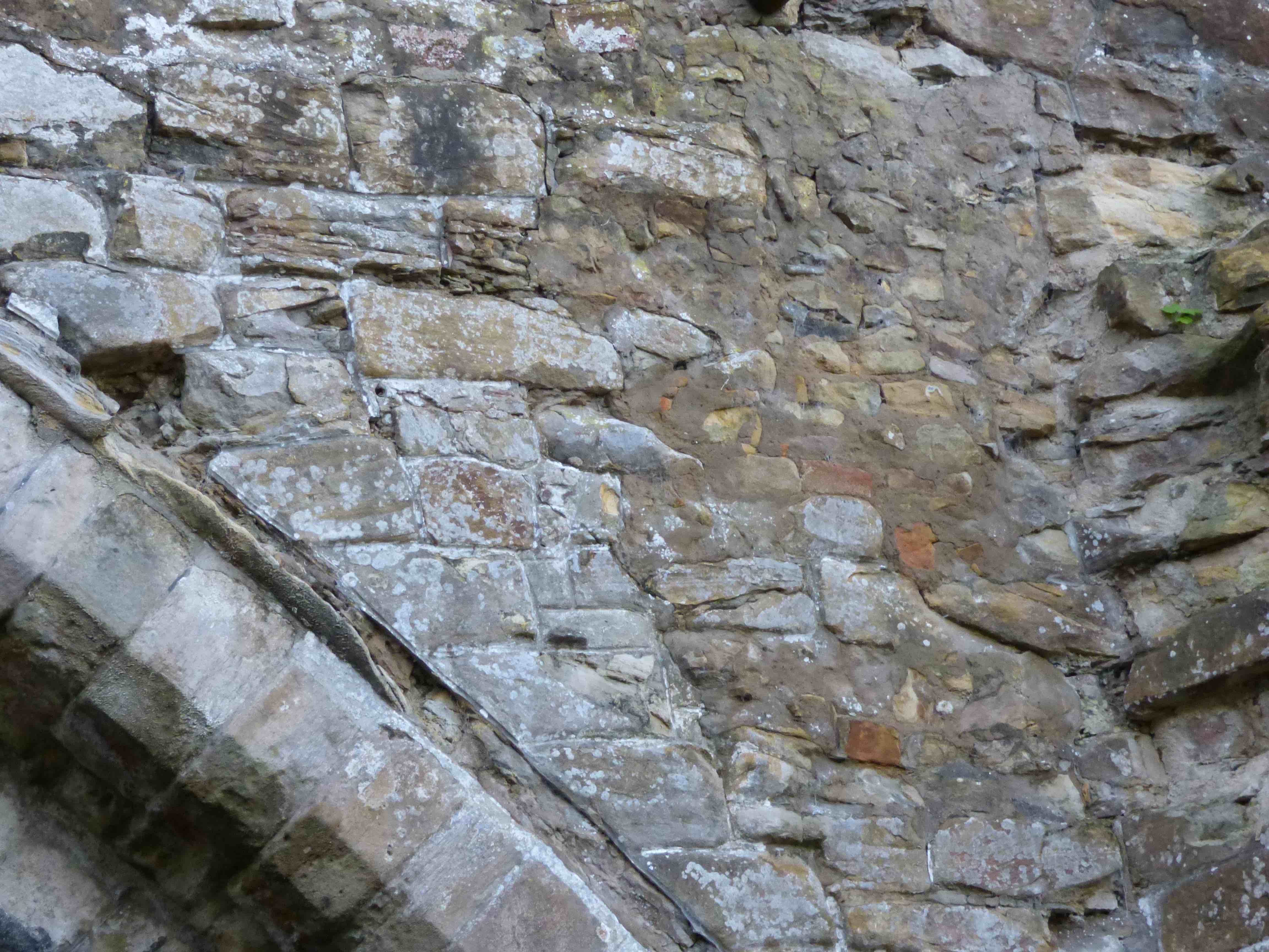
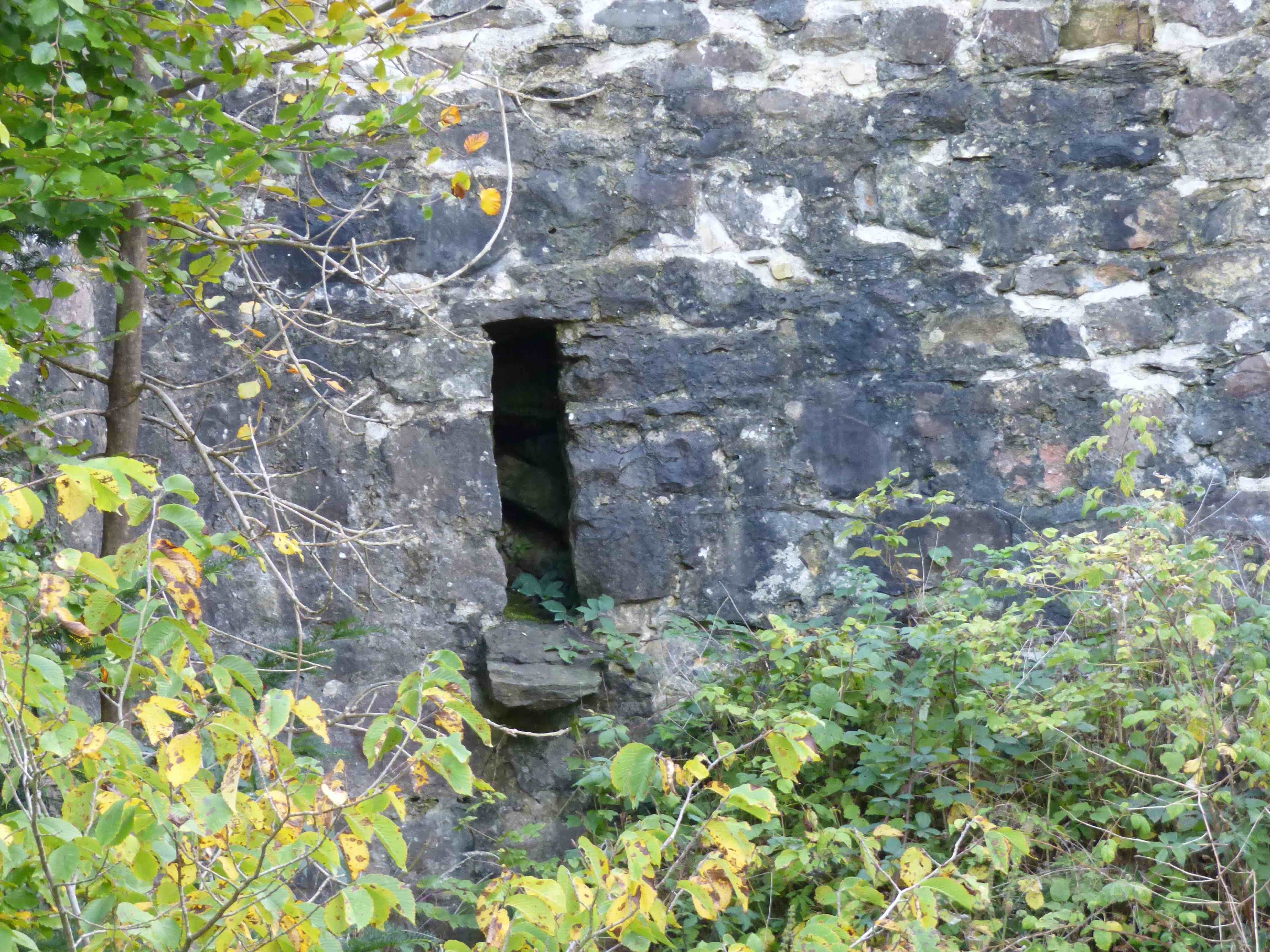
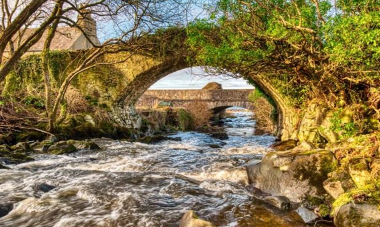
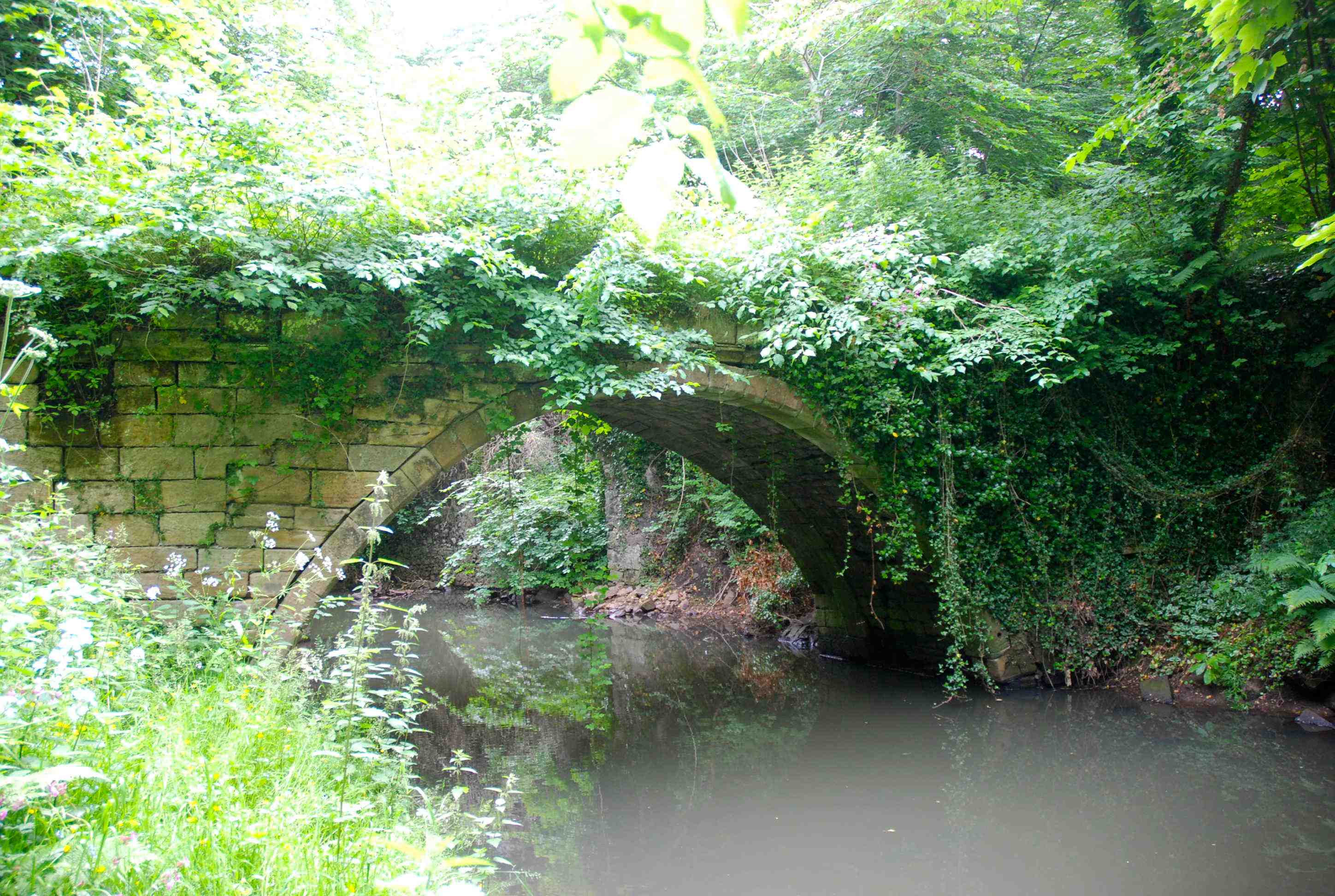
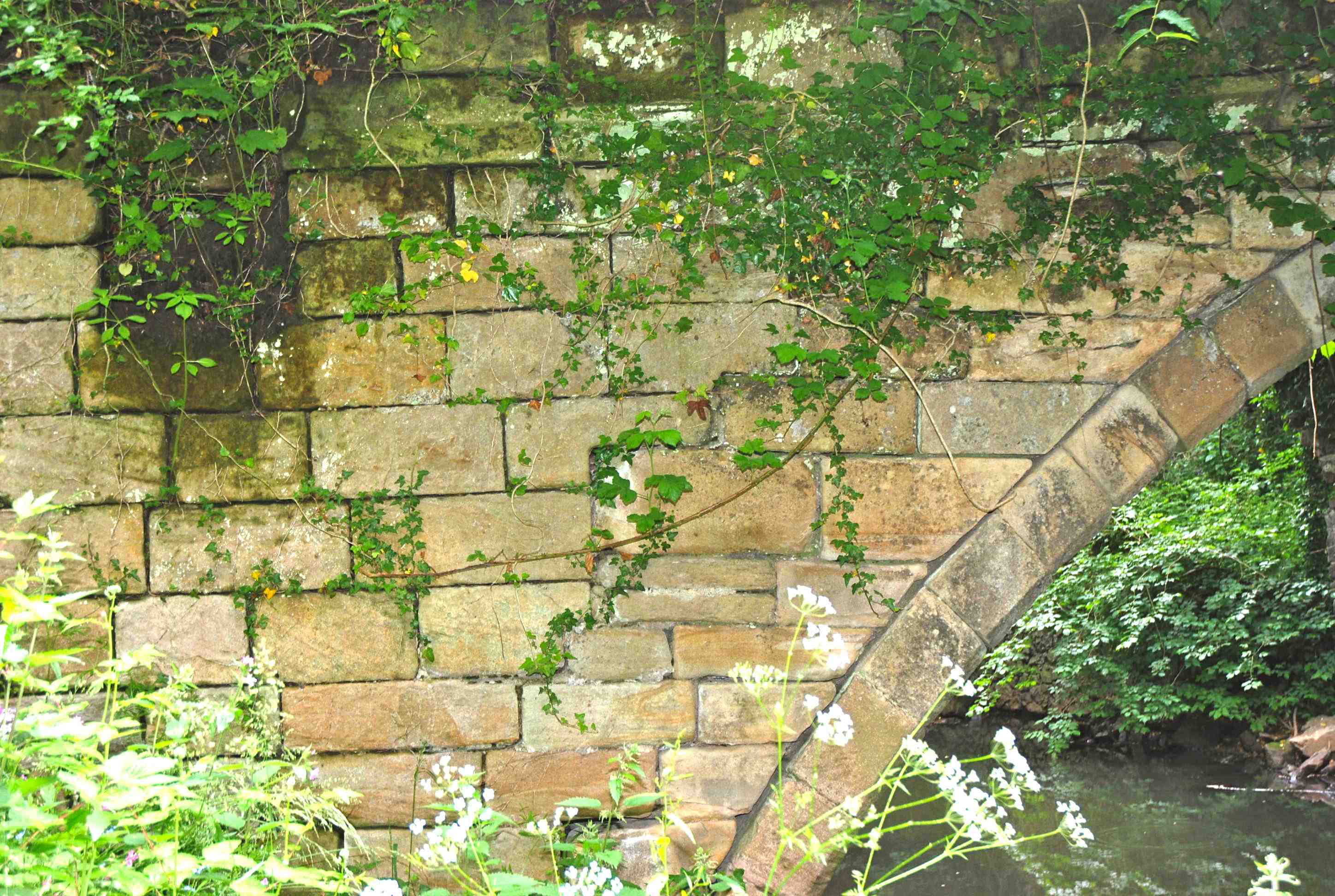
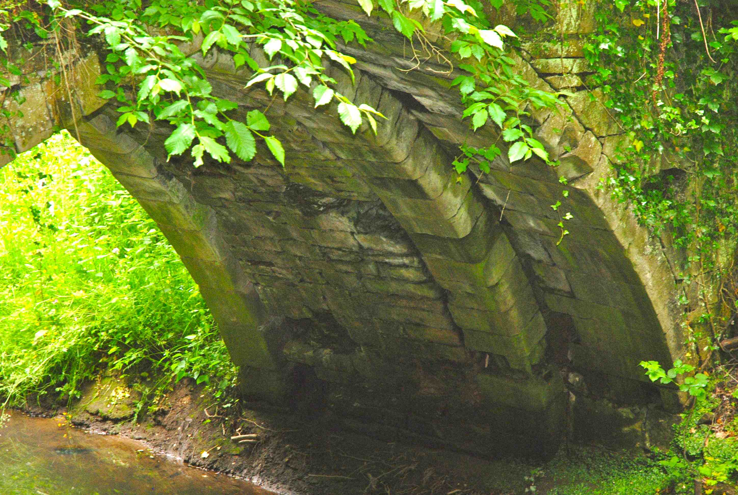
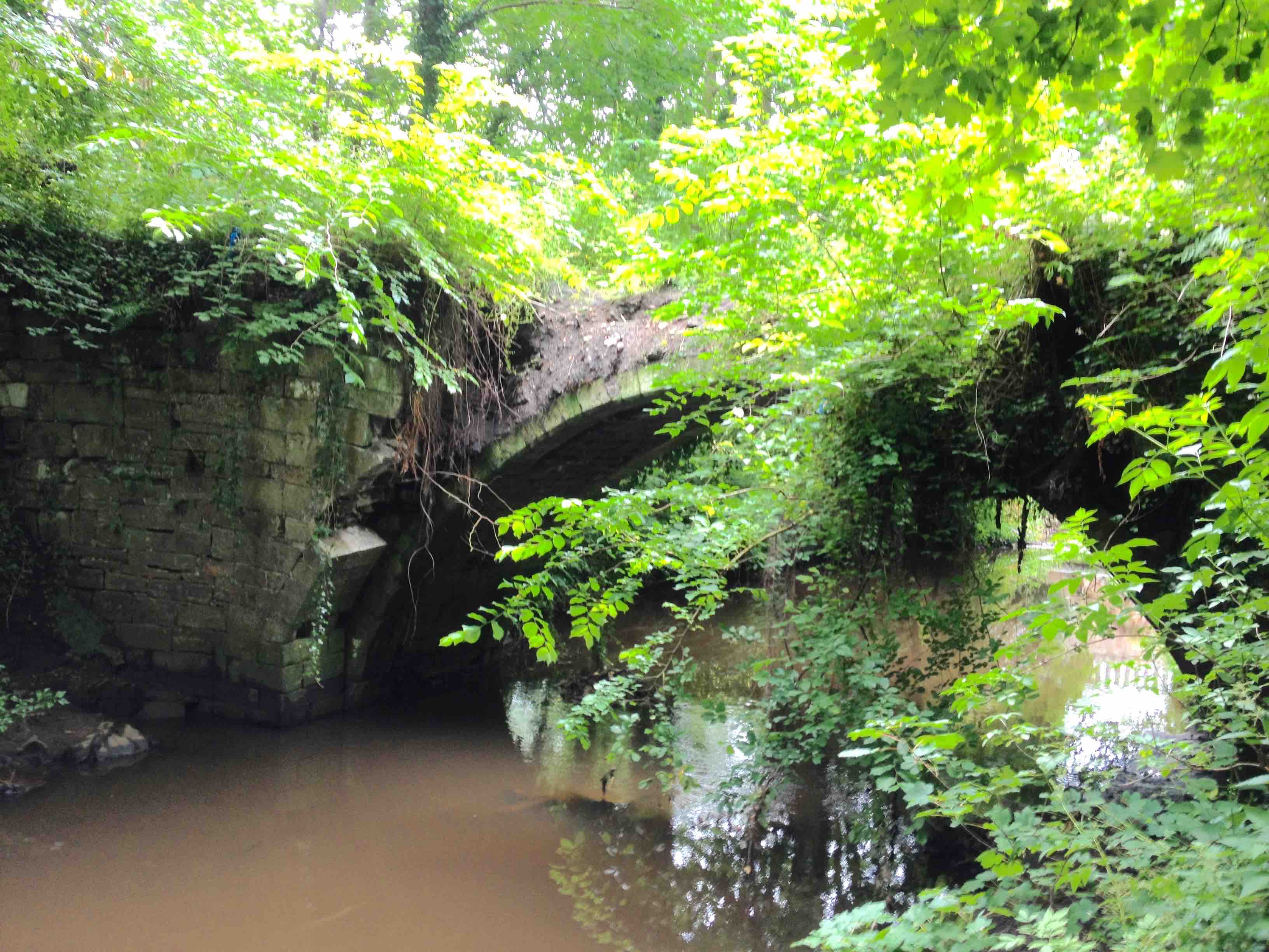
MAIDEN BRIDGE nr Dalkieth
C.Midlothian R.South Esk 333670,666587
History: Late 15th century. The maiden was Margaret Tudor, daughter of Henry VII and sister to Henry VIII. She married JamesIV of Scotland at Richmond Palace in 1503. The new thirteen year old queen then came north to Scotland in a grand journey, and it was recorded there was a need to 'make by force wayes for her carriage'. The marriage train came through Berwick towards Musselburgh and then along the Salter's Road (A6094) to Maiden Bridge. It its probable that the bridge was already in existence in 1500, but not too much earlier or we might expect to see a pointed arch.
Maps:1750(Roy) 1680s(Adair) 1640(Blaeu) Pont(1600)
Currently: Original late 15th century. Single semicircular arch with chamfered voussoirs and three heavily chamfered ribs, reset on the downstream face, flush on the upstream. 48ft span and 12 ft wide. Largely squared rubble, though very weathered, and coursing on the upstream facing. Strong protuberant string course, partially lost. Very weathered hood-moulds. Younger parapet above. Three enormous lateral buttresses to each abutment except on the NE approach where splaying occurs. Here, there is an odd slit in the masonry which may be a defensive feature; alternatively it may have served as drainage. The bridge lies within the old Newbattle Abbey estate and offered passage from there across to Dalkeith town. Today it is rather sad and dilapidated and needs some maintenance.
Link photo photo photo photo photo
_______________________________________________
OLD MANOR BRIDGE Peebles
C.Peeblesshire R.Manor 323117,639397
History: Built from a vacant church stipend. Dated 1702 and of that style, but firmly on Blaeu ('Kirk of Mennyrs'), so another structure must have preceded this bridge in the 17th century; possibly wooden. Restoration program 2009. This bridge has to be differentiated from 'Manor Bridge' which is over the Tweed, nearby.
Maps: Blaeu(1640). Strangely not on Roy. On Edgar(1741)
Currently: Early 18th century. Single narrow segmental humped bridge, 9ft wide. Random un-coursed, un-faced rubble. Fairly new pattress plates and ties. Beautifully preserved. The plaque records that 'William Duke of Queensberry designed this work and William Earl of March his second sone built the same Anno 1702.'
Link photo photo photo photo.
_______________________________________________
MEIGLE BRIDGE Skelmorlie
C.Ayrshire Slelmorlie Water 219459,665662
History: Robert Burns escorted Mary Campbell as far as Meigle Bridge when he first met her (around 1786). This was "Highland Mary" with whom he had an affair. The Roy road appears to approach from Skelmorlie Castle Road and crosses the burn at this spot, which is 200m upstream of the coast bridge.
Maps:1750(Roy)
Currently: 17th or 18th century , small single semicircular red sandstone bridge. Dressed random rubble spandrels. Squared and coursed rubble abutments. Rubble voussoirs. Date-stone looks like ‘160?’. Listed note confirms ‘ 1604’. This suggests a later rebuild. There is evidence of widening of the downstream side. Inglis claims it is a 'collection' bridge. Overall, it appears more like an 18th century bridge which suggests that the date-stone was preserved for a rebuild.
photo photo photo
_______________________________________________
MELGARVE WEST BRIDGE see DRUMMIN
______________________________________________
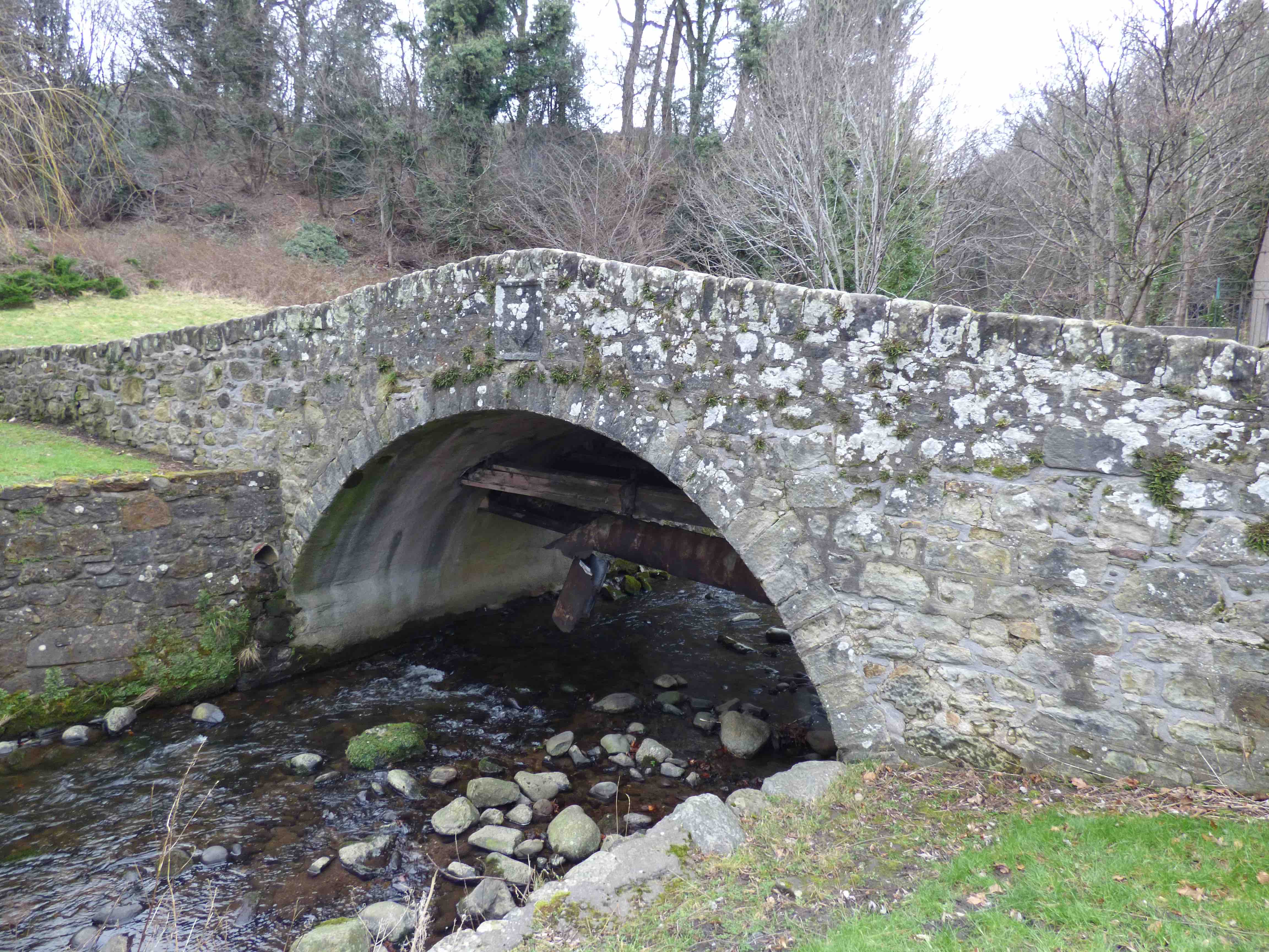
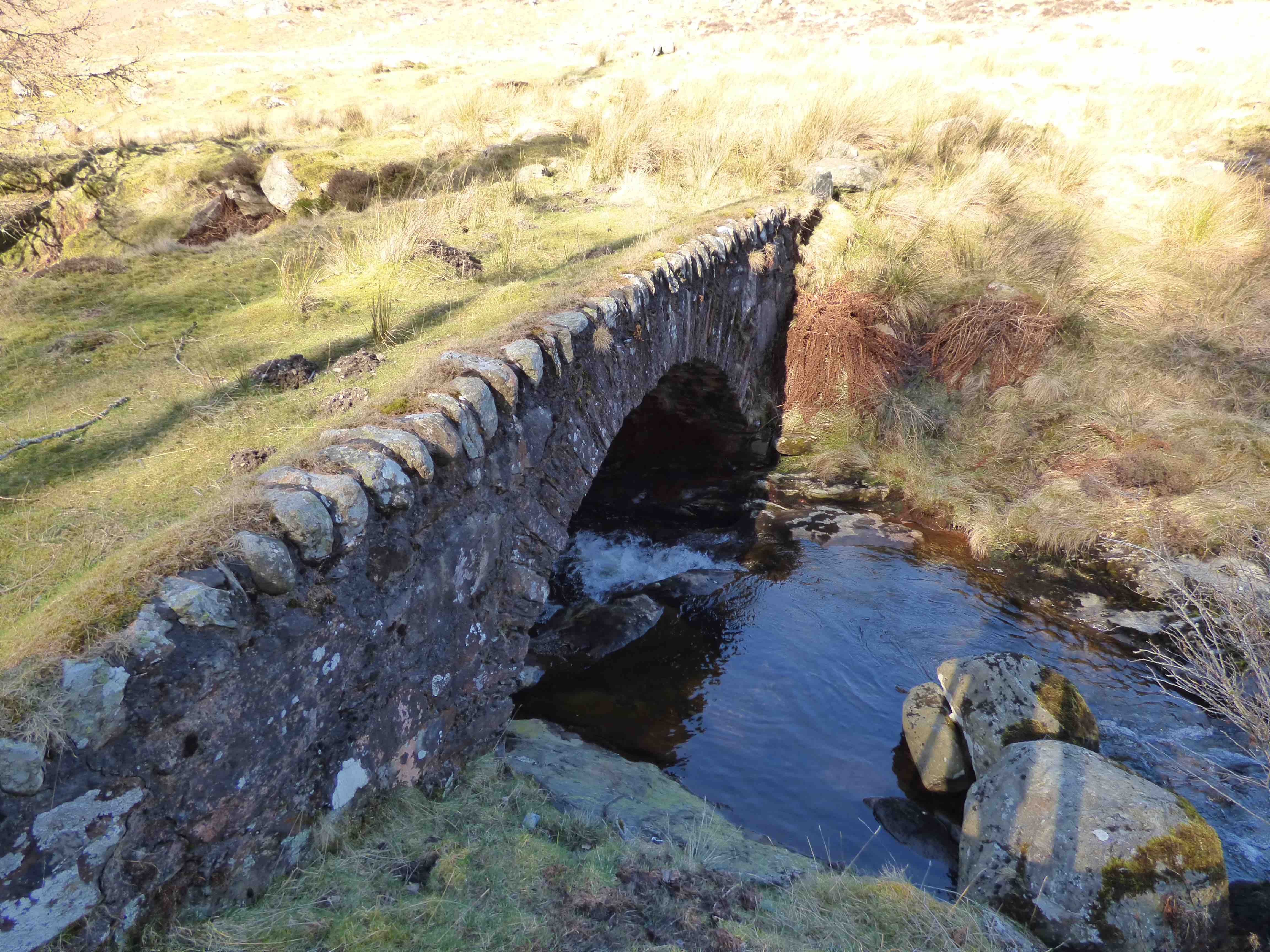
MENSTRIE BRIDGE
C.Clackmannon. Menstrie Burn 284916,697065
History:This little bridge lies on the ancient Statute Labour Hillfoots road, identified as a Via Regia in the 14th century(Cambuskenneth Charter 222). The bridge is reputed to date from 1656 and there is a worn armorial panel on the south facing from which nothing can be discerned today. It was also noted to have been parallel widened at some stage but the soffit is now harled and the division cannot be seen. It seems likely that the bridge was linked to an adjacent mill.
Maps:1680s(Adair)Both Adair maps. Not on Roy (1750).Roy had a blank-spot about the Hillfoots and does not even show the old road. Blaeu and Pont do not address this area.
Currently: probably an original 17th century bridge with 18th century widening. Single humped, flush-arched, almost semicircular. Voussoirs seem in better shape on the older southern facing which would fit. Partially coursed in lower facing. parapets appear newer. Harled soffit. 14ft p to p. May well have been a 6-7ft bridge in early years. Very worn armorial panel on south facing. 23 ft. span. North facing looks late 18th century with original parapet.
photo photo photo
______________________________________________
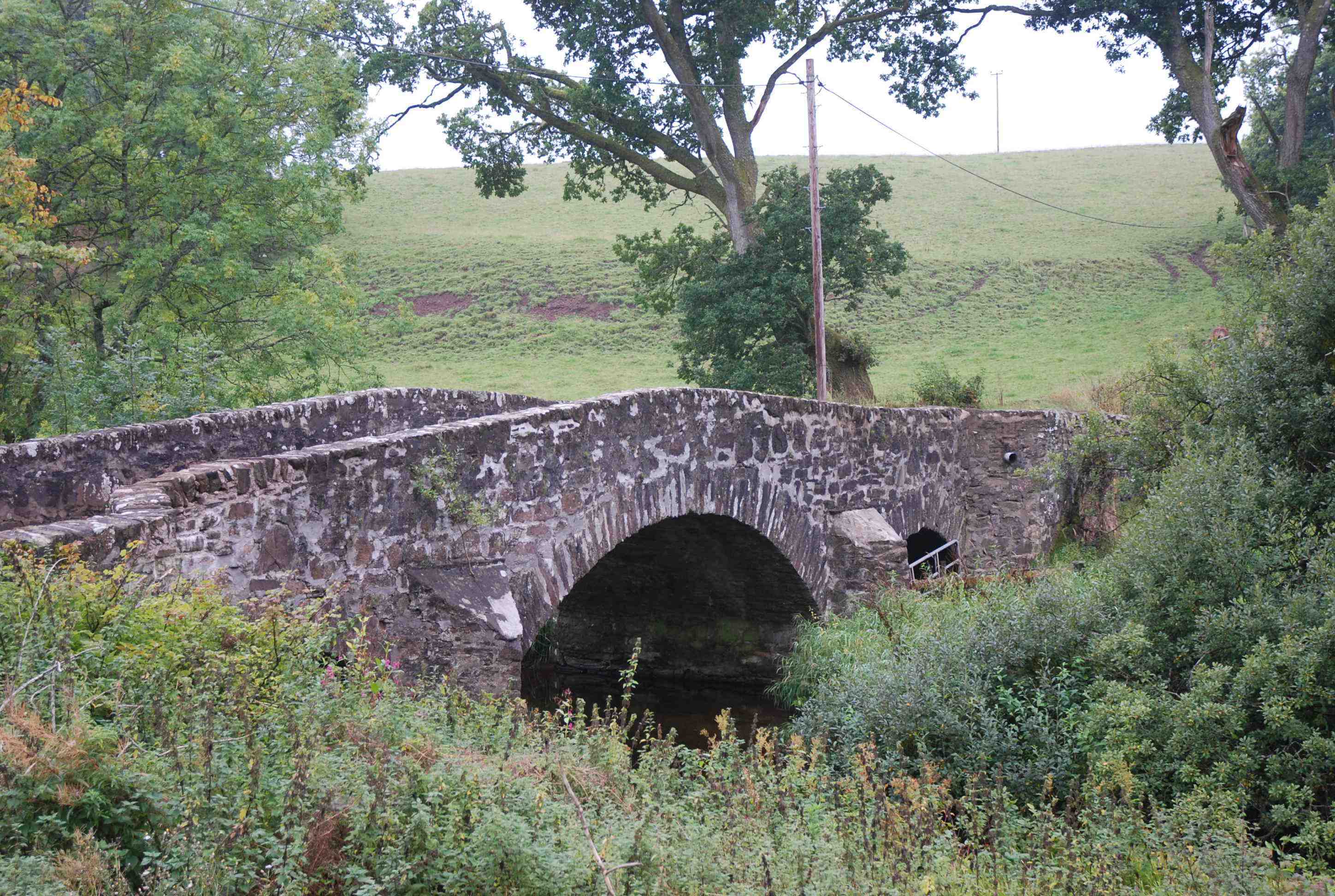
MILL OF STEPPS BRIDGE near Muthill
C.Perth Machany Water 286204,715057
History: 1743 Caulfeild Military. Stirling/Crieff road. However, it seems there was a predecessor: Macfarlane(1720s) describes a bridge with "stone pillars laid over with oak trees and covered above with gravel" This suggests there was also a road before the military arrived, which is a surprise as it was thought that the 18th century road was on virgin territory.
Maps:1750(Roy)
Currently: A classic, wholly original Caulfeild 18th century random un-coursed hammer-faced rubble bridge with large radially aligned dressed rubble voussoirs. No string course and solid coping on the parapets.
Single segmental arch flanked by two small flood arches with cutwaters. Twelve ft. wide parapet to parapet. Humped. A lovely little bridge. Worrying amount of modern traffic.
photo photo photo.
_______________________________________________
MONKS BRIDGE See LESMAHAGOW
_______________________________________________
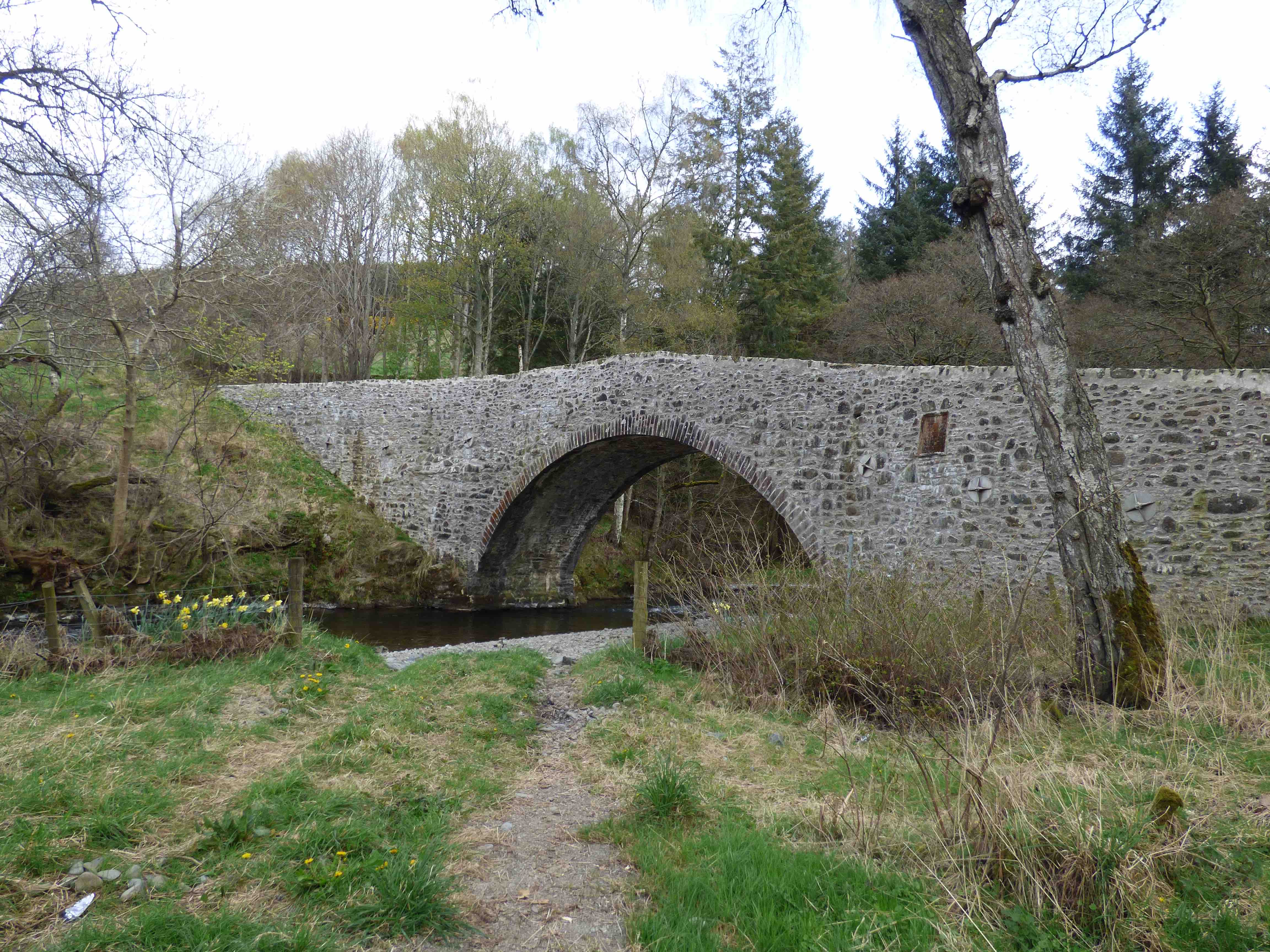
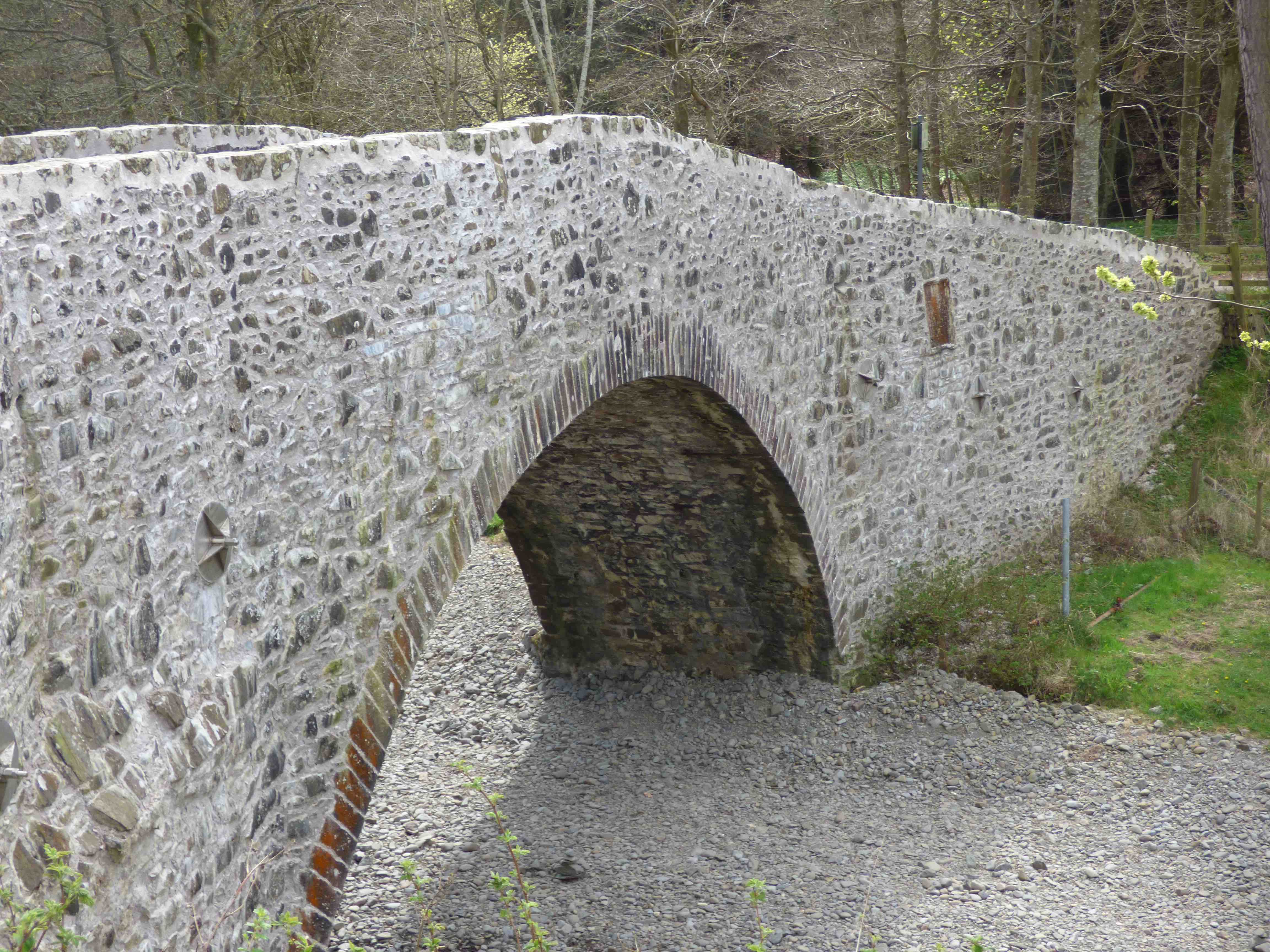
MOUSEMILL BRIDGE nr Lanark
C.Lanark Mouse Water 286943,644204
History: first recorded 1587.‘.. for Wm.Bell to ryd to Hamilton to sie the tymer to Mousbrig: 10d…for dychtin and sawing of tymer in Hamylton Wod:5 merkis….to James Crokat.. for first peaymont of the brig begin:10li’. This timber is more likely to be for wooden centering for a new arched stone bridge, and not for a timber bridge as has been suggested. In 1646, a Charles I charter ’ with sowme of four pounds for upkeep.’ but there was no mention of a new stone bridge replacing a timber bridge at this date. Indeed there is specific mention of ‘beatit(mended)and reparit’. In 1836, when the new bridge bypassed it some yards downstream, it was expected that the old bridge would be demolished. A neighbouring landowner bought it for £50 to rescue it for preservation. This bridge is sometimes described as ‘Roman’ but this is not the case.
Maps:Pont (1600) Blaeu(1640)Roy(1750). Roy less distinct.
Currently: No reason to think this is not the original 16th century bridge which appears on Pont. Un-coursed random rubble packhorse style without mortar. Flat square ashlar voussoirs. The ring is naked at the crown. Segmental arch. Overgrown but intact.
Link photo photo photo photo photo.
_______________________________________________
MUASDALE BRIDGE Kintyre
C.Argyll Clachaig Water 168014,640231
History:This bridge is on Roy's map (1750) and has the appearance of a mid 18th century build. No record found. Not on Blaeu's map(1640). It has been callMaps:1750.
Currently:18th century. Single 7m wide segmental arch which is less usual in this area for that period. Random uncoursed rubble spandrels and sidewalls. Crudely built. Mortar missing. May well have been clay mortar originally. Now bypassed by a mid 19th century bridge on the main road adjacent(this was present on the 1867 OS). The old bridge is now in Crubasdale Cottage garden.
Link Link. Photo
_______________________________________________
MUCHALLS BRIDGE nr.Stonehaven
C.Aberdeen Muchalls Burn 389444,791089
Maps:1750
Nothing appears to be known of this bridge. Next to ‘Bridge of Muchalls’ hamlet and close to Muchalls Castle (1300) suggesting ancient provenance for the bridge.
Currently: small. possibly 18th century semicircular arch rubble bridge with very splayed parapets and approaches. Spandrels are squared and coursed. Small arch but wide decking of 28ft. Spandrels look much older at the base suggesting 19th century repair and widening, probably on the downstream side.
photo.
_______________________________________________
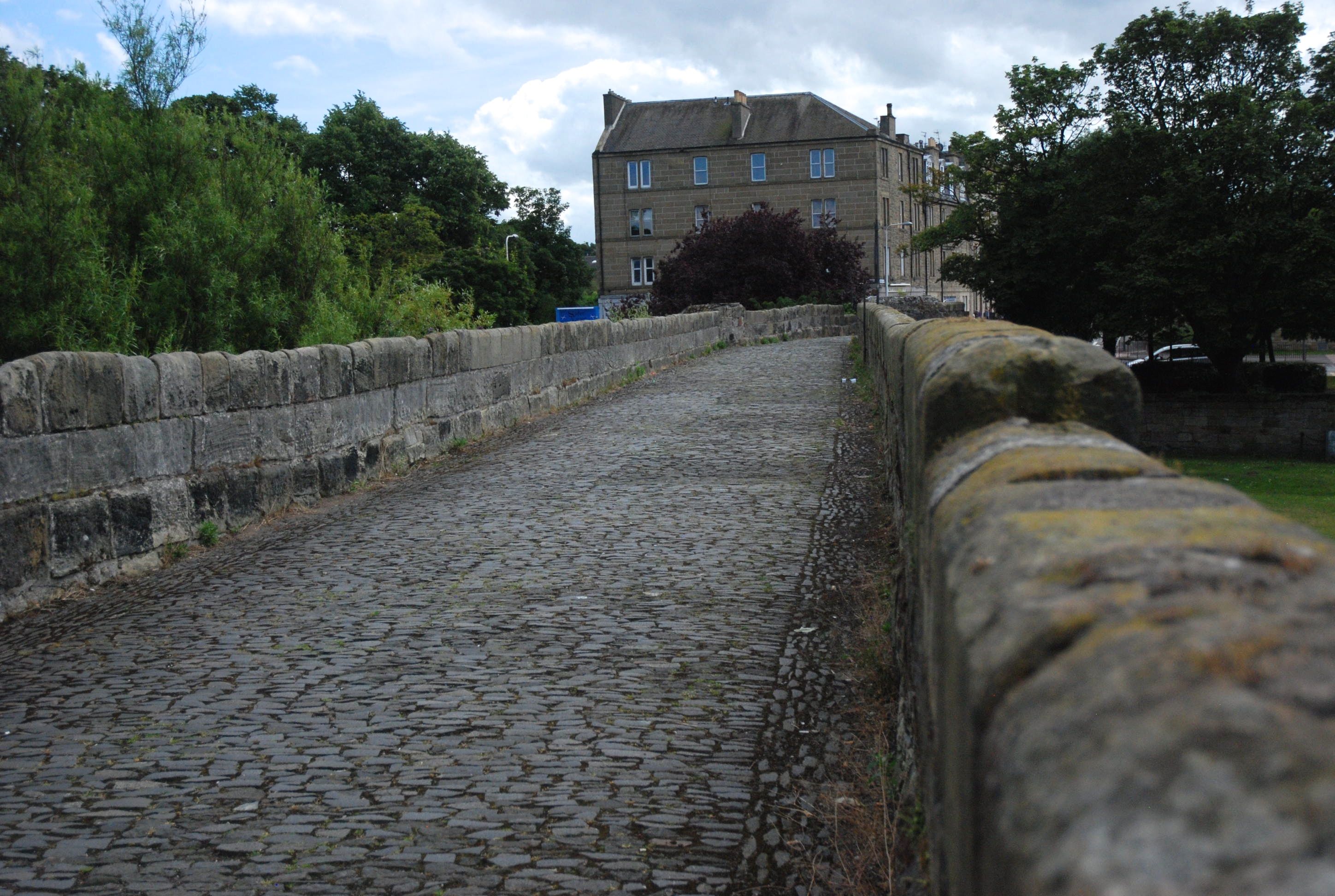
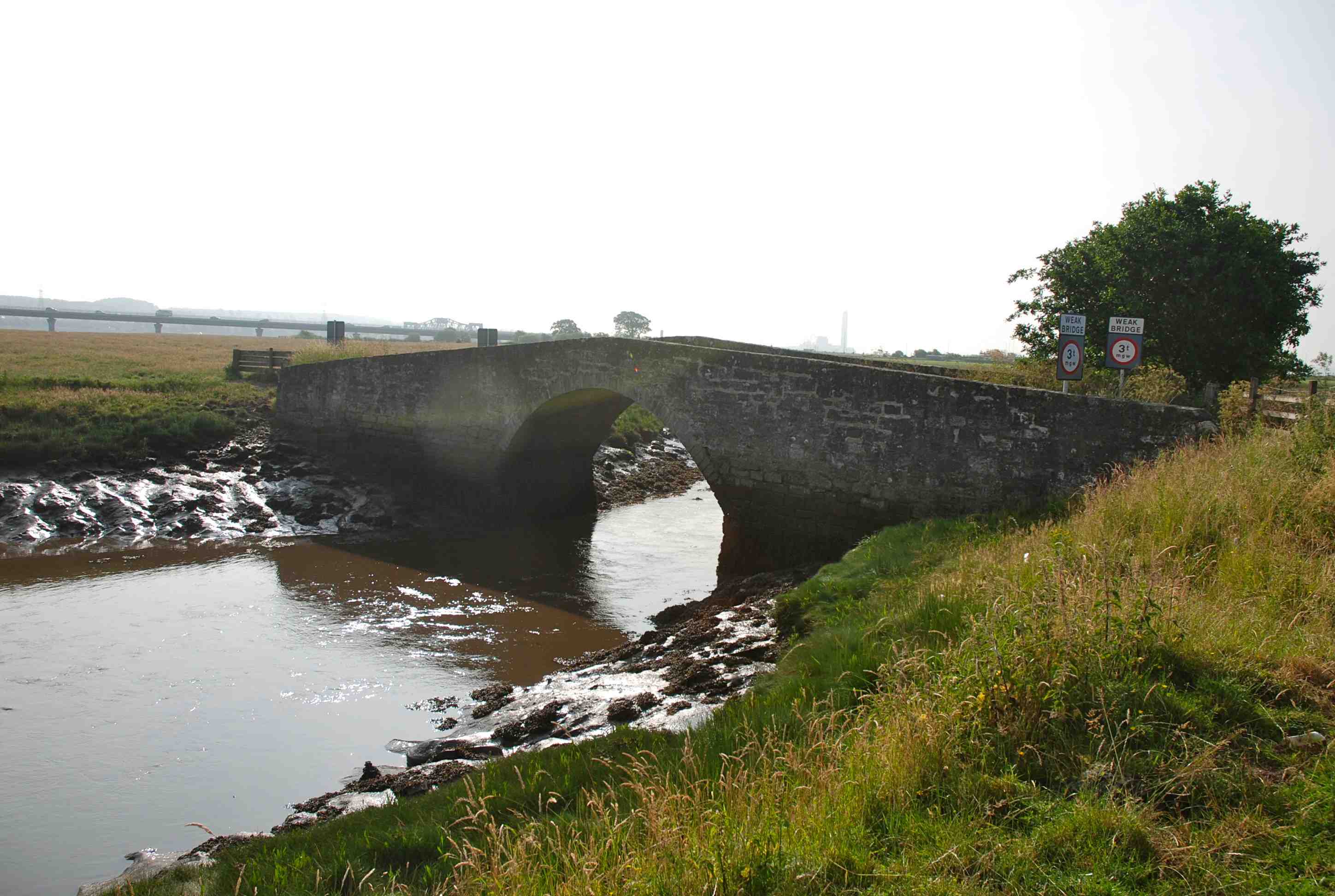
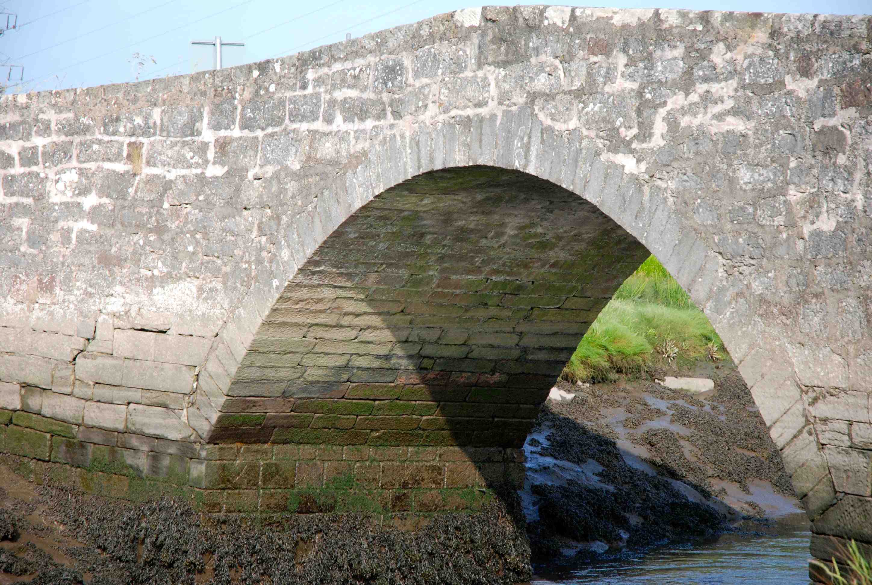
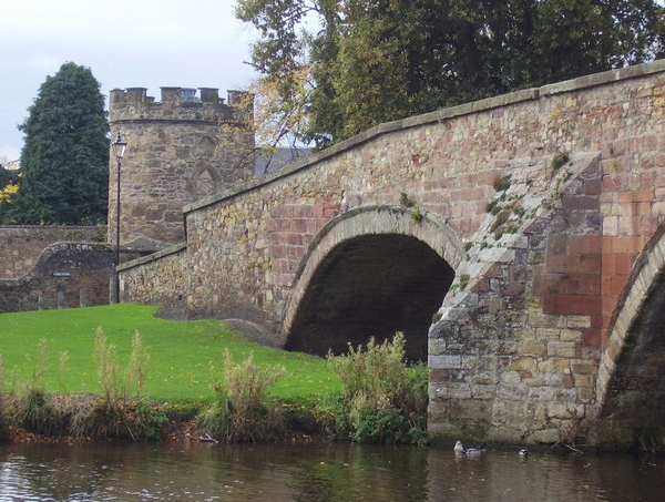
MUSSELBURGH
C.East Lothian R.Esk 334075,672537
History: Reputed to be Roman because of the proximity to Inveresk Roman fort. However, this is not a Roman bridge and there is no record or evidence of such an early existence; in fact, it is difficult even to obtain any compelling reference to the its claimed existence in the 13th and 14th century. Perhaps it should be mentioned here that early OS maps show a ford adjacent to the bridge. The English retreat from the Battle of Bannockburn was mainly through Carlisle, not Musselburgh, as is often quoted, although Edward II certainly escaped to Dunbar and then sailed for Berwick. Inglis offers evidence for a bridge in 1530. Certainly, it was standing in 1547. Possibly destroyed by English army in 1547 (Battle of Pinkie), and rebuilt in 1548 by Lady Jane Seton. The present structure is remarkably similar to Haddington's Nungate Bridge which also dates from 1548. Parliament decreed repairs in 1597 and in 1625. It had a minor role in the Battle of Dunbar (Cromwell1, 1645). Charles Edward Stuart led his army over the bridge on his way to and from the Battle of Prestonpans (1745). The abutments were opened up in 1809, during a repair, and reputedly, very ancient masonry with oak beams were found inside. This does seem to suggest an earlier existence, perhaps Medieval.
Maps:Roy(1750) Blaeu(1640) Adair(1680s)
Currently:16th century. Three flat chamfered 50ft segmental arches with distortion to two of them. Hood-mould on all arches. Steps at both ends since 1839. 11ft wide cobbled deck. Sagging squared coursed grey rubble spandrels. Large piers (built on branders) with two-stage cutwaters. Built-over refuge over one pier only at SE end. Parapets different from spandrels in ashlar blocks with no string course. North arch now dry. Three hundred yards downstream the old bridge is bypassed by John Rennie's five arched bridge of 1806.
Link photo photo photo photo.
_______________________________________________
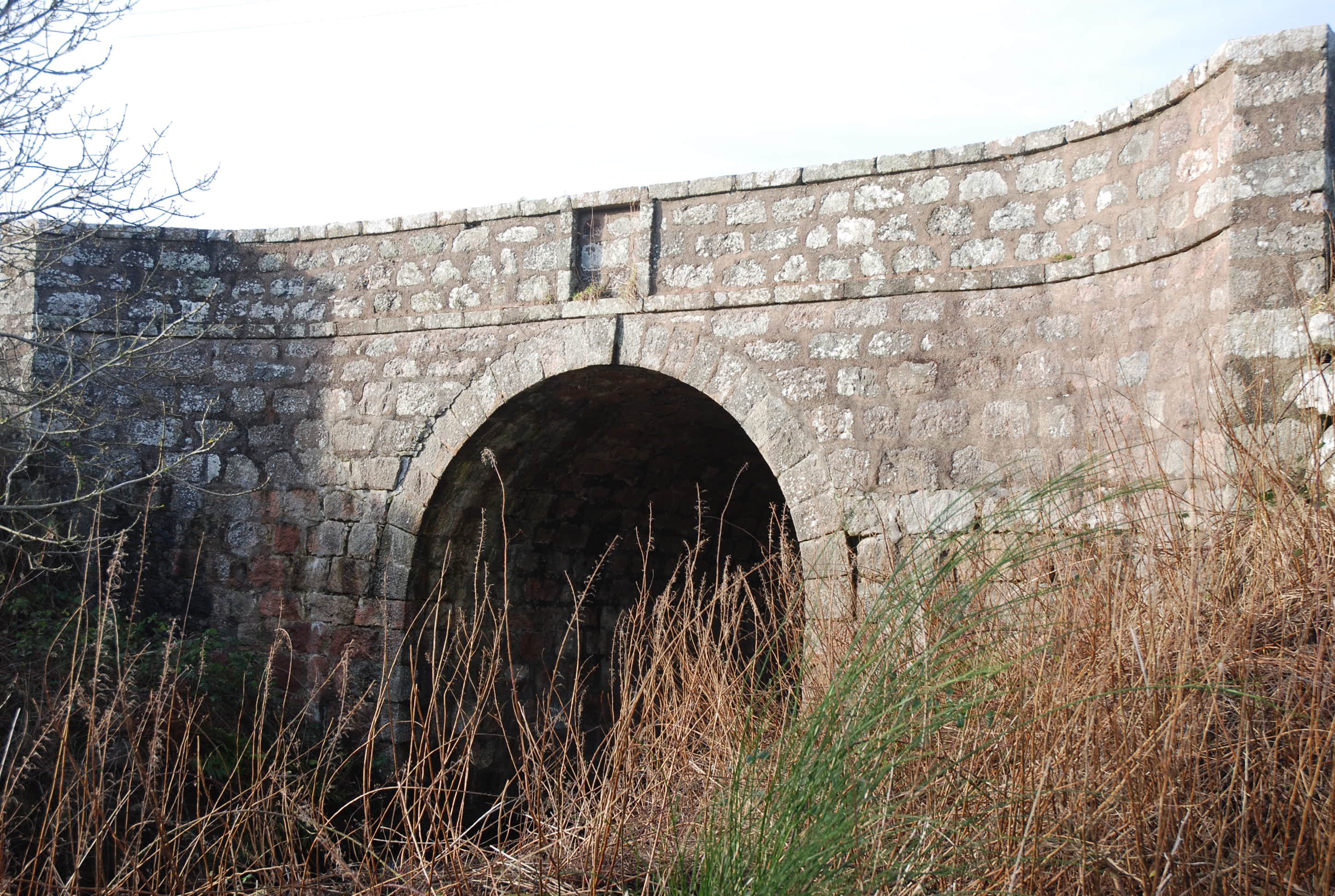
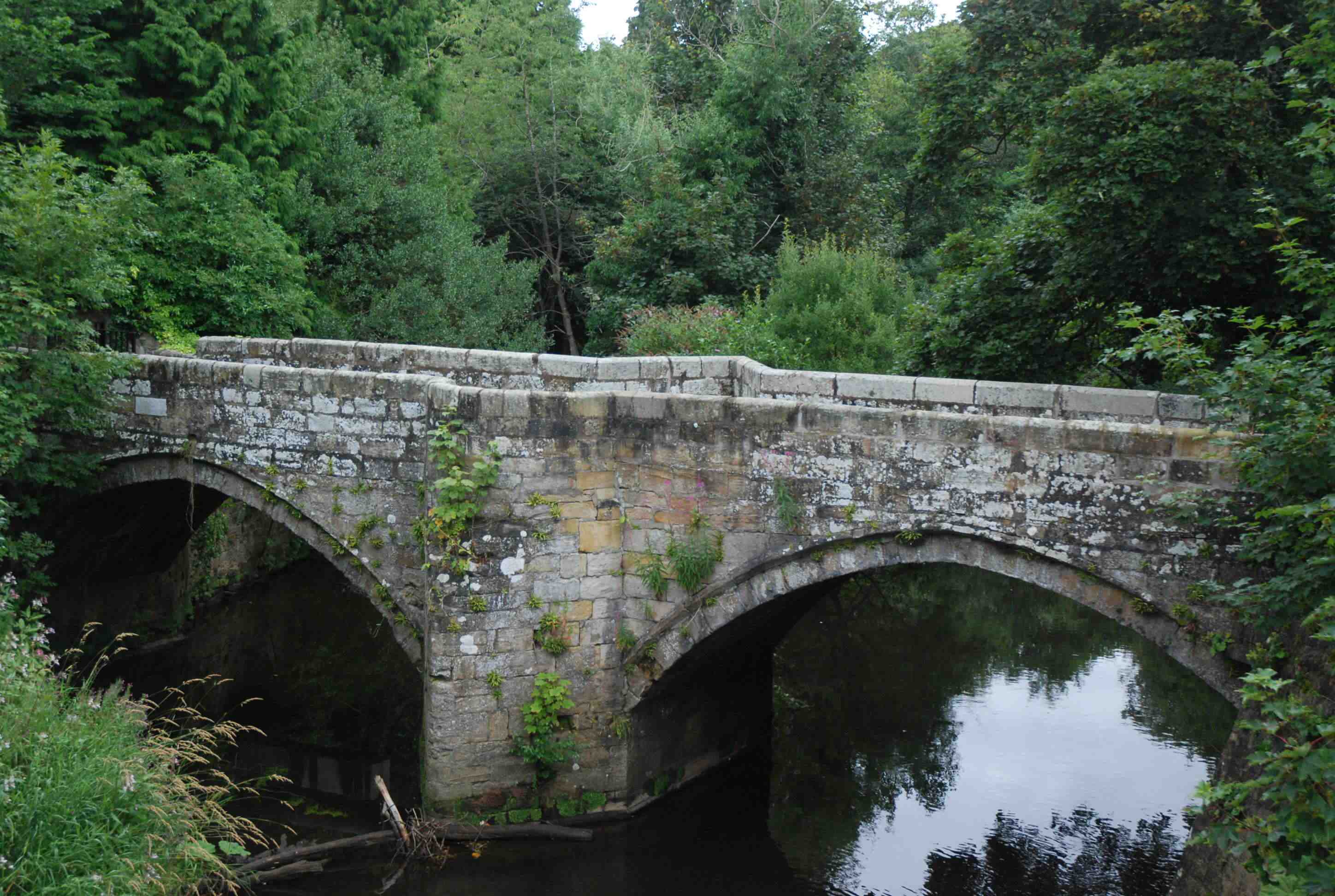
NEWBATTLE BRIDGE nr Dalkieth
C.Midlothian R.South esk 333146,665710
History: 16th century, possibly earlier. Directly adjacent to Newbattle Abbey, founded in 1140 by Cistercian monks. There are many Newbattle charters but none specifically identifes the bridge. However, a 13th century ford is identified in Charter 275, at ‘Stockford’, which is described as close to the abbey. Serious repairs in 1661. Parliament awarded 599 merks from the vacant stipend. The abbey was secularised in the 17th century to become the seat of the Marquis of Lothian.
Maps:1750(Roy) 1680s(Adair) 1640(Blaeu)
Currently:15th or16th century. Two very slightly pointed arches. Recessed ashlar voussoirs. Not chamfered. Heavily restored parapet with refuge on each side above cutwaters; oddly, one refuge is triangular, the other circular. Hood mould. Squared and coursed rubble spandrels. These pointed ashlar arches may be restored but the retained gothic profile is significant.
photo photo photo.
_______________________________________________
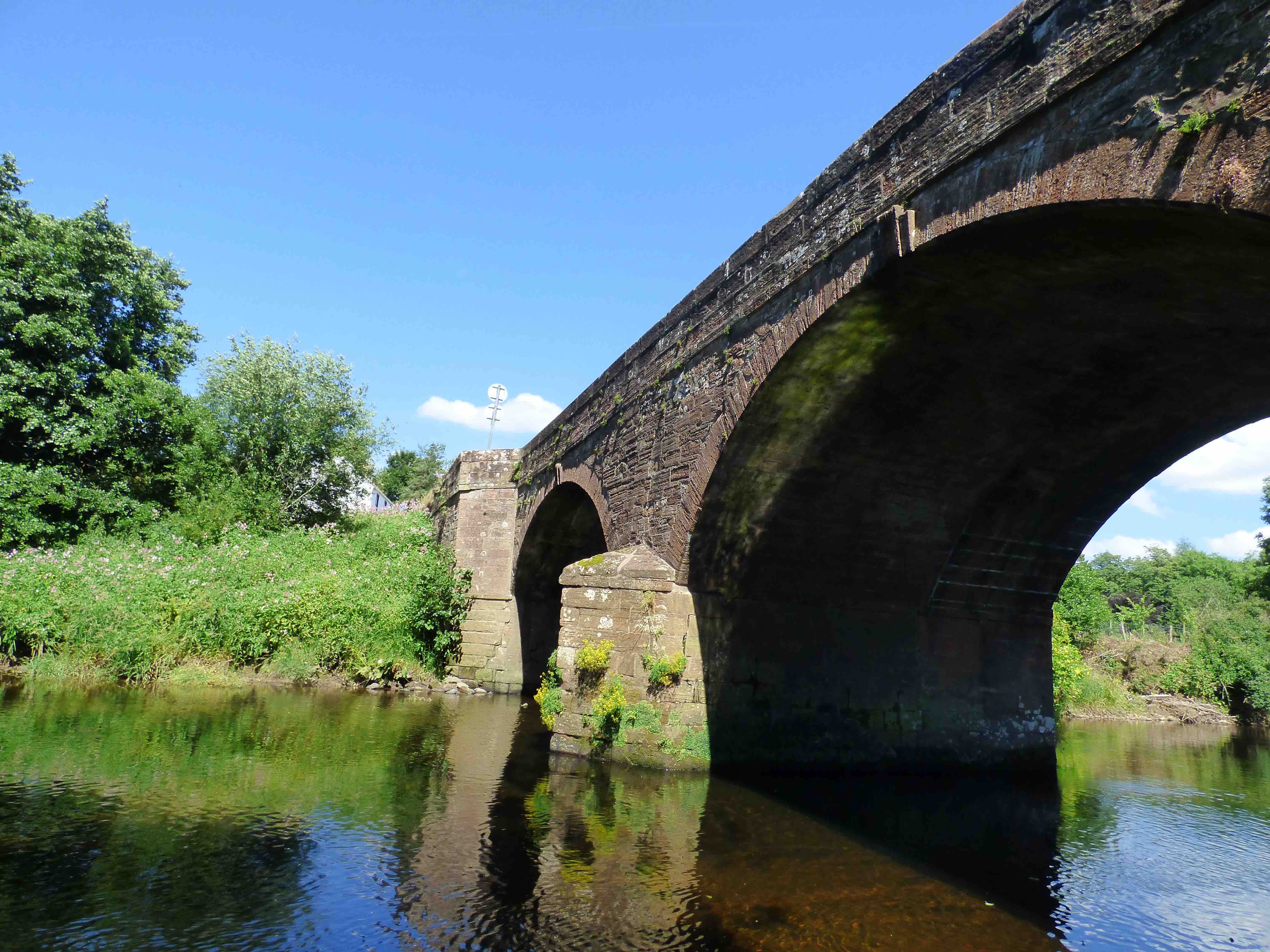
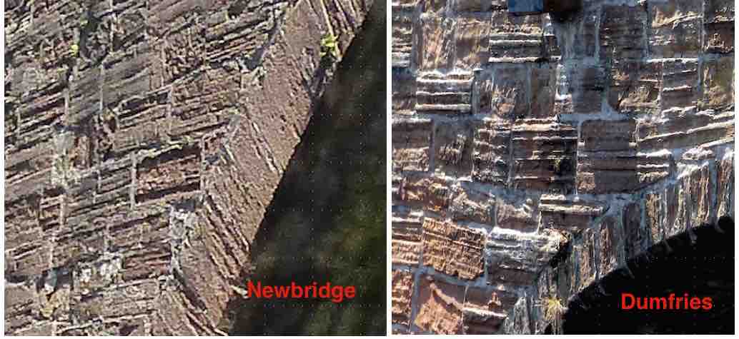
NEWBRIDGE Dumfries
C.Dum & Gall Cluden Water 294886,579092
History: This interesting bridge was on Blaeu and Pont so has probably been there since the 16th Century. This was on the main road to Glasgow from Dumfries. Listed Buildings notes Messrs Twaddel and Porteous were contracting masons in 1758 which might presume a rebuild. Also known to have been widened on the downstream side in early 20th century.
Maps: Roy (1750) Adair(1680s) Blaeu(1640) Pont (1600)
There is a remarkable similarity to the stone dressings found on the squared rubble spandrels of both this bridge (upstream side) and the Dumfries Dervogilla Bridge. See photo 3. Although the voussoirs are treated differently, both bridges have slight chamfering of the arris. On the downstream, widened side the parapets, piers, voussoirs and cutwaters are all in ashlar and the spandrels are in well dressed squared coursed rubble. If there were a rebuild in 1758, the spandrel dressed stones appear to have been retained and once again retained when the bridge was widened. This bridge appears to have elements from the 17th century since we know this part of the Dervorgilla Bridge dates from 1621.
photo photo photo
_______________________________________________
NEW LUCE BRIDGE
C.Dum & Gall Cross Water 217450,564636
History: No historical information available.
Maps:Roy(1750)
Currently:18th century narrow span broad segmental arch. Random rubble. Humped. The style suggests this could be the one on Roy's map which suggests an earlier date than thought.
Note: Main Water Bridge in Station Road is not on Roy. May be late 18th century.
_______________________________________________
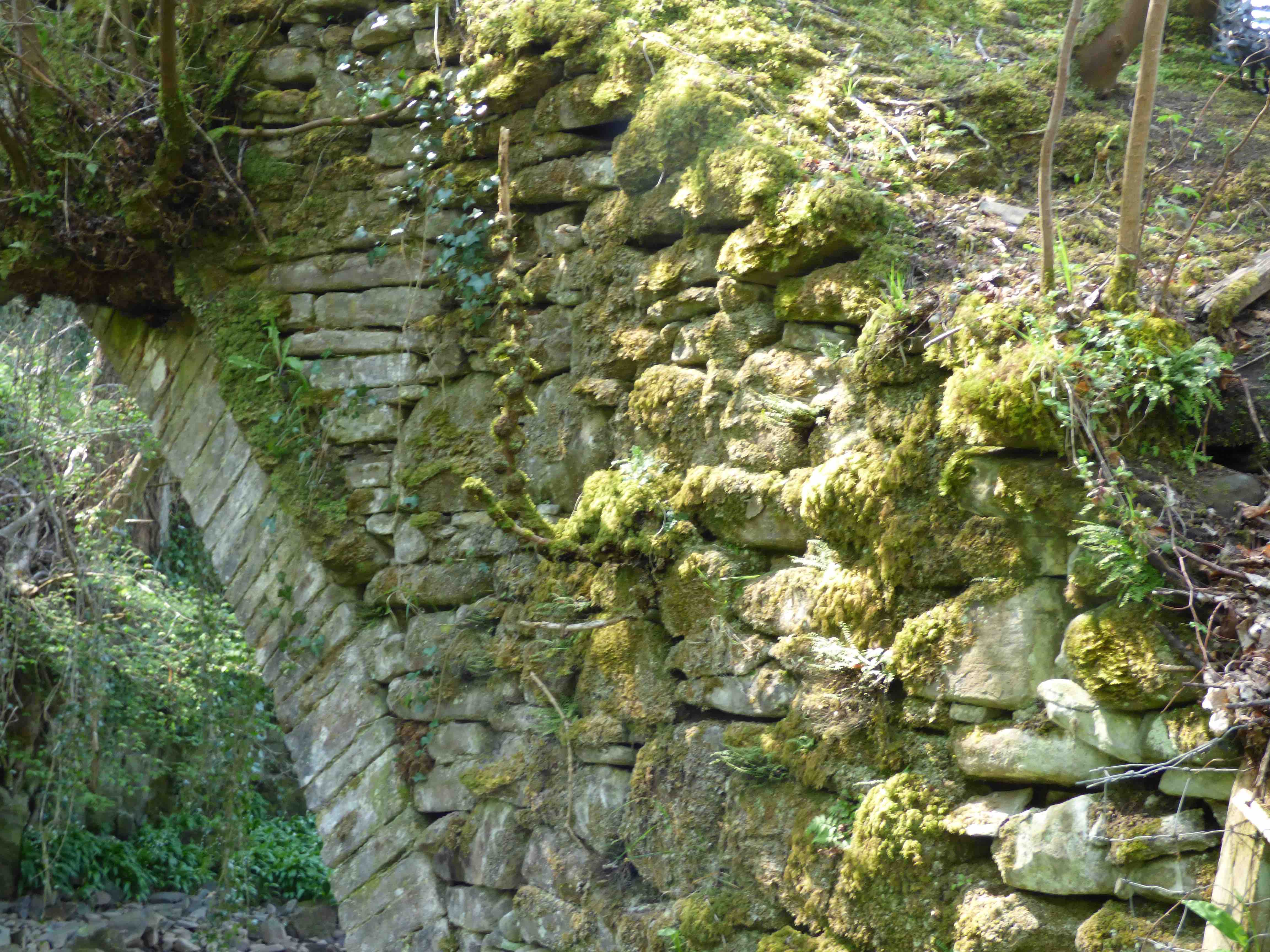
NEWMILLS BRIDGE Culross
C.Fife R.Bluther Burn 301210,686481
History: 17th century, possibly earlier. Recent partial collapse. Seriously at risk(July 2015). This remarkable old structure was part of a mill complex which dates to the early 16th century. It was worked by the monastery of Culross. Now part of the Valleyfield Estate. Ruined remains of mill workings are adjacent with a date-stone of 1776.
Maps:1750. Not on Blaeu- but the Blaeu map is small scale and fails even to show the Bluther Burn.
Currently: a semi-ruin. Overgrown. No parapets. One, almost semicircular arch and one small flood arch. This bridge is built in coursed ashlar, not rubble as has been recorded. Finely jointed stonework but very weathered.The blocks are now very clear due to partial collapse of a spandrel. Coursing is irregular and this is due to repairs. It has been underpinned by a second repair arch, rather than widened- this taking the form of two arched ribs with sideways infill of brickwork. The original arch is 'broken'- hinging in two places. Initially, It may even have been slightly pointed. On the downstream side, the earlier arch barrel is completely covered. This bridge could be 16th century.
photo photo photo photo photo
_______________________________________________
NEWMILLS BRIDGE Airth
Stirlingshire Pow Burn 291519,687272
History: Also called Pow Burn Bridge. MacFarlane mentions this bridge and the 'publick road from Higgins Neuk' where there was a ferry on the Forth. The remains of a second bridge can be seen 300m upstream. However it is the present bridge that seems to be at the location on Roy.
Maps:1750(Roy) only.
Currently:18th century. clearly repaired at intervals. Well dressed coursed squared rubble in lower spandrels. Uncoursed random rubble higher up. Splayed approaches. About 13 ft wide.Single segmental arch in dressed stone.
_______________________________________________
NEWTON BRIDGE Sma Glen
C.Perth R.Almond 288763,731490
History:1733. Military. Wade. Crieff/Dalnacardoch road.
Maps:1750
Currently: 18th century. Single segmental arch. Early 18th century characteristics, but only on the downstream side. Upstream, the bridge has been widened in the parliamentary period (early 19th century), and in typical type 3 Telford style with plumb and batter spandrels (photo 4). Also, the voussoirs are much wider on the upstream, with better finishing. Taylor records that the road north was repaired in the early 1800s, at a cost of £17000. The downstream (earlier) side has squared, sometimes coursed rubble spandrels in upper parts. Random uncoursed on lower spandrels. Flat decking. The widening line on the soffit suggests that the original bridge would have been about 13ft wide. Roy's configuration on the map is confusing and may be an error since his bridge is west of the inflowing Newton Burn; there are no remains on this spot. There is a beautiful tiny Wade bridge 300m to the north which is not on Roy's map.(photo5), and gives access to the original 18th century road going north.
photo photo photo photo photo.
_______________________________________________
NEVIS BRIDGE Fort William
C. Inverness R.Nevis 211411,774280
History: This bridge is recorded as of 'unknown date', but it exactly matches the location on Roy's map and it also has most of the characteristics of a Wade bridge. This would be the first bridge on the Great Glen military road of 1730. It may have been upgraded in the 19th century; certainly, the buttressing is unusual.
Maps:1750
Currently: Horizontal decking. Single large semicircular arch with partly whinstone, partly rubble, slim regular voussoirs. Random and sometimes roughly squared un-coursed rubble spandrels, which are plumb. Finely worked coping, which may be more recent, but no string course. A little wider than expected, at 13 ft, but no evidence of widening. Very difficult to access the river banks in summer. HES notes an 'unknown date' and Lited Buildings suggests early 19th century. However, it is not a parliamentary bridge because the walls and spandrels are plumb. The voussoirs are also of an earlier period. An early 18th century date is more likely, perhaps with later restructuring.
photo photo.
_______________________________________________
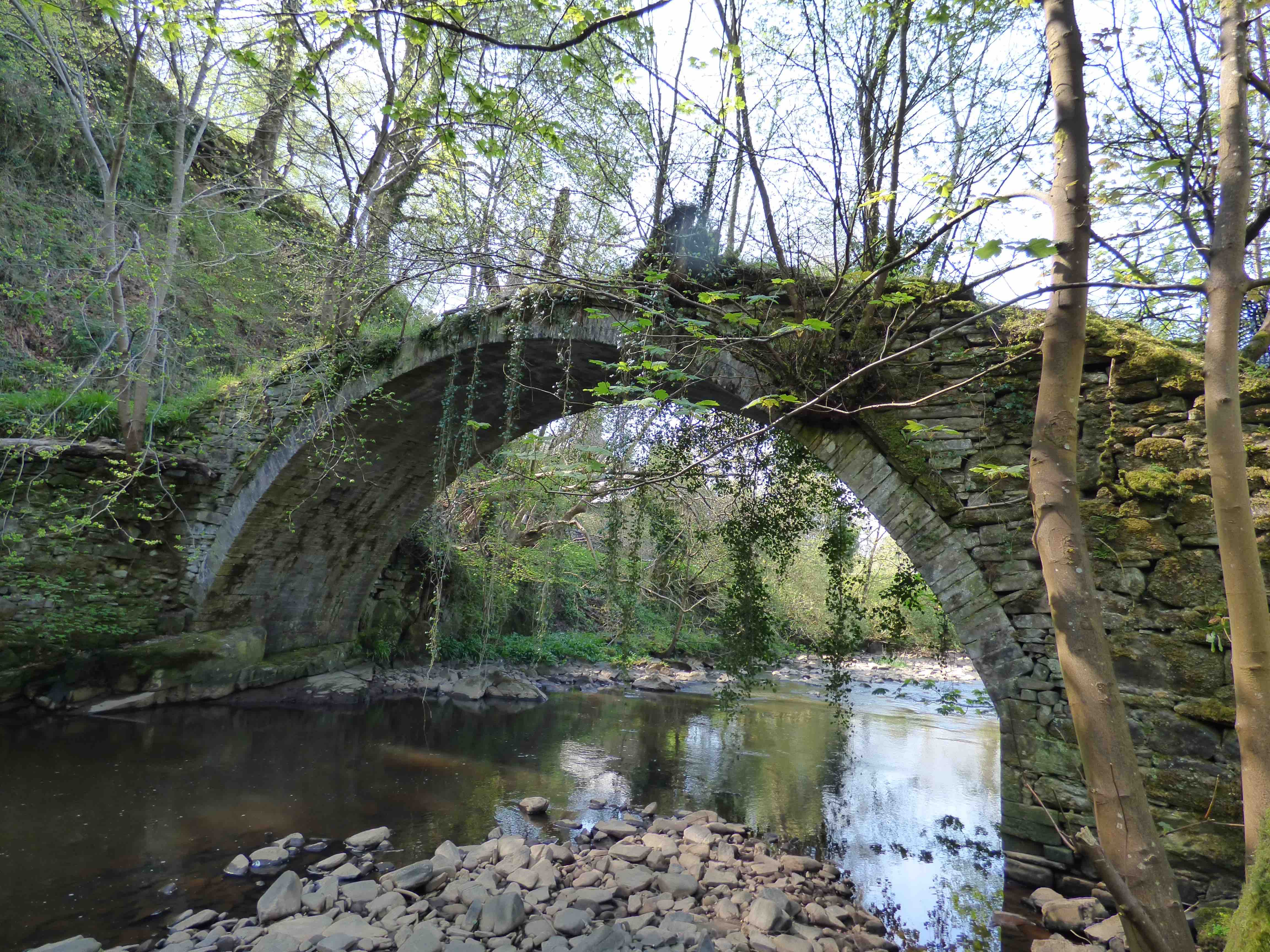
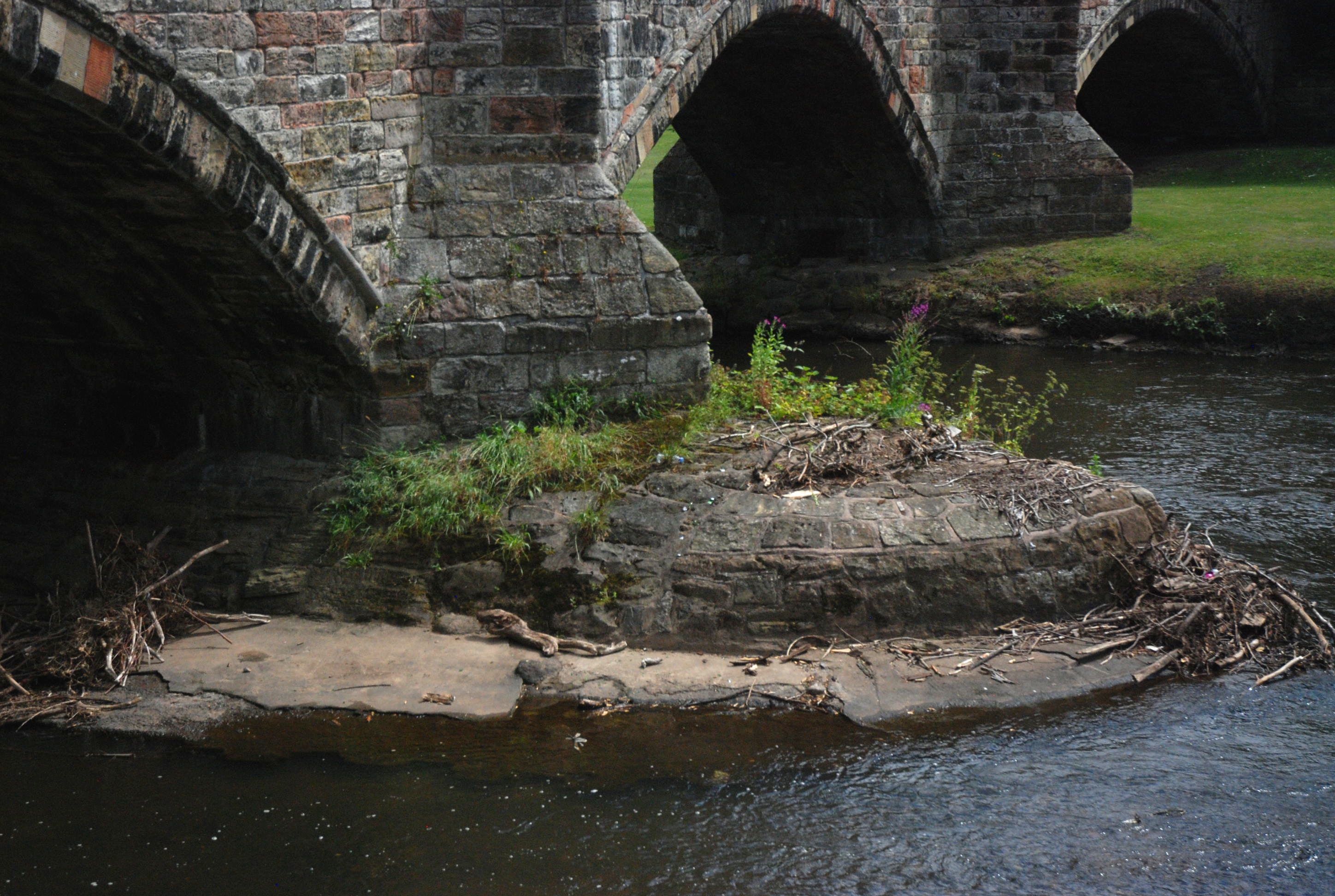
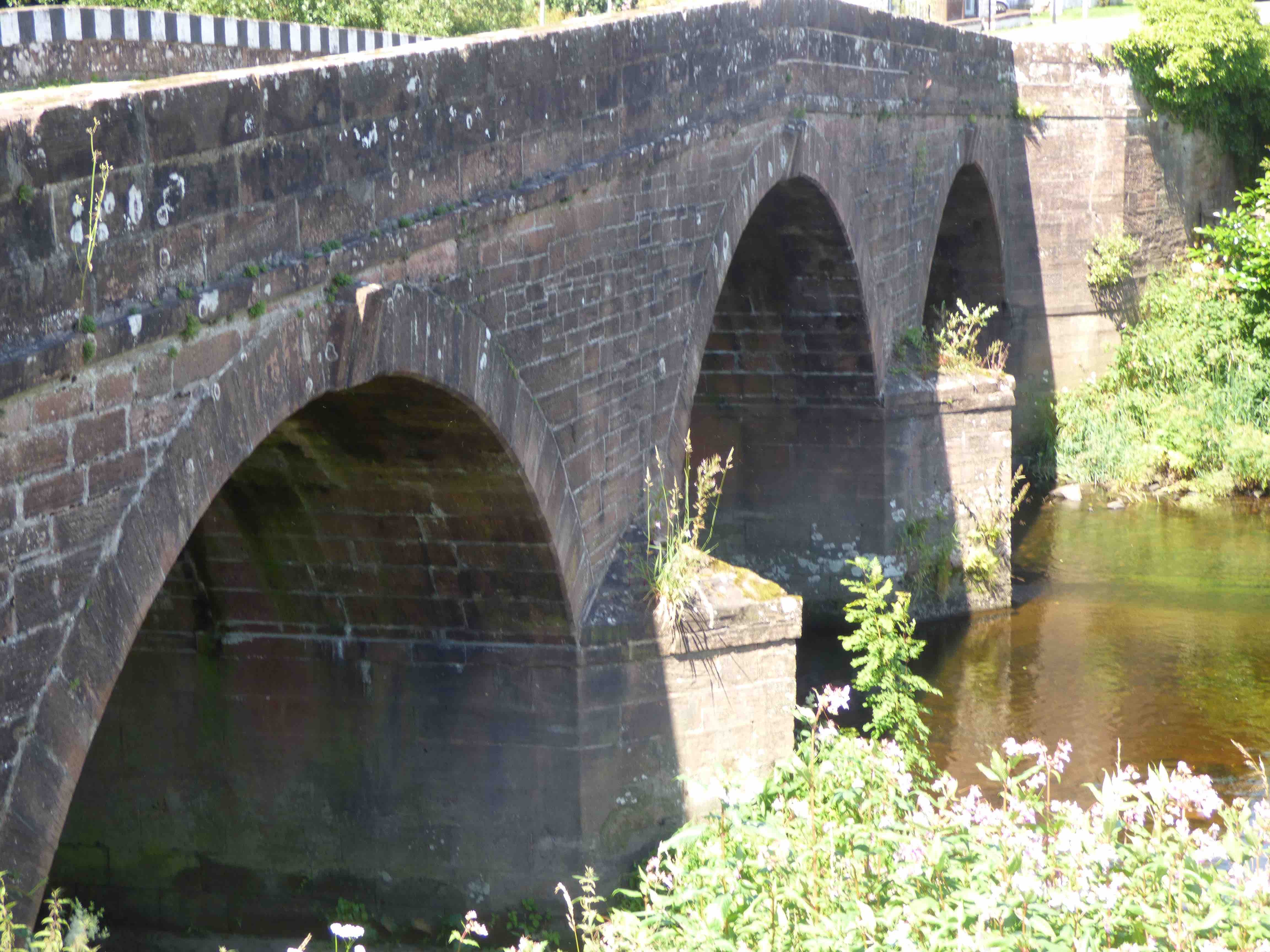
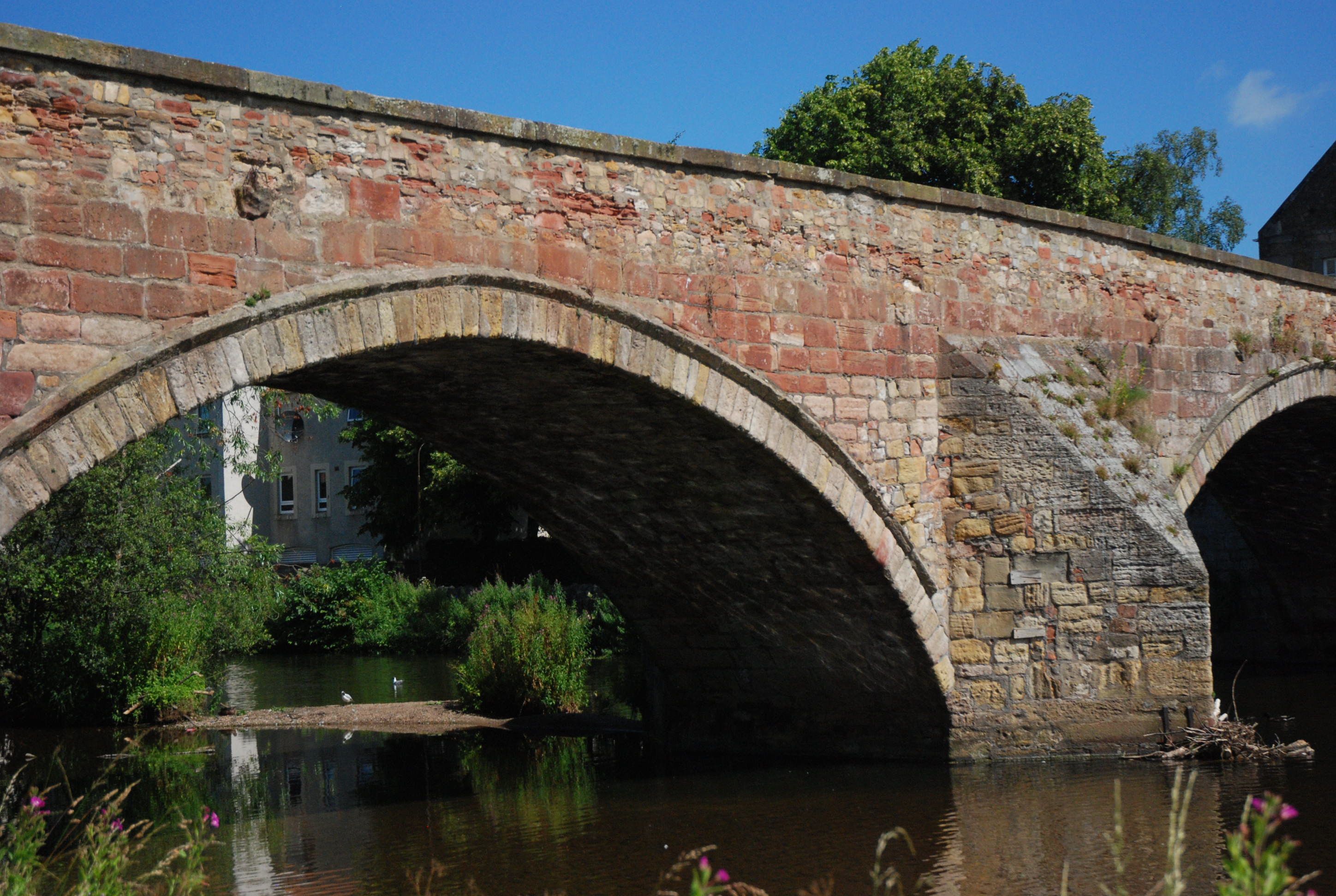
NUNGATE BRIDGE Haddington
C.East Lothian R.Tyne 351927,673784
History: Thirteenth century; mentioned in the charters of the Yesterwrits(9), dated 1202, along with a record of the road from Berwick. Further mention in 1282. Also in 1290 (Newbattle Charters). There was a nunnery about one mile beyond the eastern entrance to the town, founded in 1178: hence the Nun Gate. A flood is thought to have washed the bridge away in 1358. Severely damaged at the Siege of Haddington in 1548. Present masonry probably dates from then. It appears that some stones from a ruined section of St.Mary's Church were used, showing masons' marks. Criminals were 'restrained' on the bridge and hangings took place from the parapets. A ghost- Lady Charteris, known as 'Kitty' was sometimes seen standing on the decking. There were major repairs in 1659.
Maps:Roy(1750) Adair(1680s) Blaeu(1640)Pont(1600)
Currently: circa 1550. Three beautiful large depressed very flat segmental arches in yellow sandstone well dressed rubble. Protruding hood-mould strip. Coursed squared rubble spandrels in red sandstone on older lower parts but random un-coursed yellow rubble on younger upper parts and approaches. Many serial repairs. Eleven ft. wide decking with steps at one end. A fourth smaller arch at the stepped end over the flanking road.
Beautifully preserved. An ancient ford can also be seen from the bridge (at Ford Road).