Scotland’s Oldest Bridges.
A map-based catalogue of the oldest masonry bridges in Scotland.
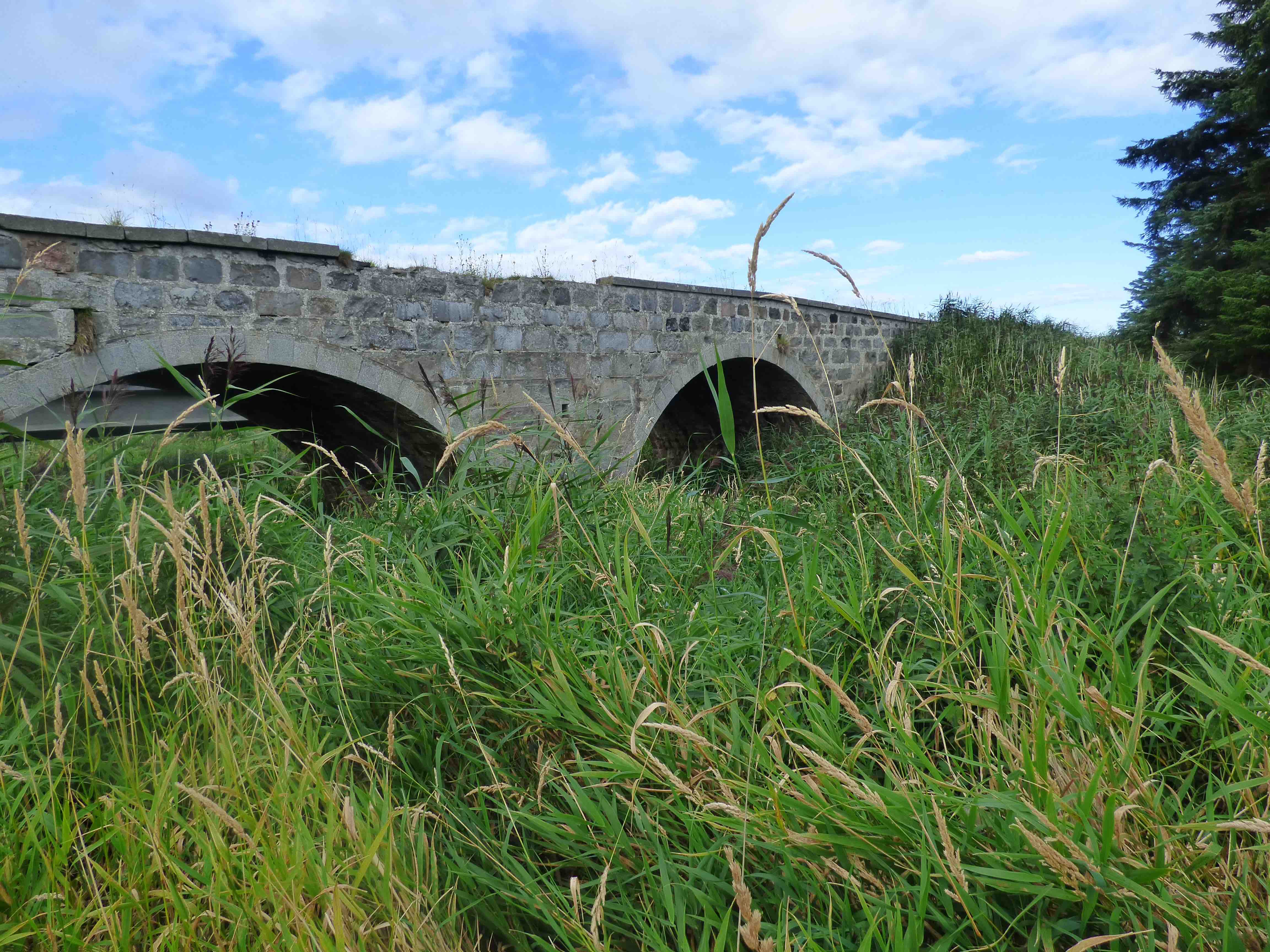
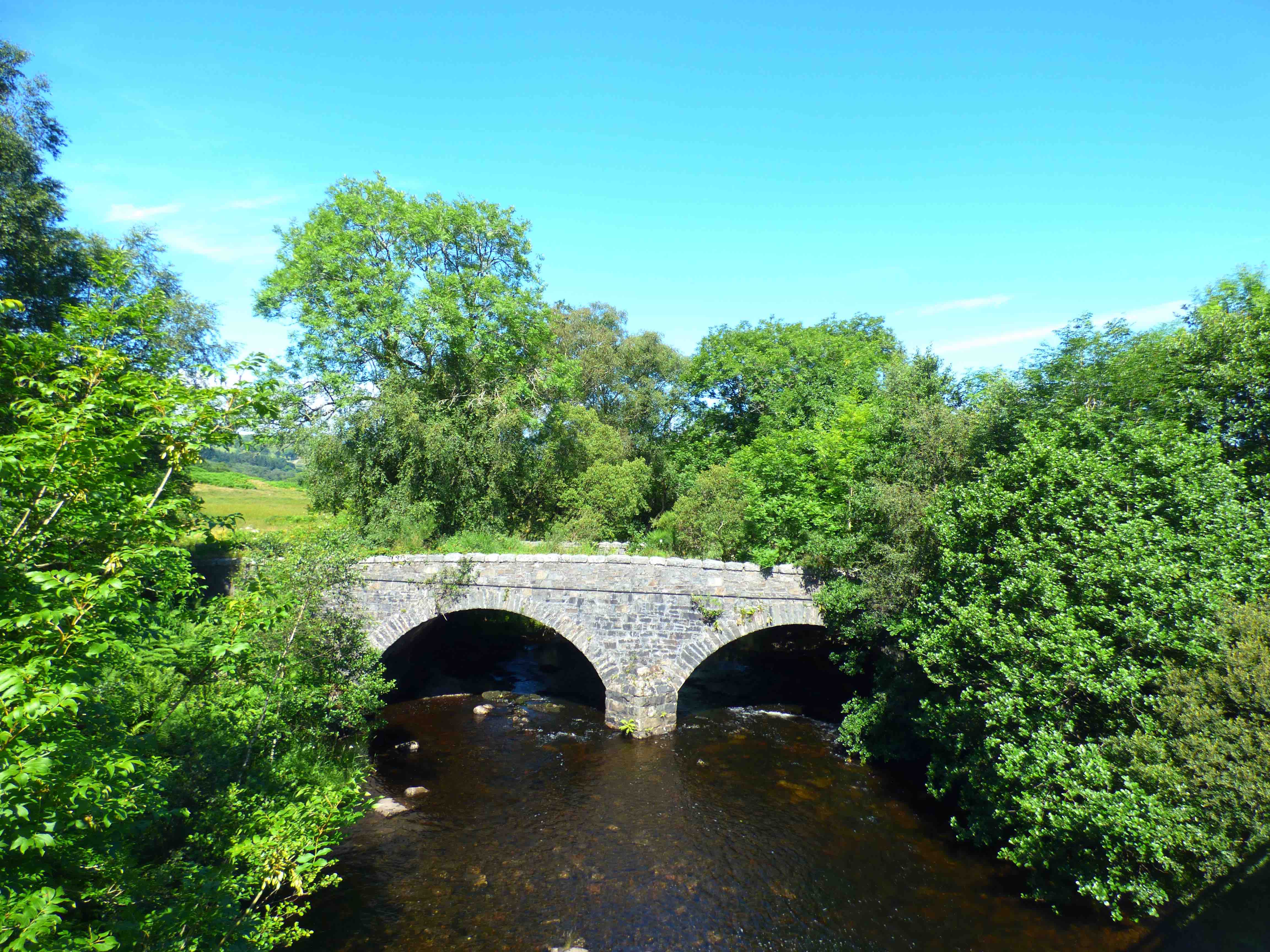
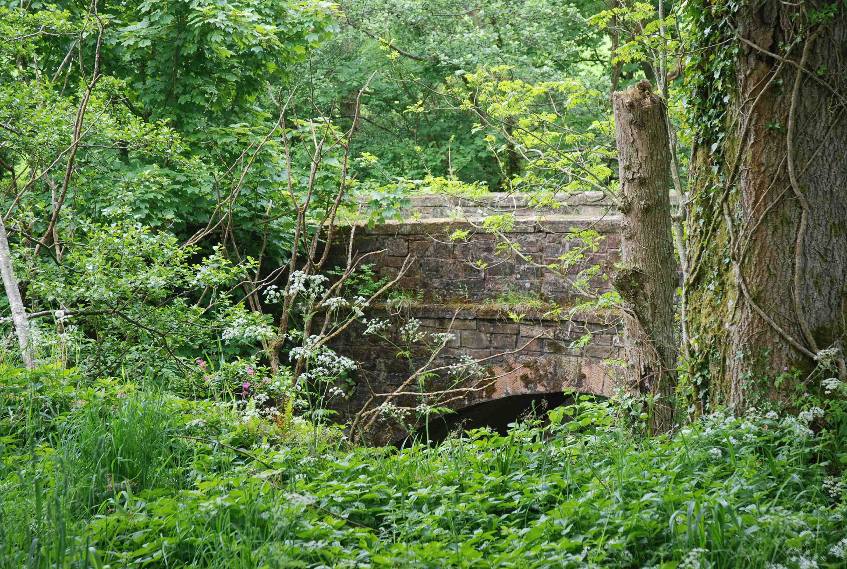
OLD PALNURE BRIDGE nr newton Stewart
C. Dum &Gall Palnure Burn 245883,564395
History: Noted in Macfarlane (1720). Repaired 1731. Rebuilt 1740. Military Road 1760s. Bypassed 1778 (1 mile downstream) Repaired 1993.
Maps:Roy(1750) Not on Blaeu
Currently: single semicircular arch rubble bridge with whinstone like voussoirs. Small stone random un-coursed rubble spandrels and buttressing both upstream and downstream on the west side. Flat simple coping with no string course. This looks like a mid 18th C.bridge: probably 1740.
Link photo photo.
_______________________________________________
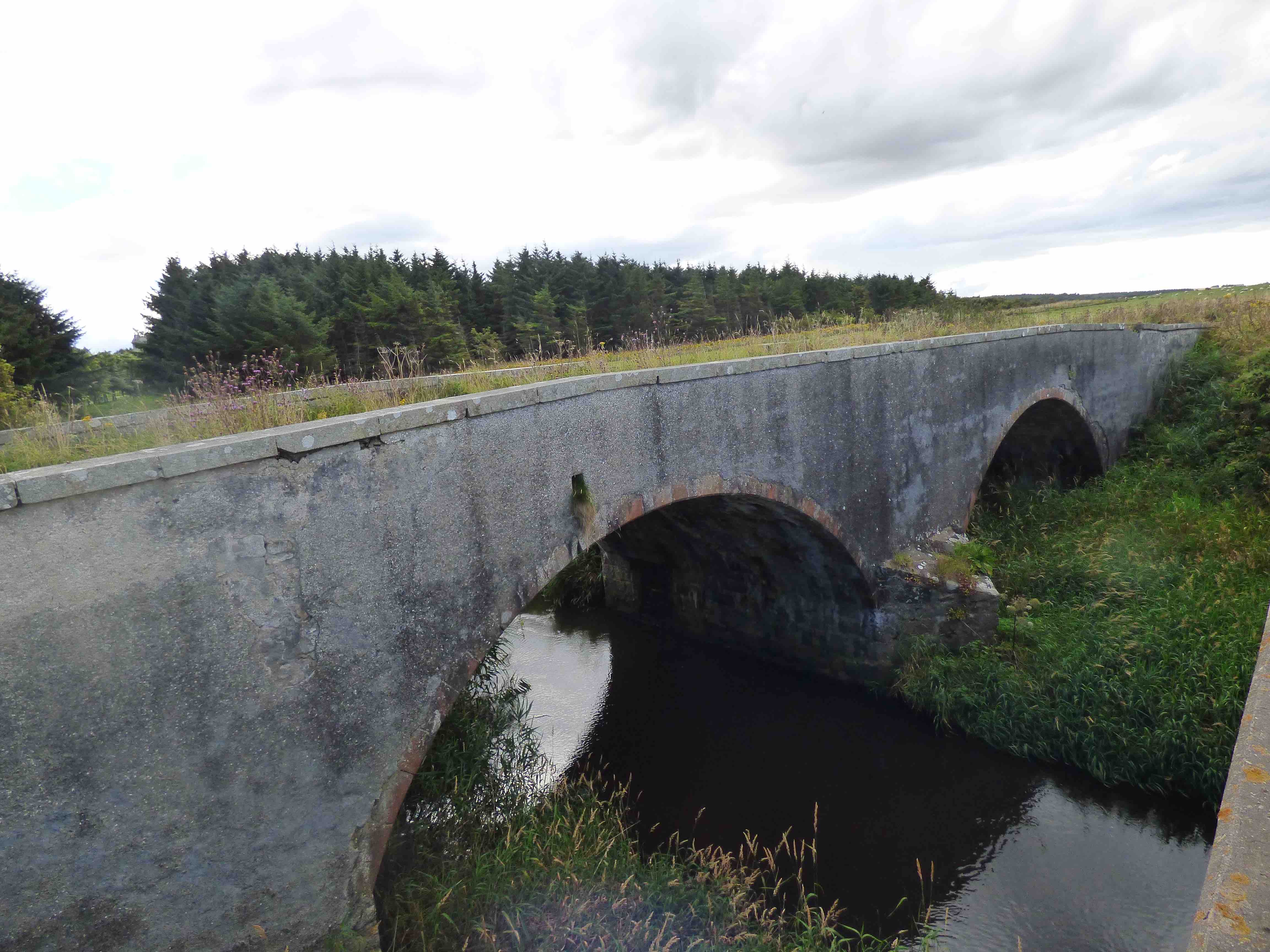
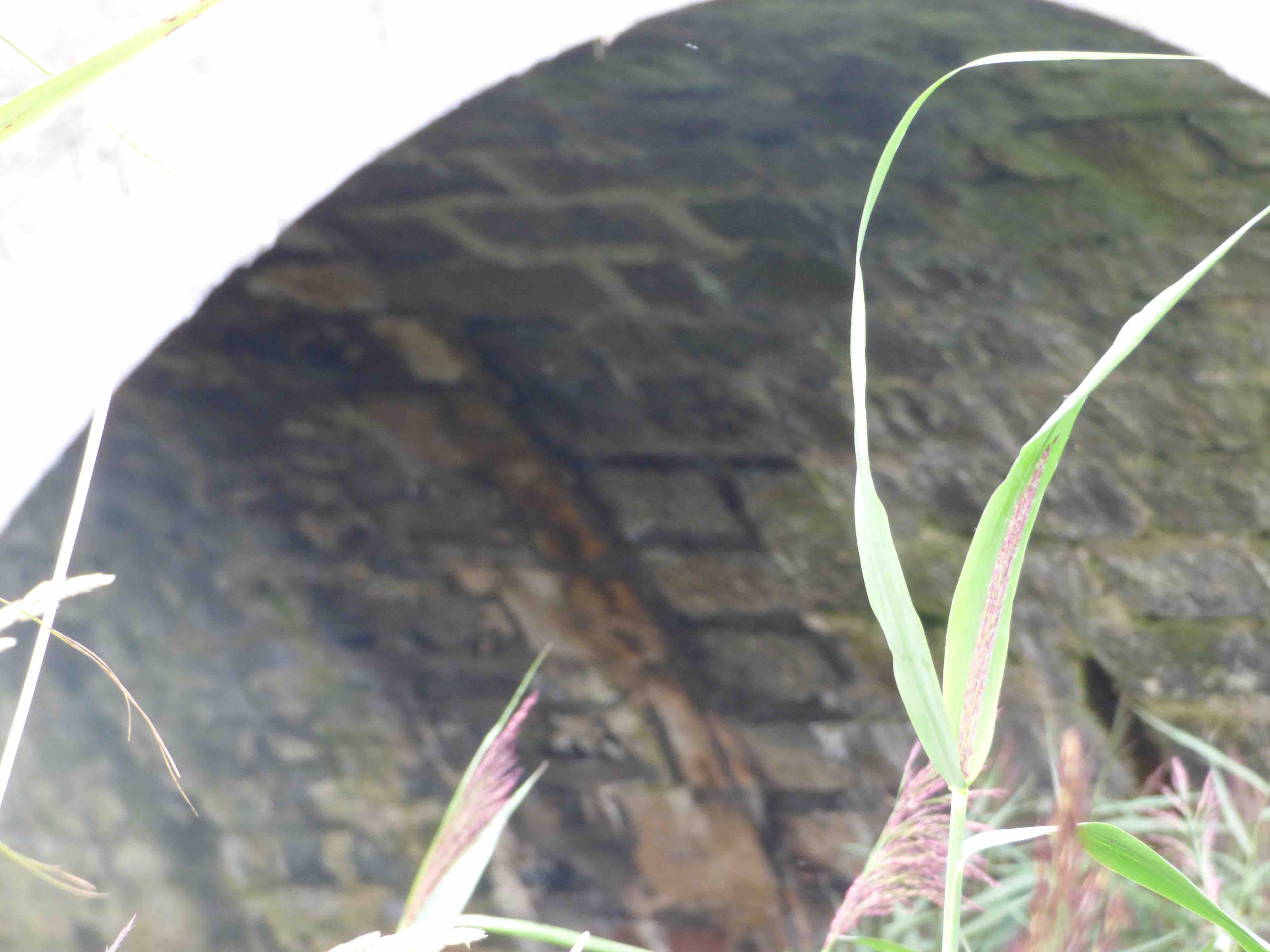
OLD BRIDGE PEEBLES
C. Peeblesshire R.Tweed 325049,640293
History: Originally wooden. Stone from 1465. OSA notes there was a toll in 1565. Fully rebuilt in 1663, using stone from the ruin of St.Andrew's Church, and further extended in 1799. New Stat.Accts (1834) : "Only 8ft wide but next summer it is hoped to widen it under an act of parliament'. Duly completed by adding 6ft on either side. In 1899, further widened to 40 ft on the downstream side. Roy's map(1750) shows a ferry alongside the bridge. This is confirmed on Armstrong. It is on the most important drove road to the south (Haldane). Two roads went south from the bridge in 1750. Today they are represented by The Southern Upland way and the Cross Border Drove Road.
Maps:1750(Roy) 1640(Blaeu).
Currently: Five late 19th century segmental arches with ashlar voussoirs. Spandrels in semi-coursed well dressed rubble. Pilasters and dentillated band course. The cutwaters are triangular on the upstream (ancient) side, and rounded on the downstream (19th C.) The arch spans vary a little, around 39ft. However, the real history can be seen on the soffits. Four sections, with a prominent 11 ft wide protrusion (suggests 8ft between the parapets) which dates to 1663 and includes the voussoirs, clearly visible. The protrusion also includes abutments at ground level. The late 18th century extension can also be seen as a flat parallel widening of about 6ft on both sides. The final 16ft widening dates from the 19th century.
photo photo photo photo.
_______________________________________________
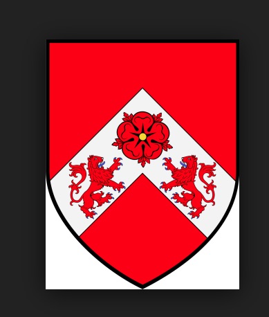
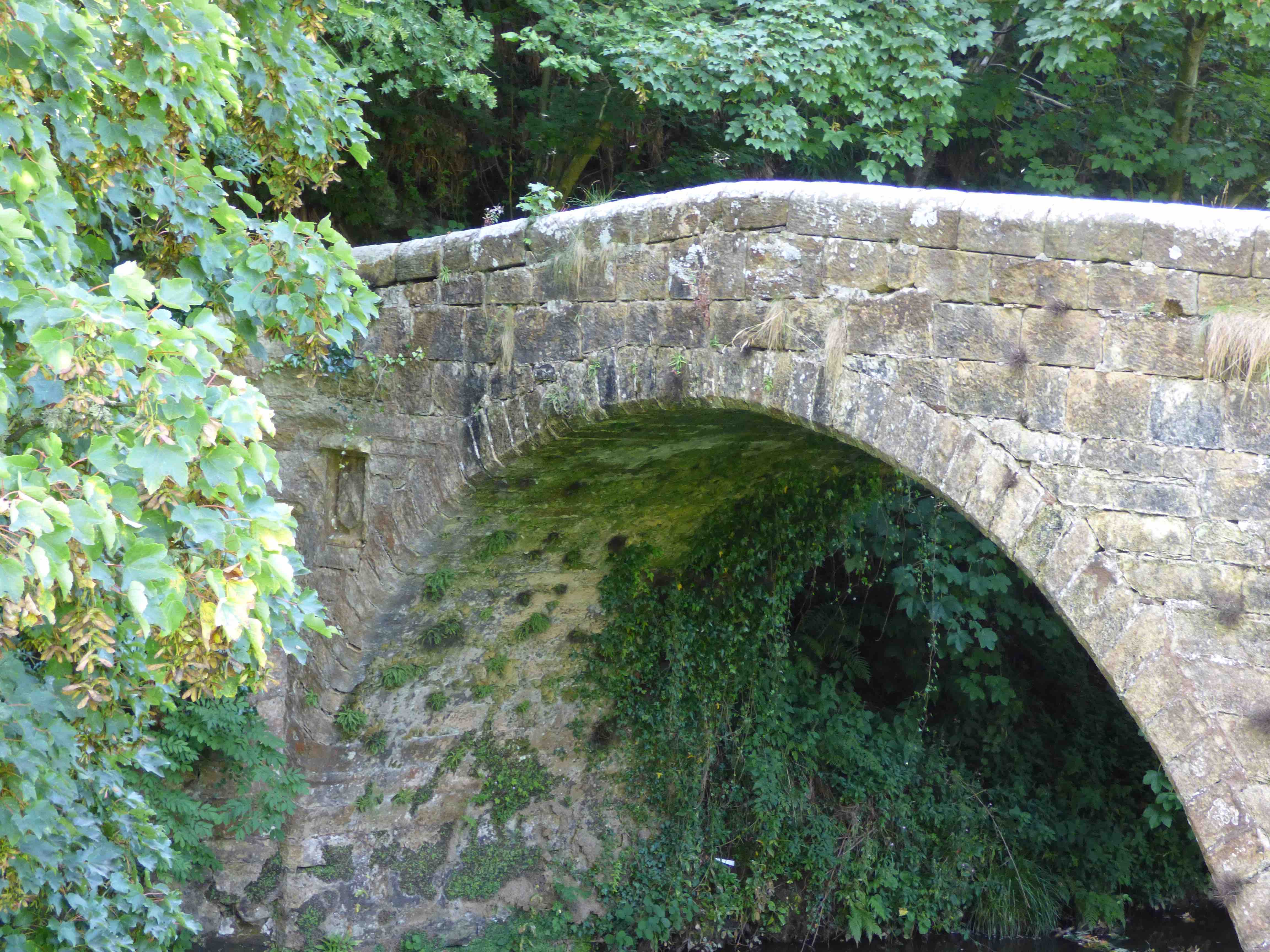
PEEKIE MILL BRIDGE nr St.Andrews
C.Fife R.Kenly 356042,712636
This small bridge is a hidden treasure. Access is difficult, just upstream of Lower Kenly Farm, or from Peekie Mill on the north bank. History: The arms panel (photo) appears contemporaneous with the build (This is not always the case; sometimes these are 'transplants' to later rebuilds). The arms are of the Hepburn family (photo) who later became Earls of Bothwell. John Hepburn and his nephew Patrick Hepburn were Priors of St.Andrews between 1512 and 1527. John also built St. Leonard's College. There is no other local link with the family. 'Puky Mill' is on Blaeu's Atlas- but no bridge is shown.
Maps:1750
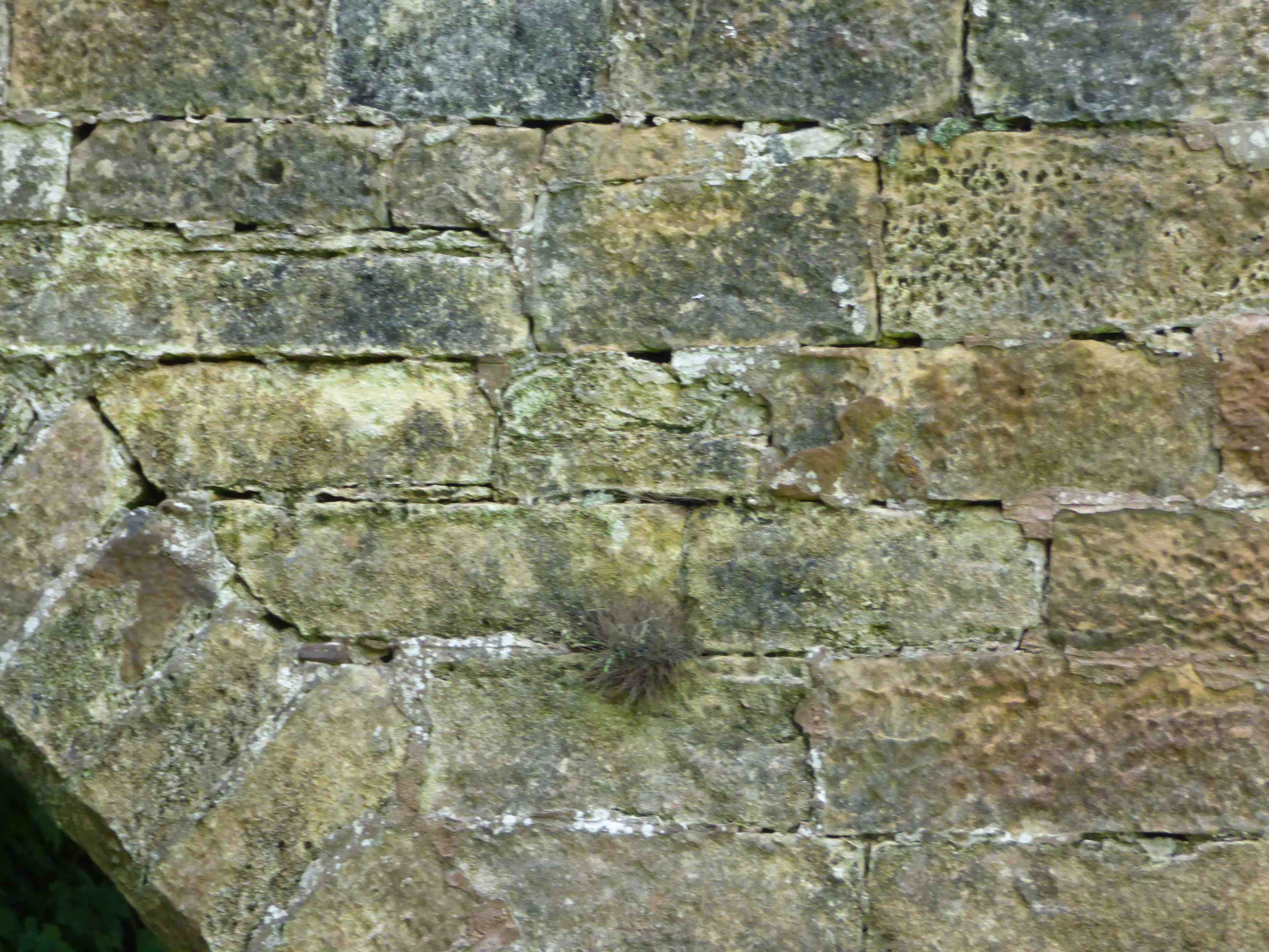
Currently: This is a 16th century bridge. H.S.describes a gothic arch but this is not the case; there is some slight sagging near the crown on the downstream arch (photo) which might give that impression. It is a semicircular arch without any ribbing. Spandrels are in very weathered squared coursed well dressed rubble with many repairs and not much mortar remaining. Voussoirs are chamfered and long on the soffit, which is unusual (photo). The old ruin of Peakie Mill is adjacent (photo). At one time there were twenty operational mills on the Kenly Water.
Link photo photo photo photo photo photo photo.
_______________________________________________
OLD PENTKILN BRIDGE See QUEEN MARY’S BRIDGE
_______________________________________________
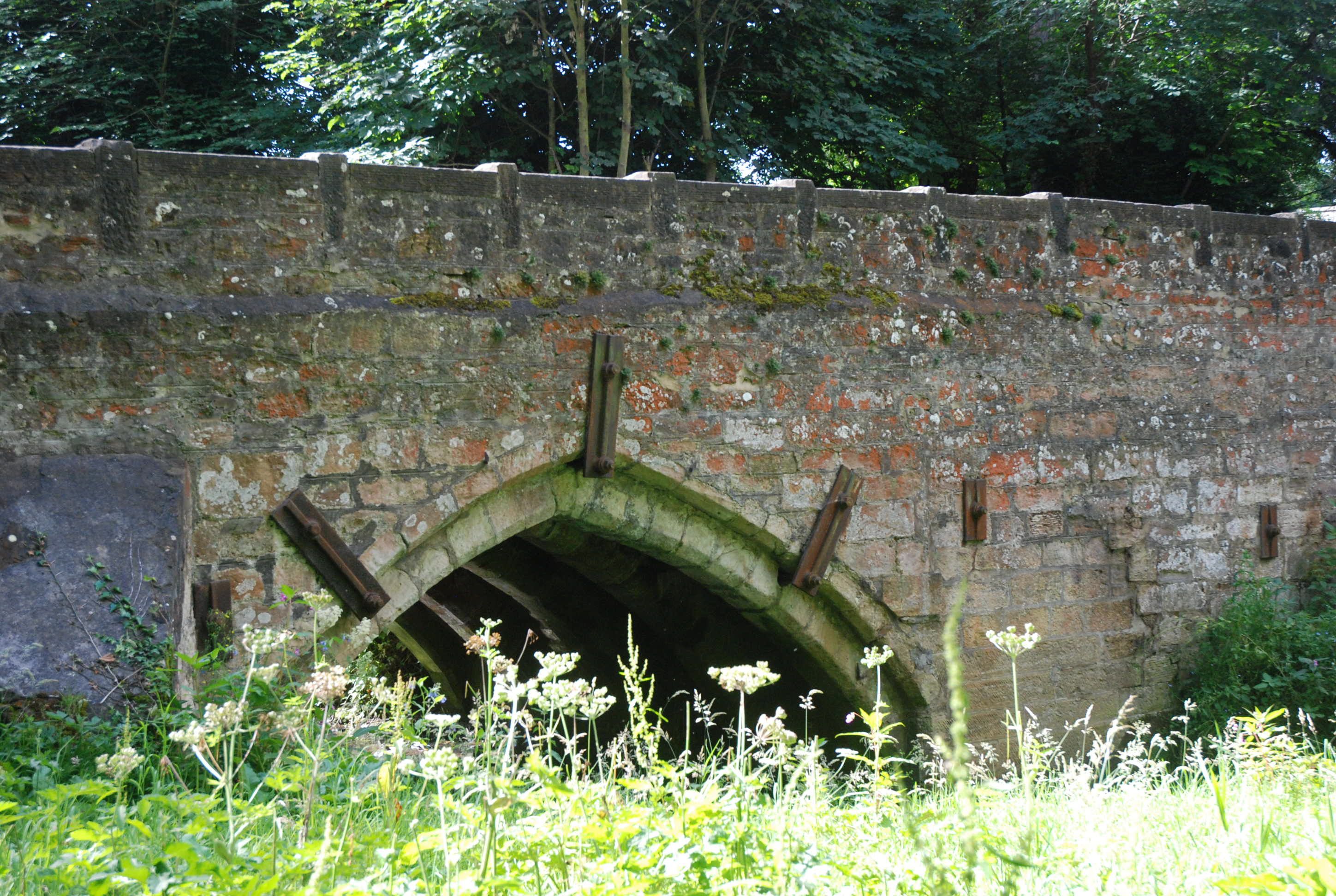
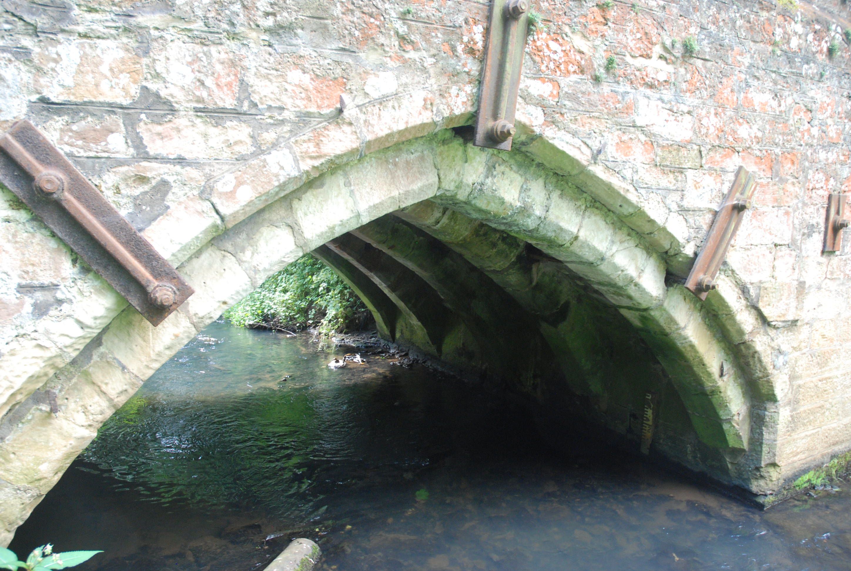
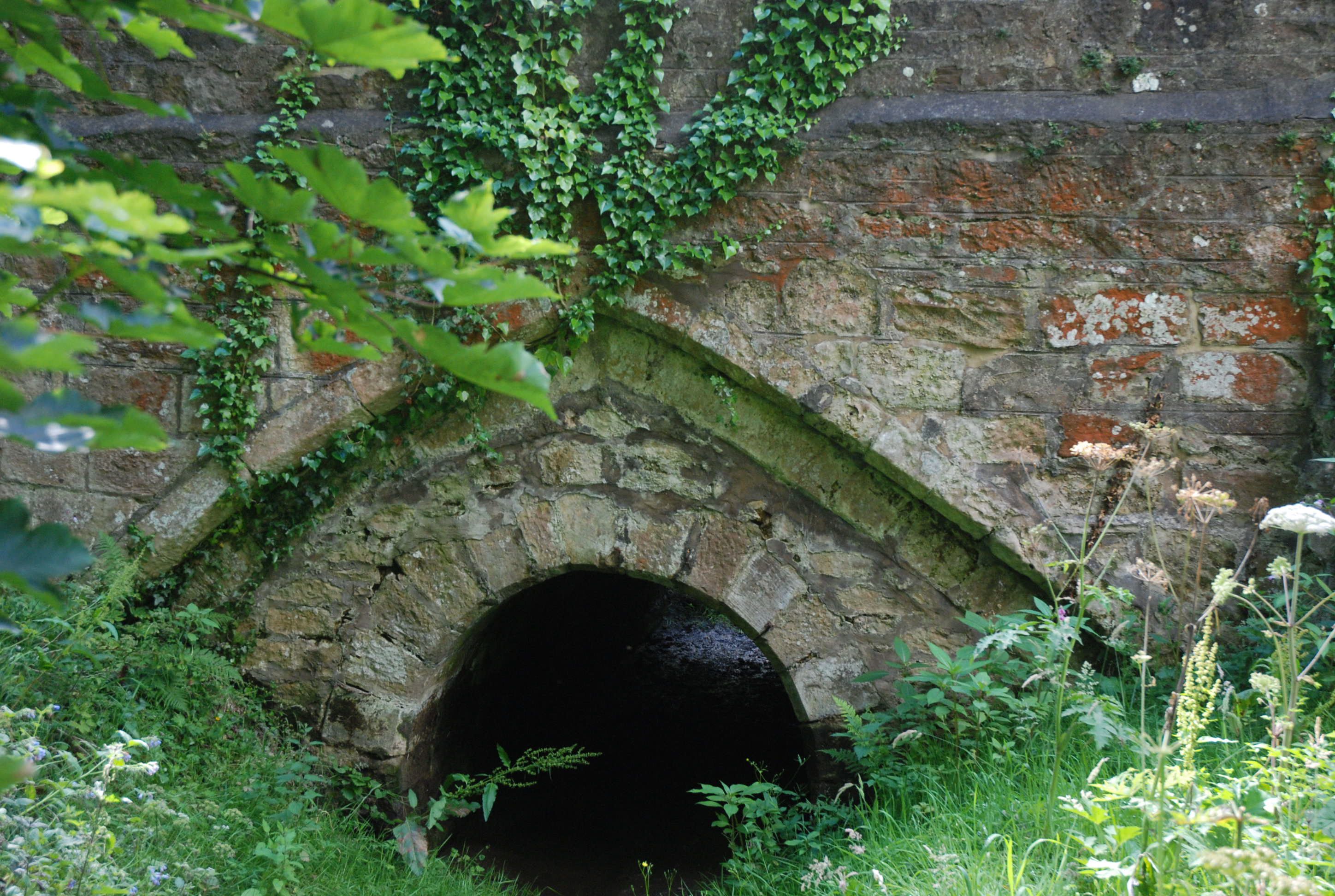
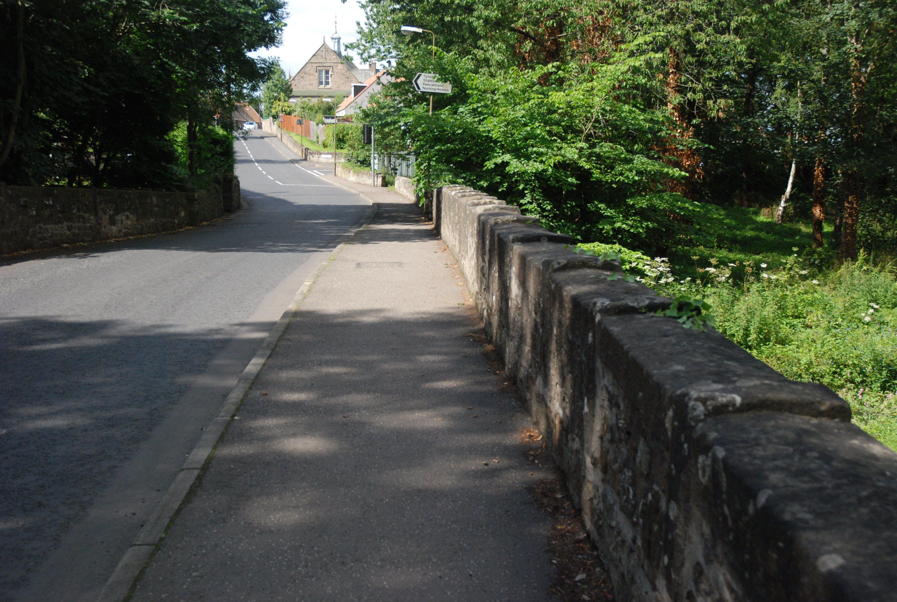
PENCAITLAND BRIDGE
C. Lothian R. Tyne 344218,669006
History: Village has a 12th century history. The church is on very ancient foundations. On the bridge is a date-stone of 1510, with Sinclair arms; almost certainly, the Sinclairs of Herdmanston. Herdmanston tower is 3Km downstream, given to the Sinclairs by charter in 1401. The 1510 date on the bridge could refer to a repair. May be older.
Maps: Roy(1750) Adair(1680s) Blaeu (1640)
Currently: Many repairs to red sandstone coursed squared rubble spandrels. Parapets more recent and light string course. Two gothic drop centred arches and one semicircular. The flanking arches are for floodwaters. Central arch has very heavy ribbing. Metal cramping to arch and spandrels. Unusual castellated coping to parapets. The small gothic flood arch is also ribbed and has been underpinned by a semicircular arch. Still open to traffic. 23 ft. parapet to parapet; this, with very small arches and heavy ribbing, almost has the feel of a culvert. Certainly widened but difficult to confirm because of the ribbing. RCAHMS notes an original width of 10-11 ft.
Link photo photo photo photo.
_______________________________________________
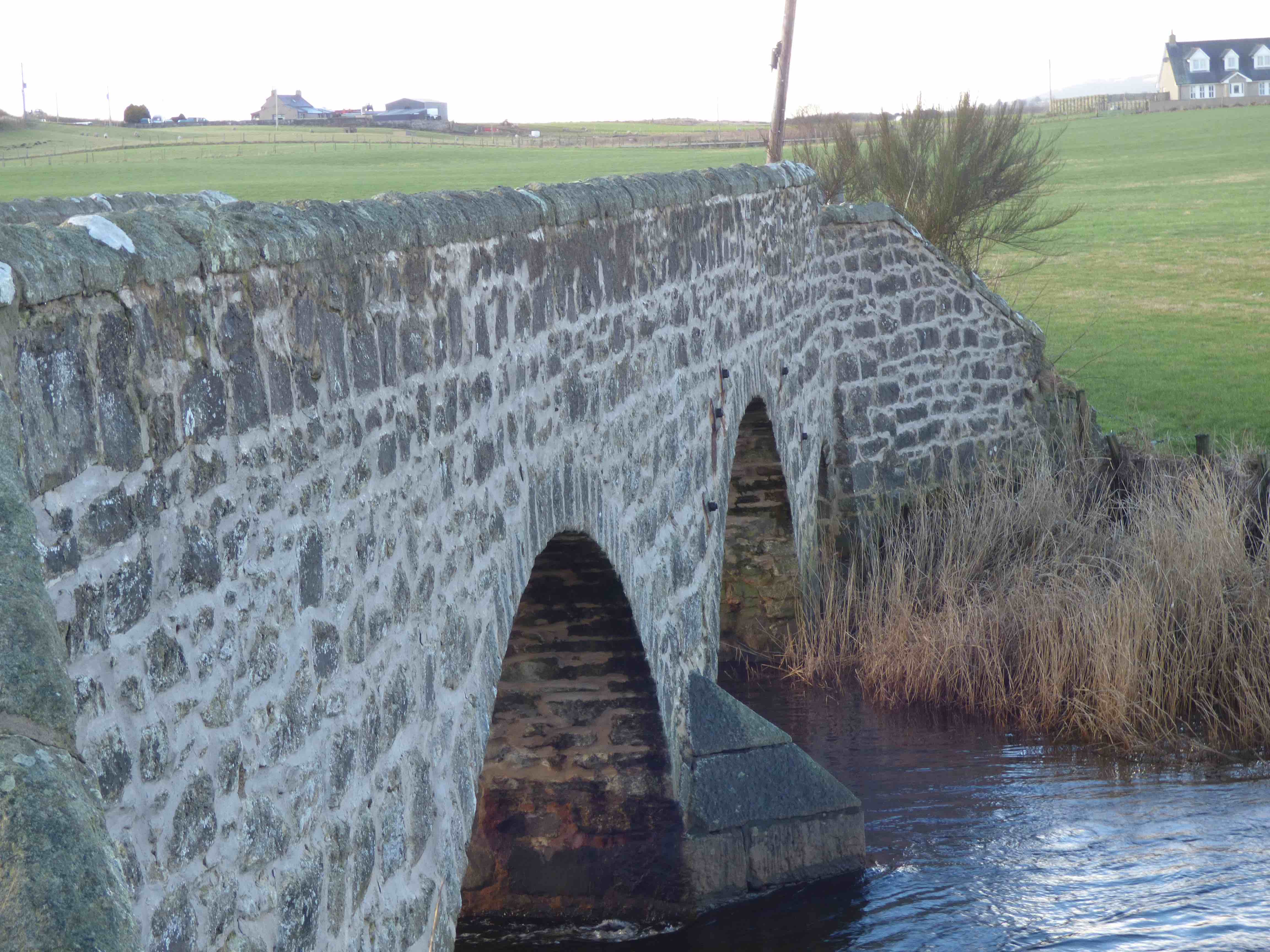
PHILORTH BRIDGE nr. Fraserburgh
C. Aberdeen Philorth Burn 401880,864401
History: Located accurately by Macfarlane(c.1720): built of wood. Replaced in stone in 1723. Located at the north end of Castle Cairnbuilg Estate (13th century). Floods destroyed the bridge in 1754. There was a Philorth Bridge railway-halt on the St Combs line and a Philorth Bridge airfield in the 1940s. The Laird at Cairnbuilg informed me that the burn was originally 'The Orth' and that the 'Phil' was a pool some distance upstream, where Vikings were reputed to have berthed their long boats.
Maps:1750 (Roy) 1640 (Blaeu)
Currently: an 18th century bridge with a great many repairs. One semicircular arch and one larger segmental. Voussoirs are small but the facing voussoirs on both sides have been renewed. Spandrels are rendered on the N. face which is unusual. The south face has squared coursed rubble spandrels and very well dressed voussoirs. Many repair areas. Simple solid coping is intact. No string course. It has been widened (photo) on the upstream side which looks more 19th century. On the downstream side the facing voussoirs are renewed but under the harling. I suspect the original early 18th century stonework will be underneath. Overgrown and with grass decking. Slightly humped. Now bypassed by a modern bridge immediately adjacent.
Link photo photo photo.
_______________________________________________
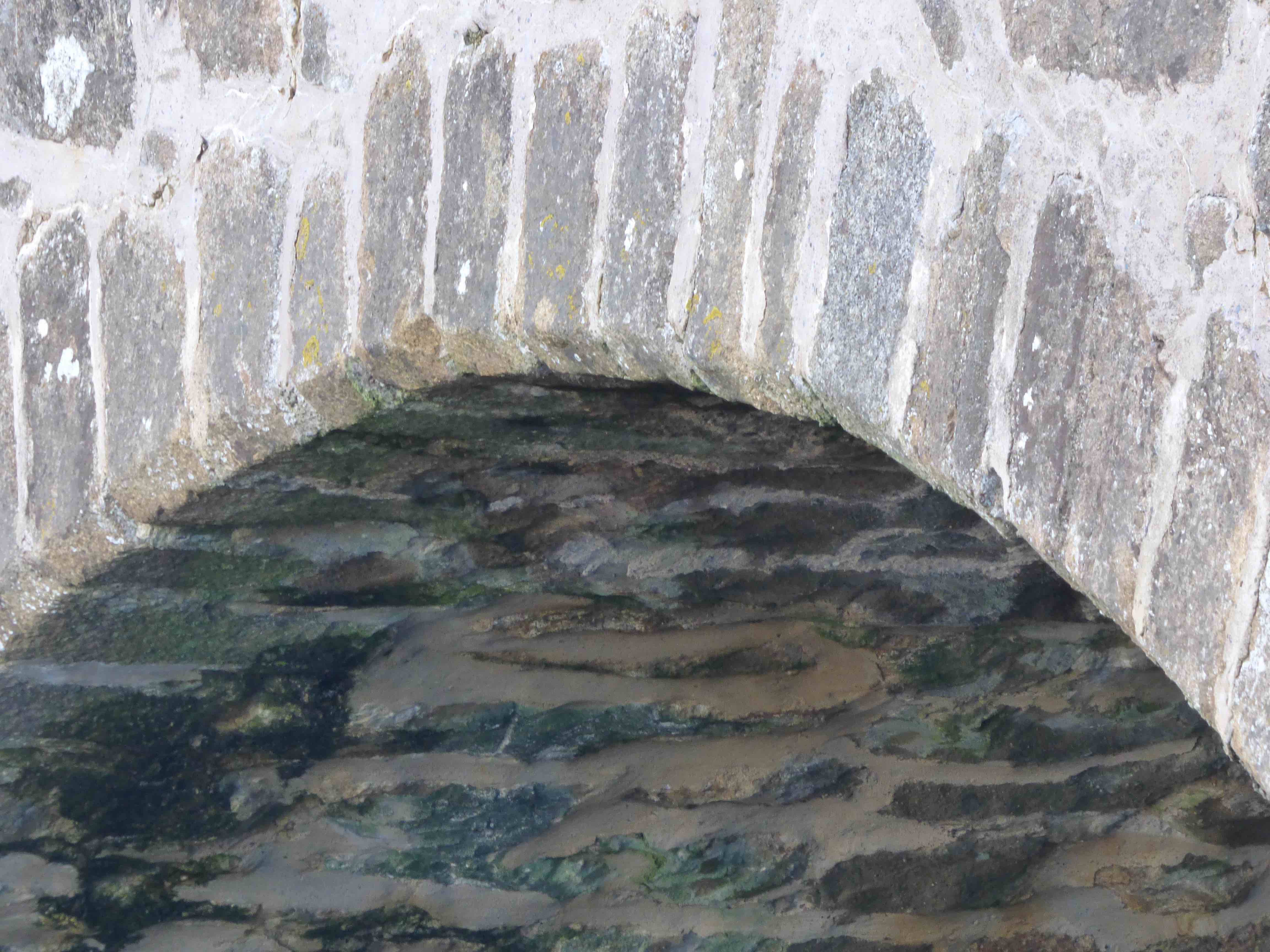
POLDULLIE BRIDGE Strathdon
C.Aberdeen R.Don 334857,812510
History: Poorly defined on Roy. Date-stone shows 'John Forbes 1715.' John Forbes was a Jacobite who died in the aftermath of the '15 Rebellion. Roy's approach roads no longer exist. Macfarlane (c.1720) notes 'there is a new bridge at Pot of Pool d'Oylie'. Poldullie was one of a few bridges that survived the 1829 flooding although it is recorded that the water was high up the spandrels.
Currently:Beautiful single semicircular arch abutted to rock springers. Famed for perfect reflection in the water. Painted by many including Queen Victoria. Spandrels are random un-coursed rubble. Rough coursing and squaring on the approaches. Voussoirs in dressed rubble. Concrete buttress at the north abutment.
( Note: This bridge featured in the 2019 film ‘Mary Queen of Scots’)
_______________________________________________
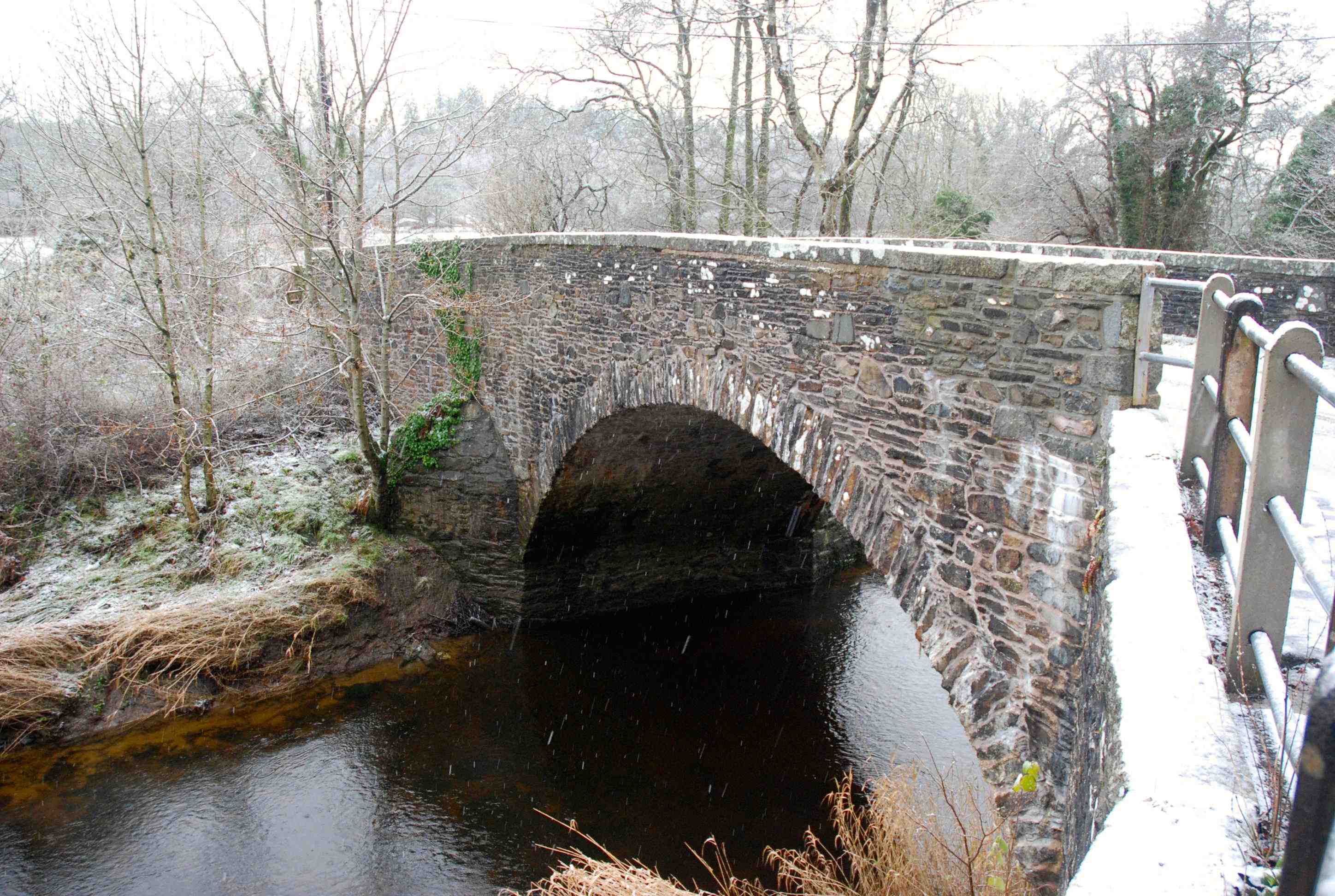
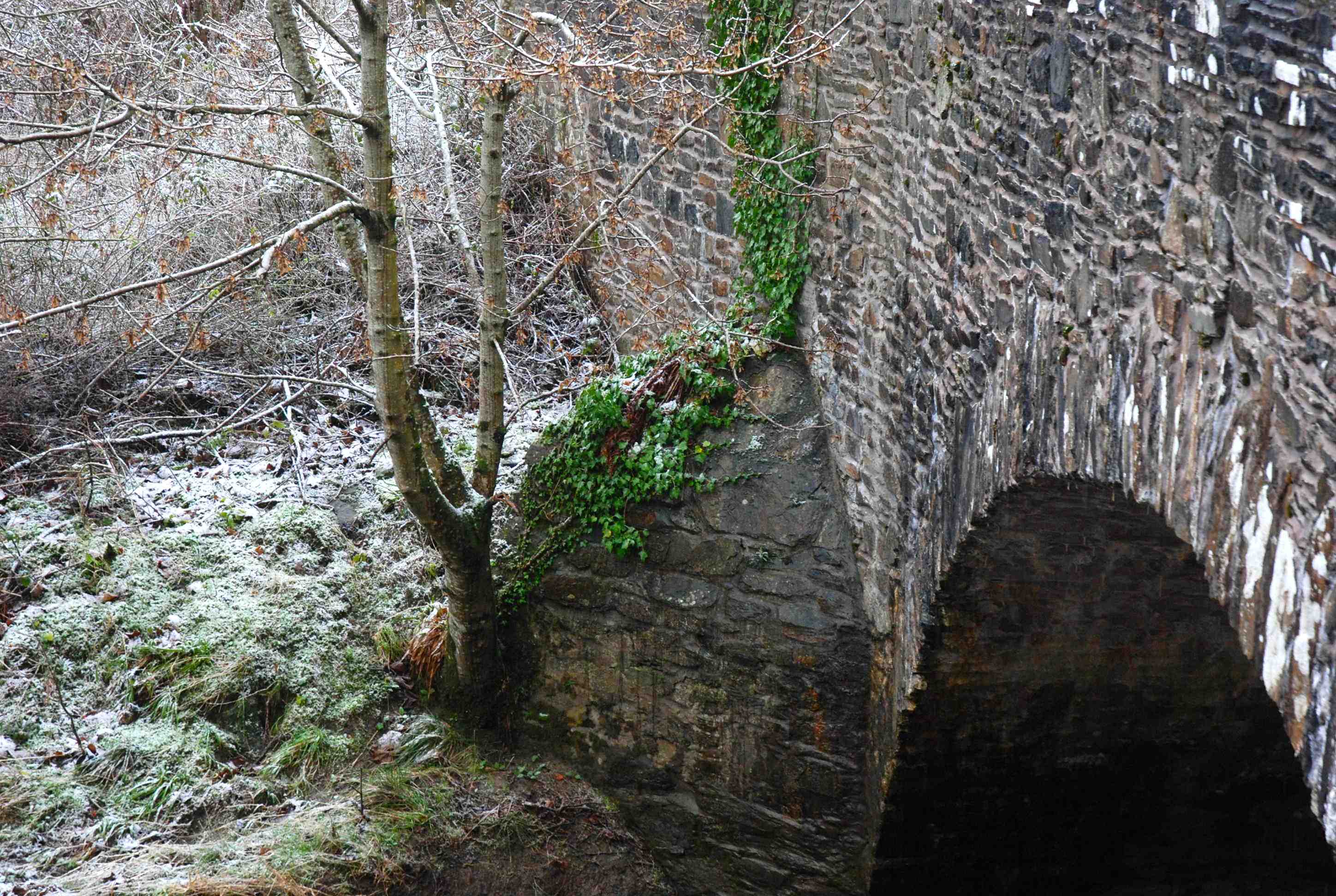
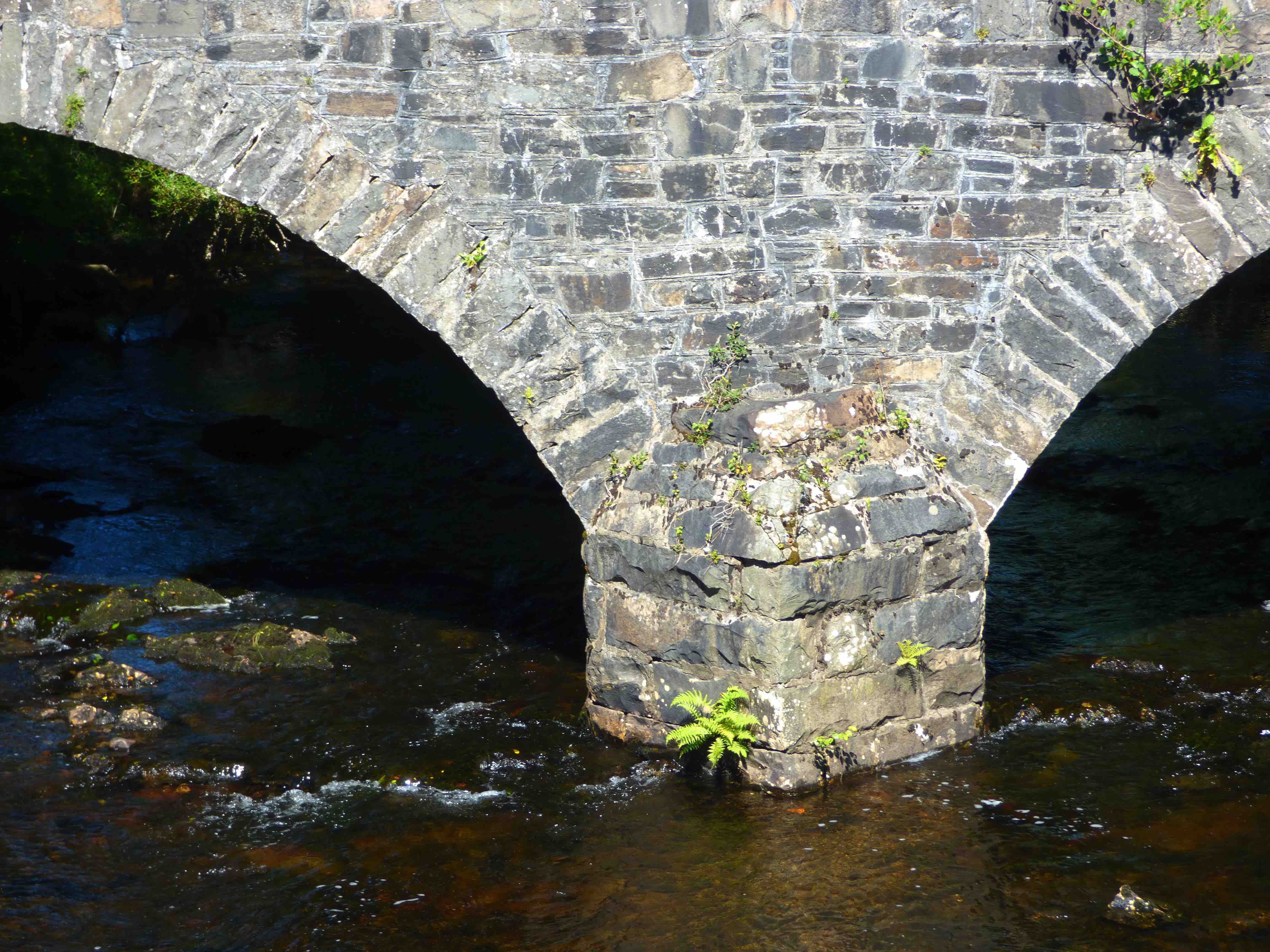
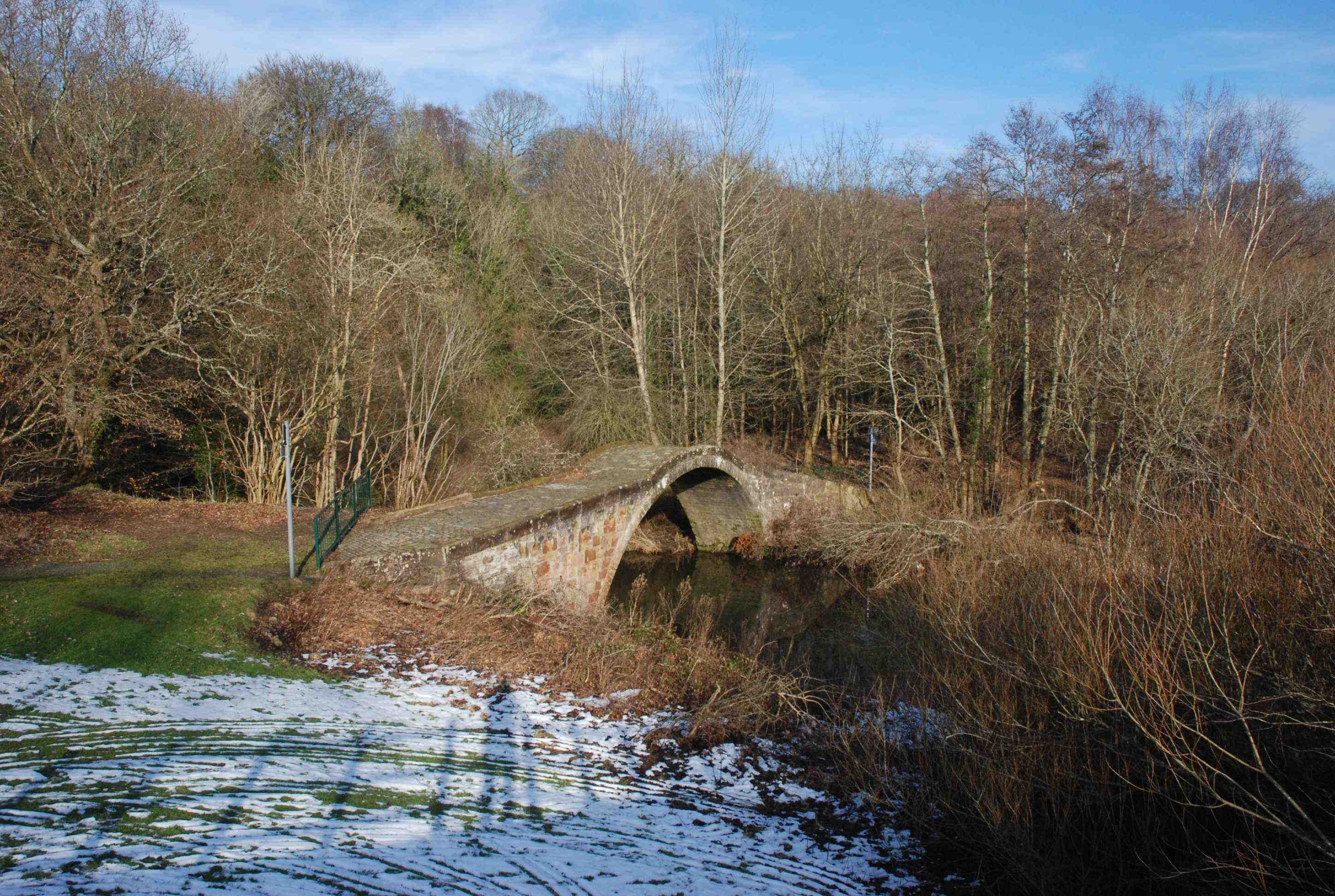
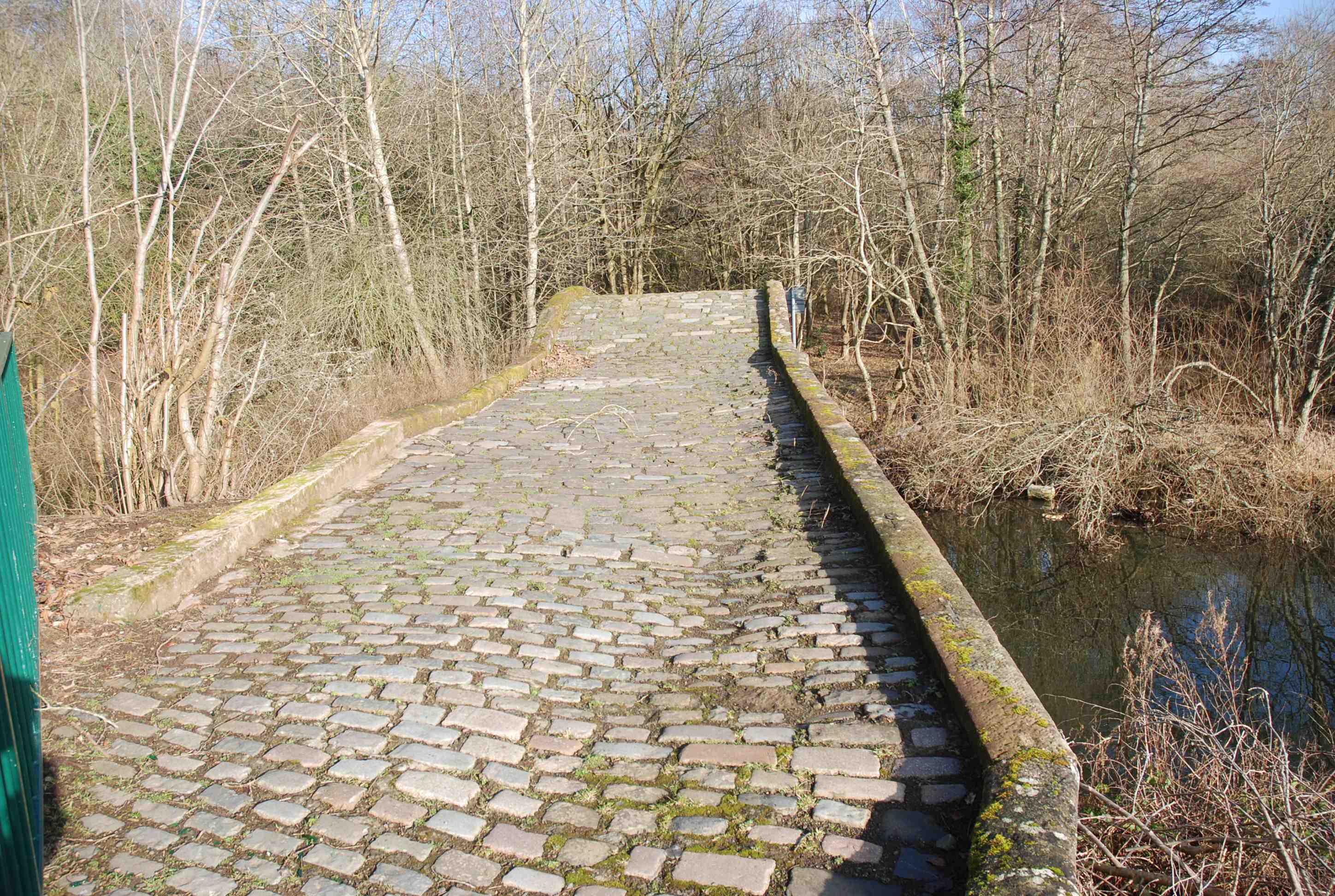
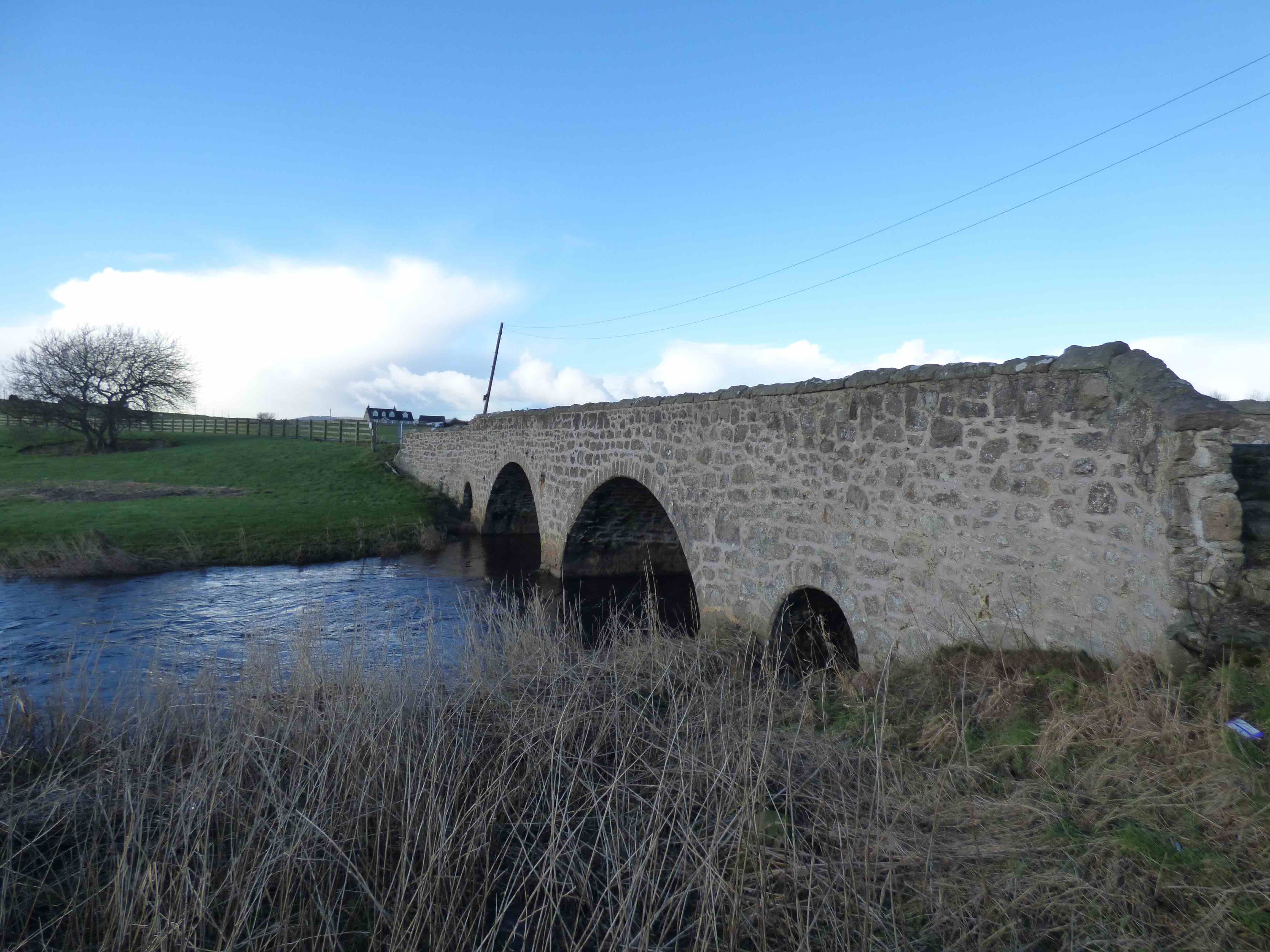
POLHARROW BRIDGE St Johns of Dalry
C.Dum & Gall Polharrow Burn 260326,584358
History: Chalmer's Caledonia(1824) reports it was built by by Quentin McLurg- a tailor- from his own earnings -in 1706. The bridge is on a Roy road coming down through the Ken Valley. Major repairs and widening in 1841 (date-stone). See photo 3. Now bypassed 50 yards downstream .
Maps:Roy(1750)
Currently: Two segmental arches with cutwaters and a smaller flood arch on the west. Squared un-coursed rubble spandrels and abutments, sometimes brought to course. Rubble voussoirs. A strong string course with parapets which appear original. Solid heavy coping stones. Decking overgrown. 21ft p to p. Original appears about 13ft wide. See photo. The date stone clearly refers to the repairs and widening. This is a lovely old 18th century bridge which has been well preserved through 19th century work.
Link photo photo photo.
_______________________________________________
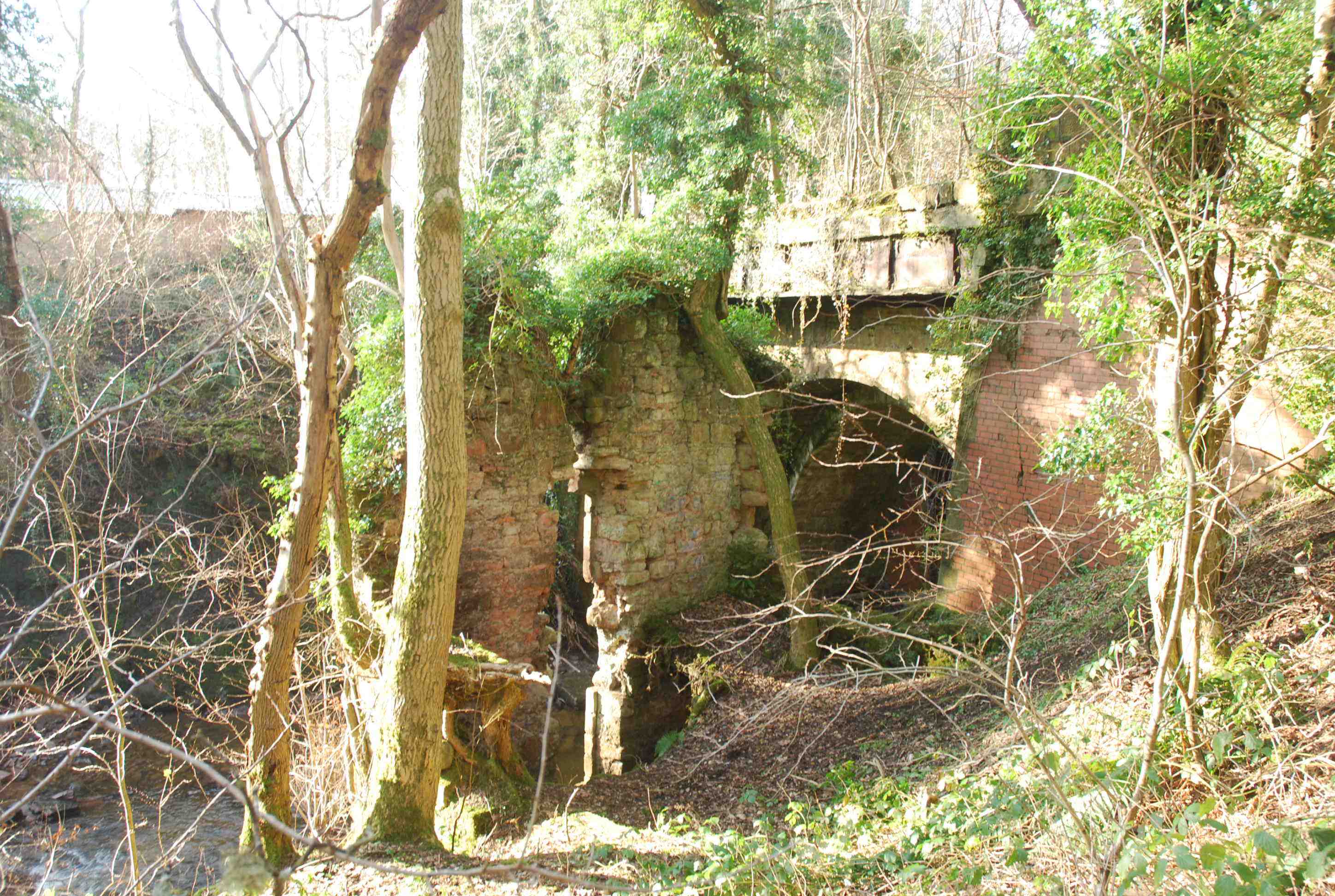
PRIORY BRIDGE Blantyre
C.Lanarkshire Rotton Calder Water 267830,658414
History: Labelled "Prox Bridge" on Roy's map. The 13th century priory was about one mile away on the Clyde. This would be entirely rural in that period and considered nearby. Folklore has it that the bridge was built at the same time as the priory. This is most unlikely. Ruins of an old mill (Black Mill) are on the bank beside the bridge. See photo. The bridge is on the Hamilton to Glasgow Road and was still in use in 1939. Trams crossed it in 1910 after the final widening.
Maps:1750(Roy)1600(Pont 34 ) 1640(Blaeu)
Currently: single span semicircular arch. Very unusual in that it has evidence of two distinct widenings: one in 1809 and one more in 1907. The original semicircular shape (10ft wide) is retained. It is possible that the original arch and remains are from the 16th century since it is firmly on Pont's map. More probably from the 17th century. The early 19th century spandrels are in squared and roughly coursed well faced rubble. The 20th century material is in red brick. The bridge is now closed and overgrown. It is very dilapidated and difficult to access.
photo photo photo photo.
_______________________________________________
PROSEN BRIDGE nr Kirriemuir
C.Angus R.Prosen 339508,758616
An 18th century bridge, thought to have been widened in 1821.
Maps: Pont29(1600) Not on Roy
Currently: Almost semicircular arch with wide red sandstone voussoirs and soffits; grey un-coursed random rubble spandrels and abutments; enormous buttresses to the abutments. Slightly pointed parapets with slight hump to crown. Very unusual widening on the downstream side with a larger arch and a 15" step on the soffit. The original width was 9-10 ft. The older upstream side has many repairs from different eras. This is an 18th century bridge but may have material and sections from an earlier period. Its existence on Pont is significant and the narrow width also suggests antiquity. However, is does not appear in MacFarlane’s collections and is absent from Roy.
Link photo photo photo photo.
_______________________________________________
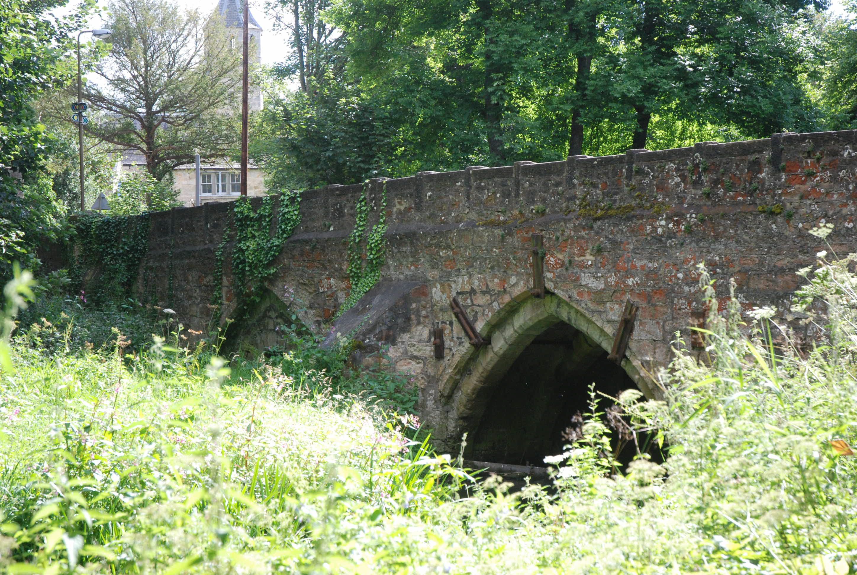
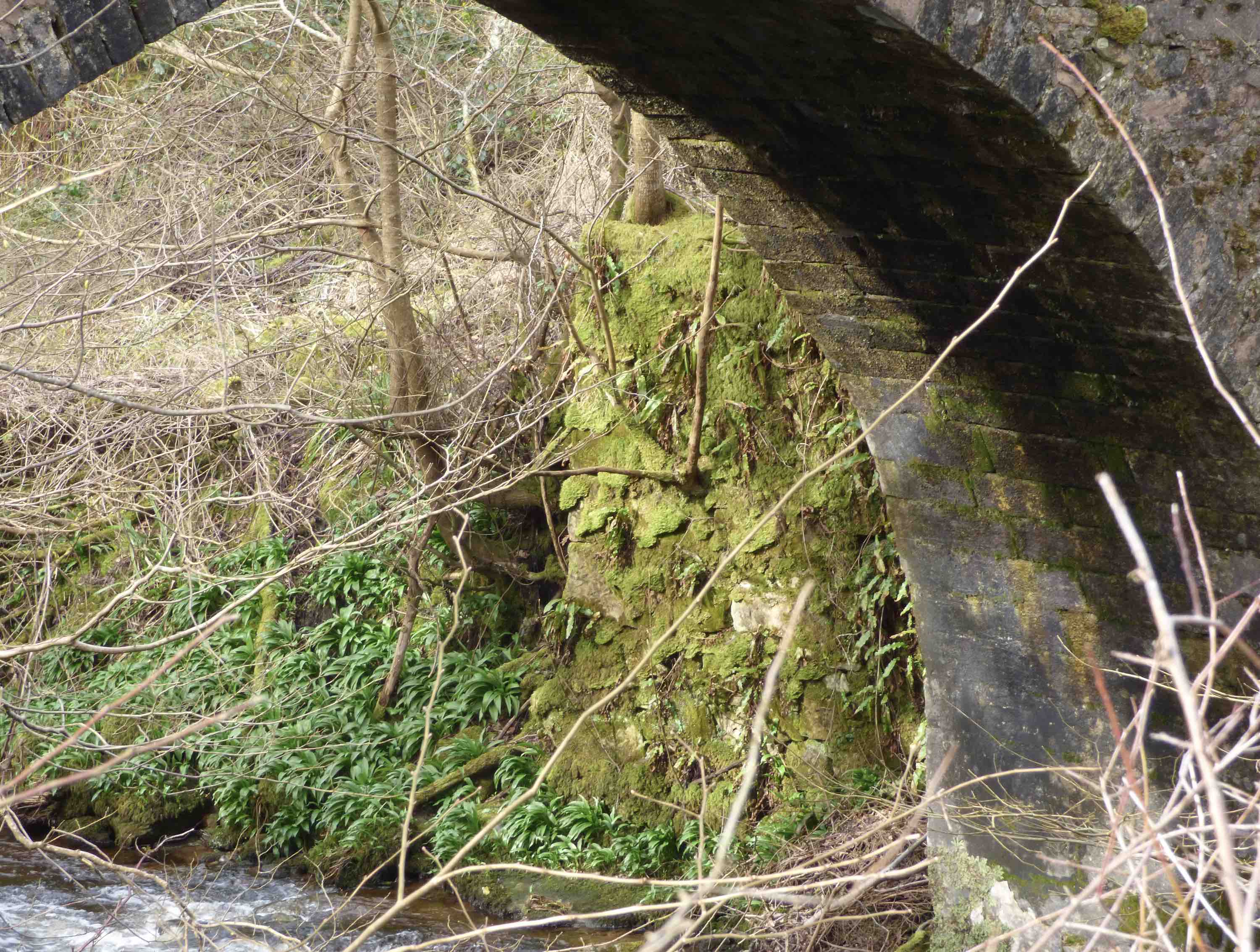
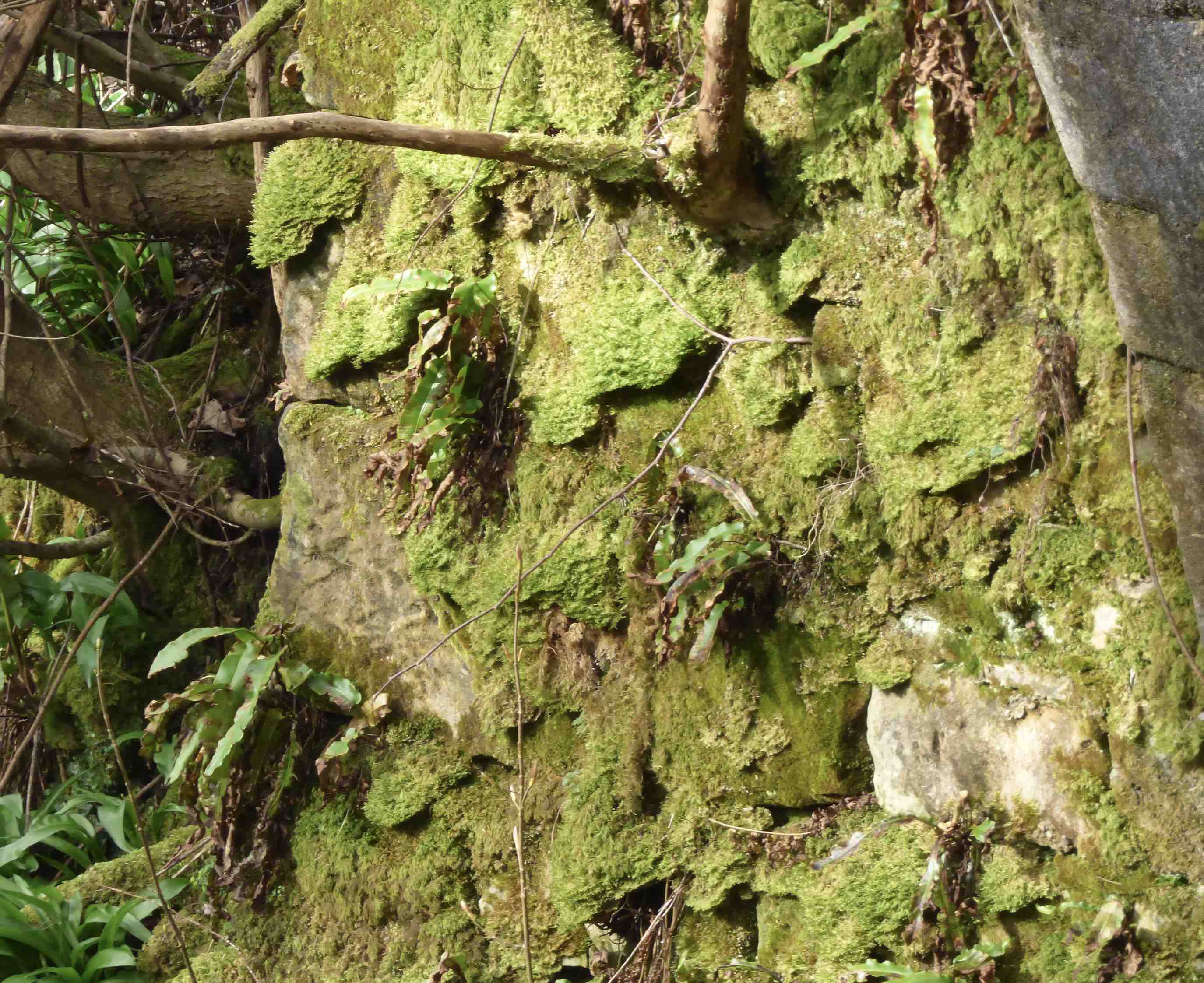
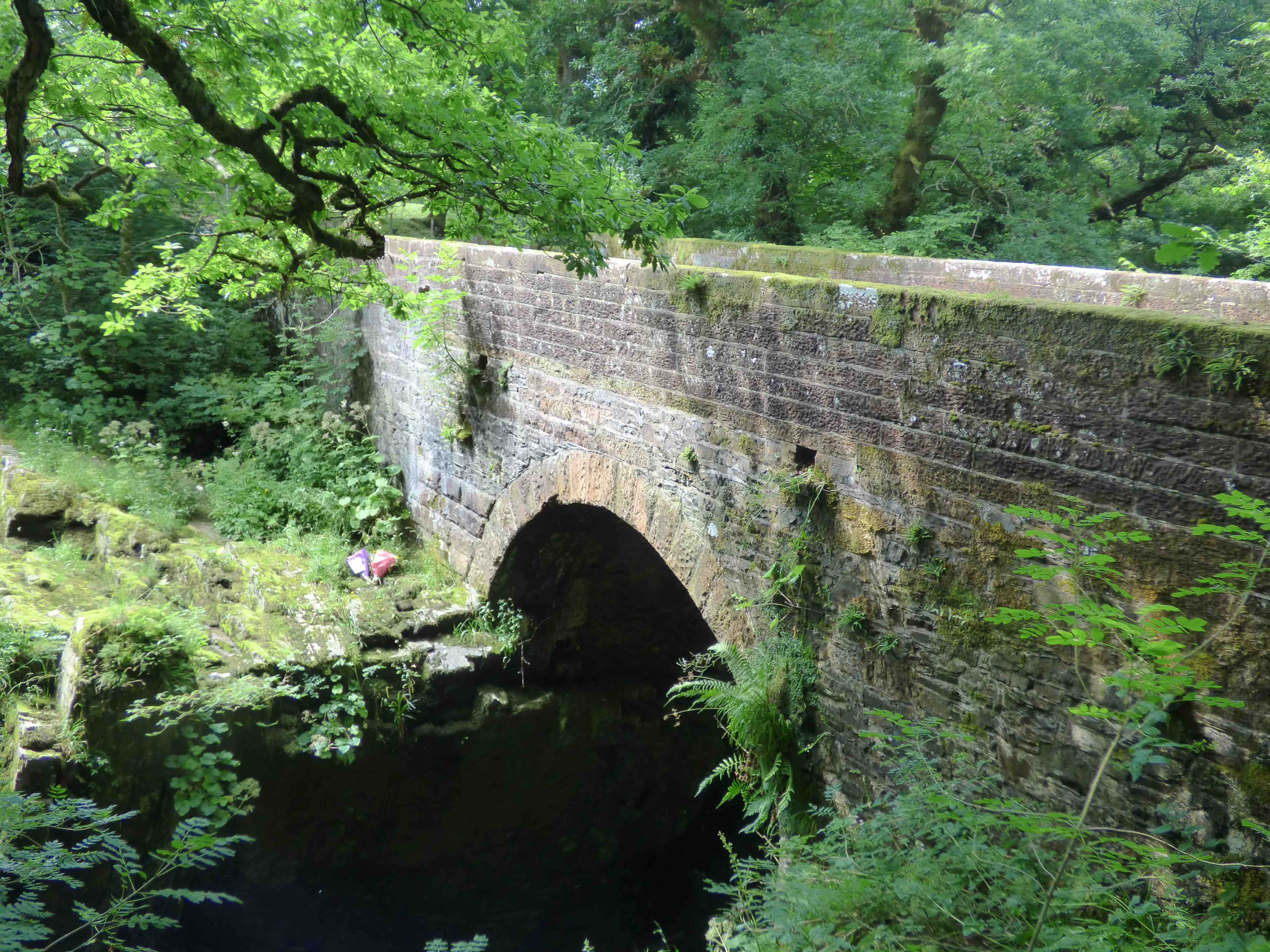
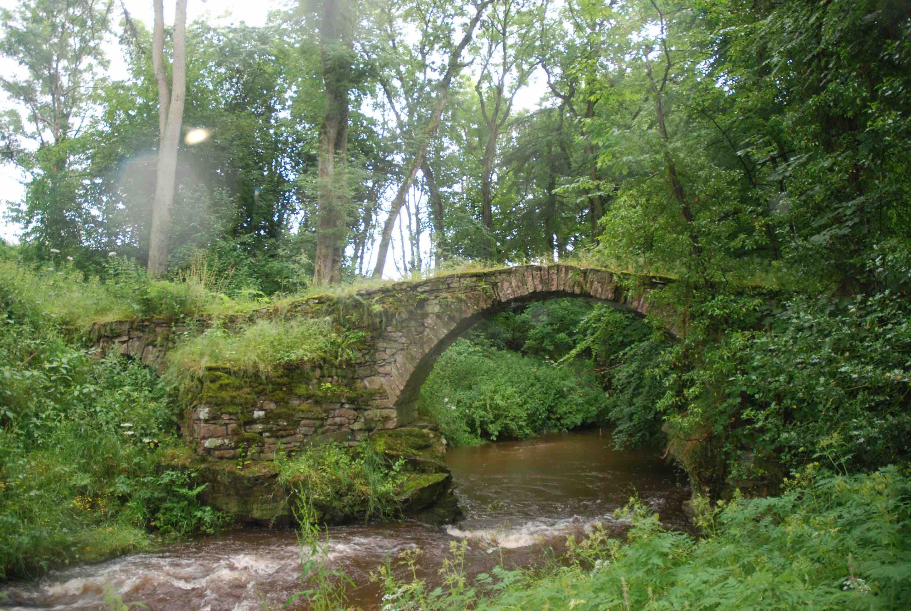
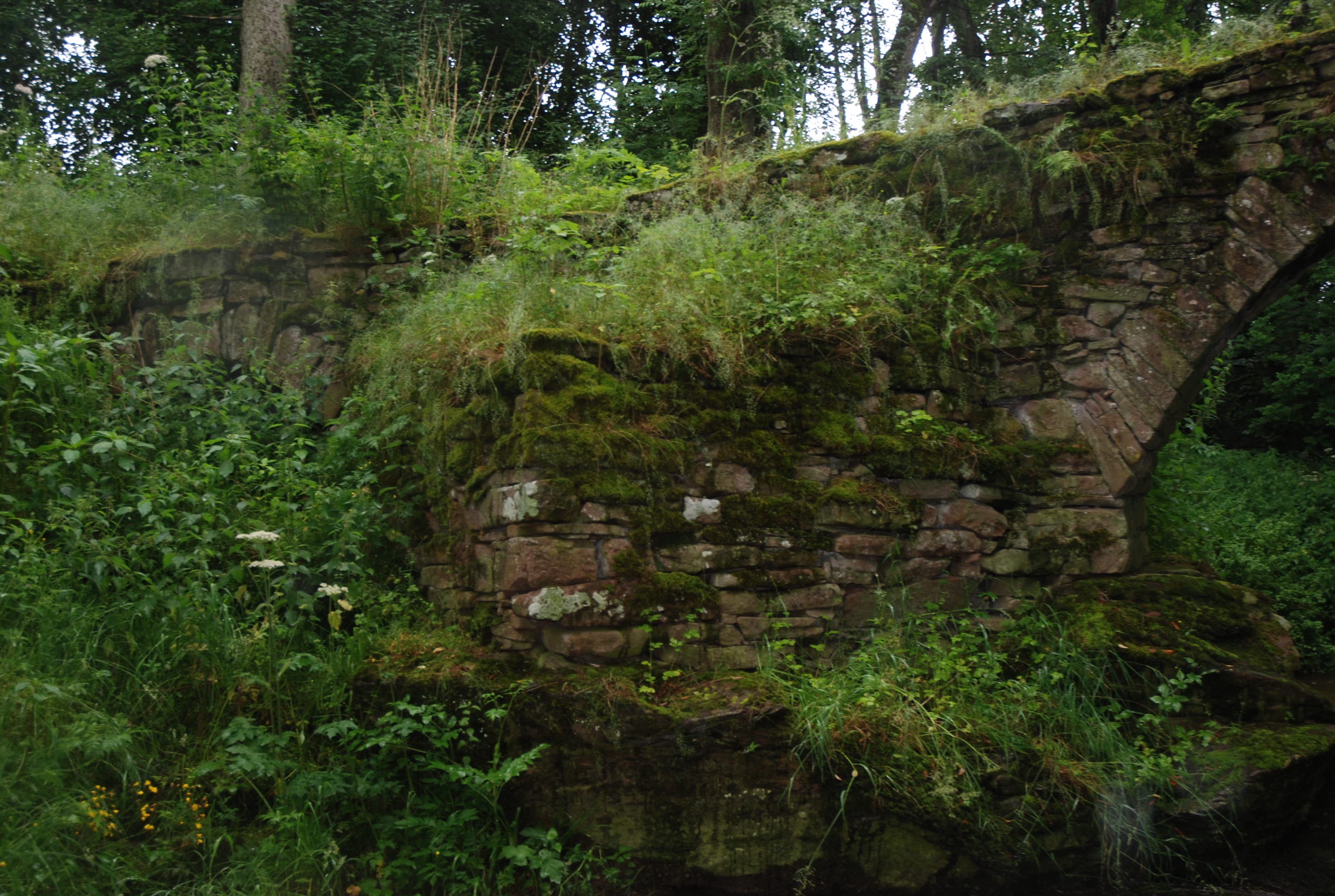
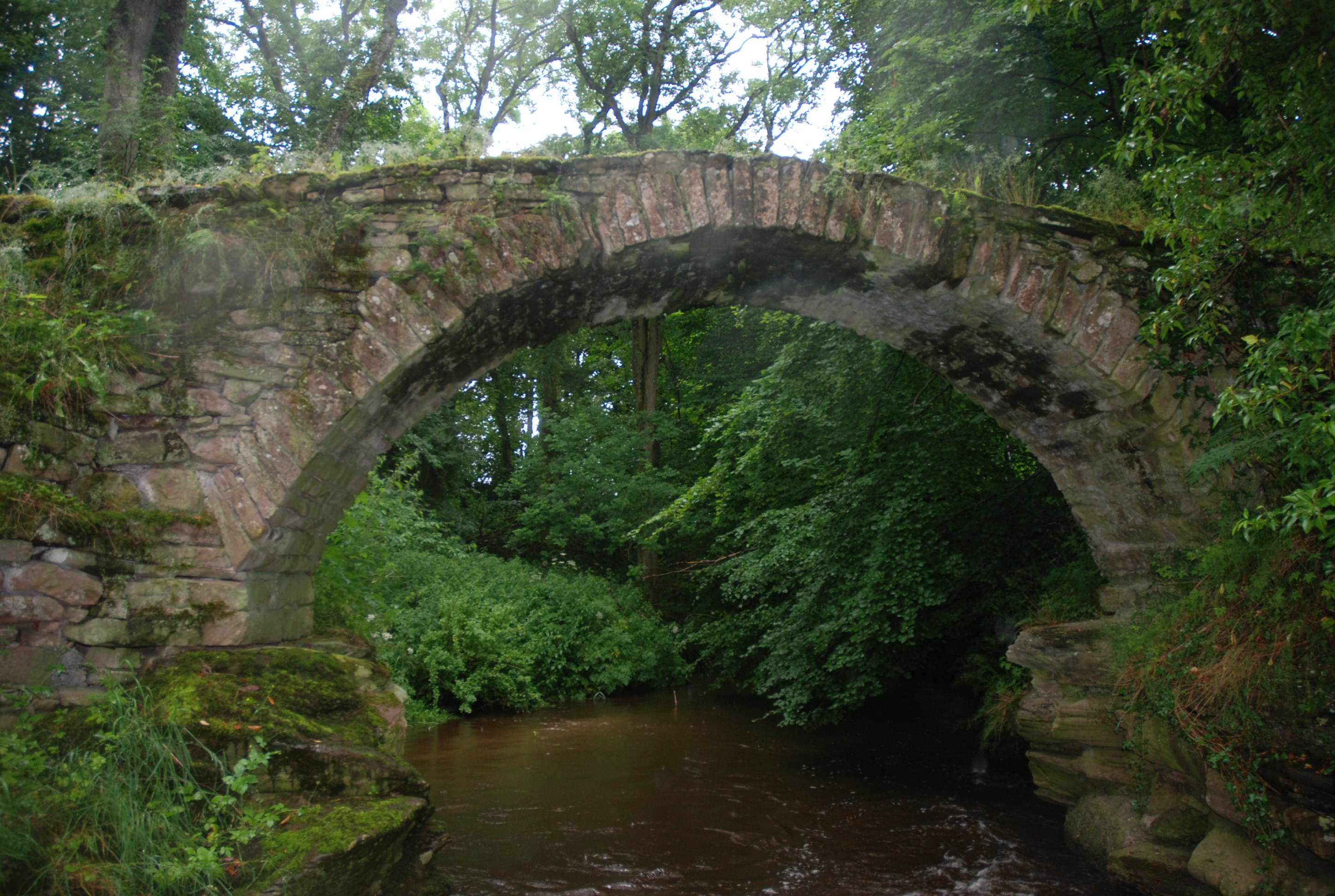
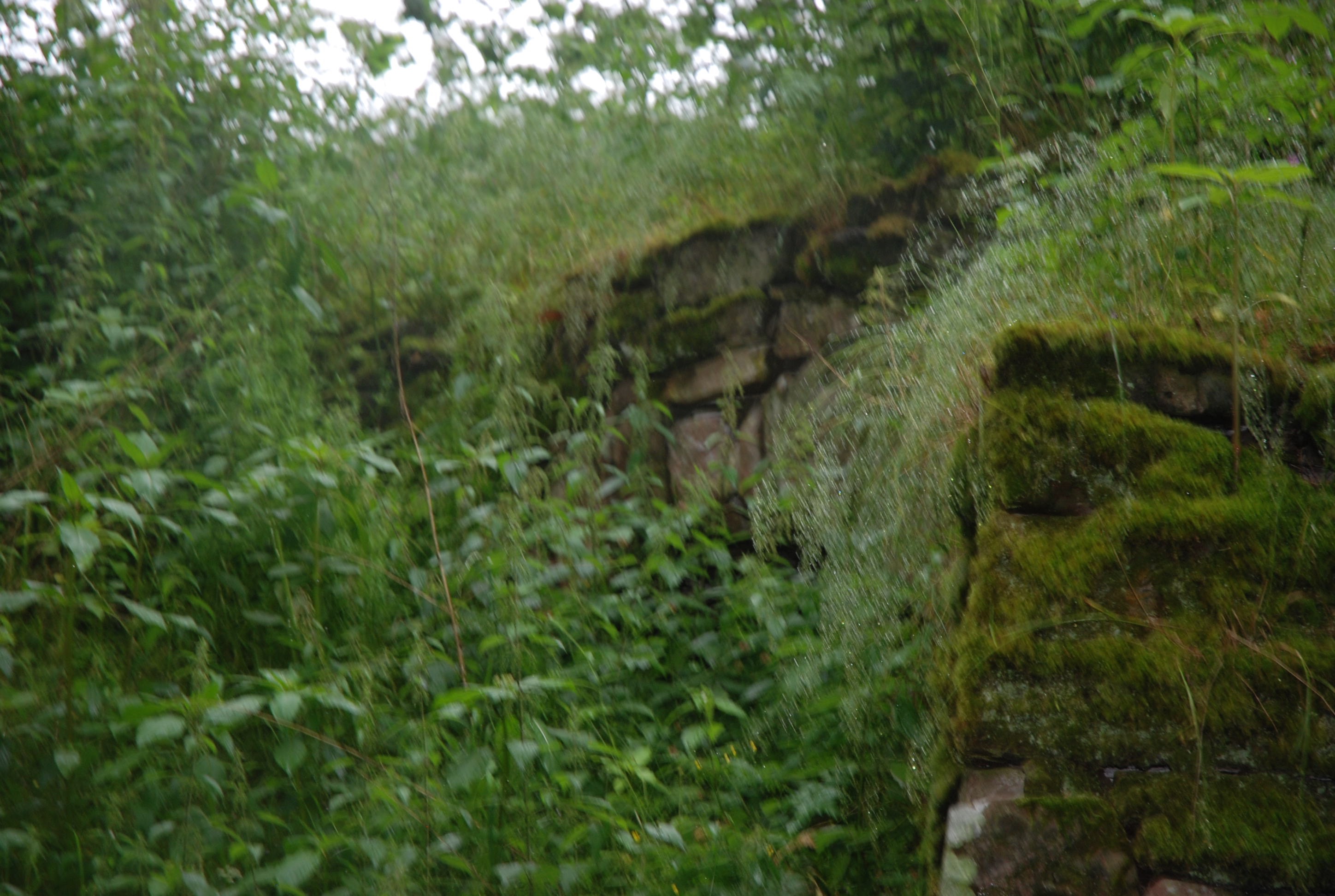
QUEEN MARY’S BRIDGE Minnigaff
C.Dum&Gall Penkiln Burn 241327,566942
History: Tradition that this bridge was crossed by Mary Queen of Scots on her 1563 tour. Probably rebuilt in the 18th century and in the 1960s. Mentioned by Macfarlane in the 1720s. Described as Old Pentkiln Bridge in 19th century maps. Collapsed in the 1960s. Photo from the 1920s.
Maps: Roy (1750) but very poorly outlined.
Currently: Well restored to eighteenth century style in the 1960s. Two almost semicircular arches. Stilted on rocks. Rubble piers, arches and voussoirs. Fairly crude stonework but roughly coursed rubble. Large cutwater is now on land, as is the second arch. Parapets have long gone; replaced by a strong string course, now supporting cast iron balustrades. Adjacent to a mill.
_______________________________________________
RICARTON BRIDGE Kilmarnock
C. Ayrshire R. Irvine 242788,636564
History:1723. Date stone. Comm. of Supply bridge which was preceded by stepping stones to the east. Bypassed by a new bridge in 1839
Maps:Roy(1750)
Currently:Three dressed stone segmental arches with hood moulds. Large cutwaters. The upper parts have been rebuilt, perhaps in the 19th century, with coursed fine ashlar spandrels and sidewalls, incorporating half of the cutwaters. There is a decorative band-course in stugged squared rubble, possible taken from the old stone before the repair. The lower spandrels and sidewalls are in coursed squared rubble and are clearly original. The bridge appears very well built and elaborate, more in keeping with the later date but the lower courses and arch are typical of early Commission of Supply.
Link photo.
_______________________________________________
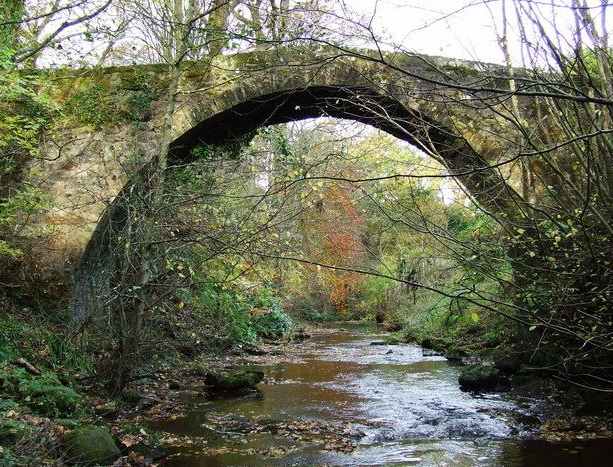
ROMAN BRIDGE Bothwellhaugh
C. Lanarkshire R. South calder 272886,657973
History: lies close to Watling Street as it approaches Bothwell from the South. Roy locates the Roman crossing a little upstream of the bridge but includes both the bridge and the Roman crossing on his map. It needs to be said that Roy did not know of the Roman Fort at the time of his map, so it is very likely that the Roman crossing was at or about this location. The bridge is noted in the Old Stat.Acct (1790s) in which claims are made for a Roman provenance. The bridge was also mentioned in Macfarlane(1720s). Late 19th century paintings suggest there was loss of masonry from spandrels and parapets before the present low level coping was added in the later 19th century. It appears be older than 18th century but its absence from Pont and Blaeu is important ( see section on Reputed Roman Bridges).
Maps:Roy(1750) Not on Blaeu. Not on Pont.
Currently: This is a 17th or early 18th century structure. It was considered very ancient in 1790 and certainly existed in 1720, both of which lean towards a 17th century date, much as the style seems later. Nine ft wide humped single semicircular arch with remarkably small voussoirs. Squared but un-coursed rubble spandrels.
photo photo photo photo.
_______________________________________________
ROMAN BRIDGE Inverkip
C. Renfrewshire Dunrod Burn 222307,672549
History: Late medieval packhorse type bridge. Confirmed on Pont and Blaeu which is important, and suggests at least a 16th century date. This is older than has been thought and recorded. There are masonic marks to found. Mentioned in OSA. Bypassed by adjacent early 19th century red sandstone semicircular arched bridge (last photo).
Maps:Roy(1750)Pont 33(1600) Blaeu(1640)
Currently: single humped packhorse style arch six ft wide with small one ft high parapets which have rubble coping. Segmental Arch. Squared and random rubble structure with rubble voussoirs of unequal length. Very overgrown. Turf decking. Slight gothic shape is discernible which might also suggest earlier date; however, it may be a slightly broken arch. Extremely beautiful profile. There is an unusual structure just adjacent to the north-east haunch (photos 6 and 7) which may or may not be the remains of an abutment from an earlier bridge. Snoddy (1950) described an odd masonry chamber next to the bridge which may be relevant. Unfortunately, the bridge is attached to someone's garden who refuses access.
Link photo photo photo photo photo photo photo.
_______________________________________________
ROMAN BRIDGE Penicuik see CENTURIANS BRIDGE
______________________________________________
BRIDGE OF RORA Longside
C.Aberdeen. R.Ugie. 404215, 849305
NSA of 1845 describes it as very old and very dilapidated. Widened on NE in 1860.
Maps: 1750 Roy. 1640 Blaeu.
Currently:early 18th and 19th century. Horizontal-decked double carriage. Two semicircular flush arches with two additional flood arches. Random rubble, scarcely dressed. Rubble voussoirs which are chamfered on the SE facing. This is unusual, but not of medieval provenance. Very small capstones on the parapets. 16 ft. width. Difficult to judge original width: probably 10ft.
______________________________________________
ROUTIN BRIDGE nr Dumfries
C. Dum & Gall Old Water 288623,579720
History: There is considerable folklore around this little bridge, including the grim reputation that witches held their covens here. There was an infamous 'Sorceress of Routin'. The local Irongray church was a centre of Covananter resistance in the late 17th century with large conventicles being held nearby. Since the 19th century, it has been a favourite local beauty spot known for its impressive waterfalls. The bridge is present on both Blaeu and Pont which confirms a 16th century existence.
Maps: Pont(35) 1600 Blaeu(1640) Not on Roy
Currently: Largely 18th century (downstream) and 19th century (upstream) stonework and style. Squared well dressed coursed rubble spandrels. Recent parapets. Segmental arch single span. Well dressed voussoirs in rubble. Appears to have been extensively repaired in the late 19th century.
Link photo photo photo
.
_______________________________________________
RUBHA BAN BRIDGE Loch Lomondside
C.Dunbarton Small unnamed burn 233201,701869
1745 Military. Caulfied. Dumbarton to Inverary road
Maps: Clearly on Roy (1750)
Currently: single arch culvert. This could be original, but we do know that Telford restructured the road in the early 19th century and that the bridge was once again rebuilt in the 1930s. This may well be a Telford bridge/culvert with a 20th century widening.
photo.
_______________________________________________
BRIDGE OF RUIM near Alyth
C.Angus Queich Burn 326954,749300
History: Also called Brig O’Rome. Recorded in 1713 in Meikle Parish Church archive but the bridge features on Pont and appears to be original.
Maps: 1600 (Pont 26) not on Roy
Currently: Original humpback packhorse type bridge. Six ft. wide.
Segmental arch in remarkable condition with a small flood arch. Undressed random rubble without any mortar. Voussoirs in red sandstone rubble. Based on rock in an angle of the burn protected by an ancient revetment. No parapets. Grass decking but still crossable. Access very difficult and quite hard to find.
Link photo photo photo photo photo.
_______________________________________________
RUITHRIESTON BRIDGE Aberdeen
C. Aberdeen Ruthrieston Burn 392952,803879
History: First mentioned in 1541. The Brig of Dee had been damaged by floods and burgh records described the need for a nearby bridge to be made safe. This 'bryg of tre'(wooden bridge )is not on Blaeu or Pont despite both showing 'Rudrieston' settlement. Built in stone in 1693 (plaques with Latin inscription of its provenance- the Bridge of Dee Fund.)
Maps:1750(Roy) Very faint.
Currently: The old bridge was taken down and reconstructed 30m to the east in 1923. It is described as a packhorse bridge although it scarcely meets Hinchcliffe's criteria. Gently humped with three semicircular arches in coursed well dressed granite rubble with granite voussoirs. Cutwaters. Splayed walls. Cobbled decking. Stepped parapets which are more recent. Much more elaborate and better built than most packhorse type bridges.
Link.
_______________________________________________
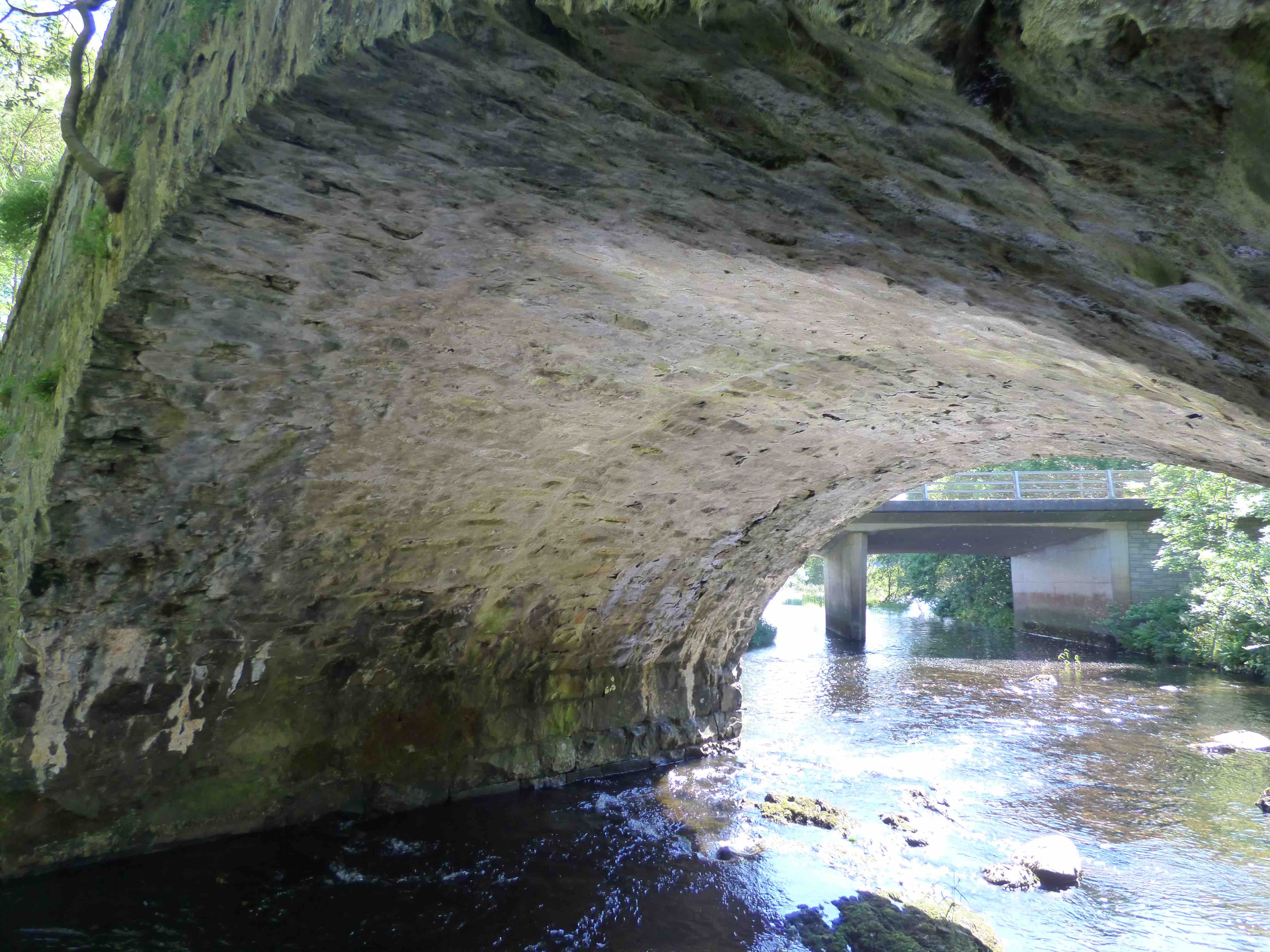
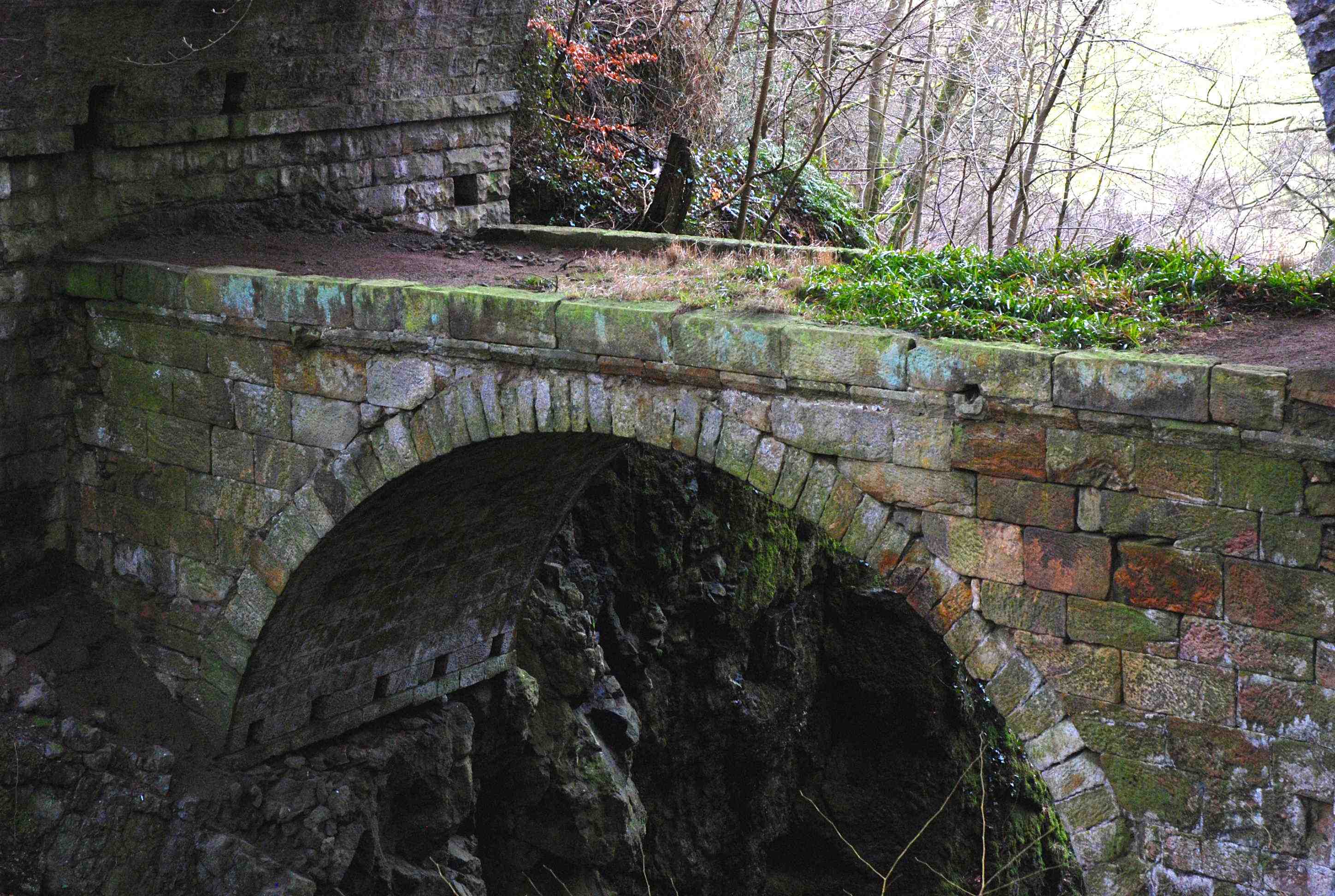
RUMBLING BRIDGE (Devon) Muchart
C.Perth R.Devon 301659,699474
History:1713 Local build . Then the bridge was included in first turnpike from Stirling to Dollar and Dunfermline (1810). OSA Muchart suggests 1723. However, in 1722 Macfarlane describes the bridge and the rapid waters 'very terrible to all spectators'.
Maps:1750
Currently:Two bridges, one superimposed on the other. Older is from 1713; 11 ft wide single semicircular arch; spandrels in block-in coursed dressed ashlar and a horizontal deck. 85 feet above the water.
Second bridge, above, is 1816; this is a beautiful decorative squared coursed rubble bridge with a semicircular arch of elaborate tooled voussoirs. 120 ft above the gorge 5.7 m wide.There is a puzzle here: the older, lower bridge, is a spectacular structure, but not at all characteristic of early 18th century style. Random rubble walls and spandrels would have been more usual. The contracting mason, William Gray from Saline, clearly chose a rather retro style for the time.