Scotland’s Oldest Bridges.
A map-based catalogue of the oldest masonry bridges in Scotland.
S - Alphabetical List
SEAN SPITTAL BRIDGE Glenshee
C.Perth R.Clunie 314883,780008
History: 1749 military bridge. Caulfeild. Coupar to Fort George road which took six years to build. This bridge was an early part of the enterprise.
Maps:1750
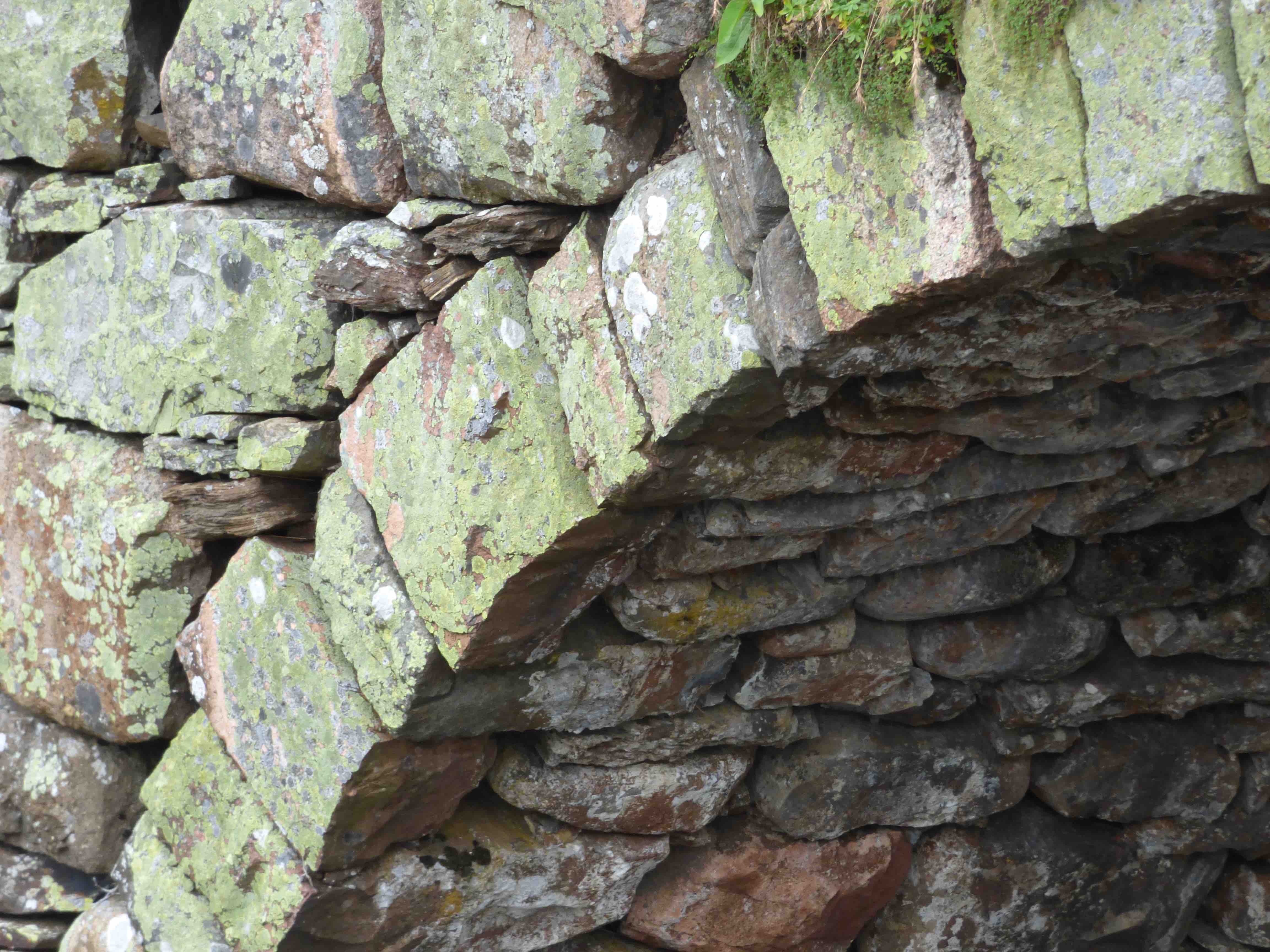
Currently: Original bridge, 500m upstream of the present bridge on the remnants of the military road. Identified by Taylor. Also, location matches that on Roy's road(1750) . Very small simple segmental arch with squared rubble masonry with very little mortar. No parapets. Looks more like an ancient 'horse' bridge than a Caulfeild military bridge, but the location is exact.
photo photo photo.
_______________________________________________
SHENNANTON BRIDGE Kirkcowan
C. Dum & Gall R. Bladnoch 234359,563234
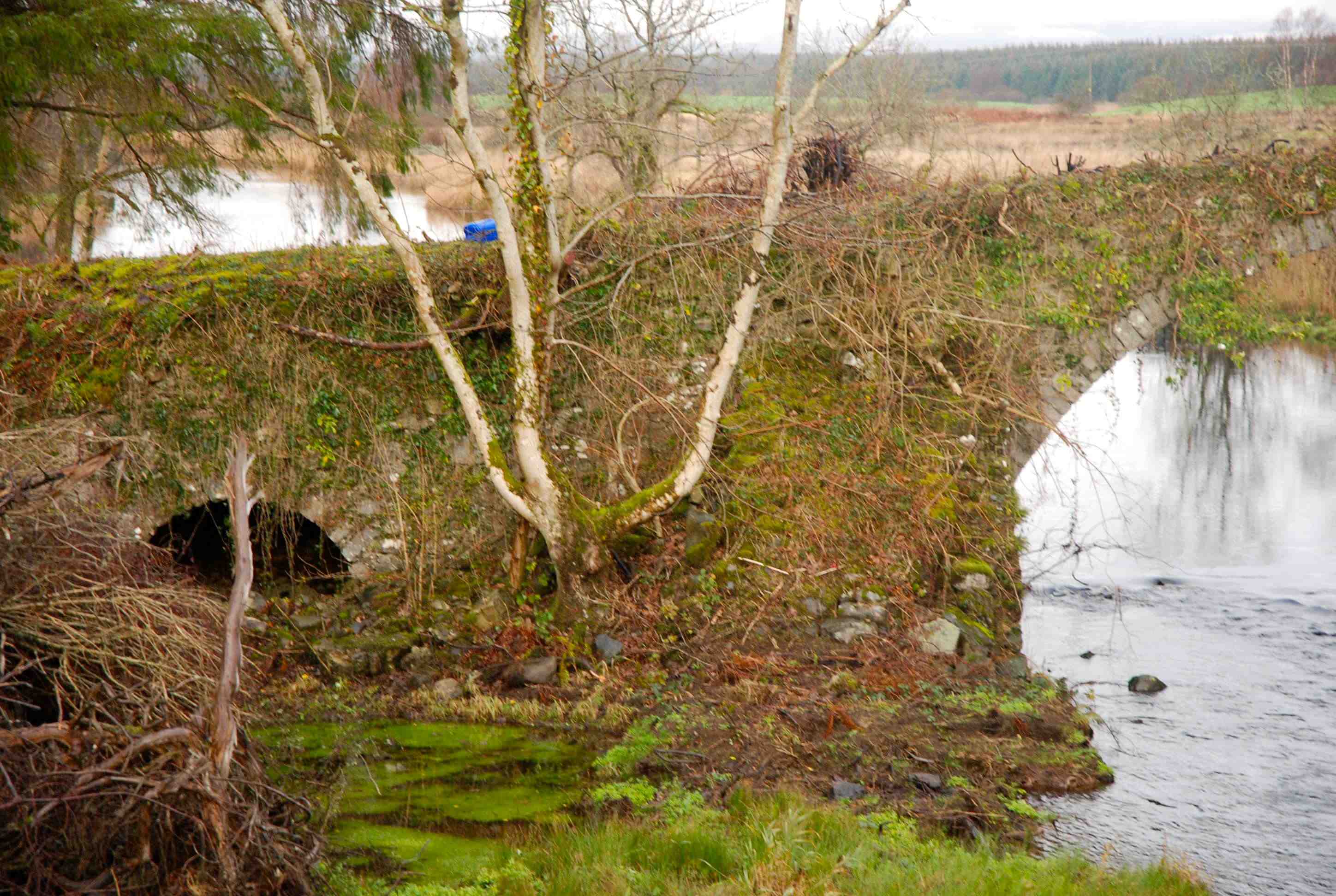
History: Just NE of Kirkcowan there are three versions of Shennanton Bridge due to serial bypasses. The earliest definitely preceded the 1760 military road and is present on Roy. Construction was not included in the 1763 reports. There is no bridge on on Blaeu despite the presence of "Schinen Town" The second bridge is 50 m downstream: a mid 19th century structure with two segmental arches. A third modern bridge is 200m yet further downstream.
Currently: The eastern arch of the old bridge collapsed in 2005 through neglect. The western arch remains very overgrown and without parapets. There is also a small flood arch on the west bank. Slim voussoirs seem intact and large-stone squared coursed rubble spandrels are very weathered and collapsing. .
Maps:Roy(1750) but not on Blaeu although the place name is there and Lincuan bridge is shown nearby at Kirkcowan.
photo photo photo.
_______________________________________________
SHIELS BRIDGE Ladybank
C.Fife R.Eden 328375,708568
Maps:1750 1680 1600 1640
History: Little to be found about its provenance but clearly a very ancient structure which firmly appears on all the maps.
Currently:18th century random rubble but well faced, and very well dressed rubble voussoirs with repairs in brick. Two segmental arches (one flood). It appears as if there was early 19th century widening and a substantial rebuild.
photo photo
_______________________________________________
SHIRRABEG BRIDGE Corrieyairack Pass
C.Inverness Dry stream bedding 255647,793057
History: The military road built by Wade in 1730. Dalwhinnie to Fort Augustus. The road was repaired by Caulfeid (1760), who spent £16335 on bridges. This bridge is characteristically ‘Caulfield’ in style.
Maps: 1750.
Currently: Single segmental random well-dressed rubble haunched arch with rubble voussoirs. 12 ft wide p to p
photo.
_______________________________________________
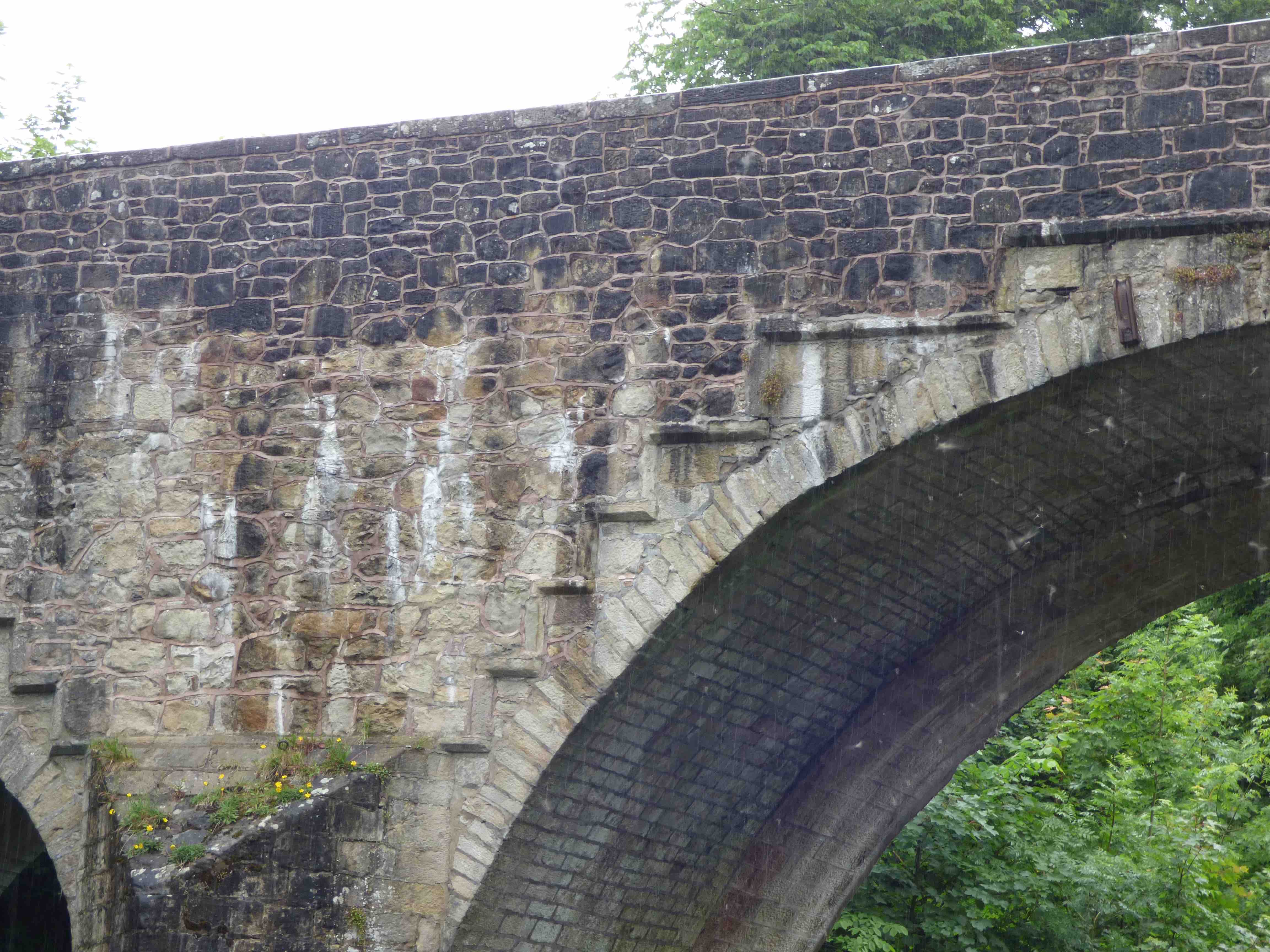
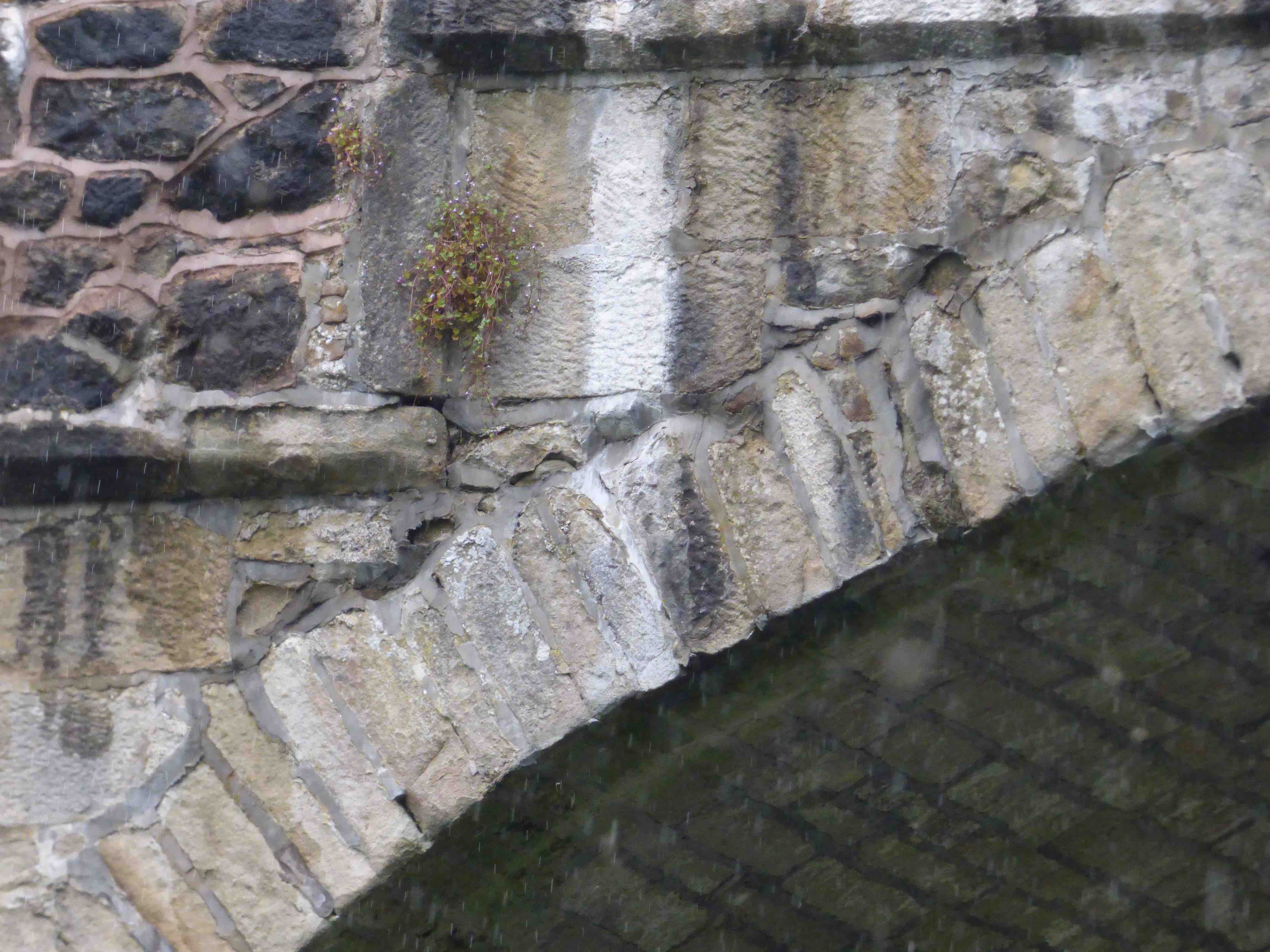
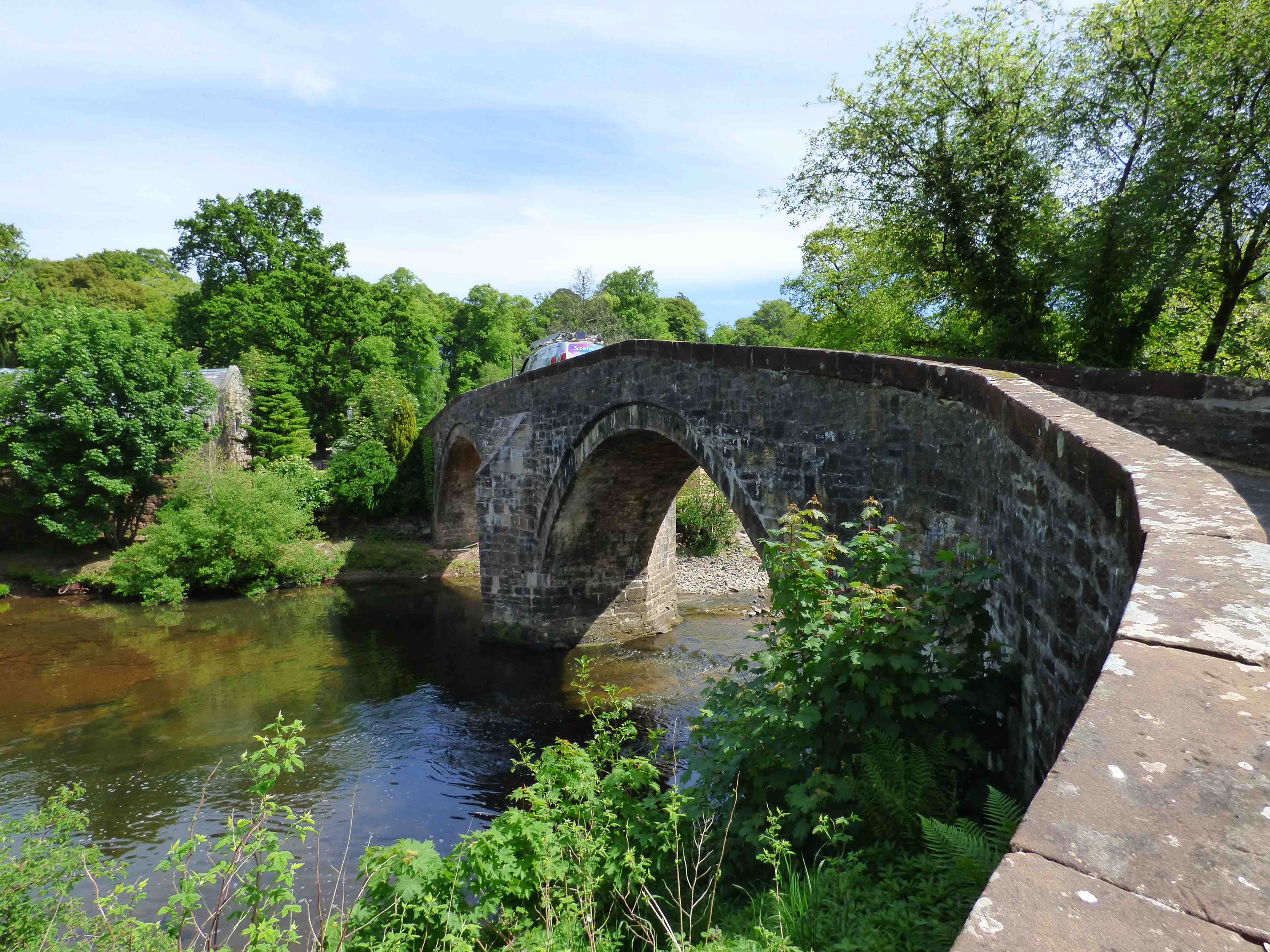
SKIPPER BRIDGE Langholm
C.Dum&Gall R.Esk 337077,583392
History:This remarkable old bridge still carries the A7 to the south. Built in 1693 and was originally about 13ft wide. Macfarlane(1720s) records 'a noble bridge of 3 arches. very large - about 44ft., built about 26years ago'. Widened on the north face to 20ft in 1806 (not by Thomas Telford although he was Langholm's most famous son.) Further restructured in 1926.
Maps:1750(Roy)
Currently: South facing remains are 17th/18thC. Two very tall stilted 44ft segmental spans and a further semicircular flood arch. Masonry vary variable. On the south face the spandrels are in un-faced random rubble mixed with squared and stugged stonework and gallets. It looks tired and hard work to maintain. The voussoirs are rubble and irregular. There is a beautiful stepped corbelling decorative string course. The parapets are from 1806 on both sides and are in un-coursed but faced random rubble. The widening can be seen on the north side. (photo) Tall triangular cutwaters. No refuges. Recessed 19th century. ashlar voussoirs on the north face and no corbelled string.
Link photo photo photo.
_______________________________________________
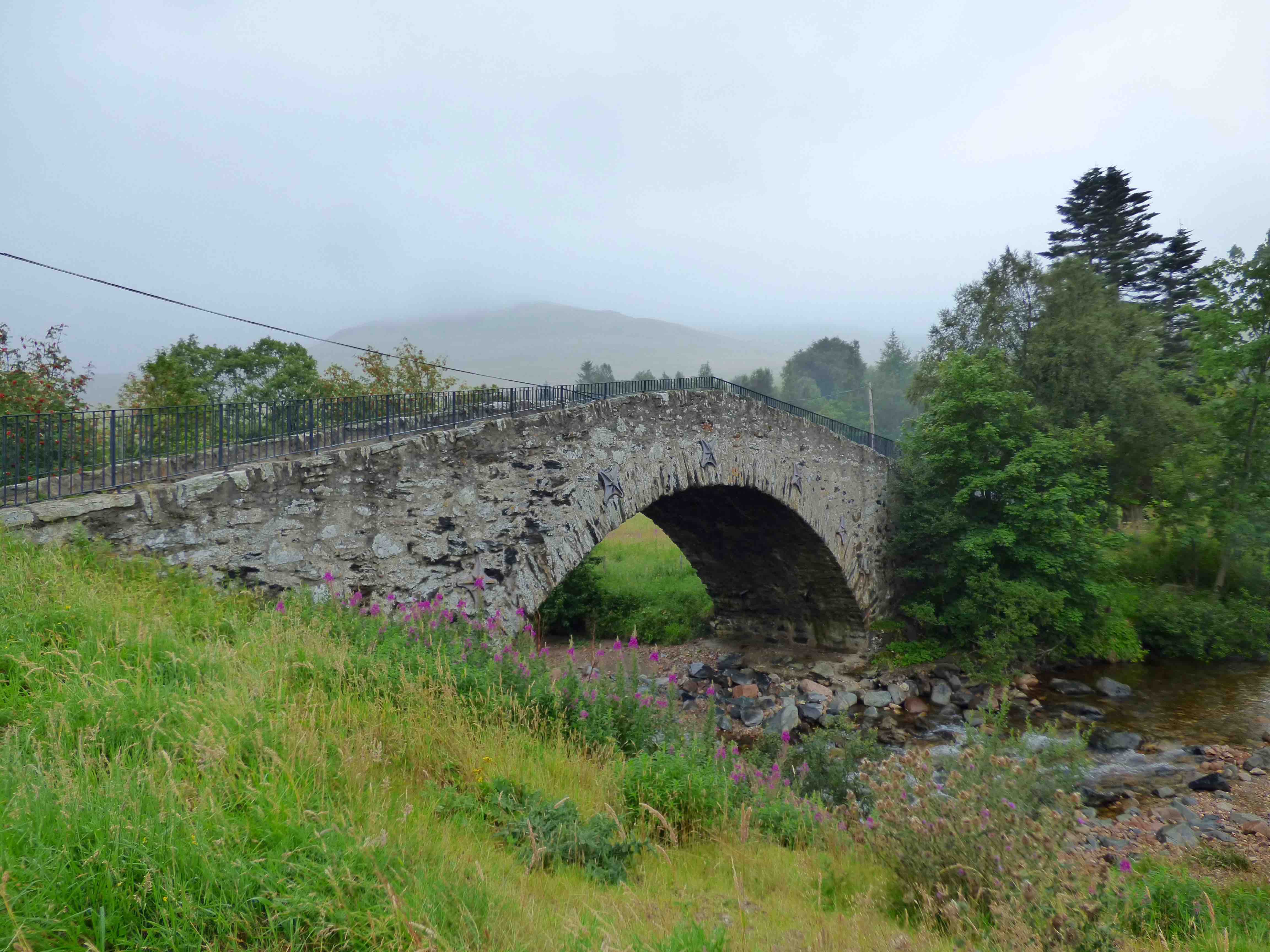
SLUGGAN BRIDGE nr Carrbridge
C. Inverness R.Dalnain 286989,822008
History: This spectacular structure is not the original. Wade's military bridge of 1730 was a two arched structure on the Dunkeld to Inverness road. It had clearly collapsed at an early stage as the present single arched bridge has many Caulfeild characteristics, suggesting a 1740s build. Roy's map shows a very light depiction. Perhaps it was 'down' at the time of the survey. The road north was realigned by Telford in 1809, and the bridge was bypassed. Then, in the 1829 floods, it was swept away. So impressive had it been, that the early Victorians carefully restored it to its former glory, despite the absence of utility.
Currently: Enormous humped, single 65 ft segmental arch with whinstone voussoirs of irregular length. The 45 ft rise of the arch is only a little short of the crown. Parapets almost absent. Spandrels in scarcely dressed random rubble. Peculiar stepped joins of the spandrels on either side of the arch may suggest that the original ramps were preserved from the two-arched Wade bridge. It is probable that these would have also survived the 1829 disaster.
photo photo photo.
_______________________________________________
SNUFF MILL BRIDGE see CATHCART
_____________________________________________
OLD BRIDGE OF SORN nr Mauchline
C. Ayr R. Ayr 254970,626730
History: Built by Rev. Steel.1736-1751, because one of his parishioners drowned at the ford on way to a service. Church is adjacent. Not to be confused with New Brig of Sorn 1871 about one km. upstream
Maps:Roy(1750)
Currently: A beautiful original 18th century two semicircular arched bridge in grey sandstone with cutwaters. Dressed stone recessed arches and un-coursed squared rubble spandrels. Splayed approaches. 9ft wide.p to p.
photo photo.
_______________________________________________
SPEAN BRIDGE see HIGH BRIDGE OF SPEAN
_______________________________________________
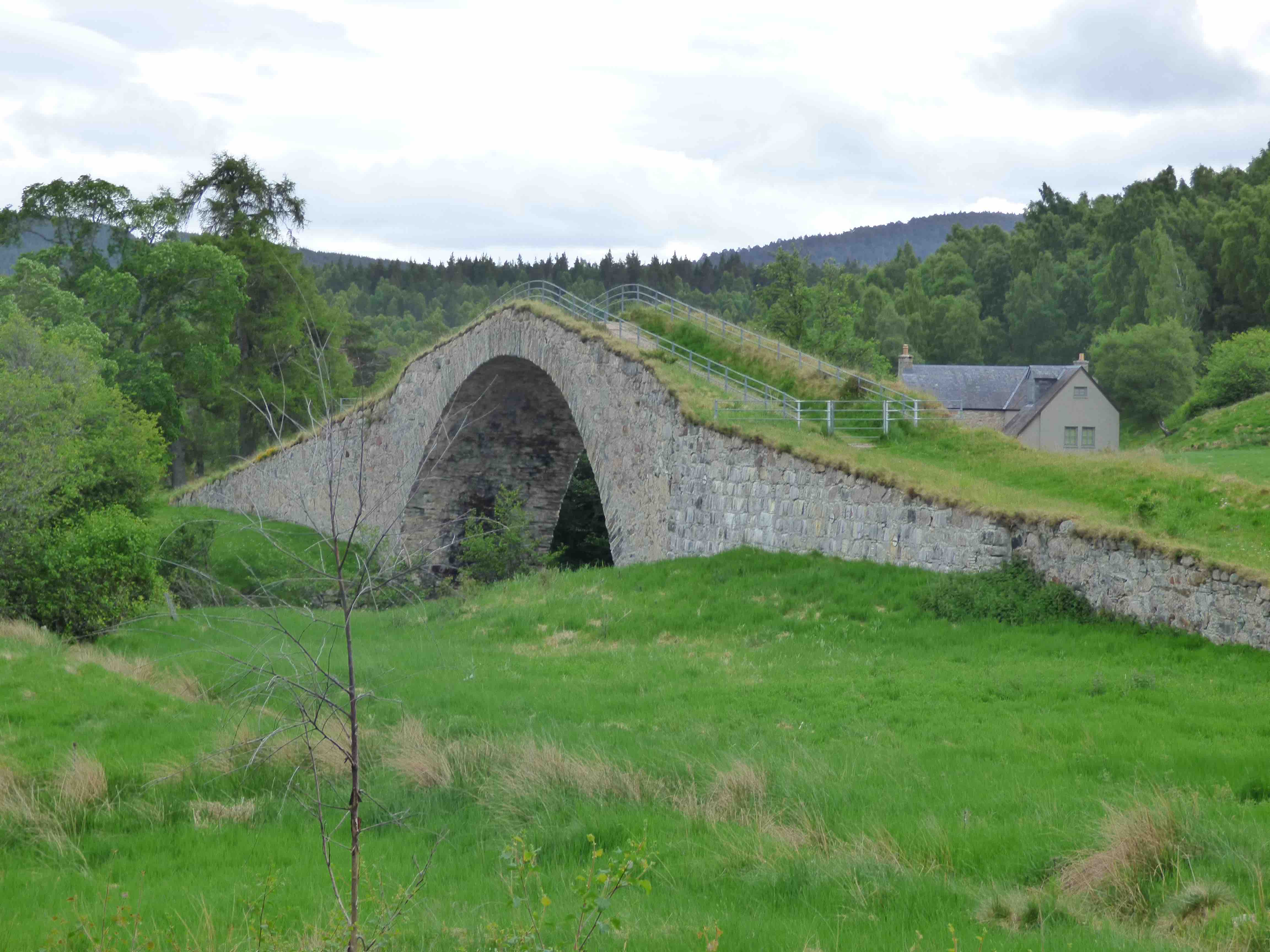
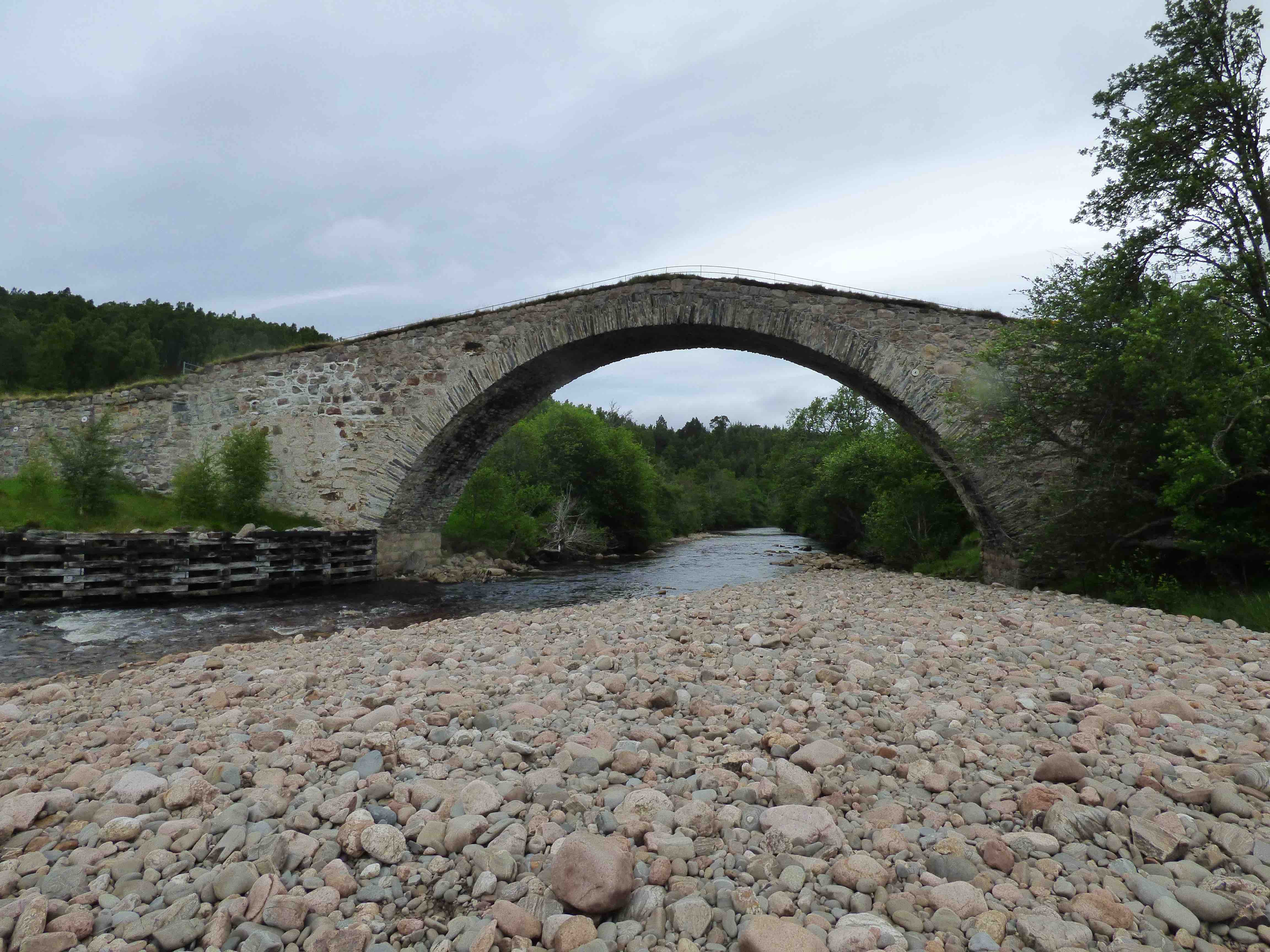
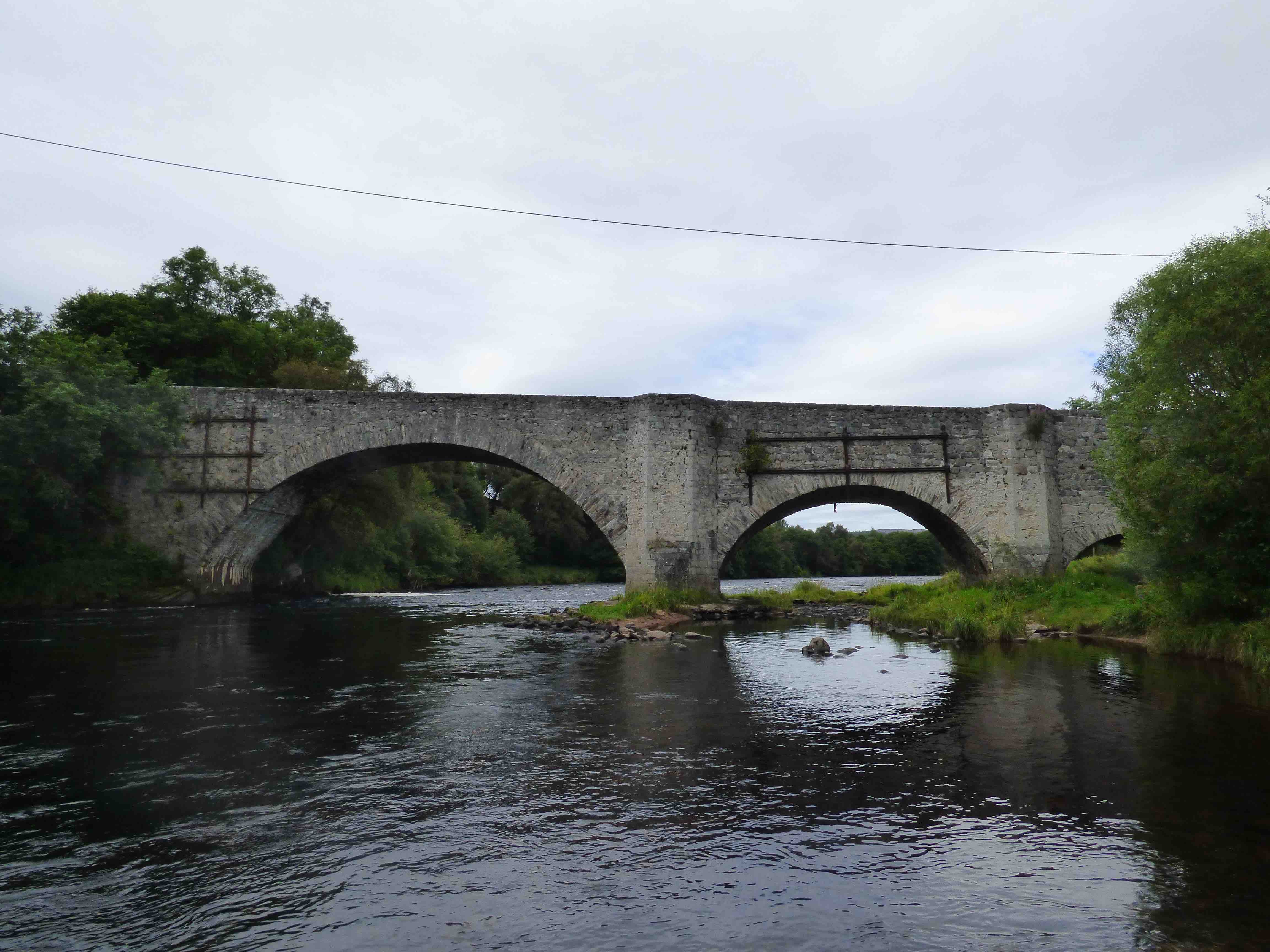
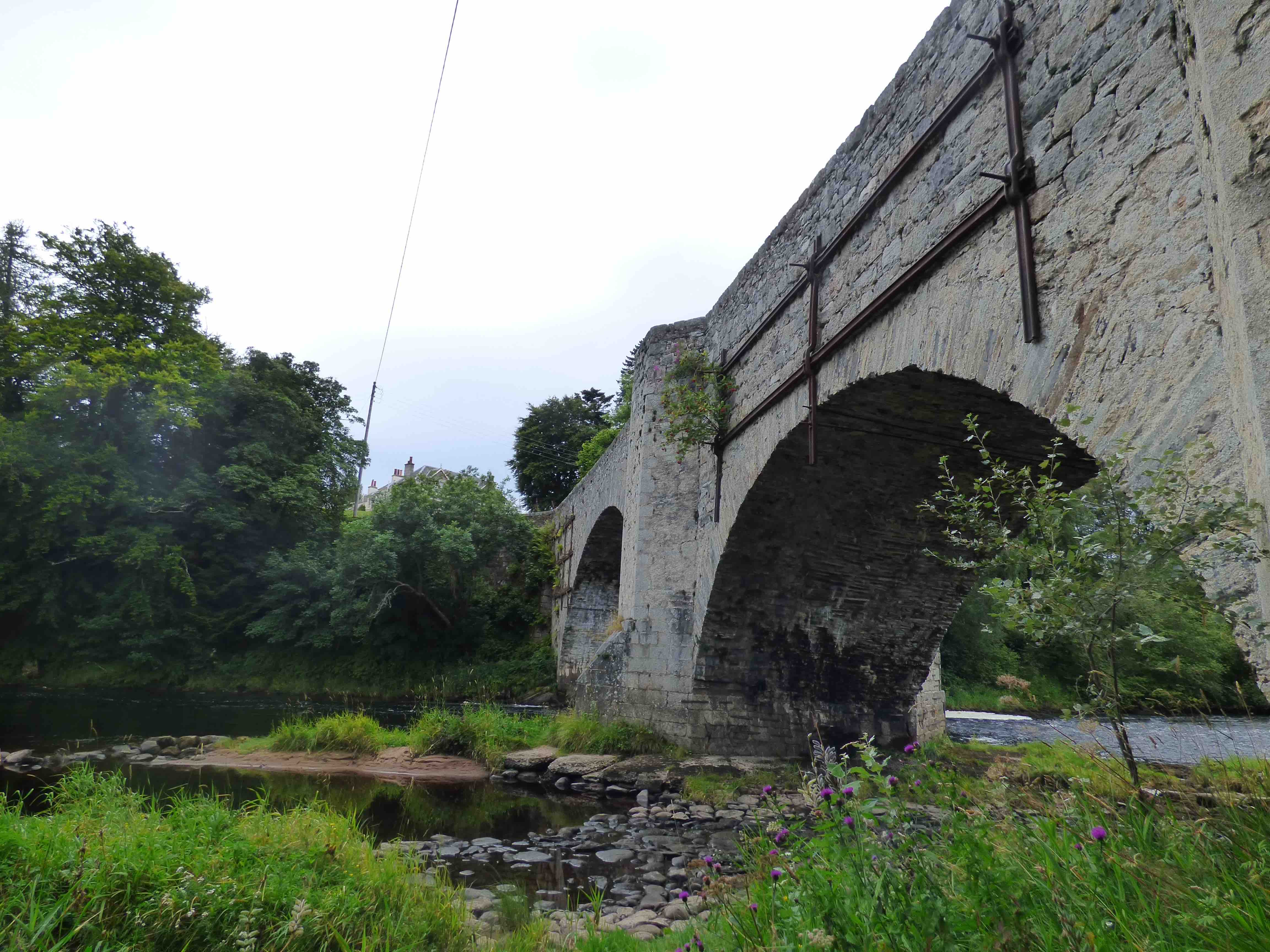
OLD SPEY BRIDGE Granton on Spey
C.Inverness R.Spey 303977,826333
History: Roy's survey was a year before this bridge was built but there seems to be some sort of crossing (perhaps a ford or ferry) on his map. Caulfeild's road from Coupar to Fort George was completed to this point in 1754. This military bridge was part of it. The smallest arch fell in the 1829 floods. Bypassed in the 1930s by a concrete bridge upstream.
Maps:1750
Currently: Three span lop sided bridge with the largest segmental arch (80ft) at one end. Very high spandrels in squared coursed rubble with iron cramping rails. Cutwaters rising (a long way) to refuges. Parapets in random rubble. Voussoirs are wide and in rubble and whinstone. Date-stone attributes the build to Col Charles Hay of the 33rd.
photo photo.
_______________________________________________
SPITTAL OF GLENSHEE BRIDGE Glenshee
C.Perth R.Shee 310903,770108
Maps:1750
History:1749 military. Caulfield. Coupar to Fort George road which took 6 years to build. This was on an early part of the construction work.
Currently: Classic Caulfeild single hump backed sometimes squared mainly random rubble bridge. Single segmental arch with radially aligned voussoirs in whinstone.
photo
_______________________________________________
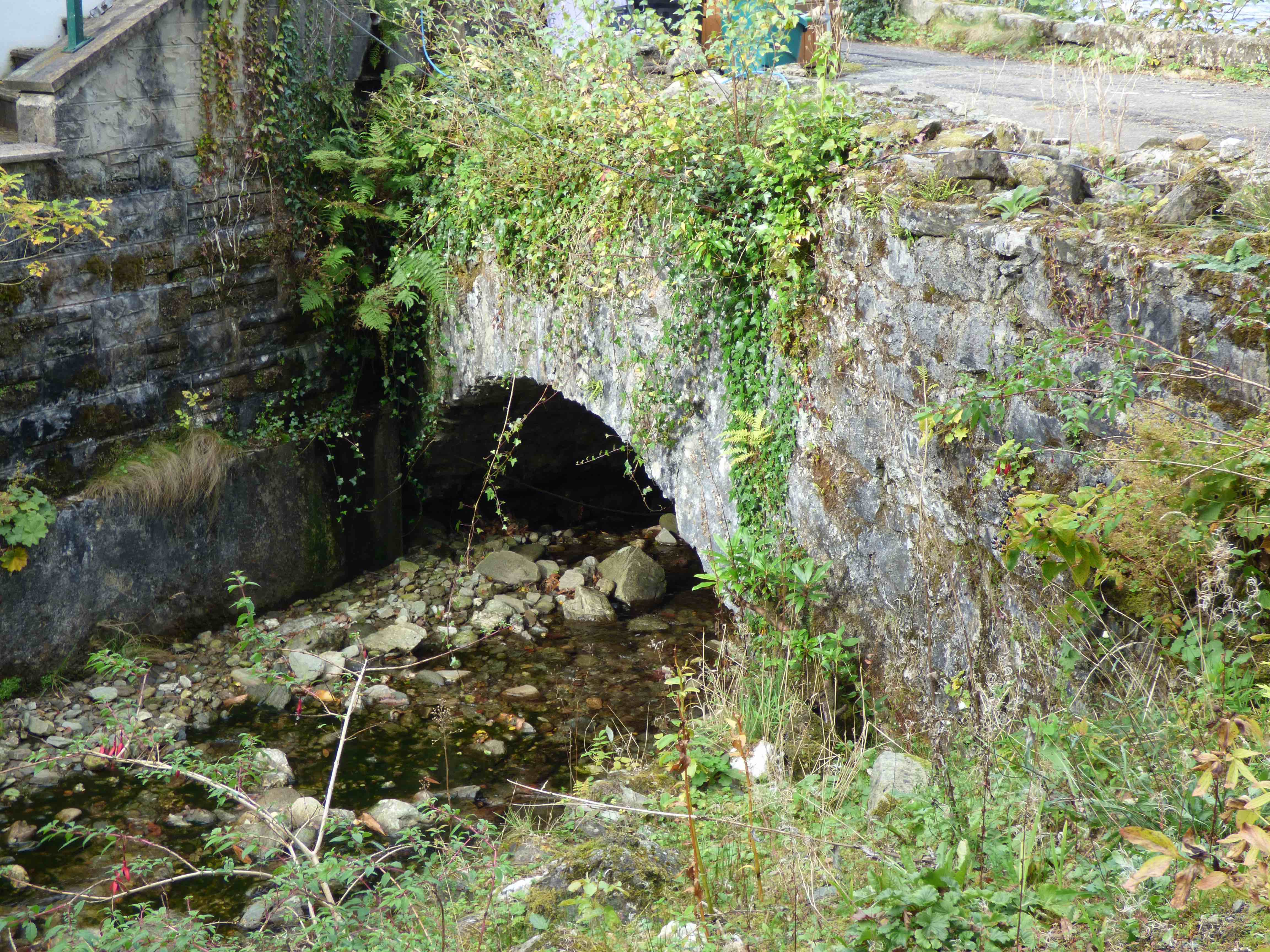
STEPENDS BRIDGE Kilmacolm
C. Renfrewshire Green Water 234508,667894
History: named as Drayhill Bridge on Roy. Mentioned Crawford and Semple 1775.
Maps:1750(Roy)
Currently:This is an early 18th century bridge. However, it has clearly been taken down and rebuilt using the original masory, probably in the late 19th century, since it looks very narrow on the First Edition OS map.
Maps: 1750 Roy.
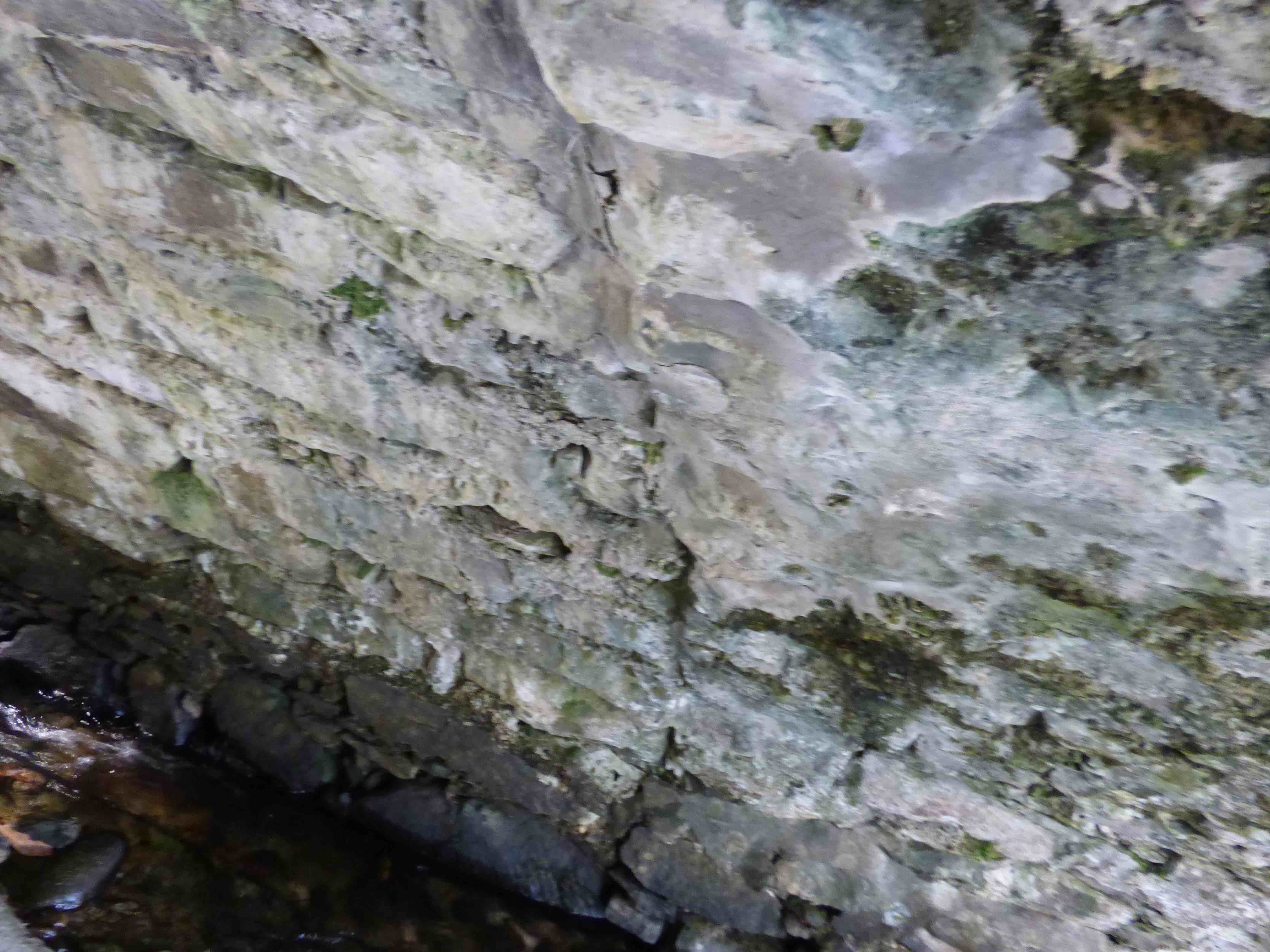
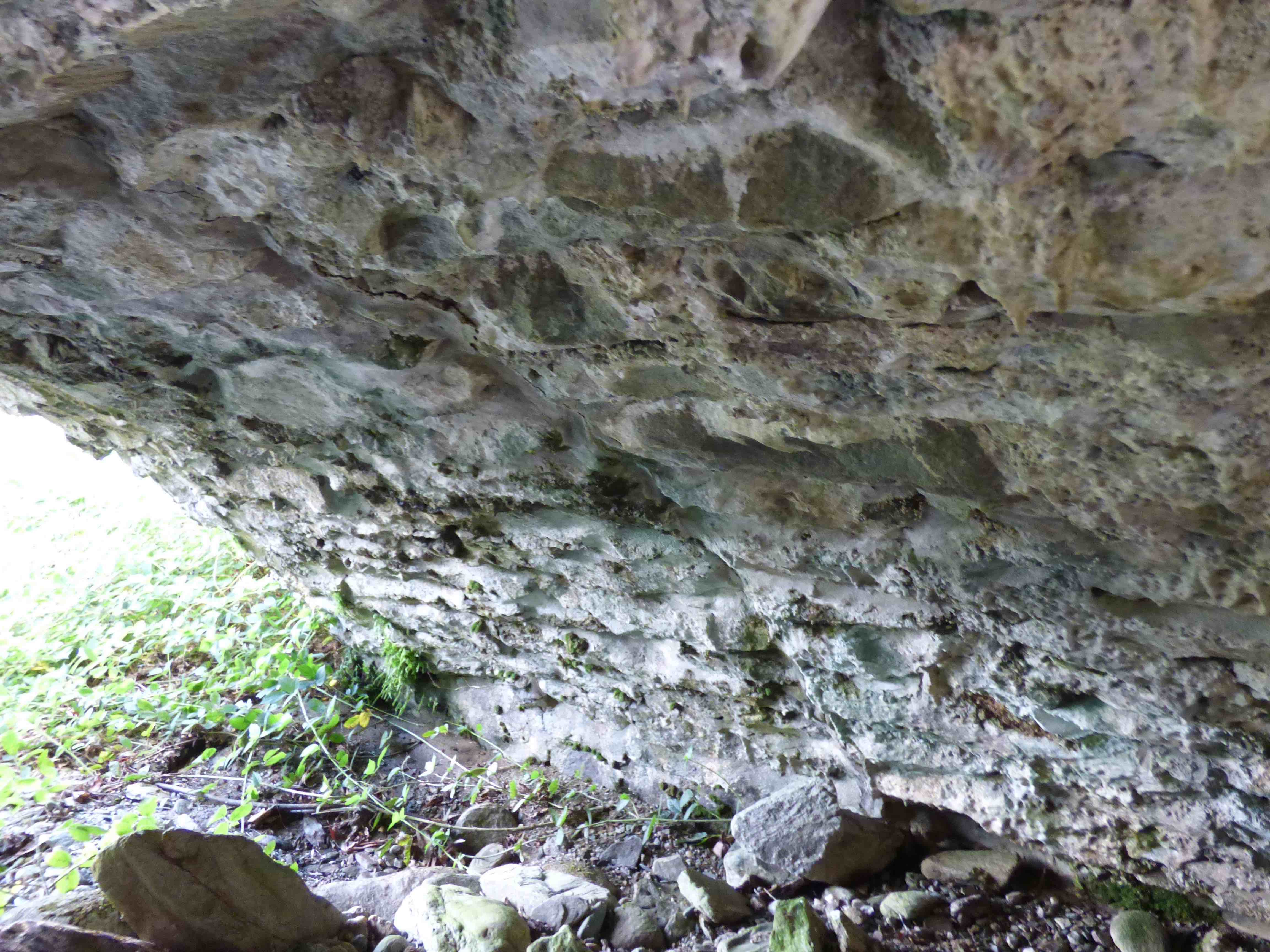
Currently: Wide single segmental arch in very well dressed ashlar which confirms a rebuild. Rough poorly-squared random rubble spandrels in the original stone. The width is 22 ft parapet to parapet with two full lanes of traffic. View of the soffit was not possible. No string course.
Photo.
_______________________________________________
STIRLING Old Bridge of Stirling.
C.Stirling R.Forth 279705,694563
LINK to FULL SUMMARY.
History:13th century.
Maps:1750(Roy) 1640(Blaeu) 1600(Pont)
Currently: probably early 15th century.
_______________________________________________
STOW BRIDGE Lauder
C. Midlothian Gala Water 345837,644394
History:1654.Recorded as a packhorse bridge, perhaps because of the low parapets. However, Hinchcliffe might disagree, particularly because of the width. In fact it may be a rather late 'collection' bridge, as it was built by the kirk session of adjacent St. Mary's Church, which itself dates from the 15th century, and has a long history of serial re-building, dating back to the 13th century. The bridge may have been used subsequently, by pack trains, as it lies on the ancient road north from Gala to Edinburgh.
Maps:1750(Roy). Not on Blaeu. Roy's map shows three separate roads at Stow, going North to South. The bridge was on an interconnection route.
Currently: Seventeenth century. Sem-ruinous, three segmental arched, humped, undressed random rubble bridge, which is part of a causeway. Ten feet wide, parapet to parapet (packhorse bridges are expected to be 6ft wide or less). It has beautiful wide arches with rubble voussoirs. The main span is 47ft. It is 125 ft. long. There is buttressing on the north facade and small triangular cutwaters, both upstream and downstream. The approaches on the lesser arches have collapsed away on the north aspect. There are odd squinch-like features at the outer ends of the spandrels (photo). Parapets are very low, but this may not be an original feature. A modern lime concrete structure now supports the primary flood arch, which is unfortunate.
photo photo photo photo.
_______________________________________________
STRAEBRIDGE Dalmally.
C.Argyll R.Strae. 214582, 729410
History:Part of an old Inverary to Bonawe road which was probably built by the military (Taylor) but paid for by the Commission of Supply. The road was completed in the 1750s but there is no record of a bridge. According to Taylor, the bridge was preceded by a ford.
Maps:1750. Roy's map gives the impression that his road and bridge were earlier than the military intervention.
Currently:small segmental gently hump-backed bridge in well dressed random rubble. Rubble voussoirs of irregular length. The bridge appears in very good condition and may well be later 18th century. (Photo by D.Bowler. DES 2000.)
_______________________________________________
STUCKGOWAN BRIDGE Loch Lomondside
C.Dunbarton Small unnamed burn 232653,702839
History:1745 Military. Caulfeild. Dunbarton to Inverary. However, the road was restructured by Telford in the early 19th century and revised again in the 1930s before being completely bypassed in the 1980s by the modern A82.
Maps:1750
Currently:small segmental random uncoursed rubble bridge on old road a little to the east of the A82, on the shore. Its most interesting feature is that it has been widened (photos 2 and 3) and that the downstream facing looks less well finished (photo 4 and 5). The older part is only 6 ft wide which suggests an ancient packhorse type bridge preceding a 12 ft wide Caulfeild or Telford parallel widening on the upstream side: more probably Caulfeild because Telford is more likely to have replaced the lot rather than extend. The bridge is in a private garden and is graced by an adjacent ruined telephone kiosk.