Scotland’s Oldest Bridges.
A map-based catalogue of the oldest masonry bridges in Scotland.
HADDINGTON see NUNGATE BRIDGE
_______________________________________________
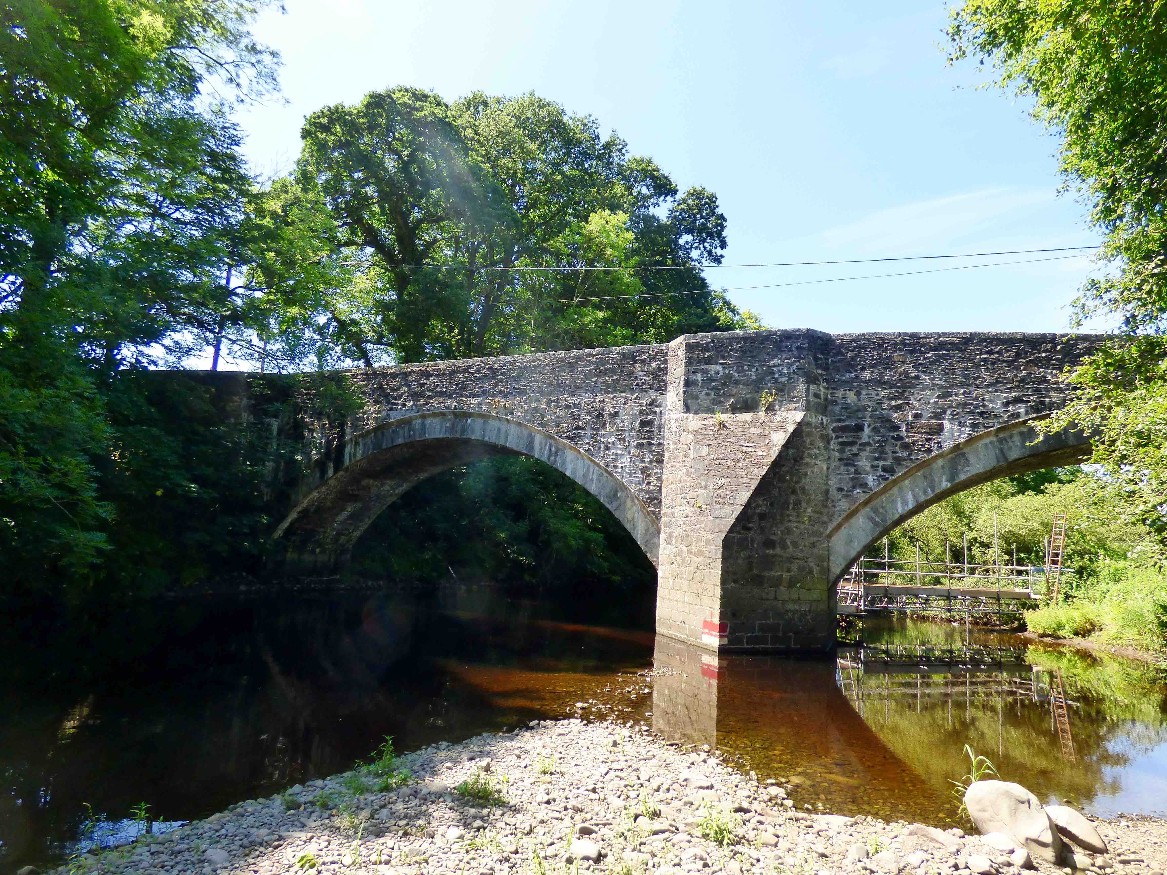
HAUGH BRIDGE (of URR ) Castle Douglas
C. Dum & Gall Urr Water 280542,565978
History: The bridge was part of the 1764 military road from Carlisle to Portpatrick. However, it is present on Roy's map (1750) so clearly there was a predecessor at the same location. There is no mention of the costs in Taylor's 'Military Roads' so it is possible it was taken-over, as was Bridge of Dee and Dumfries Bridge. It seems that maintenance was transferred to the Commissioners of Supply from 1790, and from 1805, to the Stewartry Road Trustees. Very recent floods and damage (Dec.2015) requiring repairs.
Maps:Roy(1750). Described as "Haw" Bridge.
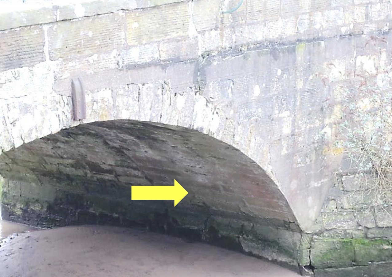
Currently: This is an 18th century bridge with two segmental arches. Spandrels in rough pitch-dressed random rubble with no coursing. However, the beautifully dressed recessed voussoirs are in ashlar and clearly come from a later date: probably an early 19th century rebuild. The single pier, cutwater and refuge also may be rebuild. Nearby Spottes Bridge is not on Roy's map as it was not built until the military road arrived.
photo photo photo.
_______________________________________________
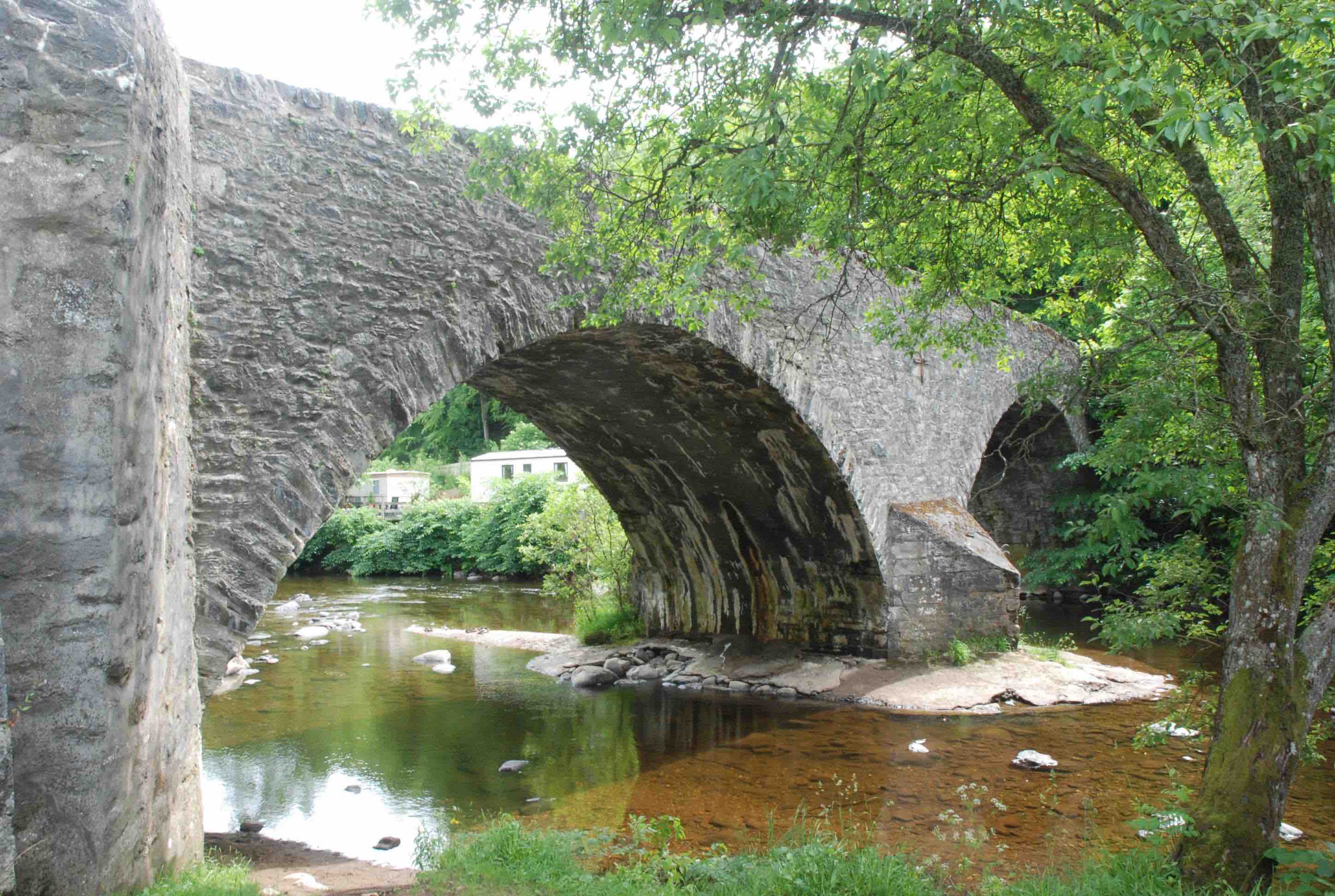
HIGH BRIDGE OF KEN nr St Johns of Dalry
C.Dum & Gall Water of Ken 261962,590194
History: Located at the College Linn and Waterfalls. No further information about history or provenance but there is a country dance named after it. Firmly on Blaeu.
Maps:Roy(1750) Blaeu(1640)
Currently: This is an 18th century bridge. Two almost semicircular flush arches in pitch-dressed random rubble, sometimes brought to course. Rubble voussoirs. Very wide central pier on rocks. Horizontal decking. Parapets are more recent. Solid well dressed coping stones. Narrow: 10ft wide p to p.
Link photo photo photo.
_______________________________________________
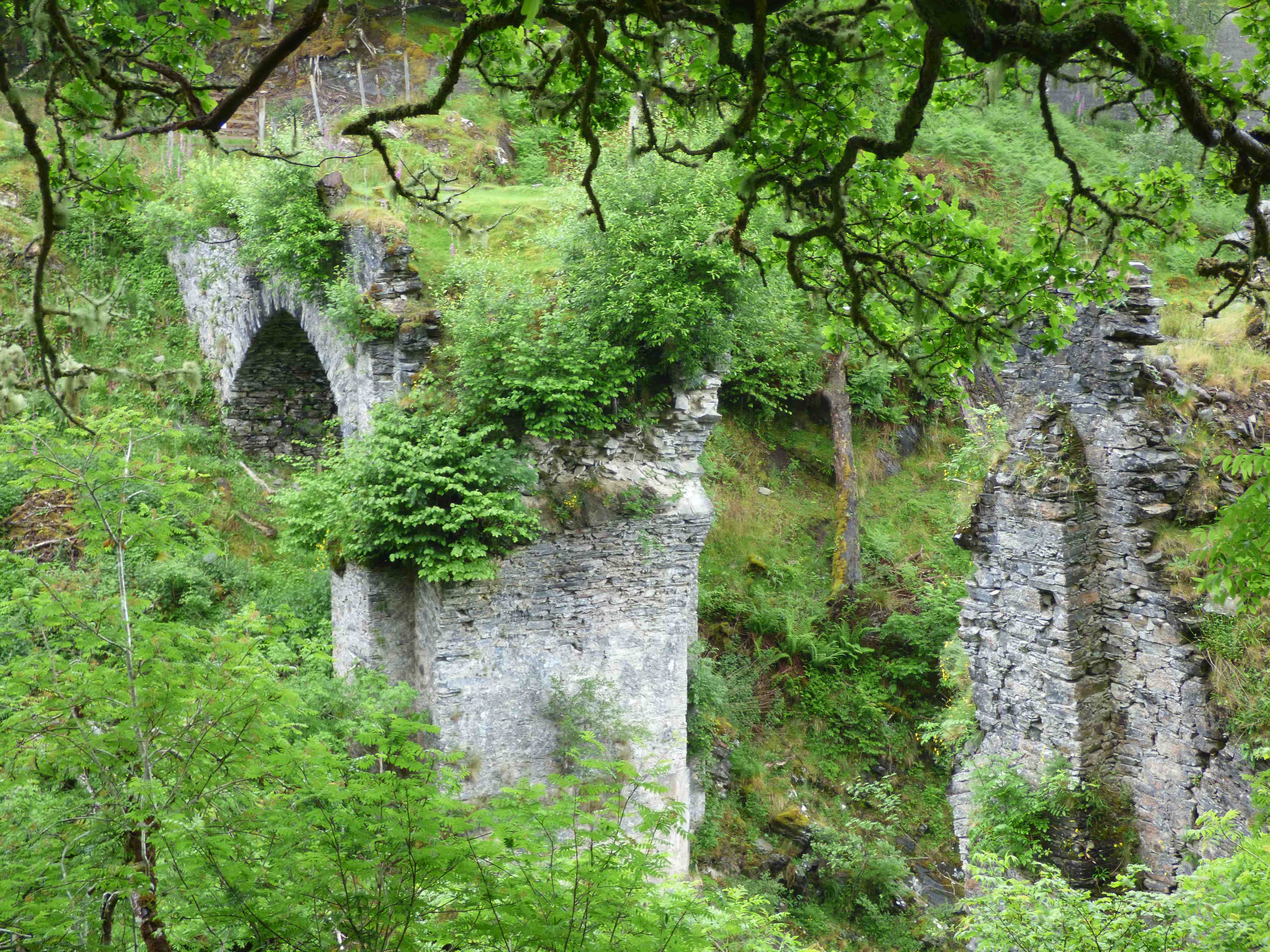
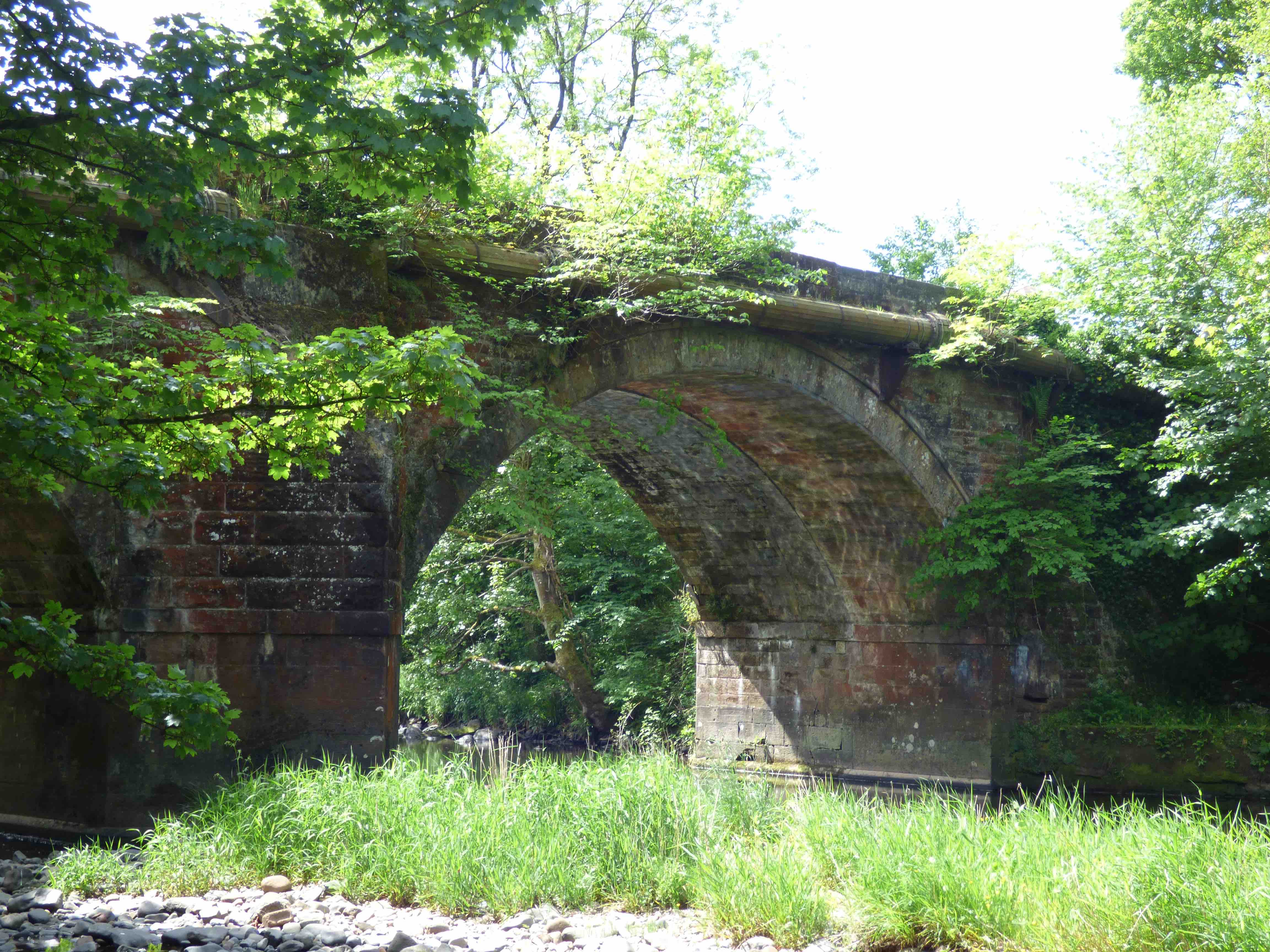
HIGH BRIDGE OF SPEAN
C.Inverness R.Spean 220064,782097
History: built in 1736, some 6 years after the completion of his road, this is a very impressive Wade bridge. It cost £1087 to build. It is on the Fort William/Inverness Road, and was the location of the first encounter of the '45 rebellion; eleven MacDonalds held the bridge against 85 Hanoverian government troops. One arch collapsed in 1915 and a second in 1979.
Maps:1750
Currently: Quite stunning. Has to be seen to appreciate the enormous proportions. Ruined and overgrown. Only the smaller east arch survives. Previously, 3 large semicircular flush arches on enormous piers, elevated 80 ft above the river. Whinstone voussoirs of great length, though regular, and roughly dressed random rubble spandrels. The voussoirs appear to be un-aligned. Centre arch was 40ft. The descending military road can still be found in the undergrowth (photo3). The bridge was bypassed by a Telford Bridge, built upstream in 1818.
photo photo photo.
_______________________________________________
HOWFORD BRIDGE nr Mauchline
C.Ayr R.Ayr 251556,625398
History:Build 1751 by Commissioners of Supply. Cost £137. Repaired in 1773 by James Armour who was later the reluctant father in law of Robert Burns. Clear evidence of widening on the soffit; presumably 19th century. Bypassed (spectacularly) to the east in 1962 (photo 3 is taken from the old bridge).
Maps:Roy(1750)
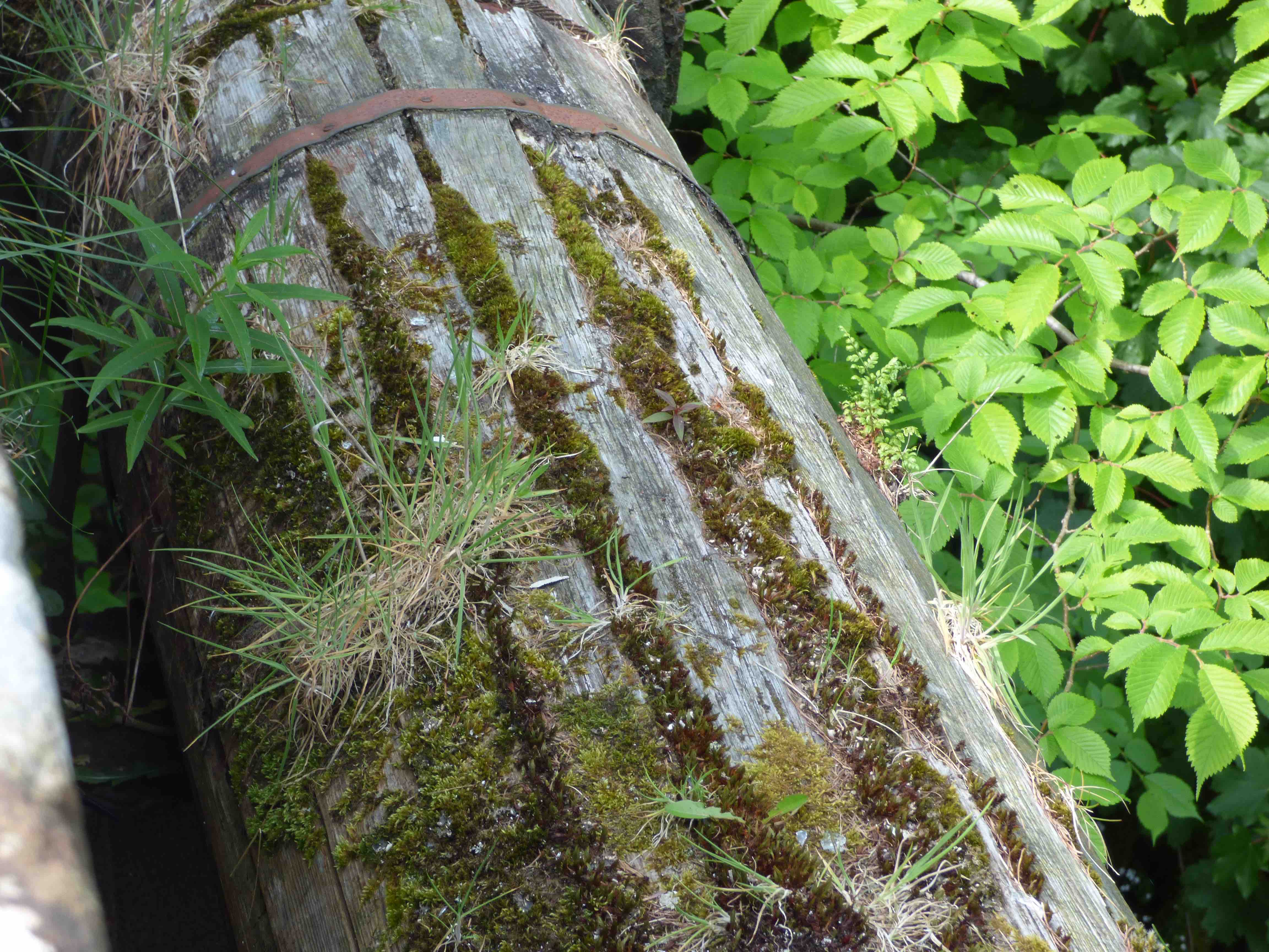
Currently:Appears to be late 18th century. Two segmental arches with cutwater. This classic Comm of Supply structure has typical recessed dressed voussoirs and well dressed coursed rubble spandrels and abutments. It must have been very new at the time of Roy's survey. The old mains pipe below the parapet is in wood (photo).
_______________________________________________
HUNTLY CASTLE BRIDGE Huntly
C.Aberdeen. R.Deveron 353267,840857,
History: This bridge is adjacent to Huntly Castle, a 13th century ruined stronghold which was extensively remodelled in the late 1500s and the late-1600s. The bridge is mentioned in MacFarlane in 1723. Also known as Elgin's Bridge. OSA in 1792 reports on a very old bridge over the Deveron. Clearly seen on Gordon 25 and on Blaeu. In 2014, collapse of the S.W. wing triggered intervention and a full assessment. This revealed that the structure was older than had been thought. Masons' marks were found on some stones which might suggest a medieval origin. Also, a cobbled decking lay under the tarmac and exploratory pits in this revealed medieval pottery shards. The narrow width of the bridge (8/9 ft) and slight chamfering of the ashlar voussoirs seem to suggest a much earlier date than was thought. Fifteenth century has been suggested (T. Robertson: personal communication) which might relate to a possible rebuild after the sacking of the castle in 1452. However, the arch shape rather suggests a later period than that and we know that the 6th Earl of Huntly largely rebuilt the castle in 1599. There is no record for bridge work in either period. Coarser stonework on the spandrels and walls suggests considerable 18th century repairs.
Maps: Roy(1750) Blaeu(1640) Gordon(1636)
Currently: It looks more like a late 16th century bridge but there is certainly evidence of remnants which are very much older than that. The slightly humped single semicircular flush arch is about 40 ft span. Rubble voussoirs. The spandrels are in lightly coursed, faced rubble but the wing-walls are in undressed random rubble. These may be later in date. The parapet copings are quite decorative. The S.W. wing is still under repair(2021). There are pattress-plates which were mentioned in the 1792 OSA. Vehicles are now banned.
_______________________________________________
INGLISMALDIE BRIDGE see UPPER NORTH WATER BRIDGE
_______________________________________________
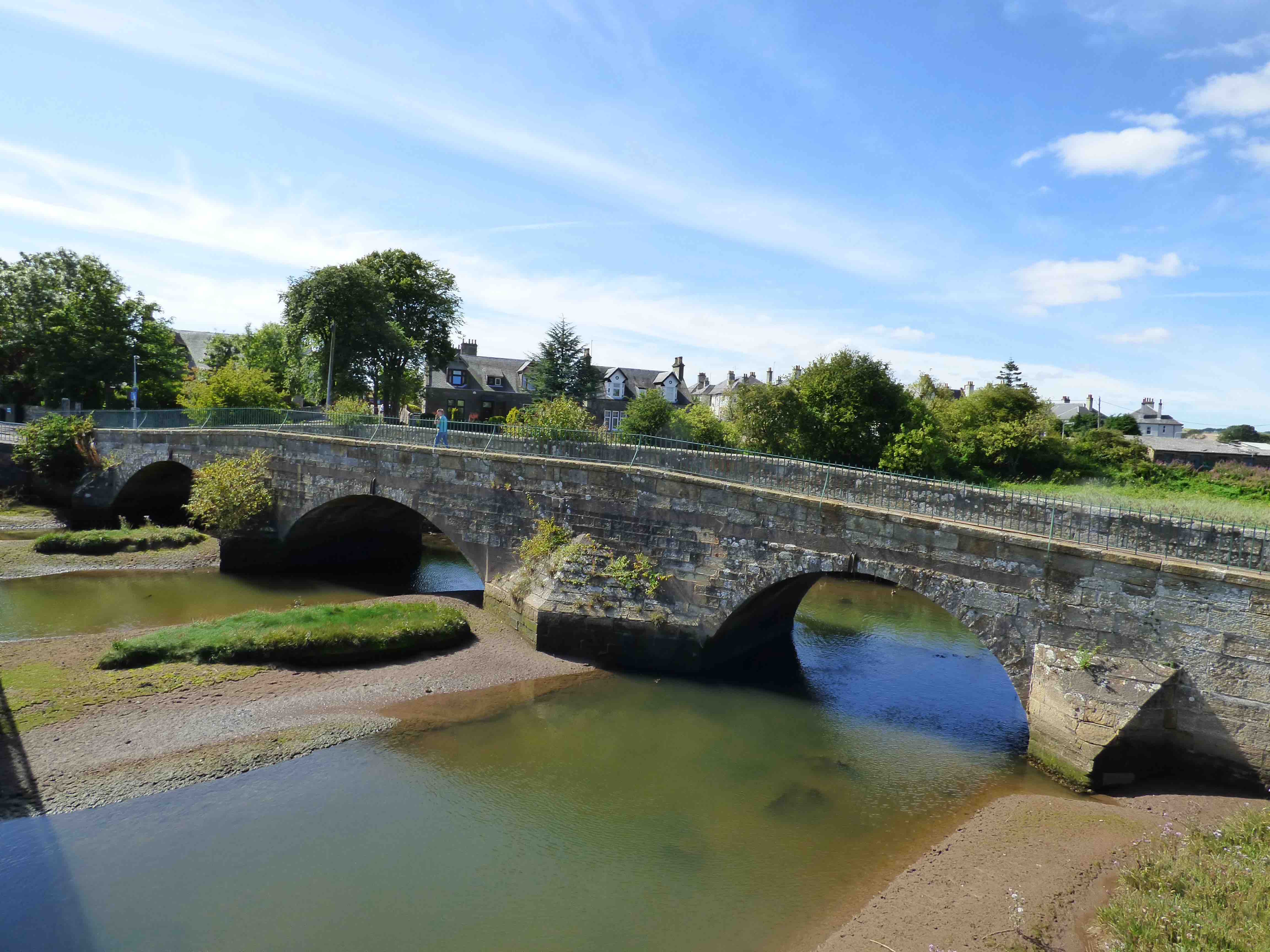
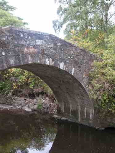
INNER BRIDGE Leuchars
C.Fife R.Mottray 345003,719777
History: Two charters (St.Andrews Liber) dating from the early 1200s mention a bridge over the 'Modrith'. Is this Mottray? Present on the oldest maps and repaired in 1598. Mentioned in several 16th and 17th century documents.
Maps:1750(Roy) 1680s(Adair)1600 (Gordon54) 1640 (Blaeu)
Currently:16th century bridge with three arches: very low and all different: one semicircular and two segmental which is unusual. Iron tie-rods at the crowns. Very weathered, coursed ashlar spandrels with modest string course and well worked more modern parapets and capstones. Huge central cutwater. Width is 5m parapet to parapet. This is unusually wide. However, a Tom Robertson photograph ( Old Bridges of Great Britain and Ireland) reveals clear evidence of widening; the original width was around 2m. This justifies a conclusion of a pre-reformation bridge with later restructuring, rather than a full 18th centurty rebuild. Mottray Water is a relatively small river with a wide estuary which may explain the tolerance of such a low profile.
photo. photo
_______________________________________________
INNERLEITHEN CUDDY BRIDGE
C.Peeblesshire Leithen Water 333327,637208
History: Cuddy Brig.1701. Built with vacant stipend money to permit parishioners to get to church. As such it could be considered a late 'collection' bridge. The church was on the west bank of the burn. The bridge became the main crossing point, east to west, on the road along the north bank of the Tweed. It was bypassed downstream by the turnpike in the 1770's and now serves as a footbrige accessing the Pirn Hill. Parapet and upper courses were rebuilt in 2006.
Maps: Doubtful on Roy and not on Blaeu or Pont. However it appears on William Edgar's 1741 map and its build is well documented.
Currently: Beautifully preserved early 18th century bridge in roughly coursed undressed random rubble with rough rubble voussoirs of unequal length. Stilted segmental arch. 9 feet wide. Splayed parapets with roughly dressed coping (recently reconstructed).
_______________________________________________
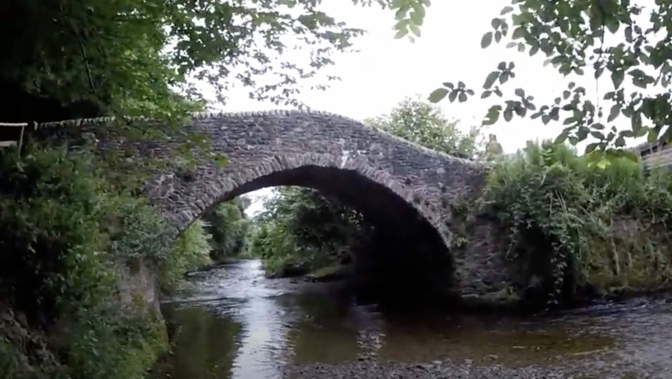
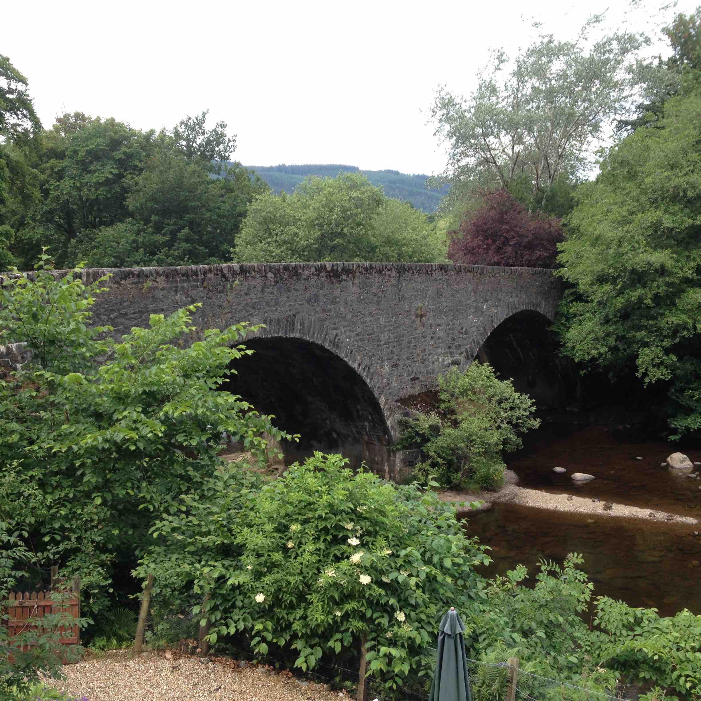
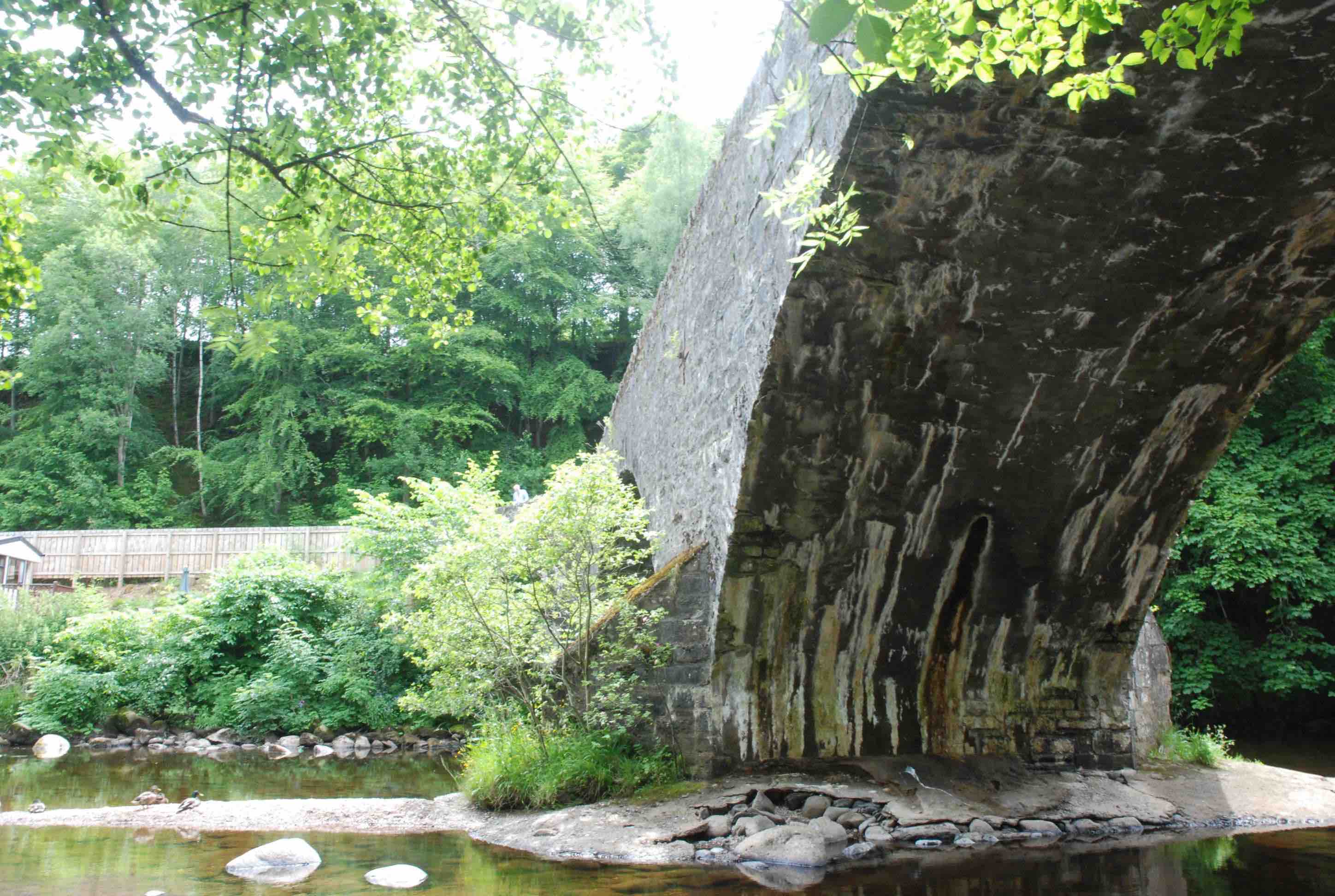
INVER BRIDGE Dunkeld Bridge
C.Perth R.Braan 301785,742061
History: Built in 1740. This is a county bridge on a road which existed, from Perth to Dunkeld, before the military took over in 1761. This bridge was swept away while still being built and was then rebuilt by Dunkeld masons. Prior to 1740, there were two ferries at Dunkeld, one over the Inver and one over the Tay. The Inver Bridge became a key crossing of the Tay complex in 1740, though the Tay Bridge was not built till much later. Confusing though it is, from this point, until the Tay Bridge was built (1808) , the Tay ferry was referred to as the Inver Ferry.
Maps:1750 1600.
Currently: 1740. very solidly built. Two flush segmental arches plus one flood arch. Roughly coursed random rubble without a string course. Voussoirs unequal rubble, but appear to be aligned. Very large buttresses on abutments. Widening is not visible on the soffit. Cutwaters. Almost horizontal decking.
photo photo photo.
_______________________________________________
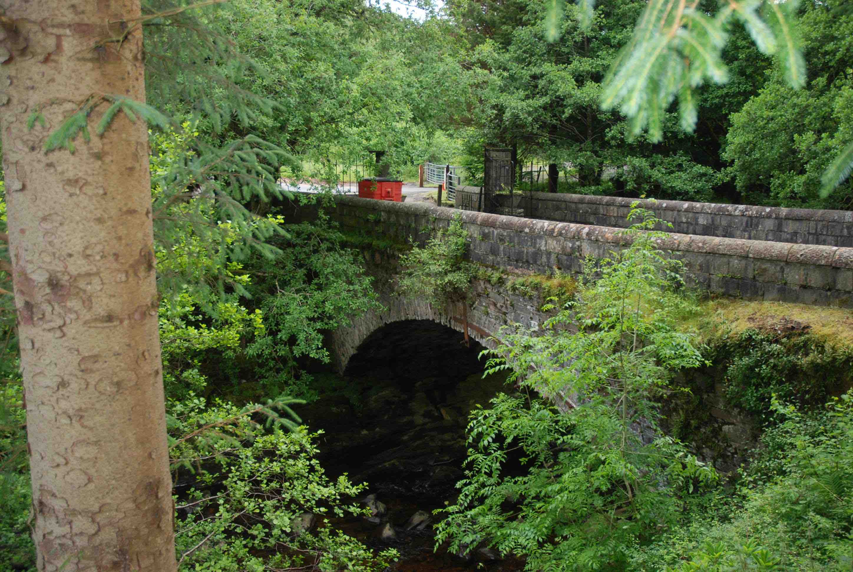
INVERBEG BRIDGE Loch Lomondside
C.Dunbarton Douglas Water 234500,697947
History:1762 plaque. Built by the County. However, the military road came through here, supervised by Willam Caulfeild, in 1745. It may be that the military accepted and incorporated a pre-existing bridge. Certainly it appears on Roy in 1750.
Maps:1750
Currently: Late 18th century on the upstream side.( 12-14 ft.) Extended by about 6 ft. in 1914 (plaque). This is not parallel widening; there is a 9 inch step between the two sections on the soffit. Segmental arch with well dressed voussoirs (possibly whinstone on the older facing ) and partially coursed dressed squared rubble spandrels. More recent parapets and coping which are not flush with the walls. A strong string course only on the older facing. This is a very well built later 18th century bridge, substantially extended and re-enforced in the 20th century.
_______________________________________________
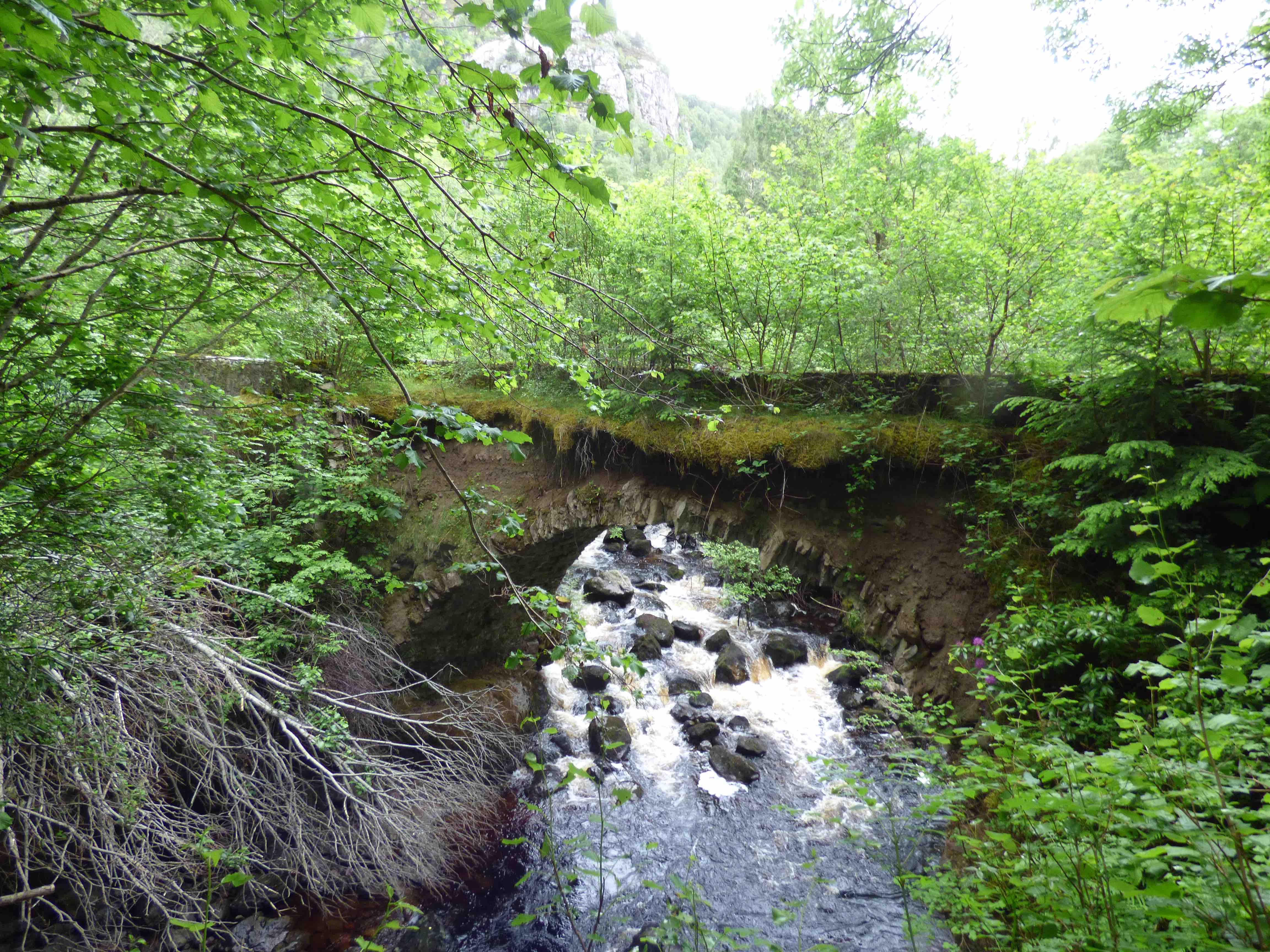
INVERFARIGAIG BRIDGE
C. Inverness R. Farigaig 252169,823882
History: 1732 military road from Fort Augustus to Inverness. Taylor tells us that Wade brought in Dunkeld masons for the work, which cost £150.
Maps:1750
Currently:1732. Horizontal decking and dressed random rubble spandrels and abutments. Large buttressing on one spandrel which appears more recent. The voussoirs are also in rubble. The arch is almost semicircular and slightly stilted on rock foundations. This bridge is collapsing and the southwestern decking has fallen away completely. It is very overgrown and quite dangerous. This issue is well documented by the Forestry Commission, and monitored. No intervention seems likely, however.
Link photo.
_______________________________________________
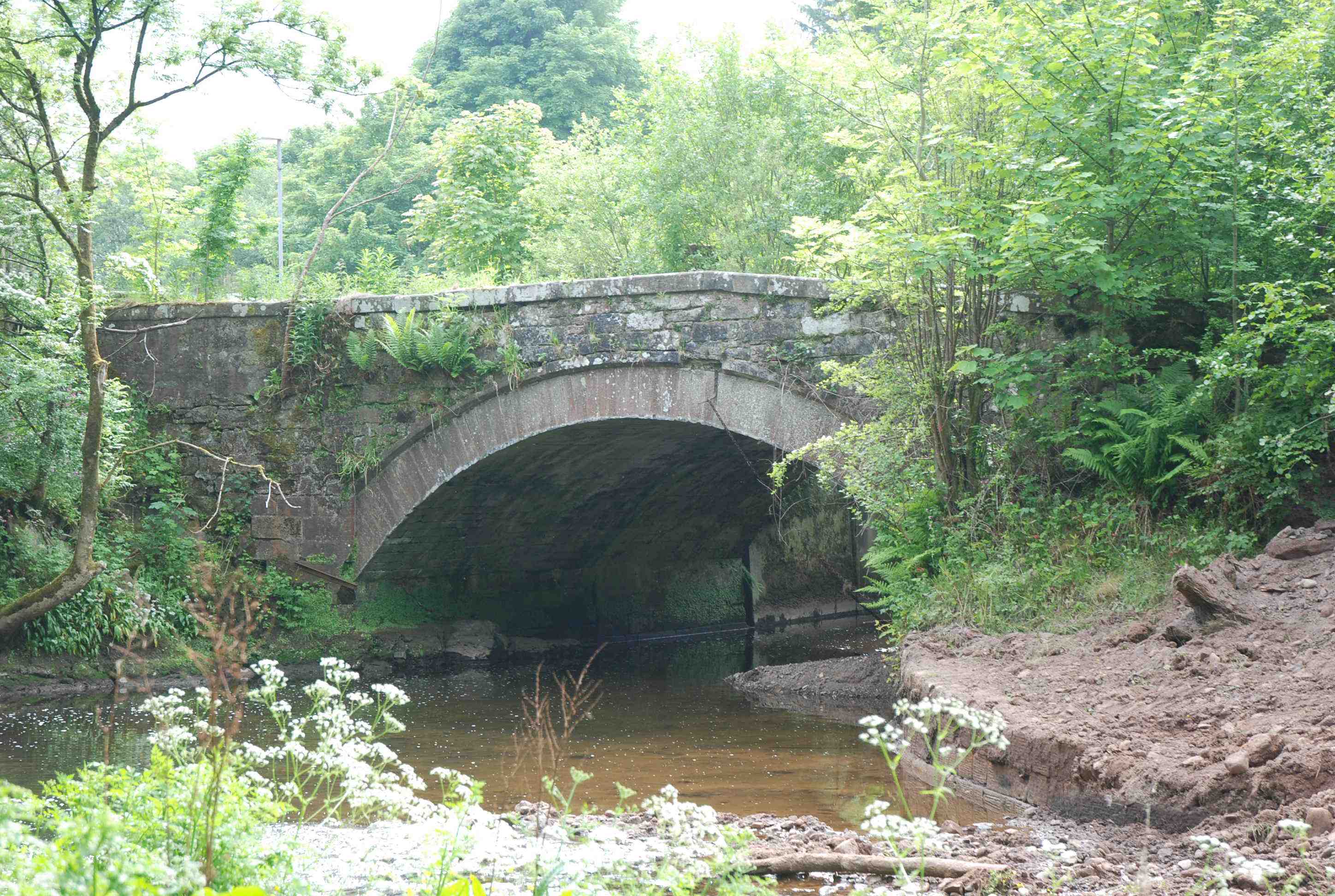
INVERKIP BRIDGE Bridgend
C.Renfrewshire Kip Water 221275,672541
History: Appears on Pont’s map (1600), but no more information found.
Maps:1750(Roy) Pont (1600)
Currently:19th century depressed, very dressed segmental arch but the spandrels look older almost as if the arch was a repair. The bridge is lightly humped but the apex of the parapets is not central to the arch which is odd. Coursed squared rubble abutments and spandrels. Hood-mould. This appears to be a very old bridge with a very solid 19th century ashlar arch and an unusual profile.
photo.
_______________________________________________
INVERMAY BRIDGE near Dunning
C.Perth R.May 305681,716236
History: Also known as Scott’s Bridge. On the old Stirling Perth Road(Roy’s map). Also on Adair’s map from 1680s.
Maps 1750 1680s
Currently: 18th century. Single semicircular arch. Very overgrown. Random rubble spandrels and rubble voussoirs. Within the Invermay Estate.
photo.
_______________________________________________
IVY BRIDGE Cullen Estate
C.Aberdeen R. Cullen Burn 350692,866080
History: Cullen House dates from 1602. This may be the oldest of the Cullen Estate bridges.
Maps:Roy (1750)
Currently:Appears to be early 18th century. Single span humped segmental arch in well faced random rubble sometimes brought to course. Well dressed rubble voussoirs.
photo photo.
_______________________________________________
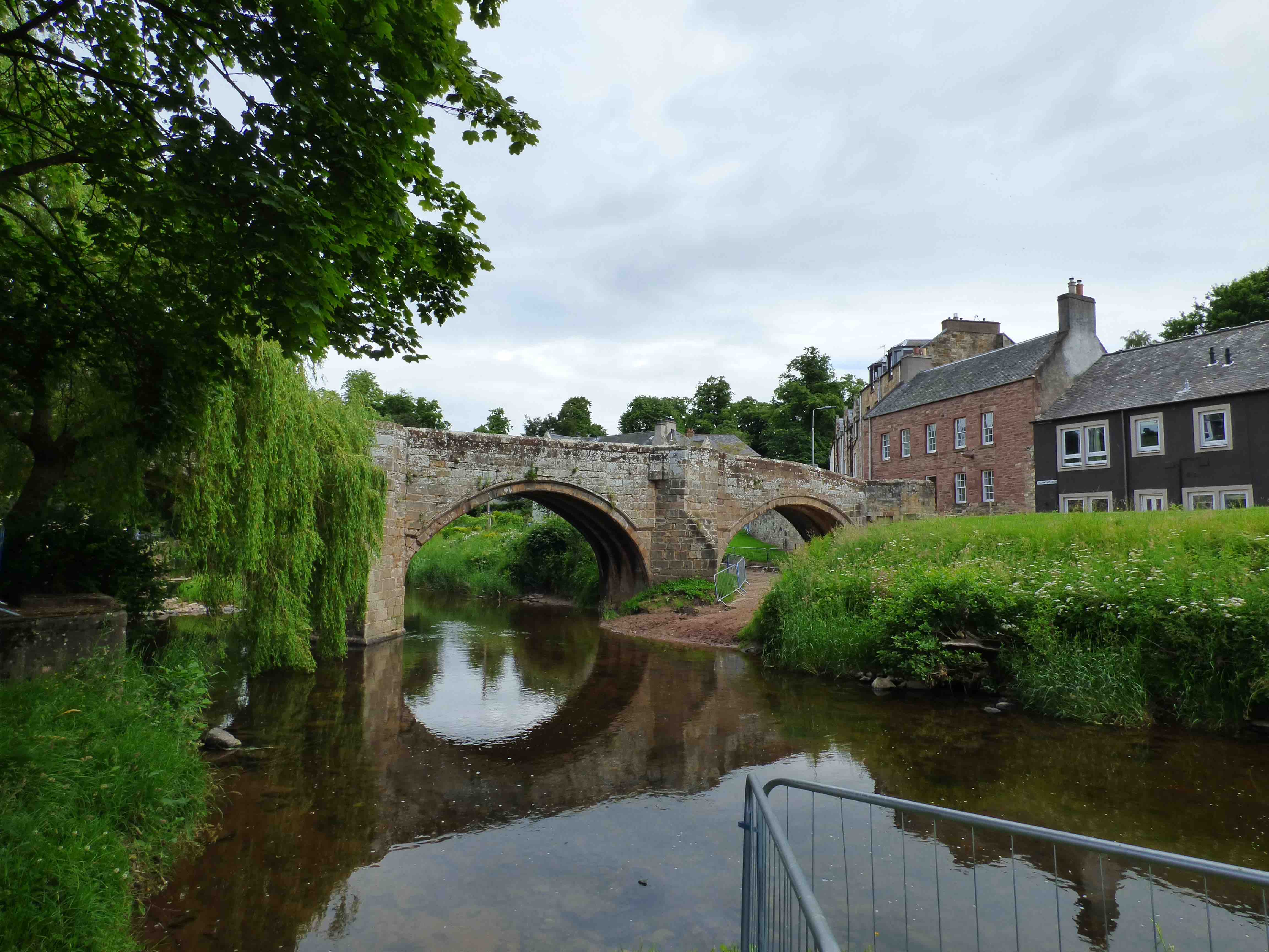
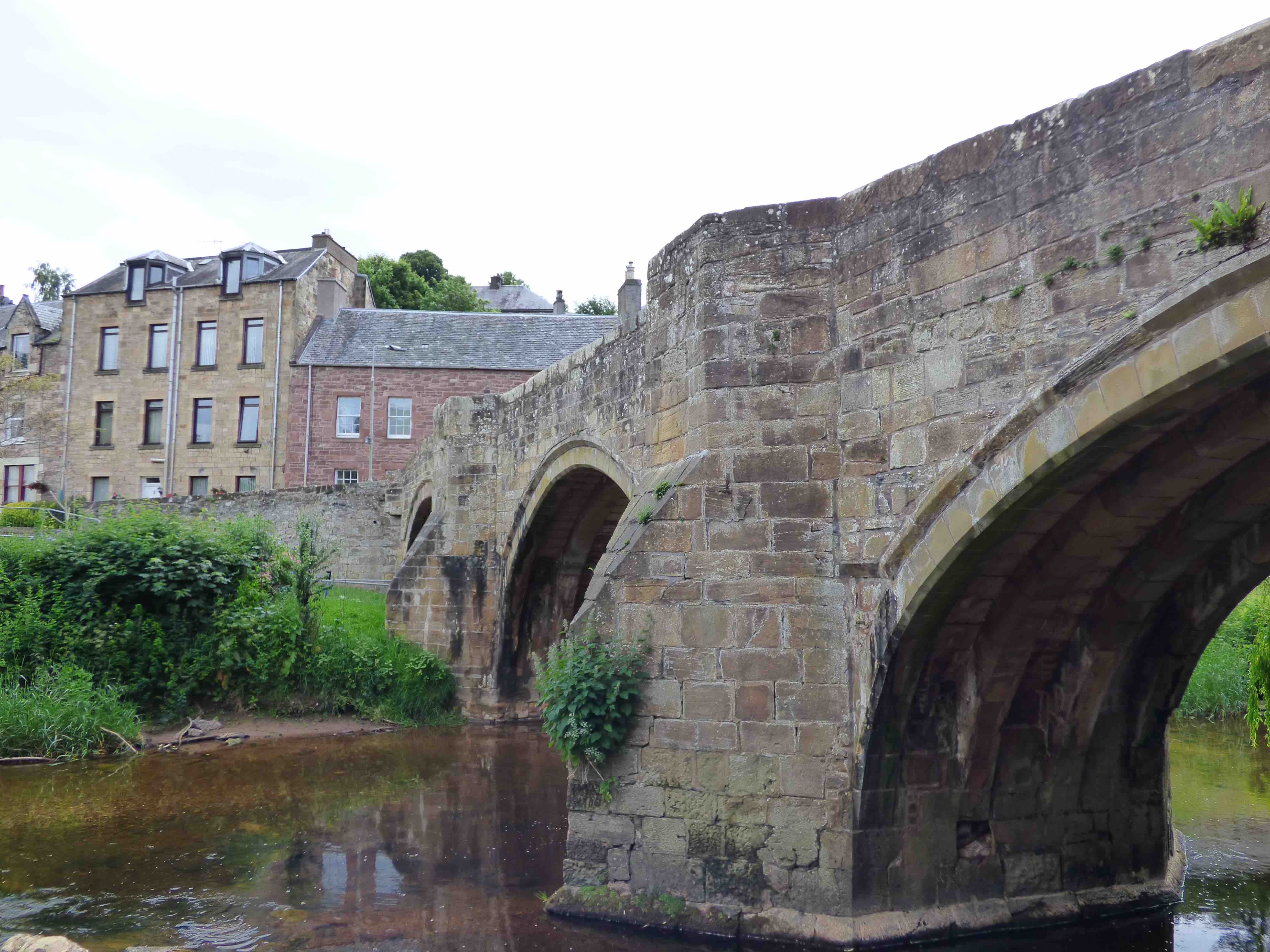
JEDBURGH BRIDGE
C. Roxburgh Jed Water 365267,620593
History: Historically important border town because of its proximity to England. The seat of one of the four great Scottish Border abbeys dating from the time of David I. The Abbey dates from 1138. The town was invaded three times by English armies in the early 14th century and burnt to the ground. The present bridge is 16th century but it seems certain that there was an earlier one. Two ancient medieval roads approached Jedburgh from the south. Bonnie Prince Charlie's army crossed the bridge in 1745 and billeted in the town. They went on to Carlisle by the Note o'the Gate pass to the SW. Also, the Roman Dere St. approaches from the SE and crosses the Teviot River just two miles north of Jedburgh. This road was certainly used in medieval times with a likely deviation through the town and over this bridge and on to another medieval bridge at Ancrum.
Maps:Roy(1750) Oddly not on Blaeu.
Currently:16th century. Three ribbed segmental arches less than 30ft span. Four chamfered ribs (two missing on east arch). No voussoir rings as such but strong hood mould layer. Clear evidence of ashlar rebuilding on the ribs. Very large piers. Cutwaters extending to refuges. Very well dressed squared coursed stonework on the spandrels. Defensive twist at each end to deter horsemen so that the approaches are almost at right angles to the bridge. Nine or ten feet wide which is quite narrow for a major route.